Saulsbury, Tennessee

Last updated

Saulsbury, Tennessee
Saulsbury fields, May 2019.jpg
Cows graze in rural Saulsbury, 2019
Hardeman County Tennessee Incorporated and Unincorporated areas Saulsbury Highlighted 4766680.svg
Location of Saulsbury in Hardeman County, Tennessee.
Coordinates: 35°2′57″N89°5′20″W / 35.04917°N 89.08889°W / 35.04917; -89.08889
Country United States
State Tennessee
County Hardeman
Area
[1]
  Total0.60 sq mi (1.57 km2)
  Land0.60 sq mi (1.57 km2)
  Water0.00 sq mi (0.00 km2)
Elevation
535 ft (163 m)
Population
 (2020) [2]
  Total112
  Density185.12/sq mi (71.44/km2)
Time zone UTC−6 (Central (CST))
  Summer (DST) UTC−5 (CDT)
ZIP Code
38067
Area code 731
FIPS code 47-66680 [3]
GNIS feature ID1300805 [4]

Saulsbury is a town in rural Hardeman County, Tennessee. It is located along State Highway 57 in southwest Hardeman County. The population was 99 at the 2000 census and 81 at the 2010 census showing a decrease of 18. Saulsbury is the least-populated incorporated municipality in Tennessee. [5]

Contents

History

Saulsbury's historical roots stem from a former settlement named Berlin, Tennessee, which was located one mile south of the current location of Saulsbury. Two regional mail roads—one from Bolivar to Ripley, Mississippi, and another from LaGrange to Corinth, Mississippi. These mail roads met at an intersection which would form into a trading center. In 1839 a post office was established there, and Berlin would be incorporated in 1846, and within five years it would be home to 351 people. Upon the completion of the Memphis and Charleston Railroad, Berlin was bypassed due to one landowner's refusal to sell their property to the railroad. A track was instead laid one mile north of Berlin, on land that was owned by Burrell Sauls and Berry Futrell. The finished railroad station and track would be called Sauls-Berry Depot. Eventually Berlin would be deserted as people moved to the new settlement and in 1856 Saulsbury was incorporated. [6]

Civil War

Just after the taking of Memphis in 1862, the Union Army took Saulsbury. Skirmishes continued throughout the area, and eventually Saulsbury would return to Confederate control. Confederate soldiers used Saulsbury as a rally point to travel to Corinth to join their regiments. After the Civil War, Saulsbury maintained itself as a town, unlike others in the area which barely survived the war. Saulsbury's cotton production survived the war as well, and Saulsbury emerged as a leader in cotton production in the region. The town also became a producer of eggs, turkeys, poultry and hogs; which were often sent to Memphis for sale. Sand mining became a major industry in the 1870s, providing 47 different types of sand for brass molding. [6]

1999 Tornado

On January 17, 1999, an F1 tornado formed just southwest of Saulsbury, and moved northeast until dissipating near Rogers Springs. [7] One person was killed, four others were injured. Fourteen houses and mobile homes were destroyed, and twenty-seven others were damaged. Power lines and trees also sustained significant damage.[ citation needed ] As a result, the town of Saulsbury installed a tornado siren at the local fire station, the only one in the area at the time. [6]

Geography

Saulsbury is located at 35°2′57″N89°5′20″W / 35.04917°N 89.08889°W / 35.04917; -89.08889 (35.049276, -89.088858). [8]

According to the United States Census Bureau, the town has a total area of 0.4 square miles (1.0 km2), all land.

Demographics

Historical population
CensusPop.Note
1860 337
1870 40018.7%
1880 188−53.0%
1910 199
1920 190−4.5%
1930 2078.9%
1940 202−2.4%
1950 143−29.2%
1960 141−1.4%
1970 15610.6%
1980 1560.0%
1990 106−32.1%
2000 99−6.6%
2010 81−18.2%
2020 11238.3%
Sources: [9] [10] [2]

As of the census [3] of 2000, there were 99 people, 43 households, and 26 families residing in the town. The population density was 271.7 inhabitants per square mile (104.9/km2). There were 53 housing units at an average density of 145.4 per square mile (56.1/km2). The racial makeup of the town was 85.86% White, 12.12% African American, and 2.02% from two or more races.

There were 43 households, out of which 25.6% had children under the age of 18 living with them, 48.8% were married couples living together, 9.3% had a female householder with no husband present, and 39.5% were non-families. 30.2% of all households were made up of individuals, and 20.9% had someone living alone who was 65 years of age or older. The average household size was 2.30 and the average family size was 2.92.

In the town, the population was spread out, with 24.2% under the age of 18, 10.1% from 18 to 24, 15.2% from 25 to 44, 29.3% from 45 to 64, and 21.2% who were 65 years of age or older. The median age was 46 years. For every 100 females, there were 110.6 males. For every 100 females age 18 and over, there were 97.4 males.

The median income for a household in the town was $30,000, and the median income for a family was $41,250. Males had a median income of $26,250 versus $28,125 for females. The per capita income for the town was $10,335. There were 22.2% of families and 29.7% of the population living below the poverty line, including 48.8% of under eighteens and none of those over 64. Most of those living below the poverty line receive federal aid.

Climate

Saulsbury's climate is generally similar to the rest of the Mid-South. The summer months are persistently hot and humid with afternoon temperatures frequently above 90 degrees Fahrenheit. Afternoon thunderstorms are frequent during some summers, but usually brief, lasting no longer than an hour. Early autumn is pleasantly drier and mild, but can remain hot until late October. Abrupt but short-lived cold snaps are common. Late autumn is rainy and colder, December being the third rainiest month of the year. Winters are mild, but cold snaps can occur. Snowfall is not abundant but does occur during most winters, with usually one or two major winter weather events occurring by the end of March. Spring often begins in late February or early March, following the onset of a sharp warmup. This season is also known as "severe weather season" due to the higher frequency of tornadoes, hail, and thunderstorms producing strong winds. Average rainfall is slightly higher during the spring months (except November) than the rest of the year. Historically, April is the month with the highest frequency of tornadoes, though tornadoes have occurred every month of the year. Saulsbury-area historical tornado activity is above Tennessee state average. It is 155% greater than the overall U.S. average. The area is sunny about 62.5% of the time. [11]

Arts and culture

In the 1970s the Saulsbury Methodist Church, which was built in 1913, was deeded to town for the community library. Upon the completion of fundraising, the town was able to renovate the building; they installed heating and air conditioning, and made it accessible. A number of antebellum homes and buildings are preserved in Saulsbury. The town has three active community clubs: the Saulsbury Community Club, the Nifty Needles Women's Club, and the Friendship Club. [6]

Annual cultural events

Saulsbury hosts three major events each year: a Christmas tree-lighting, the Community Celebration, and a home decorating contest, all in December. The community also hosts year round bake-off, a fish fry in June, and an annual stew sale in October; all which benefit community projects. [6]

The final destination for the principal characters, Lena Grove and Byron Bunch, in William Faulkner's novel, Light in August , is Saulsbury.

Government

Saulsbury is governed by a mayor and a board of six aldermen who are elected every four years. [6]

Infrastructure

Major Thoroughfares

Related Research Articles

<span class="mw-page-title-main">Hardeman County, Tennessee</span> County in Tennessee, United States

Hardeman County is a county located in the U.S. state of Tennessee. As of the 2020 census, the population was 25,462. Its county seat is Bolivar.

<span class="mw-page-title-main">Fayette County, Tennessee</span> County in Tennessee, United States

Fayette County is a county located in the U.S. state of Tennessee. As of the 2020 census, the population was 41,990. Its county seat is Somerville. The county was named after the Marquis de la Fayette, French hero of the American Revolution. A part of the Memphis, TN-MS-AR Metropolitan Statistical Area, Fayette County is culturally alike to the Mississippi Delta and was a major area of cotton plantations dependent on slave labor in the nineteenth century.

<span class="mw-page-title-main">Alamo, Tennessee</span> Town in Tennessee, United States

Alamo is a town in Crockett County, Tennessee, United States. Its population was 2,461 at the time of the 2010 U.S. Census. Alamo, located in the central part of West Tennessee, is the county seat of Crockett County.

<span class="mw-page-title-main">Somerville, Tennessee</span> Town in Tennessee, United States

Somerville is a town in Fayette County, Tennessee, United States. It is part of the Memphis metropolitan area. The population was 3,415 at the 2020 census, up from 3,094 at the 2010 census. It is the county seat of Fayette County.

<span class="mw-page-title-main">Bolivar, Tennessee</span> City in Tennessee, United States

Bolivar is a city in and the county seat of Hardeman County, Tennessee, United States. The town was named for South American revolutionary leader Simón Bolívar. As of the 2010 census, the city population was 5,417.

<span class="mw-page-title-main">Hickory Valley, Tennessee</span> Town in Tennessee, United States

Hickory Valley is a town in Hardeman County, Tennessee, United States. The population was 99 at the 2010 census. Hickory Valley's origin dates back to the blending of three independent pioneer settlements in the area that were founded by three men: William Shinault in 1820, Drury Wood in 1826 and William Barnett in 1827.

<span class="mw-page-title-main">Hornsby, Tennessee</span> Town in Tennessee, United States

Hornsby is a town in Hardeman County, Tennessee. The population was 303 at the 2010 census. The town is just east of Bolivar along U.S. Highway 64.

<span class="mw-page-title-main">Middleton, Tennessee</span> City in Tennessee, United States

Middleton is a city in Hardeman County, Tennessee, United States. The population was 706 at the 2010 census, up from 602 at the 2000 census. It is located at the intersection of Tennessee State Route 125 and Tennessee State Route 57. Its slogan is the "Crossroads of the South".

<span class="mw-page-title-main">Toone, Tennessee</span> Town in Tennessee, United States

Toone is a town in Hardeman County, Tennessee, United States. The population was 364 at the 2010 census.

<span class="mw-page-title-main">Whiteville, Tennessee</span> Town in Tennessee, United States

Whiteville is a town in Hardeman County, Tennessee, United States. The population was 2,606 at the 2020 census and 4,638 at the 2010 census, Whiteville is the location of two privately owned prisons, Whiteville Correctional Facility and Hardeman County Correctional Center.

<span class="mw-page-title-main">Gates, Tennessee</span> Town in Tennessee, United States

Gates is a town in Lauderdale County, Tennessee, United States. The population was 901 at the 2000 census and 647 at the 2010 census, showing a decline of 254.

<span class="mw-page-title-main">Samburg, Tennessee</span> Town in Tennessee, United States

Samburg is a town in Obion County, Tennessee, United States. The population was 210 at the 2020 census. Samburg is located on the eastern shores of Reelfoot Lake.

<span class="mw-page-title-main">Baxter, Tennessee</span> City in Tennessee, United States

Baxter is a city in Putnam County, Tennessee, United States. The population was 1,578 at the 2020 census. It is part of the Cookeville, Tennessee Micropolitan Statistical Area.

<span class="mw-page-title-main">Arlington, Tennessee</span> Town in Tennessee, United States

Arlington is a town in Shelby County, Tennessee, United States. The population was 2,569 at the 2000 census, 11,517 at the 2010 census, and 14,549 at the 2020 Census. From 2010 until 2020 the town's population grew by 26.326%. It is one of the seven municipalities in Shelby County. The town lies wholly within the borders of Shelby County.

<span class="mw-page-title-main">Germantown, Tennessee</span> City in Tennessee, United States

Germantown is a city in Shelby County, Tennessee, United States. The population was 41,333 at the 2020 census.

<span class="mw-page-title-main">Brighton, Tennessee</span> Town in Tennessee, United States

Brighton is a town in Tipton County, Tennessee, United States. The population was 2,735 at the 2010 census.

<span class="mw-page-title-main">Mason, Tennessee</span> Town in Tennessee, United States

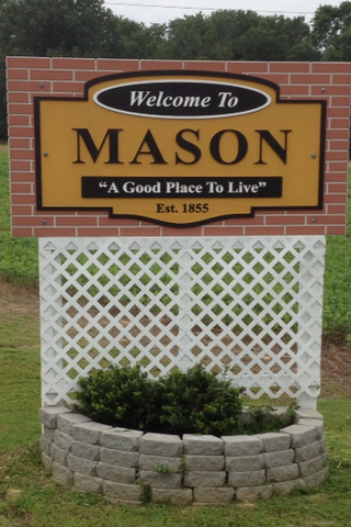
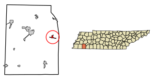
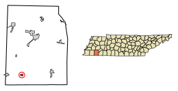
Mason is a town in Tipton County, Tennessee. The population was 1,609 at the 2010 census. Mason is located along U.S. Route 70, and is home to a federal detention facility.

<span class="mw-page-title-main">Silerton, Tennessee</span> Town in Tennessee, United States

Silerton is a town in Hardeman and Chester counties in the western part of Tennessee. The population was 111 at the 2010 census.

<span class="mw-page-title-main">Grand Junction, Tennessee</span> City in Tennessee, United States

Grand Junction is a city between the border of Hardeman and Fayette County, Tennessee, United States. The population was 325 at the 2010 census, and was estimated to be 303 in 2015.

<span class="mw-page-title-main">Kenton, Tennessee</span> Town in Tennessee, United States

Kenton is a town in Gibson and Obion counties, Tennessee. The population was 1,281 at the 2010 census, a decline of 25 from 2000. The Gibson County portion of Kenton is part of the Humboldt, TN Micropolitan Statistical Area, while the Obion County portion is part of the Union City, TN–KY Micropolitan Statistical Area.

References

  1. "ArcGIS REST Services Directory". United States Census Bureau. Retrieved October 15, 2022.
  2. 1 2 "Census Population API". United States Census Bureau. Retrieved October 15, 2022.
  3. 1 2 "U.S. Census website". United States Census Bureau . Retrieved January 31, 2008.
  4. "US Board on Geographic Names". United States Geological Survey. October 25, 2007. Retrieved January 31, 2008.
  5. Rivero, Nicolas (August 25, 2017). "The Smallest Town in Each of the 50 States". Mental Floss. Retrieved June 25, 2018.
  6. 1 2 3 4 5 6 "Saulsbury". Hardeman County Tennessee. Hardeman County Chamber of Commerce. Retrieved November 17, 2011.
  7. "Tornado map". National Oceanic and Atmospheric Administration, Southern Region Headquarters. Archived from the original on June 6, 2011. Retrieved June 6, 2010.
  8. "US Gazetteer files: 2010, 2000, and 1990". United States Census Bureau. February 12, 2011. Retrieved April 23, 2011.
  9. "Census of Population and Housing: Decennial Censuses". United States Census Bureau . Retrieved March 4, 2012.
  10. "Incorporated Places and Minor Civil Divisions Datasets: Subcounty Resident Population Estimates: April 1, 2010 to July 1, 2012". Population Estimates. U.S. Census Bureau. Archived from the original on June 11, 2013. Retrieved December 11, 2013.
  11. "Grand Junction, Tennessee (TN 38039) profile: Population, maps, real estate, averages, homes, statistics, relocation, travel, jobs, hospitals, schools, crime, moving, houses, news, sex offenders".