
The Connecticut River is the longest river in the New England region of the United States, flowing roughly southward for 406 miles (653 km) through four states. It rises at the U.S. border with Quebec, Canada, and discharges at Long Island Sound. Its watershed encompasses 11,260 square miles (29,200 km2), covering parts of five U.S. states and one Canadian province, via 148 tributaries, 38 of which are major rivers. It produces 70% of Long Island Sound's fresh water, discharging at 18,400 cubic feet (520 m3) per second.

The Housatonic River is a river, approximately 149 miles (240 km) long, in western Massachusetts and western Connecticut in the United States. It flows south to southeast, and drains about 1,950 square miles (5,100 km2) of southwestern Connecticut into Long Island Sound. Its watershed is just to the west of the watershed of the lower Connecticut River.

Chatfield Hollow State Park is a public recreation area occupying 412 acres (167 ha) that lie adjacent to Cockaponset State Forest in the town of Killingworth, Connecticut. The state park offers hiking trails, a swimming beach, trout fishing, mountain biking, rock climbing, and picnicking areas. Park attractions include 6.67-acre (2.70 ha) Schreeder Pond, Indian caves, historic sites, a restored water wheel, and a reproduction covered bridge. The park is managed by the Connecticut Department of Energy and Environmental Protection.

The Lamprey River is a 50.2-mile-long (80.8 km) river in southeastern New Hampshire, the United States. It rises in Meadow Lake in Northwood, and flows south, then generally east through Raymond, Epping, Lee, Durham and finally Newmarket. Here, it meets Great Bay, a tidal inlet of the Atlantic Ocean, to which it is connected by a tidal estuary, the Piscataqua River. The river from the Bunker Pond Dam in Epping to the confluence with the Piscassic River is part of the designated National Wild and Scenic River System.

Montauk State Park is a public recreation area occupying nearly 3,000 acres (1,200 ha) at the headwaters of the Current River, fifteen miles (24 km) southwest of Salem, Missouri. The state park contains a fish hatchery and is noted for its rainbow and brown trout angling. It was acquired in 1926. The park has several natural springs including Montauk Spring with a daily average flow of 53 million gallons of water.
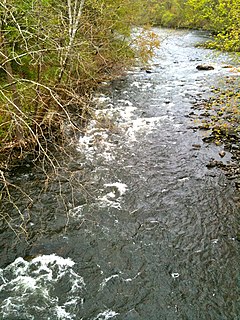
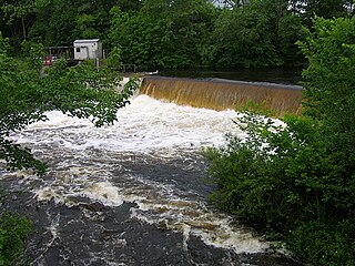
The Naugatuck River is a 40.2-mile-long (64.7 km) river in the U.S. state of Connecticut. Its waters carve out the Naugatuck River Valley in the western reaches of the state, flowing generally due south and eventually emptying into the Housatonic River at Derby, Connecticut and thence 11 miles (18 km) to Long Island Sound. The Plume and Atwood Dam in Thomaston, completed in 1960 following the Great Flood of 1955, creates a reservoir on the river and is the last barrier to salmon and trout migrating up from the sea.
The Quinebaug River is a river in south-central Massachusetts and eastern Connecticut, with watershed extending into western Rhode Island. The name "Quinebaug" comes from the southern New England Native American term, spelled variously Qunnubbâgge, Quinibauge, etc., meaning "long pond", from qunni-, "long", and -paug, "pond". The river is one of the namesake rivers in the Quinebaug and Shetucket Rivers Valley National Heritage Corridor.

San Leandro Creek is a 21.7-mile-long (34.9 km) year-round natural stream in the hills above Oakland in Alameda County and Contra Costa County of the East Bay in northern California.

Carolina is a village that straddles the border of the towns of Charlestown and Richmond on the Pawcatuck River in Washington County, Rhode Island. Rhode Island Route 112 passes through the village. Carolina is identified as a census-designated place, with a population of 970 at the 2010 census.

The Elliottville Lower Mill, also known historically as the Peep Toad Mill, is an historic cotton mill in the East Killingly section of Killingly, Connecticut. Built about 1850, it is a well-preserved example of an early wood-frame textile mill. The mill complex, which includes, a dam, pond, head race, and bridge, was listed on the National Register of Historic Places in 1982.

The Talcottville Historic District is a historic district in the town of Vernon, Connecticut. Centered on Elm Hill Road and Main Street, it encompasses a 19th-century mill village, including archaeological remnants of very early cotton-spinning facilities, and old stone dam, and a major wood-frame mill constructed by the Talcott brothers. Also included in the village are a significant number of mill worker housing units, many dating to the middle decades of the 19th century, and an 1891 lenticular pony truss bridge, built by the Berlin Iron Bridge Company. The district was listed on the National Register of Historic Places in 1989.

The Old McKenzie Fish Hatchery was used to raise trout and salmon for release into the McKenzie River in western Oregon in the United States. It is located near the unincorporated community of Vida in Lane County. The hatchery is closed, however, the historic site is now a county park. It is also listed on the National Register of Historic Places.

The Mount Whitney Fish Hatchery, located in Independence, California, in the United States, is an historic fish hatchery that has played an important role in the preservation of the golden trout, California's state fish.

Eldredge Mills Archeological District is a 2.3-acre (0.93 ha) historic district in Willington, Connecticut that was listed on the National Register of Historic Places in 2000. The property is also denoted Site No. 160-15.

The Valley Falls Cotton Mill Site is the site of a historic mill at Valley Falls Park in Vernon, Connecticut. Mills were operated on the site from colonial times until 1877, when the last mill burned. The site was listed on the National Register of Historic Places in 1997.

Messerschmidt Pond Wildlife Management Area is a tract of land in Westbrook and Deep River, Connecticut, adjacent to Cockaponset State Forest. The area includes the millpond and former site of the Deep River Manufacturing Company, which preserved a variety of historic manufacturing machinery until its demolition in 1987. The mill and an associated shed and dam were listed on the National Register of Historic Places in 1985.

The Prairie Creek Fish Hatchery near Orick, Humboldt County, California was one of the first small local fish hatcheries developed to improve the area's sport and commercial fishing, and is one of only three remaining hatcheries built in California from 1871 to 1946.

Hopeville Pond State Park is a public recreation area located on Hopeville Pond, an impoundment of the Pachaug River, in the town of Griswold, Connecticut. A portion of the 554-acre (224 ha) state park occupies the site of the lost village of Hopeville. The park manager's house occupies Avery House, which is listed on the National Register of Historic Places. The park offers fishing, swimming, camping, and trails for hiking and biking. It is managed by the Connecticut Department of Energy and Environmental Protection.

The Bennington Fish Hatchery, also known as the Bennington Fish Culture Station, is a state-operated fish hatchery at 110 Hatchery Road in Bennington, Vermont, USA. The station, the state's largest, produces a variety of trout, which are used to stock the state's water resources. Its facilities, dating to 1916, are listed on the National Register of Historic Places. The station has a visitors' center that is open daily.

The St. Johnsbury Federal Fish Culture Station, also known as the St. Johnsbury Federal Fish Hatchery, was a United States government-funded fish hatchery on Emerson Falls Road in St. Johnsbury, Vermont. The hatchery operated from 1895 to 1960, producing fish stock for headwater tributaries of the Connecticut River and St. Lawrence River in northern New England and New York. The surviving facilities of the hatchery, now adaptively reused for other purposes and in private ownership, were listed on the National Register of Historic Places in 2005.


