Siecha Lakes

Last updated
Siecha Lakes
Lagunas de Siecha.jpg
Siecha Lakes, from left (east) to right (west)
Siecha, Guasca, De los Patos
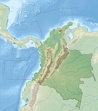
Colombia relief location map.jpg
Red pog.svg
Siecha Lakes
Location Guasca, Cundinamarca
Coordinates 4°45′52″N73°51′04″W / 4.76444°N 73.85111°W / 4.76444; -73.85111
Type Glacial
Part of Chingaza Natural National Park
Basin  countriesColombia
Surface area141,401 m2 (1,522,030 sq ft) [1]
Max. depth25 m (82 ft)
Surface elevation3,590 m (11,780 ft) [2]
Painting of Lake Siecha, 1855 Laguna de Siecha 1855 (1600x1064px-cropped).jpg
Painting of Lake Siecha, 1855
Famous Muisca raft
a similar raft was found in Lake Siecha but lost due to fire of the ship in the harbour of Bremen Muisca raft Legend of El Dorado Offerings of gold.jpg
Famous Muisca raft
a similar raft was found in Lake Siecha but lost due to fire of the ship in the harbour of Bremen

The Siecha Lakes are three glacial lakes located in the Chingaza Natural National Park in Cundinamarca, Colombia. The Andean lakes are considered sacred in the religion of the Muisca who inhabited the area before the Spanish conquest of the Muisca in the 1530s. [3]
Contents

Etymology

In the Chibcha language of the Muisca Siecha means "House of the Lord". [4]

Description

The Siecha Lakes consist of three small glacial lakes, from large to small and east to west; Siecha (63,893 m²), [1] Guasca (56,846 m²) [1] and De los Patos (20,662 m²). [1] Alternative names for the smaller two are Fausto and America. [4] The lakes belong to the municipality of Guasca. Fauna around the lakes are the birds American purple gallinule, helmeted curassow, torrent duck, Andean cock-of-the-rock, eagles and orange-fronted parakeet. In the lakes the birds Oxyura jamaicensis andina , Andean teal and the American coot can be found. Mammals around the lakes include the spectacled bear, white-tailed deer, red deer and the little red brocket. [4]

History

In the colonial period, the lakes were partly drained to extract the golden artefacts of the Muisca from the water. In 1855 a golden raft was found in one of the lakes, similar to the famous Muisca raft. It was named Balsa de Siecha or "Siecha raft" and pictured in the book El Dorado by Muisca scholar Liborio Zerda in 1883. The discovery of the raft made Zerda believe that the site of the initiation ritual of the new zipa was not in Lake Guatavita, yet in the Siecha Lakes. [5] Later, the raft was more-or-less legally taken from Colombia to Europe. The transporting ship burnt in the harbour of Bremen and the raft was lost. [4]

Tourism

To visit the lakes certain rules apply; visits are only possible on Saturdays and Sundays, access at the entrance point needs to be not later than 10:00 AM and exit not after 4:00 PM. A maximum of 30 visitors per day is allowed. [4]

See also

Related Research Articles

<span class="mw-page-title-main">Lake Guatavita</span> Lake in Cundinamarca Department, Colombia

Lake Guatavita is located in the Cordillera Oriental of the Colombian Andes in the municipality of Sesquilé in the Almeidas Province, Cundinamarca department of Colombia, 57 km (35 mi) northeast of Bogotá, the capital of Colombia.

<span class="mw-page-title-main">Zoratama</span>

Zoratama, also spelled as Soratama, was a Muisca woman and the lover of Spanish conquistador Lázaro Fonte. Her story reminds of the North American indigenous Pocahontas who married John Rolfe after saving the life of John Smith.

<span class="mw-page-title-main">Altiplano Cundiboyacense</span> Plateau in the Columbian Andes

The Altiplano Cundiboyacense is a high plateau located in the Eastern Cordillera of the Colombian Andes covering parts of the departments of Cundinamarca and Boyacá. The altiplano corresponds to the ancient territory of the Muisca. The Altiplano Cundiboyacense comprises three distinctive flat regions; the Bogotá savanna, the valleys of Ubaté and Chiquinquirá, and the valleys of Duitama and Sogamoso. The average altitude of the altiplano is about 2,600 metres (8,500 ft) above sea level but ranges from roughly 2,500 metres (8,200 ft) to 4,000 metres (13,000 ft).

<span class="mw-page-title-main">Guasca</span> Municipality and town in Cundinamarca, Colombia

Guasca is a Colombian town and municipality in the Guavio Province, part of the Cundinamarca Department located approximately 55 km from Bogotá passing through the town of La Calera, Cundinamarca or 65 km passing through Sopó. Guasca borders the municipalities Tocancipá and Guatavita in the north, Junín in the east, in the south La Calera and in the west Sopó.

<span class="mw-page-title-main">Guatavita</span> Municipality and town in Cundinamarca, Colombia

Guatavita is a municipality and town of Colombia in the Guavio Province of the department of Cundinamarca. Guatavita is located 75 km northeast of the capital Bogotá. It borders Sesquilé and Machetá in the north, Gachetá and Junín in the east, Guasca in the south and in the west are Tocancipá and Gachancipá.

<span class="mw-page-title-main">Bacatá</span> Area on the Bogotá Savannah

Bacatá is the name given to the main settlement of the Muisca Confederation on the Bogotá savanna. It mostly refers to an area, rather than an individual village, although the name is also found in texts referring to the modern settlement of Funza, in the centre of the savanna. Bacatá was the main seat of the zipa, the ruler of the Bogotá savanna and adjacent areas. The name of the Colombian capital, Bogotá, is derived from Bacatá, but founded as Santafe de Bogotá in the western foothills of the Eastern Hills in a different location than the original settlement Bacatá, west of the Bogotá River, eventually named after Bacatá as well.

<span class="mw-page-title-main">Chingaza National Natural Park</span>

Chingaza National Natural Park is located in the Eastern Ranges of the Colombian Andes, northeast of Bogotá, Colombia in the departments of Cundinamarca and Meta. The elevation in the park, to the east of the Altiplano Cundiboyacense, ranges from 800 metres (2,600 ft) to 4,020 metres (13,190 ft), and the temperature ranges from 4 to 21.5 °C. The park extends over the Cundinamarca municipalities La Calera, Fómeque, Guasca and San Juanito (Meta).

<span class="mw-page-title-main">Muisca raft</span> Pre-Columbian votive piece

The Muisca raft, sometimes referred to as the Golden Raft of El Dorado, is a pre-Columbian votive piece created by the Muisca, an indigenous people of Colombia in the Eastern Ranges of the Colombian Andes. The piece probably refers to the gold offering ceremony described in the legend of El Dorado, which occasionally took place at Lake Guatavita. In this ritual, the new chief (zipa), who was aboard a raft and covered with gold dust, tossed gold objects into the lake as offerings to the gods, before immersing himself into the lake. The figure was created between 1295 and 1410 AD by lost-wax casting in an alloy of gold with silver and copper. The raft was part of an offering that was placed in a cave in the municipality of Pasca. Since its discovery in 1969, the Muisca raft has become a national emblem for Colombia and has been depicted on postage stamps. The piece is exhibited at the Gold Museum in Bogotá.

<span class="mw-page-title-main">Muisca Confederation</span> Former Andean highlands confederation

The Muisca Confederation was a loose confederation of different Muisca rulers in the central Andean highlands of what is today Colombia before the Spanish conquest of northern South America. The area, presently called Altiplano Cundiboyacense, comprised the current departments of Boyacá, Cundinamarca and minor parts of Santander.

<span class="mw-page-title-main">Chiminigagua</span> Creator god in the religion of the Muisca people of Colombia

Chiminigagua, Chiminichagua or Chimichagua was the supreme being, omnipotent god and creator of the world in the religion of the Muisca. The Muisca and their confederation were one of the four advanced civilizations of the Americas and developed their own religion on the Altiplano Cundiboyacense in the Andes.

<span class="mw-page-title-main">Muisca religion</span> Indigenous religion of Colombia

Muisca religion describes the religion of the Muisca who inhabited the central highlands of the Colombian Andes before the Spanish conquest of the Muisca. The Muisca formed a confederation of holy rulers and had a variety of deities, temples and rituals incorporated in their culture. Supreme being of the Muisca was Chiminigagua who created light and the Earth. He was not directly honoured, yet that was done through Chía, goddess of the Moon, and her husband Sué, god of the Sun. The representation of the two main celestial bodies as husband and wife showed the complementary character of man and woman and the sacred status of marriage.

<span class="mw-page-title-main">Muisca architecture</span>

This article describes the architecture of the Muisca. The Muisca, inhabiting the central highlands of the Colombian Andes, were one of the four great civilizations of the Americas. Unlike the three civilizations in present-day Mexico and Peru, they did not construct grand architecture of solid materials. While specialising in agriculture and gold-working, cloths and ceramics, their architecture was rather modest and made of non-permanent materials as wood and clay.

<span class="mw-page-title-main">Muisca astronomy</span>

This article describes the astronomy of the Muisca. The Muisca, one of the four advanced civilisations in the Americas before the Spanish conquest of the Muisca, had a thorough understanding of astronomy, as evidenced by their architecture and calendar, important in their agriculture.

<span class="mw-page-title-main">Muisca mummification</span>

The Muisca inhabited the Altiplano Cundiboyacense in the Colombian Andes before the arrival of the Spanish and were an advanced civilisation. They mummified the higher social class members of their society, mainly the zipas, zaques, caciques, priests and their families. The mummies would be placed in caves or in dedicated houses ("mausoleums") and were not buried.

<span class="mw-page-title-main">Liborio Zerda</span>

Liborio Zerda was a Colombian physician and Muisca scholar. Zerda has been important in the natural sciences of the late 19th and early 20th century in Colombia, publishing many articles about various topics, from medicine to chemical analysis, radioactivity and the popular drink chicha.

<span class="mw-page-title-main">Muisca economy</span>

This article describes the economy of the Muisca. The Muisca were the original inhabitants of the Altiplano Cundiboyacense, the high plateau in the Eastern Ranges of central present-day Colombia. Their rich economy and advanced merchant abilities were widely known by the indigenous groups of the area and described by the Spanish conquistadores whose primary objective was the acquisition of the mineral resources of Tierra Firme; gold, emeralds, carbon, silver and copper.

<span class="mw-page-title-main">Lake Fúquene</span>

Lake Fúquene is a heart-shaped lake located in the Ubaté-Chiquinquirá Valley, part of the Altiplano Cundiboyacense, in the north of Cundinamarca, Colombia, at the border with Boyacá. The Andean lake, at an average altitude of 2,540 metres (8,330 ft), was considered sacred in the religion of the Muisca who inhabited the area before the Spanish conquest of the Muisca in the 1530s.

<span class="mw-page-title-main">Spanish conquest of the Muisca</span> Part of the Spanish conquest of Colombia

The Spanish conquest of the Muisca took place from 1537 to 1540. The Muisca were the inhabitants of the central Andean highlands of Colombia before the arrival of the Spanish conquistadors. They were organised in a loose confederation of different rulers; the psihipqua of Muyquytá, with his headquarters in Funza, the hoa of Hunza, the iraca of the sacred City of the Sun Sugamuxi, the Tundama of Tundama, and several other independent caciques. The most important rulers at the time of the conquest were psihipqua Tisquesusa, hoa Eucaneme, iraca Sugamuxi and Tundama in the northernmost portion of their territories. The Muisca were organised in small communities of circular enclosures, with a central square where the bohío of the cacique was located. They were called "Salt People" because of their extraction of salt in various locations throughout their territories, mainly in Zipaquirá, Nemocón, and Tausa. For the main part self-sufficient in their well-organised economy, the Muisca traded with the European conquistadors valuable products as gold, tumbaga, and emeralds with their neighbouring indigenous groups. In the Tenza Valley, to the east of the Altiplano Cundiboyacense where the majority of the Muisca lived, they extracted emeralds in Chivor and Somondoco. The economy of the Muisca was rooted in their agriculture with main products maize, yuca, potatoes, and various other cultivations elaborated on elevated fields. Agriculture had started around 3000 BCE on the Altiplano, following the preceramic Herrera Period and a long epoch of hunter-gatherers since the late Pleistocene. The earliest archaeological evidence of inhabitation in Colombia, and one of the oldest in South America, has been found in El Abra, dating to around 12,500 years BP.

<span class="mw-page-title-main">Muisca art</span> Pre-Columbian art

This article describes the art produced by the Muisca. The Muisca established one of the four grand civilisations of the pre-Columbian Americas on the Altiplano Cundiboyacense in present-day central Colombia. Their various forms of art have been described in detail and include pottery, textiles, body art, hieroglyphs and rock art. While their architecture was modest compared to the Inca, Aztec and Maya civilisations, the Muisca are best known for their skilled goldworking. The Museo del Oro in the Colombian capital Bogotá houses the biggest collection of golden objects in the world, from various Colombian cultures including the Muisca.

References

  1. 1 2 3 4 Google Maps Area Calculator
  2. Google Maps Elevation Finder
  3. Ocampo López, 2013, p.213
  4. 1 2 3 4 5 (in Spanish) Description of the Siecha Lakes
  5. Guarín Martínez, 2005, p.239

Bibliography