The Muisca are an indigenous people and culture of the Altiplano Cundiboyacense, Colombia, that formed the Muisca Confederation before the Spanish conquest. The people spoke Muysccubun, a language of the Chibchan language family, also called Muysca and Mosca. They were encountered by conquistadors dispatched by the Spanish Empire in 1537 at the time of the conquest.

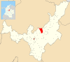
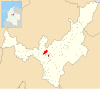
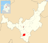
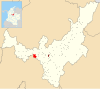
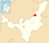
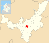
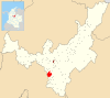
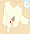
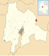
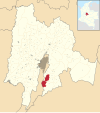
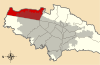
Zipaquirá is a municipality and city of Colombia in the department of Cundinamarca. Its neighboring municipalities are Cogua and Nemocón to the north; Tocancipá to the east; Tabio, Cajicá and Sopó to the south; and Subachoque and Pacho to the west. Its seat of municipal government is 49 kilometers from the national capital Bogotá. It is part of the Greater Bogotá Metropolitan Area, and is the capital of the Sabana Centro province. It is also the headquarters of the diocese of the same name and that includes much of the Department of Cundinamarca, extending to the centre of Bogotá, the region of Rionegro, the Ubaté Valley, and the region of Guavio.
Chibcha, Mosca, Muisca, Muysca, or Muysca de Bogotá is a language spoken by the Muisca people of the Muisca Confederation, one of the many indigenous cultures of the Americas. The Muisca inhabit the Altiplano Cundiboyacense of what today is the country of Colombia.

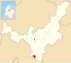
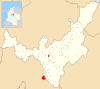
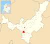
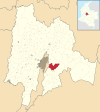
Simijaca is a town and municipality in the Ubaté Province, part of the Cundinamarca Department, Colombia. The town centre is located at an altitude of 2,559 metres (8,396 ft) on the Altiplano Cundiboyacense at 136 kilometres (85 mi) from the capital Bogotá. Simijaca borders the Boyacá municipalities Chiquinquirá and Caldas in the north, Susa and Carmen de Carupa in the south, Caldas in the west and San Miguel de Sema in the east.

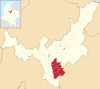
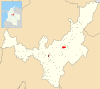
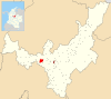
Boyacá is a town and municipality in the Márquez Province, part of the department of Boyacá, Colombia. It is located approximately 15 kilometres (9.3 mi) from the city of Tunja, the capital of the department. Boyacá limits Tunja and Soracá in the north, Jenesano in the south, Nuevo Colón and Ramiriquí in the west and Ventaquemada in the east.
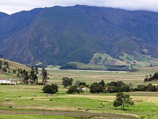
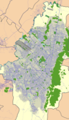
The Altiplano Cundiboyacense is a high plateau located in the Eastern Cordillera of the Colombian Andes covering parts of the departments of Cundinamarca and Boyacá. The altiplano corresponds to the ancient territory of the Muisca. The Altiplano Cundiboyacense comprises three distinctive flat regions; the Bogotá savanna, the valleys of Ubaté and Chiquinquirá, and the valleys of Duitama and Sogamoso. The average altitude of the altiplano is about 2,600 metres (8,500 ft) above sea level but ranges from roughly 2,500 metres (8,200 ft) to 4,000 metres (13,000 ft).

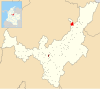
Motavita is a town and municipality in the Colombian Department of Boyacá, part of the subregion of the Central Boyacá Province. It covers approximately 62 square kilometres (24 sq mi).

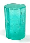
Chivor is a town and municipality in the Eastern Boyacá Province, part of the Colombian department of Boyacá. The mean temperature of the village in the Tenza Valley is 18 °C (64 °F) and Chivor is located at 215 kilometres (134 mi) from the department capital Tunja. Economic activity includes emerald mining.

Guateque is a town and municipality in the Colombian Department of Boyacá, part of the subregion of the Eastern Boyacá Province. Guateque's urban center is located at an altitude of 1,815 metres (5,955 ft) on the Altiplano Cundiboyacense at distances of 125 kilometres (78 mi) from the department capital Tunja and 112 kilometres (70 mi) from Bogotá, capital of Colombia. It borders the municipalities of La Capilla, Tenza, Sutatenza, Somondoco of Boyacá and Tibiritá and Manta of Cundinamarca.
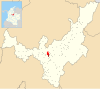
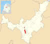
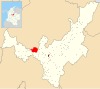
Viracachá is a town and municipality in the Márquez Province, Colombia, part of the Colombian department of Boyacá. Viracachá is situated on the Altiplano Cundiboyacense at 22 kilometres (14 mi) from the department capital Tunja and the small urban center at 2,520 metres (8,270 ft) above sea level. Other parts of Viracachá reach 3,200 metres (10,500 ft). The municipality borders Siachoque, Rondón and Soracá in the north and east, in the south Ciénega and Ciénega, Soracá and Ramiriquí in the west.

Cerinza is a town and municipality in the Colombian Department of Boyacá, and part of the Tundama Province subregion. Cerinza borders Belén in the north, Encino, Santander in the west, Santa Rosa de Viterbo in the south and Floresta and Betéitiva in the east.

Machetá is a municipality and town of Colombia in Almeidas Province of the department of Cundinamarca. Machetá is situated on the Altiplano Cundiboyacense at 82.6 kilometres (51.3 mi) from the capital Bogotá and 74.3 kilometres (46.2 mi) from Tunja. It borders Tibiritá and Manta in the east, Chocontá and Sesquilé in the west and Guatavita and Gachetá in the south.

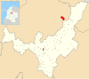
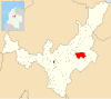
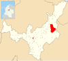
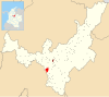
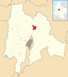
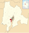
Nemocón is a municipality and town of Colombia in the Central Savanna Province, part of the department of Cundinamarca. Nemocón, famous for its salt mine, was an important village in the Muisca Confederation, the country in the central Colombian Andes before the arrival of the Spanish. The municipality is situated in the northern part of the Bogotá savanna, part of the Altiplano Cundiboyacense with its urban centre at an altitude of 2,585 metres (8,481 ft) and 65 kilometres (40 mi) from the capital Bogotá. Nemocón is the northeasternmost municipality of the Metropolitan Area of Bogotá and the Bogotá River originates close to Nemocón. The median temperature of Nemocón is 12.8 °C. The municipality borders Tausa in the north, Suesca and Gachancipá in the east, Tocancipá and Zipaquirá in the south and in the west the rivers Checua and Neusa and the municipality of Cogua.

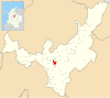
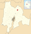
Pacho is a municipality and town of Colombia in the department of Cundinamarca. Pacho is part of the Rionegro Province and the urban centre is situated at a distance of 88 kilometres (55 mi) from the capital Bogotá at an altitude of 2,136 metres (7,008 ft), while the altitude ranges from 1,000 metres (3,300 ft) to 3,700 metres (12,100 ft). The municipality borders San Cayetano, Villagómez and Topaipí in the north, Supatá and Subachoque in the south, Vergara and El Peñón in the west and in the east Zipaquirá, Tausa and Cogua.
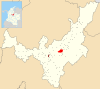
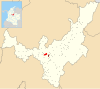
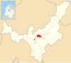
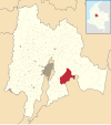
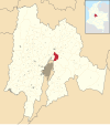
Tausa is a municipality and town of Colombia in the Ubaté Province, part of the department of Cundinamarca. Tausa is and was an important town on the Altiplano Cundiboyacense due to its salt mine. It was the third most prolific salt deposit for the original inhabitants of the area; the Muisca. Tausa's urban centre is located at an elevation of 2,950 metres (9,680 ft) and a distance of 65 kilometres (40 mi) from the capital Bogotá. The municipality borders San Cayetano, Carmen de Carupa and Sutatausa in the north, Pacho in the west, Sutatausa, Cucunubá and Suesca in the east and in the south with Nemocón and Cogua.

Aquiminzaque was the last hoa of Hunza, on which the Spanish city of Tunja was built, reigning from 1537 until his death. His psihipqua counterpart in the southern area of the Muisca was Sagipa. Aquiminzaque was for the Muisca what Túpac Amaru was for the Inca; and as the Inca leader, Quiminza was executed by decapitation.
The Muisca Confederation was a loose confederation of different Muisca rulers in the central Andean highlands of what is today Colombia before the Spanish conquest of northern South America. The area, presently called Altiplano Cundiboyacense, comprised the current departments of Boyacá, Cundinamarca and minor parts of Santander.

José Domingo Duquesne was a Colombian clergyman, theologist, scientist and writer. Polyglot Duquesne spoke Spanish, French, Latin, Greek, Italian and Chibcha.
This article describes the role of women in the society of the Muisca. The Muisca are the original inhabitants of the Altiplano Cundiboyacense before the Spanish conquest of the Muisca in the first half of the 16th century. Their society was one of the four great civilizations of the Americas.
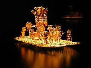
The Spanish conquest of the Muisca took place from 1537 to 1540. The Muisca were the inhabitants of the central Andean highlands of Colombia before the arrival of the Spanish conquistadors. They were organised in a loose confederation of different rulers; the psihipqua of Muyquytá, with his headquarters in Funza, the hoa of Hunza, the iraca of the sacred City of the Sun Sugamuxi, the Tundama of Tundama, and several other independent caciques. The most important rulers at the time of the conquest were psihipqua Tisquesusa, hoa Eucaneme, iraca Sugamuxi and Tundama in the northernmost portion of their territories. The Muisca were organised in small communities of circular enclosures, with a central square where the bohío of the cacique was located. They were called "Salt People" because of their extraction of salt in various locations throughout their territories, mainly in Zipaquirá, Nemocón, and Tausa. For the main part self-sufficient in their well-organised economy, the Muisca traded with the European conquistadors valuable products as gold, tumbaga, and emeralds with their neighbouring indigenous groups. In the Tenza Valley, to the east of the Altiplano Cundiboyacense where the majority of the Muisca lived, they extracted emeralds in Chivor and Somondoco. The economy of the Muisca was rooted in their agriculture with main products maize, yuca, potatoes, and various other cultivations elaborated on elevated fields. Agriculture had started around 3000 BCE on the Altiplano, following the preceramic Herrera Period and a long epoch of hunter-gatherers since the late Pleistocene. The earliest archaeological evidence of inhabitation in Colombia, and one of the oldest in South America, has been found in El Abra, dating to around 12,500 years BP.