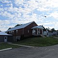
Sinking Spring, Ohio | |
---|---|
Coordinates: 39°04′29″N83°23′13″W / 39.07472°N 83.38694°W | |
Country | United States |
State | Ohio |
County | Highland |
Area | |
• Total | 0.47 sq mi (1.21 km2) |
• Land | 0.47 sq mi (1.21 km2) |
• Water | 0.00 sq mi (0.00 km2) |
Elevation | 879 ft (268 m) |
Population (2020) | |
• Total | 118 |
• Density | 252.68/sq mi (97.55/km2) |
Time zone | UTC-5 (Eastern (EST)) |
• Summer (DST) | UTC-4 (EDT) |
ZIP code | 45172 |
Area code(s) | 937, 326 |
FIPS code | 39-72578 [3] |
GNIS feature ID | 2399826 [2] |
Sinking Spring is a village in Highland County, Ohio, United States. The population was 118 at the 2020 census.
A post office called Sinking Spring has been in operation since 1817. [4] The village was named for a losing stream near the original town site. This city was noted in the 1980s Sesame Street movie Follow That Bird . [5]
According to the United States Census Bureau, the village has a total area of 0.47 square miles (1.22 km2), all land. [6]
Census | Pop. | Note | %± |
---|---|---|---|
1830 | 109 | — | |
1840 | 75 | −31.2% | |
1870 | 200 | — | |
1880 | 107 | −46.5% | |
1900 | 238 | — | |
1910 | 187 | −21.4% | |
1920 | 128 | −31.6% | |
1930 | 177 | 38.3% | |
1940 | 223 | 26.0% | |
1950 | 187 | −16.1% | |
1960 | 202 | 8.0% | |
1970 | 178 | −11.9% | |
1980 | 239 | 34.3% | |
1990 | 189 | −20.9% | |
2000 | 158 | −16.4% | |
2010 | 133 | −15.8% | |
2020 | 118 | −11.3% | |
U.S. Decennial Census [7] |
As of the census [8] of 2010, there were 133 people, 53 households, and 37 families living in the village. The population density was 283.0 inhabitants per square mile (109.3/km2). There were 62 housing units at an average density of 131.9 per square mile (50.9/km2). The racial makeup of the village was 100.0% White.
There were 53 households, of which 28.3% had children under the age of 18 living with them, 50.9% were married couples living together, 17.0% had a female householder with no husband present, 1.9% had a male householder with no wife present, and 30.2% were non-families. 24.5% of all households were made up of individuals, and 13.2% had someone living alone who was 65 years of age or older. The average household size was 2.51 and the average family size was 3.03.
The median age in the village was 45.2 years. 23.3% of residents were under the age of 18; 7.5% were between the ages of 18 and 24; 18.9% were from 25 to 44; 27.1% were from 45 to 64; and 23.3% were 65 years of age or older. The gender makeup of the village was 49.6% male and 50.4% female.
As of the census [3] of 2000, there were 158 people, 57 households, and 44 families living in the village. The population density was 337.6 inhabitants per square mile (130.3/km2). There were 63 housing units at an average density of 134.6 per square mile (52.0/km2). The racial makeup of the village was 97.47% White, 1.90% Native American, and 0.63% from two or more races.
There were 57 households, out of which 45.6% had children under the age of 18 living with them, 61.4% were married couples living together, 12.3% had a female householder with no husband present, and 21.1% were non-families. 17.5% of all households were made up of individuals, and 15.8% had someone living alone who was 65 years of age or older. The average household size was 2.77 and the average family size was 3.04.
In the village, the population was spread out, with 27.8% under the age of 18, 8.9% from 18 to 24, 34.8% from 25 to 44, 15.2% from 45 to 64, and 13.3% who were 65 years of age or older. The median age was 32 years. For every 100 females there were 88.1 males. For every 100 females age 18 and over, there were 83.9 males.
The median income for a household in the village was $38,750, and the median income for a family was $47,500. Males had a median income of $38,333 versus $21,875 for females. The per capita income for the village was $15,089. About 7.7% of families and 7.7% of the population were below the poverty line, including none of those under the age of eighteen and 28.6% of those 65 or over.
Harrod is a village in Allen County, Ohio, United States. The population was 423 at the 2020 census. It is included in the Lima, Ohio Metropolitan Statistical Area.
Neville is a village in Clermont County, Ohio, United States, along the Ohio River. The population was 87 at the 2020 census.
Midland is a village in Clinton County, Ohio, United States. The population was 307 at the 2020 census.
Nellie is a village in Coshocton County, Ohio, United States, along the Walhonding River. The population was 122 at the 2020 census.
Plainfield is a village in Coshocton County, Ohio, United States, along Wills Creek. The population was 141 at the 2020 census.
Gordon is a village in Darke County, Ohio, United States. The population was 245 at the 2020 census.
Ithaca is a village in Darke County, Ohio, United States. The population was 81 at the 2020 census.
New Madison is a village in Darke County, Ohio, United States. The population was 840 at the 2020 census.
Osgood is a village in Darke County, Ohio, United States. The population was 306 at the 2020 census.
Pitsburg is a village in Monroe Township, Darke County, Ohio, United States. The population was 381 at the 2020 census.
Valleyview is a village in Franklin County, Ohio, United States. The population was 669 at the 2020 census.
Spring Valley is a village in Greene County, Ohio, United States. The population was 415 at the 2020 census. It is part of the Dayton Metropolitan Statistical Area.
North Bend is a village in Miami Township, Hamilton County, Ohio, United States, along the Ohio River. It is a part of the Greater Cincinnati area. The population was 835 at the 2020 census.
Jenera is a village in Hancock County, Ohio, United States. The population was 257 at the 2020 census. It is surrounded by Van Buren Township and is part of the Cory-Rawson Local School District.
New Athens is a village in Harrison County, Ohio, United States. The population was 222 at the 2020 census.
Hartford is a village in the township of the same name in Licking County, Ohio, United States. The population was 404 at the 2020 census.
Fultonham is a village in Muskingum County, Ohio, United States. The population was 115 at the 2020 census. It is part of the Zanesville micropolitan area. Fultonham was named for Robert Fulton, inventor of the first commercially successful steamboat.
Zaleski is a village in Vinton County, Ohio, United States. The population was 230 at the 2020 census.
Macksburg is a village in Washington County, Ohio, United States, along the West Fork of Duck Creek. The population was 120 at the 2020 census. The village is about 28 miles (45 km) south of Cambridge, Ohio.
Bairdstown is a village in Wood County, Ohio, United States. The population was 115 at the 2020 census.