The New Haven Green is a 16-acre (65,000 m2) privately owned park and recreation area located in the downtown district of the city of New Haven, Connecticut, United States. It comprises the central square of the nine-square settlement plan of the original Puritan colonists in New Haven, and was designed and surveyed by colonist John Brockett. Today the Green is bordered by the modern paved roads of College, Chapel, Church, and Elm streets. Temple Street bisects the Green into upper (northwest) and lower (southeast) halves.

Plantsville is a neighborhood in the town of Southington, Hartford County, Connecticut, United States. It is centered at the merger between South Main Street and West Main Street. As of the 2000 Census there were 10,387 people living in the Zip Code Tabulation Area for zip code 06479, which is assigned the postal city name Plantsville. The Zip Code Tabulation Area includes the entire southwestern corner of the town of Southington, including Marion and Milldale. Beginning in 2015 Plantsville was listed as a census-designated place.

The Canterbury Center Historic District is a historic district in Canterbury, Connecticut. The district is centered on the town green, located at the junction of Route 169 and Route 14. It has been the town center since 1705, and includes a fine assortment of 18th and early 19th-century architecture. It was listed on the National Register of Historic Places (NRHP) in 1998.

Litchfield Historic District, in Litchfield, Connecticut, is a National Historic Landmark District designated in 1968 as a notable and well-preserved example of a typical late 18th century New England village. As a National Historic Landmark, it is listed on the National Register of Historic Places (NRHP). It is the core area of a larger NRHP-listed historic district that includes the entire borough of Litchfield and was designated a state historic district in 1959.

The Hatfield Center Historic District encompasses the traditional center of Hatfield, Massachusetts. The area, first laid out in 1661, is bounded by Maple Street to the south, the Connecticut River to the east, Day Avenue and School Street to the north, and the Mill River to the west. The area's layout and land use patterns are relatively little altered since they were laid out, leaving a well-preserved early colonial village landscape. The district was added to the National Register of Historic Places in 1994.

Norwichtown is a historic neighborhood in the city of Norwich, Connecticut, United States. It is generally the area immediately north of the Yantic River between I-395 and Route 169.

Bolton Green Historic District is a historic district that includes the town green, Bolton Green, of the town of Bolton, Connecticut. The green and the surrounding buildings were listed on the National Register of Historic Places in 2001. The district encompasses 9 buildings, 1 site, 4 structures, and 2 objects that contribute to the historical significance of the area. The district extends east about 500 yards (460 m) from the green along Bolton Center Road. The oldest existing buildings around the Green are the former tavern and the Bolton General Store. The most prominent building around the Green is the Bolton Congregational Church, a Greek Revival structure built in 1818 with a truncated box-spire. Other structures around the green are a house facing the green on the east side built in the 1840s, and a new ranch house that was built on the former site of an 1870s house that was destroyed by fire. Other properties in the district includes the Brick Tavern, the site of Bolton's first post office, the town hall, the Tuthill residence, and the Bolton Heritage Farm.

Madison Green is the town green of the New England town of Madison, Connecticut. The green is the centerpiece of the Madison Green Historic District, and is located just west of the commercial strip of Madison on United States Route 1. The green is bounded on the south by US 1, Meeting House Lane on the east and north, and Copse Road on the west. Surrounding the green are several buildings, most prominent being the First Congregational Church. Other buildings around the green include Memorial Hall (1896), a community meeting building, Academy Elementary School (1884), and Lee Academy (1821), as well as many historic houses.
The East Haven Green is the town green of the New England town of East Haven, Connecticut. It is bounded by River Street, Hemingway Avenue, Main Street, and Park Place and is the focal point of the East Haven Green Historic District, listed on the National Register of Historic Places. This area is also part of the commercial business district of the town and contains many two- and three-story brick office buildings that have been constructed within the last ten or fifteen years. Farther to the northwest are a shopping center and high-rise apartment buildings.

Wolcott Green Historic District a historic district in the New England town of Wolcott, Connecticut. The district encompasses the town green and the surrounding buildings. The green is located in the town center of Wolcott along Center Road. It has a triangular shape and is surrounded by several houses, a church and the town hall. The other streets bounding the green are Bound Line Road and Kenea Avenue.

West Haven Green is the town green of the New England town of West Haven, Connecticut. The green is bordered by Church Street on the south, Savin Avenue on the west, Main Street on the north and Campbell Avenue on the east. The green and surrounding buildings are part of the West Haven Green Historic District.
The Bethlehem Green Historic District is a historic district in the center of the town of Bethlehem, Connecticut, listed on the National Register of Historic Places in 1982 for the architectural significance of the houses around the town green. The historic district includes the green and 63 contributing properties over an area of 55 acres (22 ha).
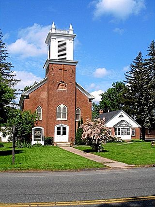
The First Congregational Church of Cheshire is a historic church at 111 Church Drive in Cheshire, Connecticut. Built in 1827, it was designed by David Hoadley and is a prominent local example of Federal period architecture. It was added to the National Register of Historic Places in 1973. The congregation is affiliated with the United Church of Christ.

The Groton Bank Historic District, commonly known as Groton Heights, is a primarily residential 50-acre (20 ha) historic district in the City of Groton in Connecticut. The district was added to the National Register of Historic Places on March 24, 1983.

The New Preston Hill Historic District encompasses a small rural 19th-century village center in the New Preston area of the town of Washington, in Litchfield County, Connecticut. Settled in the late 18th century, it is distinctive for its examples of stone architecture, include a rare Federal period stone church. The district, located at the junction of New Preston Road with Gunn Hill and Findlay Roads, was listed on the National Register of Historic Places in 1985.

The Downtown Waterbury Historic District is the core of the city of Waterbury, Connecticut, United States. It is a roughly rectangular area centered on West Main Street and Waterbury Green, the remnant of the original town commons, which has been called "one of the most attractive downtown parks in New England."

The Old Town Hall is a historic public building on Chester Green in Chester, Connecticut. Built in 1793 and subsequently altered and enlarged, it has been a significant civic meeting point for the community since its construction, hosting religious services, town meetings, and theatrical productions. It was listed on the National Register of Historic Places in 1972.
The Icabod Bradley House is a historic building at 537 Shuttle Meadow Road in Southington, Connecticut. Built in 1813, it is a good local example of transitional Colonial-Federal architecture. It was listed on the National Register of Historic Places in 1989.

The Ebenezer Gay House, also known locally as the Gay-Hoyt House, is a historic house museum at 18 Main Street in Sharon, Connecticut. Built in 1775, it is a well-preserved example of Georgian colonial architecture in brick. It was listed on the National Register of Historic Places in 1979, and is part of the Sharon Historic District, listed in 1993. It is now home to the Sharon Historical Society.

The Watertown Center Historic District encompasses the historic village center of Watertown, Connecticut. It exhibits architectural and historic changes from the early 1700s into the 20th century. It is roughly bounded by Main, Warren, North, Woodbury, Woodruff, and Academy Hill Roads, and was listed on the National Register of Historic Places in 2001.