St. Leon, Indiana

Last updated

St. Leon, Indiana
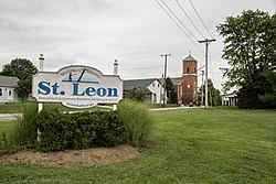
St. Leon, Indiana.jpg
Dearborn County Indiana Incorporated and Unincorporated areas St. Leon Highlighted 1866978.svg
Location of St. Leon in Dearborn County, Indiana.
Coordinates: 39°17′39″N84°59′02″W / 39.29417°N 84.98389°W / 39.29417; -84.98389
Country United States
State Indiana
County Dearborn
Township Kelso
Area
[1]
  Total6.84 sq mi (17.71 km2)
  Land6.83 sq mi (17.68 km2)
  Water0.01 sq mi (0.03 km2)
Elevation
[2]
1,004 ft (306 m)
Population
 (2020)
  Total660
  Density96.67/sq mi (37.32/km2)
Time zone UTC-5 (EST)
  Summer (DST) UTC-4 (EDT)
Area code 812
FIPS code [3]
GNIS feature ID2396899 [2]
Website www.stleon.us

St. Leon or Saint Leon [2] is a town in Kelso Township, Dearborn County, Indiana, United States. The population was 678 at the 2010 census.

Contents

History

A post office was established at St. Leon in 1852, and remained in operation until it was discontinued in 1955. [4] The town was likely named for St. Leon Bembo. [5]

Geography

According to the 2010 census, St. Leon has a total area of 6.989 square miles (18.10 km2), of which 6.98 square miles (18.08 km2) (or 99.87%) is land and 0.009 square miles (0.02 km2) (or 0.13%) is water. [6]

Demographics

Historical population
CensusPop.Note
1880 254
1890 36844.9%
1900 3690.3%
1910 261−29.3%
1920 257−1.5%
1930 2767.4%
1940 2760.0%
1950 2884.3%
1960 31910.8%
1970 43536.4%
1980 51518.4%
1990 493−4.3%
2000 387−21.5%
2010 67875.2%
2020 660−2.7%
U.S. Decennial Census [7]

2010 census

As of the census [8] of 2010, there were 678 people, 252 households, and 182 families living in the town. The population density was 97.1 inhabitants per square mile (37.5/km2). There were 263 housing units at an average density of 37.7 per square mile (14.6/km2). The racial makeup of the town was 98.1% White, 0.1% African American, 0.6% Asian, 0.4% from other races, and 0.7% from two or more races. Hispanic or Latino of any race were 0.3% of the population.

There were 252 households, of which 36.5% had children under the age of 18 living with them, 59.1% were married couples living together, 9.5% had a female householder with no husband present, 3.6% had a male householder with no wife present, and 27.8% were non-families. 24.2% of all households were made up of individuals, and 9.9% had someone living alone who was 65 years of age or older. The average household size was 2.69 and the average family size was 3.23.

The median age in the town was 36.2 years. 26.8% of residents were under the age of 18; 9% were between the ages of 18 and 24; 24.9% were from 25 to 44; 26.2% were from 45 to 64; and 13.1% were 65 years of age or older. The gender makeup of the town was 50.0% male and 50.0% female.

2000 census

As of the census [3] of 2000, there were 387 people, 133 households, and 109 families living in the town. The population density was 54.0 inhabitants per square mile (20.8/km2). There were 139 housing units at an average density of 19.4 per square mile (7.5/km2). The racial makeup of the town was 99.74% White and 0.26% Asian.

There were 133 households, out of which 35.3% had children under the age of 18 living with them, 74.4% were married couples living together, 6.0% had a female householder with no husband present, and 17.3% were non-families. 15.8% of all households were made up of individuals, and 8.3% had someone living alone who was 65 years of age or older. The average household size was 2.91 and the average family size was 3.25.

In the town, the population was spread out, with 27.1% under the age of 18, 7.2% from 18 to 24, 25.6% from 25 to 44, 23.8% from 45 to 64, and 16.3% who were 65 years of age or older. The median age was 38 years. For every 100 females, there were 107.0 males. For every 100 females age 18 and over, there were 104.3 males.

The median income for a household in the town was $39,821, and the median income for a family was $52,000. Males had a median income of $42,500 versus $19,107 for females. The per capita income for the town was $19,225. About 5.7% of families and 8.4% of the population were below the poverty line, including 18.6% of those under age 18 and none of those age 65 or over.
Education

St. Leon, Indiana, is served by East Central High School which draws from many surrounding areas as well.

Related Research Articles

<span class="mw-page-title-main">Beaverville, Illinois</span> Village in Illinois, United States

Beaverville is a village in Beaverville Township, Iroquois County, Illinois, United States. The population was 362 at the 2010 census.

<span class="mw-page-title-main">Aurora, Indiana</span> City in Indiana, United States

Aurora is a city in Center Township, Dearborn County, Indiana, United States. The population was 3,750 at the 2010 census.

<span class="mw-page-title-main">Bright, Indiana</span> Census-designated place in Indiana, United States

Bright is an unincorporated community and census-designated place (CDP) in Dearborn County, Indiana, United States. The population was 5,814 at the 2020 census.

<span class="mw-page-title-main">Dillsboro, Indiana</span> Town in Indiana, United States

Dillsboro is a town in Clay Township, Dearborn County, Indiana, United States. As of 2020, the population is 1,360.

<span class="mw-page-title-main">Greendale, Indiana</span> City in Indiana, United States

Greendale is a city in Dearborn County, Indiana, United States. The population was 4,520 at the 2010 census.

<span class="mw-page-title-main">Lawrenceburg, Indiana</span> City in Indiana, United States

Lawrenceburg is a city and the county seat of Dearborn County, Indiana, United States. The population was 5,129 at the 2020 census. It is the largest city in Dearborn County. Lawrenceburg is in southeast Indiana, on the Ohio River west of Cincinnati.

<span class="mw-page-title-main">Moores Hill, Indiana</span> Town in Indiana, United States

Moores Hill is a town in Sparta Township, Dearborn County, Indiana, United States. The population was 597 at the 2010 census.

<span class="mw-page-title-main">West Harrison, Indiana</span> Town in Indiana, United States

West Harrison is a town in Harrison Township, Dearborn County, Indiana, United States. The population was 289 at the 2010 census.

<span class="mw-page-title-main">St. Paul, Indiana</span> Town in Indiana, United States

St. Paul or Saint Paul is a small town on the border of Decatur and Shelby counties in the U.S. state of Indiana. The population was 1,031 at the 2010 census.

<span class="mw-page-title-main">Ashley, Indiana</span> Town in Indiana, United States

Ashley is a town in Indiana located on the border of Smithfield Township, DeKalb County and Steuben Township, Steuben County. The population was 983 at the 2010 census.

<span class="mw-page-title-main">Andrews, Indiana</span> Town in Indiana, United States

Andrews is a town in Dallas Township, Huntington County, Indiana, United States. The population was 1,048 at the 2020 census.

<span class="mw-page-title-main">Bethany, Indiana</span> Town in Indiana, United States

Bethany is a town in Clay Township, Morgan County, in the U.S. state of Indiana. The population was 95 at the 2020 census.

<span class="mw-page-title-main">Paragon, Indiana</span> Town in Indiana, United States

Paragon is a town in Ray Township, Morgan County, in the U.S. state of Indiana. The population was 556 at the 2020 census, down from 659 in 2010.

<span class="mw-page-title-main">Avilla, Indiana</span> Town in Indiana, United States

Avilla is a town in Allen Township, Noble County, in the U.S. state of Indiana. The population was 2,401 at the 2010 census.

<span class="mw-page-title-main">Rising Sun, Indiana</span> City in Indiana, United States

Rising Sun is a city in Randolph Township and the county seat of Ohio County, Indiana, United States, along the Ohio River. It is also the only incorporated community in the county. The population of Rising Sun was 2,304 at the 2010 census.

<span class="mw-page-title-main">North Liberty, Indiana</span> Town in Indiana, United States

North Liberty is a town in Liberty Township, St. Joseph County, in the U.S. state of Indiana. The population was 1,896 at the 2010 Census. North Liberty is part of the South Bend–Mishawaka, IN-MI, Metropolitan Statistical Area.

<span class="mw-page-title-main">Osceola, Indiana</span> Town in Indiana, United States

Osceola is a town in Penn Township, St. Joseph County, in the U.S. state of Indiana. The population was 2,463 at the 2010 Census. It is part of the South Bend–Mishawaka, IN-MI, Metropolitan Statistical Area.

<span class="mw-page-title-main">Clear Lake, Indiana</span> Town in Indiana, United States

Clear Lake is a town located in the northeast corner of Steuben County, Indiana, in Clear Lake Township. As such, is the northeasternmost community in the State of Indiana. The population was 339 at the 2010 census.

<span class="mw-page-title-main">Leon, West Virginia</span> Town in West Virginia, United States

Leon is a town in Mason County, West Virginia, United States, situated along the Kanawha River. The population was 137 at the 2020 census. It is part of the Point Pleasant, WV–OH Micropolitan Statistical Area.

<span class="mw-page-title-main">Dearborn, Missouri</span> City in Missouri, United States

Dearborn is a city in Buchanan and Platte counties in the U.S. state of Missouri and is part of the Kansas City metropolitan area. The population was 482 at the 2020 census.

References

  1. "2020 U.S. Gazetteer Files". United States Census Bureau. Retrieved March 16, 2022.
  2. 1 2 3 U.S. Geological Survey Geographic Names Information System: St. Leon, Indiana
  3. 1 2 "U.S. Census website". United States Census Bureau . Retrieved January 31, 2008.
  4. "Dearborn County". Jim Forte Postal History. Retrieved August 31, 2014.
  5. Exploring Indiana Highways: Trip Trivia. Exploring America's Highway. 2007. p. 55. ISBN   978-0-9744358-3-1.
  6. "G001 - Geographic Identifiers - 2010 Census Summary File 1". United States Census Bureau. Archived from the original on February 13, 2020. Retrieved July 25, 2015.
  7. "Census of Population and Housing". Census.gov. Retrieved June 4, 2015.
  8. "U.S. Census website". United States Census Bureau . Retrieved December 11, 2012.