Stanton Park

Last updated
Stanton Park
View of Stanton Park in August.jpg
Stanton Park in August, with the statue of Nathanael Greene
Location map Washington, D.C. east.png
Red pog.svg
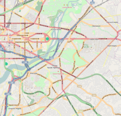
Location within Washington, D.C.
Location Washington, D.C.
Coordinates 38°53′37″N76°59′56″W / 38.8935°N 76.999°W / 38.8935; -76.999
Website www.nps.gov/cahi/historyculture/cahi_stanton.htm

Stanton Park, previously known as Stanton Square, is a national park in Washington D.C. [1] It is located at the intersection of Maryland Avenue and Massachusetts Avenue in the Capitol Hill neighborhood of Northeast, Washington, D.C. It is bounded by 4th Street to the west and 6th Street to the east. North and south of the park are the respective westbound and eastbound lanes of C Street, NE.

The park is named after Edwin M. Stanton, [1] the United States Secretary of War during the American Civil War, [2] whose attempted later removal prompted the impeachment of President Andrew Johnson. Located in the center of Stanton Park is a statue of American Revolutionary War Major General Nathanael Greene. [1] The park was included in Pierre L'Enfant's original plan for the city.

A playground is located in the western section of the park; a section in the eastern half is often used by dog walkers. The park is maintained by the National Park Service [3] and as such, dogs are not allowed off-leash. [4]

"Stanton Park" is also commonly used to describe the surrounding neighborhood. There are no official boundaries, but the Stanton Park Neighborhood Association [5] represented the area from 2nd Street, NE to 10th Street, NE, and from East Capitol Street to H Street, NE.

See also

Related Research Articles

<span class="mw-page-title-main">Dupont Circle</span> Place in the United States

Dupont Circle is a historic roundabout park and neighborhood of Washington, D.C., located in Northwest D.C. The Dupont Circle neighborhood is bounded approximately by 16th Street NW to the east, 22nd Street NW to the west, M Street NW to the south, and Florida Avenue NW to the north. Much of the neighborhood is listed on the National Register of Historic Places. However, the local government Advisory Neighborhood Commission and the Dupont Circle Historic District have slightly different boundaries.

<span class="mw-page-title-main">Capitol Hill</span> United States historic place and neighborhood of Washington, D.C.

Capitol Hill is the largest historic residential neighborhood in Washington, D.C., stretching easterly in front of the United States Capitol along wide avenues. It is one of the oldest residential neighborhoods in Washington, D.C., and, with roughly 35,000 people in just under 2 square miles (5 km2), it is also one of the most densely populated. The name is also frequently used as a metonym for the United States Congress.

<span class="mw-page-title-main">Southeast (Washington, D.C.)</span> Quadrant in the United States

Southeast is the southeastern quadrant of Washington, D.C., the capital of the United States, and is located south of East Capitol Street and east of South Capitol Street. It includes the Capitol Hill and Anacostia neighborhoods, the Navy Yard, the Joint Base Anacostia-Bolling (JBAB), the U.S. Marine Barracks, the Anacostia River waterfront, Eastern Market, the remains of several Civil War-era forts, historic St. Elizabeths Hospital, RFK Stadium, Nationals Park, and the Congressional Cemetery. It also contains a landmark known as "The Big Chair," located on Martin Luther King Jr. Avenue. The quadrant is split by the Anacostia River, with the portion that is west of the river sometimes referred to as "Near Southeast". Geographically, it is the second-smallest quadrant of the city.

<span class="mw-page-title-main">K Street (Washington, D.C.)</span> Major thoroughfare in Washington, D.C.; a metonym for the U.S. lobbying industry

K Street is a major thoroughfare in the United States capital of Washington, D.C., known as a center for lobbying and the location of numerous advocacy groups, law firms, trade associations, and some think tanks. In political discourse, "K Street" has become a metonym for Washington's lobbying industry or lobbying in the United States in general, the same way Wall Street in New York City became a metonym for the financial markets of the United States, since many lobbying firms are or at least traditionally were located on the section in Northwest Washington which passes from Georgetown through a portion of Downtown Washington, D.C.

<span class="mw-page-title-main">Northwest (Washington, D.C.)</span> Quadrant in the United States

Northwest is the northwestern quadrant of Washington, D.C., the capital of the United States, and is located north of the National Mall and west of North Capitol Street. It is the largest of the four quadrants of the city, and it includes the central business district, the Federal Triangle, and the museums along the northern side of the National Mall, as well as many of the District's historic neighborhoods.

<span class="mw-page-title-main">Northeast (Washington, D.C.)</span> Quadrant in the United States

Northeast is the northeastern quadrant of Washington, D.C., the capital of the United States. It encompasses the area located north of East Capitol Street and east of North Capitol Street.

<span class="mw-page-title-main">Swampoodle (Washington, D.C.)</span> Place in the United States

Swampoodle was a neighborhood in Washington, D.C. on the border of Northwest and Northeast in the second half of 19th and early 20th century. This neighborhood is no longer known as Swampoodle and has been replaced in large part by NoMa.

<span class="mw-page-title-main">Constitution Avenue</span> Street in the city of Washington, D.C.

Constitution Avenue is a major east–west street in the northwest and northeast quadrants of the city of Washington, D.C., in the United States. It was originally known as B Street, and its western section was greatly lengthened and widened between 1925 and 1933. It received its current name on February 26, 1931, though it was almost named Jefferson Avenue in honor of Thomas Jefferson.

<span class="mw-page-title-main">Outdoor sculpture in Washington, D.C.</span>

There are many outdoor sculptures in Washington, D.C. In addition to the capital's most famous monuments and memorials, many figures recognized as national heroes have been posthumously awarded with his or her own statue in a park or public square. Some figures appear on several statues: Abraham Lincoln, for example, has at least three likenesses, including those at the Lincoln Memorial, in Lincoln Park, and the old Superior Court of the District of Columbia. A number of international figures, such as Mohandas Gandhi, have also been immortalized with statues. The Statue of Freedom is a 19½-foot tall allegorical statue that rests atop the United States Capitol dome.

<span class="mw-page-title-main">Massachusetts Avenue (Washington, D.C.)</span> Major road in Washington, D.C., U.S.

Massachusetts Avenue is a major diagonal transverse road in Washington, D.C., and the Massachusetts Avenue Historic District is a historic district that includes part of it.

<span class="mw-page-title-main">Florida Avenue</span>

Florida Avenue is a major street in Washington, D.C. It was originally named Boundary Street, because it formed the northern boundary of the Federal City under the 1791 L'Enfant Plan. With the growth of the city beyond its original borders, Boundary Street was renamed Florida Avenue in 1890.

<span class="mw-page-title-main">M Street (Washington, D.C.)</span> Four streets of the same name in Washington, D.C.

<span class="mw-page-title-main">7th Street (Washington, D.C.)</span>

There are two north–south arteries in Washington, D.C. named 7th Street that are differentiated by the quadrants of the city in which they are located.

<span class="mw-page-title-main">Barney Circle</span> Neighborhood in the United States

Barney Circle is a small residential neighborhood located between the west bank of the Anacostia River and the eastern edge of Capitol Hill in southeast Washington, D.C., in the United States. The neighborhood is characterized by its sense of community, activism, walkability, and historic feel. The neighborhood's name derives from the eponymous former traffic circle Pennsylvania Avenue SE just before it crosses the John Philip Sousa Bridge over the Anacostia. The traffic circle is named for Commodore Joshua Barney, Commander of the Chesapeake Bay Flotilla in the War of 1812.

The streets and highways of Washington, D.C., form the core of the surface transportation infrastructure in Washington, D.C., the federal capital of the United States. Given that it is a planned city, the city's streets follow a distinctive layout and addressing scheme. There are 1,500 miles (2,400 km) of public roads in the city, of which 1,392 miles (2,240 km) are owned and maintained by city government.

<span class="mw-page-title-main">Northeast Boundary</span> Place in the United States

Northeast Boundary is small neighborhood located in the northeast quadrant of Washington, D.C., in the United States. Along with the Capitol View neighborhood, it is the easternmost neighborhood of the District of Columbia.

<span class="mw-page-title-main">Downtown (Washington, D.C.)</span> United States historic place

Downtown is the central business district of Washington, D.C., located in Northwest D.C. It is the fourth largest central business district in the United States. The "Traditional Downtown" has been defined as an area roughly between Union Station in the east and 16th Street NW in the west, and between the National Mall on the south and Massachusetts Avenue on the north, including Penn Quarter. However, nowadays, Downtown D.C. usually refers to a larger area, as the DC Office of Planning states:

…most residents, workers, and visitors think of Downtown in a broader sense — including areas as far north as Dupont Circle, as far west as Foggy Bottom, and as far east as Capitol Hill. Only about half of the central city workforce is located within the city’s traditional Downtown.

<span class="mw-page-title-main">Quadrants of Washington, D.C.</span> Geographical quadrant

Washington, D.C., is administratively divided into four geographical quadrants of unequal size, each delineated by their ordinal directions from the medallion located in the Crypt under the Rotunda of the Capitol. Street and number addressing, centered on the Capitol, radiates out into each of the quadrants, producing a number of intersections of identically named cross-streets in each quadrant. Originally, the District of Columbia was a near-perfect square. However, even then the Capitol was never located at the geographic center of the territory. As a result, the quadrants are of greatly varying size. Northwest is quite large, encompassing over a third of the city's geographical area, while Southwest is little more than a neighborhood and military base.

<span class="mw-page-title-main">P Street</span> Street in Washington, D.C., United States

P Street refers to four different streets within the city of Washington, D.C. The streets were named by President George Washington in 1791 as part of a general street naming program, in which east–west running streets were named alphabetically and north–south running streets numerically.

References

  1. 1 2 3 Stanton Park at US National Park Service website
  2. Stanton Park, a Chicago park, is also named for the man. The Chicago park was part of the appropriately-named Lincoln Park Commission.
  3. National Park Service Listing
  4. Stanton Park Neighborhood Association Newsletter
  5. Stanton Park Neighborhood Association

The lessons of DC’s circles and squares [1]