Related Research Articles

The White House is the official residence and workplace of the president of the United States. It is located at 1600 Pennsylvania Avenue NW in Washington, D.C., and has been the residence of every US president since John Adams in 1800. The term "White House" is often used as a metonym for the president and their advisers.

Pennsylvania Avenue is a diagonal street in Washington, D.C., and Prince George's County, Maryland, that connects the White House and the United States Capitol and then crosses the city to Maryland. In Maryland it is also Maryland Route 4 to MD 717 in Upper Marlboro, where it becomes Stephanie Roper Highway. The section between the White House and Congress is called "America's Main Street"; it is the location of official parades and processions, as well as protest marches. Moreover, Pennsylvania Avenue is an important commuter road and is part of the National Highway System.

Dupont Circle is a traffic circle, park, neighborhood, and historic district in Northwest Washington, D.C. The Dupont Circle neighborhood is bounded approximately by 16th Street NW to the east, 22nd Street NW to the west, M Street NW to the south, and Florida Avenue NW to the north. Much of the neighborhood is listed on the National Register of Historic Places. However, the local government Advisory Neighborhood Commission and the Dupont Circle Historic District have slightly different boundaries.
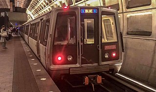
The Blue Line is a rapid transit line of the Washington Metro system, consisting of 27 stations in Fairfax County, Alexandria and Arlington, Virginia; the District of Columbia; and Prince George's County, Maryland, United States. The Blue Line runs from Franconia–Springfield to Largo Town Center. The line shares tracks with the Orange Line for 13 stations, the Silver Line for 18, and the Yellow Line for six. Only three stations are exclusive to the Blue Line.
U.S. Route 240 is a defunct designation for a short, but once very important, segment of highway between Frederick, Maryland and Washington, D.C. It is now commonly known as I-270.

Northwest is the northwestern quadrant of Washington, D.C., the capital of the United States, and is located north of the National Mall and west of North Capitol Street. It is the largest of the four quadrants of the city, and it includes the central business district, the Federal Triangle, and the museums along the northern side of the National Mall, as well as many of the District's historic neighborhoods.

Congress Heights is a residential neighborhood in Southeast Washington, D.C., in the United States. The irregularly shaped neighborhood is bounded by the St. Elizabeths Hospital campus, Lebaum Street SE, 4th Street SE, and Newcomb Street SE on the northeast; Shepard Parkway and South Capitol Street on the west; Atlantic Street SE and 1st Street SE on the south; Oxon Run Parkway on the southeast; and Wheeler Street SE and Alabama Avenue SE on the east. Commercial development is heavy along Martin Luther King, Jr. Avenue and Malcolm X Avenue.

The Kalorama area within the Northwest Quadrant of Washington, D.C., includes the residential neighborhoods of Kalorama Triangle and Sheridan-Kalorama. The area is accessible from the Dupont Circle and Woodley Park Metro stations, as well as various bus lines. Kalorama Triangle is bordered by Connecticut Avenue, Columbia Road, Calvert Street, and Rock Creek Park. Sheridan-Kalorama is adjacent, to the southwest, between Connecticut Avenue, Rock Creek Park, Massachusetts Avenue, and Florida Avenue.

President's Park, located in Washington, D.C., encompasses the White House and includes the Eisenhower Executive Office Building, the Treasury Building, and grounds; the White House Visitor Center; Lafayette Square; and The Ellipse. President's Park was the original name of Lafayette Square. The current President's Park is administered by the National Park Service. The park is officially referred to as President's Park or The White House and President's Park.
Constitution Avenue is a major east–west street in the northwest and northeast quadrants of the city of Washington, D.C., in the United States. It was originally known as B Street, and its western section was greatly lengthened and widened between 1925 and 1933. It received its current name on February 26, 1931, though it was almost named Jefferson Avenue in honor of Thomas Jefferson. Constitution Avenue's western half defines the northern border of the National Mall and extends from the United States Capitol to the Theodore Roosevelt Bridge. Its eastern half runs through the neighborhoods of Capitol Hill and Kingman Park before it terminates at Robert F. Kennedy Memorial Stadium. Many federal departmental headquarters, memorials, and museums line Constitution Avenue's western segment.

New York Avenue is a diagonal avenue radiating northeast from the White House in Washington, D.C. to the border with Maryland. It is a major east–west route in the city's Northwest and Northeast quadrants and connects downtown with points east and north of the city via Cheverly, Maryland, the John Hanson Highway, the Baltimore–Washington Parkway, and eventually, Interstate 95.
Mount Vernon Square is a city square and neighborhood in the Northwest quadrant of Washington, D.C. The square is located where the following streets would otherwise intersect: Massachusetts Avenue NW, New York Avenue NW, K Street NW, and 8th Street NW.

Independence Avenue is a major east-west street in the southwest and southeast quadrants of the city of Washington, D.C., in the United States, running just south of the United States Capitol. Originally named South B Street, Independence Avenue SW was constructed between 1791 and 1823. Independence Avenue SE was constructed in pieces as residential development occurred east of the United States Capitol and east of the Anacostia River. Independence Avenue SW received its current name after Congress renamed the street in legislation approved on April 13, 1934. Independence Avenue SW originally had its western terminus at 14th Street SW, but was extended west to Ohio Drive SW between 1941 and 1942. The government of the District of Columbia renamed the portion of the road in the southeast quadrant of the city in 1950.

H Street is a set of east-west streets in several of the quadrants of Washington, D.C. It is also used as an alternate name for the Near Northeast neighborhood, as H Street NW/NE is the neighborhood's main commercial strip.
The streets and highways of Washington, D.C., form the core of the city's surface transportation infrastructure. Given that it is a planned city, streets in the capital of the United States follow a distinctive layout and addressing scheme. There are 1,500 miles (2,400 km) of public roads in the city, of which 1,392 miles (2,240 km) are owned and maintained by the district government.

Hillcrest is a neighborhood in the southeast quadrant of Washington, D.C., United States. Hillcrest is located on the District-Maryland line in Ward 7, east of the Anacostia River.

Downtown is a neighborhood of Washington, D.C., as well as a colloquial name for the central business district in the northwest quadrant of the city. Historically, the Downtown has been defined as an area east of 16th Street NW, north of the National Mall/US Capitol complex, and south of Massachusetts Avenue, including the Penn Quarter. However, the city says that most residents, workers, and visitors think of Downtown in a broader sense—including areas as far north as Dupont Circle, the Golden Triangle, as far west as Foggy Bottom, and as far east as Capitol Hill. A small portion of this area is known as the Downtown Historic District and was listed on the NRHP in 2001.

Sixteenth Street Heights is a large neighborhood of rowhouses, duplexes, and American Craftsman and American Foursquare detached houses in Northwest Washington, D.C..

West Executive Avenue Northwest is a closed street in Washington, D.C., that, as of 2017, functions as a parking lot for persons employed by the Executive Office of the President. It runs adjacent to the White House.
References
- 1 2 3 Bredemeier, Kenneth (December 7, 1984). "East Executive Ave., Goodbye". The Washington Post . Retrieved February 13, 2017.
- ↑ "From Jefferson to jumpers, two centuries of the White House fence". Lexington Herald-Leader . July 24, 2015. Retrieved February 13, 2017.
- ↑ Livingston, Mark (2006). Newcomer's Handbook for Moving to And Living in Washington D.C.: Including Northern Virginia And Suburban Maryland . First Books. p. 9. ISBN 091230166X.
| Executive Residence |
|     | ||||||||||||
|---|---|---|---|---|---|---|---|---|---|---|---|---|---|---|
| West Wing | ||||||||||||||
| East Wing | ||||||||||||||
| Grounds | ||||||||||||||
| Annex | ||||||||||||||
| Nearby streets |
| |||||||||||||
| Other | ||||||||||||||