In 1920, more than 500 trees were planted along 16th Street between Alaska Avenue and Varnum Street to honor fallen soldiers from World War I. Today, the 16th Street World War I Memorial Trees and their corresponding markers have largely been lost to history.
In July 2005, just before Congress's summer recess, TexasRepublican congressman Henry Bonilla quietly introduced resolution H.R. 3525[7] to rename 16th Street NW "Ronald Reagan Boulevard" in honor of the former president of the United States. Mayor Anthony A. Williams objected on the grounds that the proposal would have changed Pierre L'Enfant's 1791 design for the city and cost an estimated $1 million for new signs and maps. The plan was ultimately quashed by Rep. Tom Davis, chairman of the House Government Reform Committee and a fellow Republican representing Washington's Virginia suburbs.[8]
On June 6, 2020, activists altered the mural. They removed the stars from the D.C. flag, changing it to an equals sign, and added the words "defund the police" so that the mural read "Black Lives Matter = Defund the Police".[14][15] The plaza was removed in March 2025.
By the end of the 19th century, 16th Street NW stretched some 2.5 miles from the White House north to Morris Road NW (now Monroe Street NW). On March 30, 1899, the United States Congress authorized the extension of the street to the D.C.-Maryland line. Within two years, the city completed condemnation proceedings to obtain the necessary land.[17] But bridging the natural obstacle of the Piney Branch valley—with the nation's first parabolic arch bridge—would take until 1909.[18]
The northern and central portions of 16th Street—and the Crestwood neighborhood, in particular—have for a half century been the chosen neighborhood of accomplished African Americans in Washington. Known colloquially as "The Gold Coast", these sections of 16th Street are lined with early 20th-century Tudor mansions.[19] As 16th Street continues north through the Shepherd Park neighborhood, the street passes 7700 16th Street NW, a Tudor-style house that was the scene of a notorious crime; several houses of worship, including the Ohev Sholom synagogue and historic Tiffereth Israel synagogue, across the street from one another; and the Washington Ethical Society.[citation needed]
The street's proximity to Rock Creek Park and importance as a thoroughfare has made it a natural dividing boundary for Washington neighborhoods. Outside of the downtown area, no neighborhood in the city falls on both sides of 16th Street; the neighborhoods that surround it have 16th as either their eastern or their western boundary. For many years, the wide street was the de facto "boundary" between Caucasian and African-American neighborhoods of the city, especially in the tense years after the 1968 race riots.[citation needed]
A pair of similarly named streets, 16th Street Northeast and 16th Street Southeast, are three miles (5km) away in the northeast and southeast quadrants of Washington. They are contiguous with each other and parallel to 16th Street NW. There is no 16th Street Southwest, as this space is occupied by the National Mall and the Washington Channel.[citation needed]
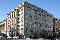
↑Michael D. Shear (March 18, 1993). "NRA makes move to Fair Oaks". The Washington Post. Archived from the original on February 11, 2021. Retrieved May 17, 2023. The National Rifle Association has decided to move 400 of its employees from the District to a new building in the Fair Oaks section of Fairfax County, Board of Supervisors Chairman Thomas M. Davis III said.
↑"His Annual Report". The Evening Star. November 11, 1902. p.7.
↑"Bridge Nearly Ready". The Washington Post. March 25, 1910. p.16.
↑Lewis, Neil A. (May 19, 1985). "The Shifting 'Gold Coast'". The New York Times. Archived from the original on July 27, 2018. Retrieved April 18, 2010.
This page is based on this Wikipedia article Text is available under the CC BY-SA 4.0 license; additional terms may apply. Images, videos and audio are available under their respective licenses.