Shepherd Park

Last updated
Intersection of 14th and Hemlock Streets NW in Shepherd Park, February 2018 Shepherd Park DC.jpg
Intersection of 14th and Hemlock Streets NW in Shepherd Park, February 2018
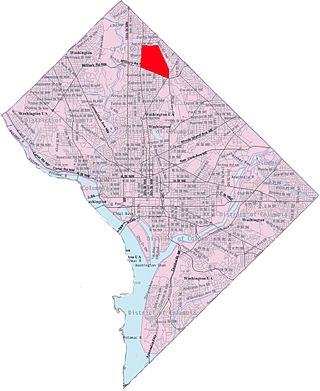
Map of Washington, D.C., with Shepherd Park highlighted in maroon DC Neighborhoods - Shepherd Park.svg
Map of Washington, D.C., with Shepherd Park highlighted in maroon

Shepherd Park is a neighborhood in the northwest quadrant of Washington, D.C. In the years following World War II, restrictive covenants which had prevented Jews and African Americans from purchasing homes in the neighborhood were no longer enforced, and the neighborhood became largely Jewish and African American. Over the past 40 years, the Jewish population of the neighborhood has declined (though it is now increasing again)[ citation needed ] but the neighborhood has continued to support a thriving upper and middle class African American community. The Shepherd Park Citizens Association and Neighbors Inc. led efforts to stem white flight from the neighborhood in the 1960s and 1970s, and it has remained a continuously integrated neighborhood, with very active and inclusive civic groups.

Contents

Shepherd Park and the rest of Ward 4 were represented in the Council of the District of Columbia by Muriel Bowser, until her election as Mayor of the District of Columbia in the fall of 2014. It is home to a number of prominent people, including former NAACP President Benjamin Jealous. A number of judges, professors, newspaper reporters, and doctors also live in the community.[ citation needed ]

Geography

The northern line of the neighborhood is defined by Eastern Avenue NW, which divides Shepherd Park from Silver Spring, Maryland. [1] The neighborhood is further bounded at the south by Parks at Walter Reed (the former Walter Reed Army Medical Center), at the east by Georgia Avenue NW, and the west by 16th Street NW. [1]

Most east-west streets are named after flowers, shrubs, and trees. Iris Street, Kalmia Road, and Geranium Street are but a few flower-inspired street names.

Georgia Avenue is the only commercial corridor near the neighborhood. [2] Downtown Silver Spring and Rock Creek Park are both within walking distance. The neighborhood is served by bus services on Georgia Ave. and 16th Street, and the Silver Spring and Takoma Park Metros are equidistant, both approximately one mile away.

Local architecture includes Tudor Revival, Colonial Revival, and Spanish Colonial Revival houses; bungalows and other early-20th-century vernacular styles; and mid-century ramblers. There is a significant concentration of mail-order kit houses by the Lewis Manufacturing Company and by Sears in the southeast corner of the neighborhood.

History

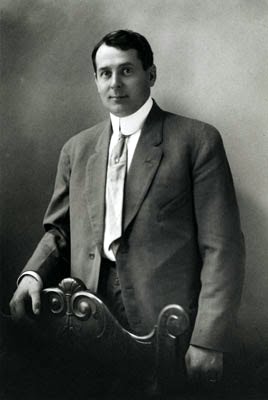
The neighborhood takes its name from its most famous resident: Alexander Robey Shepherd, the governor of the then-Territory of DC from 1873 to 1874. The neighborhood was originally called Sixteenth Street Heights. Part of the neighborhood was renamed Shepherd Park in 1926 when developer L.E. Breuninger proposed 200 new homes. His first model home was built in the new Shepherd Park was 7707 13th St., NW. [3]

Alexander Robey Shepherd Alexander-Robey-Shepherd.jpg
Alexander Robey Shepherd

Shortly before becoming governor (in 1868), Shepherd built a grand Second Empire-style Victorian that once stood near the corner of Floral and 14th Street. (The carriage house still stands in the alley off of Floral, entrance across from the modern house.) Shepherd chose the location because of its elevation and its proximity to Rock Creek. [4]

Shepherd dubbed his large country home "Bleak House" after the Dickens novel Bleak House , which he and his wife were reading at the time of their home's construction. [5] The mansion was demolished in 1916. [5]

Shepherd owned a plant nursery in the District of Columbia, which enabled the 60,000 trees he had planted. His nursery led to a variety of wild flowers that still thrive in the yards of city residents. It is also the genesis of the streets in Shepherd Park being named for flowers.

The Shepherd Park Citizens Association formed 1917 to petition the government to build a neighborhood elementary school and pave 16th Street between Alaska Avenue and the District line. [2]

After developers acquired the land around 1911, they designed it so that the new homes would sit on large tracts of land, and they advertised the location as a "high-class" neighborhood. [5] The developers made sure to retain the large trees in the neighborhood when building the streets. [6] The developers also made sure that the land was bound by covenants prohibiting its sale to blacks and Jews. [7] The covenants stood until after World War II when the Supreme Court struck them down as unconstitutional. [7] At that point, speculators would move a black family into a house on a block that otherwise had white residents. Speculators would then tell the white residents that property values would imminently fall and pressure the white families to sell their homes to the speculators. The speculators would then sell the homes to other black families at large profits. This was called blockbusting. Starting in 1958, the Shepherd Park Citizens Association and Neighbors Inc led efforts to fight blockbusting and maintain the integrated nature of the neighborhood in the 1960s and 1970s. It is one of the only neighborhoods on the east side of Rock Creek Park where white flight was stemmed in those years.

In 1973, 7 family members of Hamaas Abdul Khaalis family were murdered at 7700 16th Street NW, which had been purchased by Kareem Abdul-Jabbar and donated for use of the Hanafi Muslims.

In 1985, residents learned that the owner of an apartment building on Georgia Avenue was close to selling the land for a Wendy's to be built on it. [8] Residents protested, saying that the neighborhood needed a library much more than another fast food location. [7] The District Council decided to build a library on the site instead, [9] and the library opened in 1990. [10] Named the Juanita E. Thornton/Shepherd Park Library, it is named after the neighborhood activist who led the neighborhood association in its efforts to have the library built there. [10]

Neighborhood Institutions

Education

The Juanita E. Thornton/Shepherd Park Neighborhood Library in 2018 Juanita E. Thornton - Shepherd Park Branch Library.jpg
The Juanita E. Thornton/Shepherd Park Neighborhood Library in 2018

District of Columbia Public Schools operates public schools.

District of Columbia Public Library operates the Juanita E. Thornton/Shepherd Park Neighborhood Library, [11] which opened in 1990. [2]

Juanita E. Thornton/Shepherd Park Neighborhood Library

Juanita E. Thornton/Shepherd Park Neighborhood Library is part of the District of Columbia Public Library (DCPL) System. It opened to the public on July 29, 1990.

Related Research Articles

<span class="mw-page-title-main">Mount Pleasant (Washington, D.C.)</span> Neighborhood of Washington, D.C.

Mount Pleasant is a neighborhood in the northwestern quadrant of Washington, D.C. It is bounded by Rock Creek Park to the north and west; Harvard Street NW to the south; and 16th Street NW to the east. It is north of Adams Morgan and west of Columbia Heights. It is home to about 10,000 people.

<span class="mw-page-title-main">Cleveland Park</span> Neighborhood in Washington, D.C.

Cleveland Park is a residential neighborhood in the Northwest quadrant of Washington, D.C. It is located at 38°56′11″N77°3′58″W and bounded approximately by Rock Creek Park to the east, Wisconsin and Idaho Avenues to the west, Klingle and Woodley Roads to the south, and Rodman and Tilden Streets to the north. Its main commercial corridor lies along Connecticut Avenue NW, where the eponymous Cleveland Park station of the Washington Metro's Red Line can be found; another commercial corridor lies along Wisconsin Avenue. The neighborhood is known for its many late 19th century homes and the historic Art Deco Uptown Theater. It is also home to the William L. Slayton House and the Park and Shop, built in 1930 and one of the earliest strip malls.

<span class="mw-page-title-main">West End (Washington, D.C.)</span> Place in the United States

The West End is a neighborhood in the Northwest quadrant of Washington, D.C., bounded by K Street NW to the south, Rock Creek Park to the west and north, and New Hampshire Avenue NW and 23rd Street NW to the east. The West End is so named because it was the westernmost part of the original L'Enfant Plan for the city of Washington, before the annexation of Georgetown. It is home to the embassies of Spain and Qatar as well as the Delegation of the European Union to the United States. The George Washington University and George Washington University Hospital are on the edge of the West End, at Washington Circle.

<span class="mw-page-title-main">Forest Hills (Washington, D.C.)</span> Place in the United States

Forest Hills is a residential neighborhood in the northwest quadrant of Washington, D.C., United States, bounded by Connecticut Avenue NW to the west, Rock Creek Park to the east, Chevy Chase to the north, and Tilden Street NW to the south. The neighborhood is frequently referred to as Van Ness because it is served by the Van Ness–UDC station on the Washington Metro's Red Line and is near the Van Ness campus of the University of the District of Columbia (UDC).

<span class="mw-page-title-main">Kalorama (Washington, D.C.)</span> Neighborhood of Washington, D.C.

Kalorama is a neighborhood in Northwest Washington, D.C., United States. It includes the Kalorama Triangle Historic District and Sheridan-Kalorama Historic District. It is named after the Kalorama mansion.

<span class="mw-page-title-main">Takoma (Washington, D.C.)</span> Neighborhood of Washington, D.C.

Takoma, Washington, D.C., is a neighborhood in Washington, D.C. It is located in Advisory Neighborhood Commission 4B, in the District's Fourth Ward, within the northwest quadrant. It borders the city of Takoma Park, Maryland.
<span class="mw-page-title-main">Bloomingdale (Washington, D.C.)</span> Place in the United States

Bloomingdale is a neighborhood in the Northwest quadrant of Washington, D.C., less than two miles (3 km) north of the United States Capitol building. It is a primarily residential neighborhood, with a small commercial center near the intersection of Rhode Island Avenue and First Street NW featuring bars, restaurants, and food markets.

<span class="mw-page-title-main">Petworth (Washington, D.C.)</span> Place in District of Columbia, United States

Petworth is a residential neighborhood in the Northwest quadrant of Washington, D.C. It is bounded to the east by the Armed Forces Retirement Home and Rock Creek Cemetery, to the west by Arkansas Avenue NW, to the south by Rock Creek Church Road NW and Spring Road NW, and to the north by Kennedy Street NW.

<span class="mw-page-title-main">Brightwood (Washington, D.C.)</span> Place in the United States

Brightwood is a neighborhood in the northwestern quadrant of Washington, D.C. Brightwood is part of Ward 4.
<span class="mw-page-title-main">Pleasant Plains (Washington, D.C.)</span> Neighborhood of Washington, D.C.

Pleasant Plains is a neighborhood in central Washington, D.C. largely occupied by Howard University. For this reason it is also sometimes referred to as Howard Town or, less frequently, Howard Village.

<span class="mw-page-title-main">Georgia Avenue</span> Major north-south artery in NW Washington, DC, and Montgomery County, Maryland, US

Georgia Avenue is a major north-south artery in Northwest Washington, D.C., and Montgomery County, Maryland. Within the District of Columbia and a short distance in Silver Spring, Maryland, Georgia Avenue is also U.S. Route 29. Howard University is located on Georgia Avenue.

<span class="mw-page-title-main">New Hampshire Avenue</span> Diagonal street in Washington, D.C.

New Hampshire Avenue is a diagonal street in Washington, D.C., beginning at the Kennedy Center and extending northeast for about 5 miles (8 km) and then continuing into Maryland where it is designated Maryland Route 650. New Hampshire Avenue, however, is not contiguous. It stops at 15th and W Streets NW and resumes again on the other side of Columbia Heights at Park Road NW, a few blocks from Georgia Avenue. New Hampshire Avenue passes through several Washington neighborhoods including Foggy Bottom, Dupont Circle, Petworth and Lamond-Riggs.

<span class="mw-page-title-main">Washington Highlands (Washington, D.C.)</span> Residential neighborhood, southeast Washington, D.C., United States

Washington Highlands is a residential neighborhood in Southeast Washington, D.C., in the United States. It lies within Ward 8.

<span class="mw-page-title-main">Manor Park (Washington, D.C.)</span>

Manor Park is a neighborhood in Ward 4 of northwest Washington, D.C.

<span class="mw-page-title-main">Woodland Normanstone</span> Place in the United States

Woodland Normanstone is a small, residential neighborhood in Northwest Washington, D.C., adjoining the larger neighborhoods of Woodley Park, Massachusetts Avenue Heights, and Observatory Circle.

<span class="mw-page-title-main">Downtown (Washington, D.C.)</span> United States historic place

Downtown is the central business district of Washington, D.C., located in Northwest D.C. It is the fourth largest central business district in the United States. The "Traditional Downtown" has been defined as an area roughly between Union Station in the east and 16th Street NW in the west, and between the National Mall on the south and Massachusetts Avenue on the north, including Penn Quarter. However, nowadays, Downtown D.C. usually refers to a larger area, as the DC Office of Planning states:

…most residents, workers, and visitors think of Downtown in a broader sense — including areas as far north as Dupont Circle, as far west as Foggy Bottom, and as far east as Capitol Hill. Only about half of the central city workforce is located within the city’s traditional Downtown.

The District of Columbia Public Library (DCPL) is the public library system for Washington, D.C. The system includes 26 individual libraries including Martin Luther King Jr. Memorial Library, DCPL's central library.

Fort Stevens Ridge is a neighborhood in Northwest Washington, D.C. built during the 1920s. The neighborhood comprises about 50 acres (0.20 km2) and is very roughly bounded by Peabody Street, Fifth Street, Underwood Street, and Ninth Street. As of the 2010 census, the neighborhood had 2,597 residents. It was named for nearby Fort Stevens, a Civil War-era fort used to defend the nation's capital from invasion by Confederate soldiers.

<span class="mw-page-title-main">Strivers' Section Historic District</span> Historic district in Washington, D.C., United States

The Strivers' Section Historic District is a historic district located in the Dupont Circle neighborhood of Washington, D.C. Strivers' Section was historically an enclave of upper-middle-class African Americans, often community leaders, in the late 19th and early 20th centuries. It takes its name from a turn-of-the-20th-century writer who described the district as "the Striver's section, a community of Negro aristocracy." The name echoes that of Strivers' Row in Harlem, a New York City historic neighborhood of black professionals. The district is roughly bounded by Swann Street and the Dupont Circle Historic District on the south, Florida Avenue and the Washington Heights Historic District on the north and west, and the Sixteenth Street Historic District on the east.

<span class="mw-page-title-main">Juanita E. Thornton/Shepherd Park Neighborhood Library</span>

Juanita E. Thornton/Shepherd Park Neighborhood Library is part of the District of Columbia Public Library (DCPL) System. It was opened to the public on July 29, 1990. The library was named in honor of Juanita E. Thornton, a teacher and community activist.

References

  1. 1 2 Harriston, Keith (December 8, 1990). "Fighting For Their Character: Shepherd Park Meets Any Crisis Head-On". The Washington Post. p. E1. ProQuest   307317975.
  2. 1 2 3 Brenner, Joel Glenn (October 2, 1993). "Shepherd Park: Feisty Fighter for Community Standards". The Washington Post. p. E1. ProQuest   307690356.
  3. "Announcement Opening and Naming of 'Shepherd Park' (formerly part of 16ht St. Heights) The Old Homestead of Gov. Shepherd..." The Evening Star. May 1, 1926.
  4. Sadler, Christine (November 28, 1939). "Untitled". The Washington Post. p. 17. ProQuest   151124410.
  5. 1 2 3 Kelly, John (February 13, 2011). "Alaska won a place on D.C. maps long before it won statehood". The Washington Post. p. C3. ProQuest   851396405.
  6. "Keep Natural Charm: Modern Idea Marks Sixteenth Street Heights". The Washington Post. June 22, 1913. p. R2. ProQuest   145270669.
  7. 1 2 3 Bruske, Ed (August 15, 1987). "Shepherd Park: Activism Working Within Tradition". The Washington Post. p. E1. ProQuest   139188985.
  8. Bredemeier, Kenneth (May 2, 1985). "Neighbors' Beefs Stall Wendy's Plans". The Washington Post. p. C1. ProQuest   138646969.
  9. "Council Votes to Build Shepherd Park Library". The Washington Post. July 4, 1985. p. DC3. ProQuest   138614647.
  10. 1 2 Camp, Margaret (July 26, 1990). "Library to Open in Northwest: Neighbors Win 'Books Not Burgers' in Fight Against Planned Eatery". The Washington Post. p. DC7. ProQuest   140148430.
  11. "Hours & Locations." District of Columbia Public Library. Retrieved on October 21, 2009.

38°59′04″N77°01′59″W / 38.9844°N 77.033°W / 38.9844; -77.033