Takoma (Washington, D.C.)

Last updated

Takoma
Takoma Masonic Building DC.jpg
Takoma Masonic Building
USA District of Columbia location map.svg
Red pog.svg
Takoma
Coordinates: 38°58′30″N77°1′13″W / 38.97500°N 77.02028°W / 38.97500; -77.02028
Country United States
District Washington, D.C.
WardWard 4
Government
  Councilmember Janeese Lewis George

Takoma, Washington, D.C., is a neighborhood in Washington, D.C. It is located in Advisory Neighborhood Commission 4B, in the District's Fourth Ward, within the northwest quadrant. It borders the city of Takoma Park, Maryland.

Contents

Overview

Intersection of 5th St. and Aspen St. NW, Takoma, February 2019 Intersection of 5th St. and Aspen St. NW, Takoma, Washington, DC.jpg
Intersection of 5th St. and Aspen St. NW, Takoma, February 2019

In 2019 Nina Zafar of the Washington Post characterized Takoma as an ethnically diverse neighborhood, and stated that it "feels like a small town within a big city, and residents are proud of its broad-mindedness." [1] It is populated mostly by middle-class families. Its small downtown has recently been redeveloped, bringing in new residents and attractive new businesses. Many of the houses in Takoma are historic, and some are over 100 years old.[ when? ][ citation needed ]

Takoma and the rest of Ward 4 are represented in the Council of the District of Columbia by Janeese Lewis George.

Geography

Map of Washington, D.C., with Takoma highlighted in red Map takoma.jpg
Map of Washington, D.C., with Takoma highlighted in red

Along Eastern Avenue, Takoma borders Takoma Park, Maryland, a city with which Takoma shares its origins. Takoma shares a common identity with the neighboring city in Maryland, and the downtown area surrounding the Takoma Metro station crosses the District of Columbia line.

Takoma is bounded by Georgia Avenue to the west, somewhere between Tuckerman and Van Buren Streets to the south, and Eastern Avenue to the northeast. The former site of the Walter Reed Army Medical Center on Georgia Avenue separates it from Rock Creek Park. However, the neighborhood historically and culturally spans across the Maryland line into the greater neighborhood of Takoma Park.

History

Takoma Park Historic District
Takoma HD, DC.JPG
House on Cedar St. NW
Usa edcp location map.svg
Red pog.svg
LocationRoughly bounded by DC/Maryland boundary, 7th Street, Piney Branch Road, Aspen Street, and Fern Street.
NRHP reference No. 83001416
Added to NRHPJune 30, 1983

Takoma, which was originally named Takoma Park, was developed in 1883 by developer Benjamin Franklin Gilbert as a commuter suburb on the Metropolitan Branch of the Baltimore and Ohio railroad line. [2] Gilbert welcomed the Seventh-day Adventist Church to set up their world headquarters and publishing house in Takoma Park, D.C. with a hospital and college in neighboring Takoma Park, Maryland, and promoted the community's reputation for vegetarianism and "clean living" away from the "malarial swamps" of the city. Takoma, D.C. was originally regarded as the commercial hub for the entire surrounding area, prior to the development of Silver Spring, Maryland, as it featured large shops and industrial buildings in the area now occupied by the Metro station. Its commercial hub is considered to be part of Takoma Park's Historic District. [3]

Gilbert wished to rename the train stop called Brightwood, and the name Takoma was chosen in 1883 by D.C. resident Ida Summy, who believed it to mean "high up" or "near heaven". [4]

The Seventh-day Adventist Church maintained its world headquarters and a publishing house on the Eastern Avenue side of the D.C. line until the early 1980s; after moving to Silver Spring, the former site of the publishing house became art lofts and rehearsal space for the Washington Opera.

The Takoma Theater, built in 1924, is located in the neighborhood and is supported by the Takoma Theatre Conservancy, a nonprofit preservation group that raised money to buy and refurbish the theater. [5]

The Takoma Masonic Center's ground-breaking ceremony took place on November 12, 1924, at the corner of Carroll Street NW and Maple Street NW. On November 29, 1924, the masonic cornerstone ceremony was conducted by the Grand Master of Masons of the District of Columbia, Charles F. Roberts, and Grand Lodge officers and members of the Grand Lodge of the District of Columbia, Free And Accepted Masons. [6] Hiram-Takoma Lodge No. 10 [7] and Takoma Chapter No. 12, Order of the Eastern Star of the District of Columbia, have met there since May 27, 1925.

Both Takoma Park, D.C., and Takoma Park, Maryland, have been noted, regionally and nationally, for progressive politics dating from the 1960s, [8] when area residents (led by future Takoma Park, Maryland mayor Sam Abbott) rallied to prevent a 10-lane freeway from bisecting the community, [9] and lobbied to build the Metrorail system, near the site of the former B&O railroad station around which the community had been built. Neighbors Inc, a non-profit interracial group of DC residents, worked extensively in the early 1960s to oppose blockbusting efforts and to foster integrated middle-class neighborhoods. [10] Both of the remaining areas, on either side of the D.C.-Maryland line, are now protected as U.S. Historic Districts. [3]

Transportation

The Takoma station of Washington Metro is the station for Takoma. [1]

Education

District of Columbia Public Schools operates public schools. Takoma Education Campus (K-8 school) and Coolidge High School are the public schools of the area, [1] and located in Takoma, D.C.

District of Columbia Public Library operates the Takoma Park Neighborhood Library. [11] It was the first neighborhood library in Washington, D.C., [12] and a Carnegie library. Washington Adventist University (formerly Columbia Union College—1960-2010) is the only graduate university in Takoma Park, and the only graduate institution in Montgomery County, Maryland.

EF International Languages Center Washington, D.C., a private English school for foreign students, is located in Takoma.

See also

Related Research Articles

<span class="mw-page-title-main">Takoma Park, Maryland</span> City in the United States

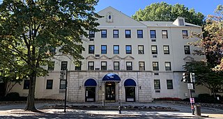
Takoma Park is a city in Montgomery County, Maryland, United States. It is a suburb of Washington, and part of the Washington metropolitan area. Founded in 1883 and incorporated in 1890, Takoma Park, informally called "Azalea City", is a Tree City USA and a nuclear-free zone. A planned commuter suburb, it is situated along the Metropolitan Branch of the historic Baltimore and Ohio Railroad, just northeast of Washington, D.C., and it shares a border and history with the adjacent Washington, D.C. neighborhood of Takoma. It is governed by an elected mayor and six elected councilmembers, who form the city council, and an appointed city manager, under a council-manager style of government. The city's population was 17,629 at the 2020 census.

<span class="mw-page-title-main">Chillum, Maryland</span> Census-designated place in Maryland

Chillum is an unincorporated area and census-designated place in Prince George's County, Maryland, United States, bordering Washington, D.C., and Montgomery County.

<span class="mw-page-title-main">Langley Park, Maryland</span> Census-designated place in Maryland, United States

Langley Park is an unincorporated area and census-designated place (CDP) in Prince George's County, Maryland, United States. It is located inside the Capital Beltway, on the northwest edge of Prince George's County, bordering Montgomery County. Per the 2020 census, the population was 20,126.

<span class="mw-page-title-main">Georgetown (Washington, D.C.)</span> Place in the United States

Georgetown is a historic neighborhood and commercial district in Northwest Washington, D.C., situated along the Potomac River. Founded in 1751 as part of the colonial-era Province of Maryland, Georgetown predated the establishment of Washington, D.C. by 40 years. Georgetown was an independent municipality until 1871 when the United States Congress created a new consolidated government for the entire District of Columbia. A separate act, passed in 1895, repealed Georgetown's remaining local ordinances and renamed Georgetown's streets to conform with those in Washington, D.C.

<span class="mw-page-title-main">Takoma station</span> Washington Metro station

Takoma station is a Washington Metro station on the Red Line in the Takoma neighborhood of Washington, D.C., bordering Takoma Park, Maryland. The station is considered to be located in part of Takoma Park's Historic District. It is the last station in the District of Columbia on the eastern end of the Red Line heading to Maryland, located east of the intersection of Blair Road NW and Cedar Street NW. The station's parking lot and bus stops are accessed from Eastern Avenue NW, which runs along the DC–Maryland line.

<span class="mw-page-title-main">Tenleytown</span> Place in the United States

Tenleytown is a historic neighborhood in Northwest, Washington, D.C.

<span class="mw-page-title-main">Anacostia</span> Neighborhood in Washington, D.C.

Anacostia is a historic neighborhood in Southeast Washington, D.C. Its downtown is located at the intersection of Marion Barry Avenue and Martin Luther King Jr. Avenue. It is located east of the Anacostia River, after which the neighborhood is named.

<span class="mw-page-title-main">Cleveland Park</span> Neighborhood in Washington, D.C.

Cleveland Park is a residential neighborhood in the Northwest quadrant of Washington, D.C. It is located at 38°56′11″N77°3′58″W and bounded approximately by Rock Creek Park to the east, Wisconsin and Idaho Avenues to the west, Klingle and Woodley Roads to the south, and Rodman and Tilden Streets to the north. Its main commercial corridor lies along Connecticut Avenue NW, where the eponymous Cleveland Park station of the Washington Metro's Red Line can be found; another commercial corridor lies along Wisconsin Avenue. The neighborhood is known for its many late 19th century homes and the historic Art Deco Uptown Theater. It is also home to the William L. Slayton House and the Park and Shop, built in 1930 and one of the earliest strip malls.

<span class="mw-page-title-main">Shepherd Park</span>

Shepherd Park is a neighborhood in the northwest quadrant of Washington, D.C. In the years following World War II, restrictive covenants which had prevented Jews and African Americans from purchasing homes in the neighborhood were no longer enforced, and the neighborhood became largely Jewish and African American. Over the past 40 years, the Jewish population of the neighborhood has declined but the neighborhood has continued to support a thriving upper and middle class African American community. The Shepherd Park Citizens Association and Neighbors Inc. led efforts to stem white flight from the neighborhood in the 1960s and 1970s, and it has remained a continuously integrated neighborhood, with very active and inclusive civic groups.

<span class="mw-page-title-main">Chevy Chase (Washington, D.C.)</span> Place in the United States

Chevy Chase is a neighborhood in northwest Washington, D.C. It borders Chevy Chase, Maryland.

<span class="mw-page-title-main">Woodridge (Washington, D.C.)</span> Place in the United States

Woodridge is a residential neighborhood located in Ward 5 of Northeast Washington, D.C. Woodridge is contained between Eastern Avenue N.E. to the east, Taylor Street N.E. to the north, South Dakota Avenue N.E. to the west, and Bladensburg Road N.E. to the south. Its central commercial strips are Rhode Island Avenue NE and Bladensburg Road N.E. Woodridge borders the adjacent neighborhoods of Brookland, Langdon, North Michigan Park, and Fort Lincoln in Northeast Washington D.C. In addition to these neighborhoods in the District of Columbia, Woodridge borders the city of Mount Rainier and town of Cottage City in Maryland. In terms of public transportation, residents of Woodridge have access to the Brookland-CUA and Rhode Island Avenue Metro stations.

<span class="mw-page-title-main">Brightwood (Washington, D.C.)</span> Place in the United States

Brightwood is a neighborhood in the northwestern quadrant of Washington, D.C. Brightwood is part of Ward 4.

<span class="mw-page-title-main">Georgia Avenue</span> Major north-south artery in NW Washington, DC, and Montgomery County, Maryland, US

Georgia Avenue is a major north-south artery in Northwest Washington, D.C., and Montgomery County, Maryland. In Washington, D.C., and for a short distance in Silver Spring, Maryland, Georgia Avenue is also U.S. Route 29. Howard University is located on Georgia Avenue.

<span class="mw-page-title-main">Maryland Route 195</span> State highway in Montgomery County, Maryland, United States, known as Carroll Avenue

Maryland Route 195 is a state highway in the U.S. state of Maryland. Known as Carroll Avenue, the state highway runs 1.90 miles (3.06 km) from Eastern Avenue at the District of Columbia boundary in Takoma Park north to MD 193 in Silver Spring. MD 195 is the main north–south state highway through Takoma Park in southeastern Montgomery County. The highway provides access to Washington Adventist University and Washington Adventist Hospital and crosses Sligo Creek on the Carroll Avenue Bridge. The state highway was constructed from Washington, D.C. to Silver Spring in the late 1920s on a road that has existed since the 19th century. The Carroll Avenue Bridge was built in 1932 as the third bridge at the site. Reconstruction of the bridge began in 2015 and was completed in 2017.

<span class="mw-page-title-main">Woodley Park (Washington, D.C.)</span> Place in the United States

Woodley Park is a neighborhood in Washington, D.C., located in Northwest D.C. Primarily residential, Woodley Park hosts a commercial corridor of restaurants and shops located along Connecticut Avenue. The neighborhood is noted as the home of the National Zoological Park, part of the Smithsonian Institution.

Carole Highlands is an unincorporated community in Prince George's County, Maryland, United States. It is contained between East West Highway to the south, University Boulevard to the north, Larch Avenue, Hopewell Avenue, and 15th Avenue to the west, and Riggs Road to the east. Carole Highlands borders the adjacent neighborhoods of Chillum, Green Meadows, Lewisdale, and Langley Park in Prince George's County, while bordering the city of Takoma Park in Montgomery County. For statistical purposes, it is part of the Langley Park census-designated place (CDP). The community also has a community association and non-profit: Carole Highlands Neighborhood Association

<span class="mw-page-title-main">Riggs Park</span> Place in the United States

Riggs Park, also known as Lamond Riggs, is a residential neighborhood in Ward 4 of Northeast Washington, D.C. Riggs Park is contained between Eastern Avenue N.E. to the east, Riggs Road N.E. to the south, North Capitol Street N.W. to the north and west, and the Blair Road Community Garden to the north. Riggs Park is adjacent to the neighborhoods of Queens Chapel, North Michigan Park, and Fort Totten, located in Ward 5 of Northeast Washington D.C. In addition to these neighborhoods, Riggs Park also borders the city/neighborhood Chillum, which is located in Prince George's County, Maryland. The WMATA Red Line train tracks pass through the Riggs Park neighborhood when traveling between the Takoma and Fort Totten Metro Stations. In addition to the WMATA Red Line, the CSX, MARC, and Amtrak train tracks, pass through the Riggs Park neighborhood as well.

The District of Columbia Public Library (DCPL) is the public library system for Washington, D.C. The system includes 26 individual libraries including Martin Luther King Jr. Memorial Library, DCPL's central library.

<span class="mw-page-title-main">Outline of Washington, D.C.</span> Overview of and topical guide to District of Columbia

The following outline is provided as an overview of and topical guide to the District of Columbia:

<span class="mw-page-title-main">Takoma Park Neighborhood Library</span> Branch of District of Columbia Public Library

The Takoma Park Neighborhood Library is part of the District of Columbia Public Library (DCPL) System. It was opened to the public in 1911.

References

  1. 1 2 3 Zafar, Nina (August 28, 2019). "D.C.'s Takoma is a neighborhood that fought for diversity and still reaps its benefits". Washington Post . Retrieved July 23, 2024.
  2. Historic Takoma (2011). Takoma Park: Images of America. Arcadia Publishing. p. 9. ISBN   978-0-7385-8641-0.
  3. 1 2 "Washington, DC--Takoma Park Historic District". www.nps.gov. Retrieved March 25, 2018.
  4. Kohn, Diana (November 2008). "Takoma Park at 125" (PDF). Takoma Voice. pp. 14–15. Retrieved May 8, 2014.
  5. Meno, Mike.Grants offer hope for Takoma Theatre renewal. Maryland Gazette. 2008-07-16.
  6. "The Grand Lodge of the District of Columbia". The Grand Lodge of the District of Columbia.
  7. "Hiram-Takoma Lodge No. 10". Hiram-Takoma Lodge No. 10.
  8. DCist.com. "Takoma Park Votes to Impeach President Bush". Archived from the original on October 16, 2015. Commonly referred to as...'The Berkeley of the East'
  9. Historic Takoma (2011). Takoma Park: Images of America. Arcadia Publishing. p. 87. ISBN   978-0-7385-8641-0.
  10. "Race and real estate in mid-century D.C. - D.C. Policy Center". April 16, 2019.
  11. "Hours & Locations." District of Columbia Public Library. Retrieved on October 21, 2009.
  12. "Takoma Park Library History." District of Columbia Public Library. Retrieved on September 21, 2010.