Cheverly is a town in Prince George's County, Maryland, United States, located very close to Washington, D.C., though not bordering it directly. The town was founded in 1918 and incorporated in 1931. Per the 2020 census, the population was 6,170. Cheverly borders the communities of Tuxedo, Chapel Oaks, Landover, Landover Hills, Villa Heights, and Bladensburg.

Northeast is the northeastern quadrant of Washington, D.C., the capital of the United States. It encompasses the area located north of East Capitol Street and east of North Capitol Street.
Trinidad is a neighborhood located in Ward 5, in the northeast quadrant of Washington, D.C. and is a largely residential area.

New York Avenue is a diagonal avenue radiating northeast from the White House in Washington, D.C. to the border with Maryland. It is a major east–west route in the city's Northwest and Northeast quadrants and connects downtown with points east and north of the city via Cheverly, Maryland, the John Hanson Highway, the Baltimore–Washington Parkway, and eventually, Interstate 95.

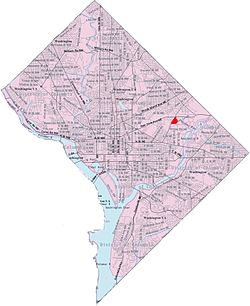
Woodridge is a residential neighborhood located in Ward 5 of Northeast Washington, D.C. Woodridge is contained between Eastern Avenue N.E. to the east, Taylor Street N.E. to the north, South Dakota Avenue N.E. to the west, and Bladensburg Road N.E. to the south. Its central commercial strips are Rhode Island Avenue NE and Bladensburg Road N.E. Woodridge borders the adjacent neighborhoods of Brookland, Langdon, North Michigan Park, and Fort Lincoln in Northeast Washington D.C. In addition to these neighborhoods in the District of Columbia, Woodridge also borders the city of Mount Rainier and town of Cottage City in Maryland. In terms of public transportation, residents of Woodridge have access to the Brookland-CUA and Rhode Island Avenue Metro stations.

H Street is a set of east–west streets in several of the quadrants of Washington, D.C. It is also used as an alternate name for the Near Northeast neighborhood, as H Street NW/NE is the neighborhood's main commercial strip.

Ivy City is a small neighborhood in Northeast Washington, D.C., in the United States. About half the neighborhood is industrial or formerly industrial, dominated by warehouses. The Ivy City Yard, a railroad coach yard and maintenance facility for the passenger railroad Amtrak, is situated northwest across New York Avenue NE. Ivy City was laid out as a suburban development for African Americans in 1873. Development was slow. From 1879 to 1901, the neighborhood hosted the Ivy City Racetrack, a major horse racing facility in the District of Columbia. Construction on the rail yard began in 1907 and was complete within a year, although much of the facilities there were demolished in 1953 and 1954 as railroads switched from coal-fired locomotives to diesel-fueled or electric engines. The Alexander Crummell School, a major focal point of the community, opened in 1911. After some years of enrollment decline, it closed in 1972 but has not been demolished. The area has undergone some gentrification in the 21st century, although people living in the residential core of Ivy City remain very poor and unemployment is high.

Near Northeast is a neighborhood in Northeast Washington, D.C. It is bounded by North Capitol Street to the west, Florida Avenue to the north, F Street to the south, and 15th Street to the east.

Carver Langston is a cluster of two neighborhoods, Carver and Langston, just south of the United States National Arboretum in Northeast Washington, D.C. The two neighborhoods are most often referred to as one, because they are two small triangular neighborhoods that together form a square of land on the western bank of the Anacostia River.

Gateway is the name of a small industrial and residential neighborhood in Northeast Washington, D.C. It is bounded by New York Avenue NE to the south and southeast, Bladensburg Road to the west, and South Dakota Avenue to the northeast. Gateway is across New York Avenue from the U.S. National Arboretum.
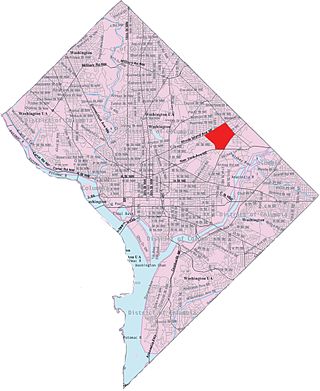
Langdon, is a neighborhood located in Ward 5 of Northeast Washington, D.C. Historical surveys of D.C. recognize Langdon as a neighborhood dating back to at least 1903. Langdon is bounded by Montana Ave. NE to the west/southwest, New York Ave. NE to the south, Bladensburg Rd. NE to the southeast, South Dakota Ave. NE to the northeast, and Rhode Island Ave. NE to the north/northwest. Langdon is adjacent to the Northeast D.C. neighborhoods of Brentwood (west), Woodridge (east), Fort Lincoln (southeast), Gateway (south), and Brookland (north).

Fort Lincoln is a neighborhood located in northeastern Washington, D.C. It is bounded by Bladensburg Road to the northwest, Eastern Avenue to the northeast, New York Avenue NE to the south, and South Dakota Avenue NE to the southwest. The town of Colmar Manor, Maryland, is across Eastern Avenue from the Fort Lincoln neighborhood, as is the Fort Lincoln Cemetery.

Greenway is a residential neighborhood in Southeast Washington, D.C., in the United States. The neighborhood is bounded by East Capitol Street to the north, Pennsylvania Avenue SE to the south, Interstate 295 to the west, and Minnesota Avenue to the east.

River Terrace is an urban cul-de-sac neighborhood in Northeast Washington, D.C., on the eastern bank of the Anacostia River. River Terrace is Washington, DC's only planned unit development that has an unimpeded connection to and relationship with the Anacostia River.
Fort Stevens Ridge is a neighborhood in Northwest Washington, D.C. built during the 1920s. The neighborhood comprises about 50 acres (0.20 km2) and is very roughly bounded by Peabody Street, Fifth Street, Underwood Street, and Ninth Street. As of the 2010 census, the neighborhood had 2,597 residents. It was named for nearby Fort Stevens, a Civil War-era fort used to defend the nation's capital from invasion by Confederate soldiers.
Avondale is an unincorporated community in Prince George's County Maryland, United States. It is contained between Eastern Avenue NE to the south, Queens Chapel Road (MD-500) to the east, and the Northwest Branch Anacostia River to the north and west.
Morris Cafritz was a Washington, D.C. real estate developer, and philanthropist. As CEO of the Cafritz Company, he was Washington, D.C.'s largest private developer from the late 1920's to the early 1960's.

The Starburst Intersection refers to the intersection of six streets in northeast Washington, D.C.: Bladensburg Road NE (part of U.S. Route 1 Alternate, Benning Road NE, 15th Street NE, Maryland Avenue NE, and H Street NE intersect directly, and to the immediate northwest of this intersection is the easternmost point of Florida Avenue. The name "starburst" refers to the star-like shape created by these roads when viewed on a map.

Franklin Knolls is a residential neighborhood located in Silver Spring, a census-designated place in Montgomery County.

The Annapolis Road Line, designated Route T18, is a daily bus route operated by the Washington Metropolitan Area Transit Authority between the New Carrollton station of the Orange Line of the Washington Metro and the Rhode Island Avenue–Brentwood station of the Red Line of the Washington Metro. The line operates every 12 minutes during the weekdays between 7AM and 9PM and 45-60 minutes after 9PM. T18 trips roughly take 50 minutes.