Anacostia is a historic neighborhood in Washington, D.C. Its downtown is located at the intersection of Good Hope Road and Martin Luther King Jr. Avenue. It is located east of the Anacostia River, after which the neighborhood is named. Like the other quadrants of Washington, D.C., Southeast encompasses many named neighborhoods, of which Anacostia is the most well known. Anacostia includes all of the Anacostia Historic District that was listed on the National Register of Historic Places in 1978. Often the name Anacostia is incorrectly used to refer to the entire portion of the city that is southeast of the Anacostia River. The Anacostia Business Improvement District is responsible for the development of the area.

Southeast is the southeastern quadrant of Washington, D.C., the capital of the United States, and is located south of East Capitol Street and east of South Capitol Street. It includes the Capitol Hill and Anacostia neighborhoods, the Navy Yard, the Joint Base Anacostia-Bolling (JBAB), the U.S. Marine Barracks, the Anacostia River waterfront, Eastern Market, the remains of several Civil War-era forts, historic St. Elizabeths Hospital, RFK Stadium, Nationals Park, and the Congressional Cemetery. It also contains a landmark known as "The Big Chair," located on Martin Luther King Jr. Avenue. The quadrant is split by the Anacostia River, with the portion that is west of the river sometimes referred to as "Near Southeast". Geographically, it is the second-smallest quadrant of the city.
Southwest is the southwestern quadrant of Washington, D.C., the capital of the United States, and is located south of the National Mall and west of South Capitol Street. It is the smallest quadrant of the city, and contains a small number of named neighborhoods and districts, including Bellevue, Southwest Federal Center, the Southwest Waterfront, Buzzard Point, and the military installation known as Joint Base Anacostia–Bolling.
Northeast is the northeastern quadrant of Washington, D.C., the capital of the United States. It encompasses the area located north of East Capitol Street and east of North Capitol Street.

Congress Heights is a residential neighborhood in Southeast Washington, D.C., in the United States. The irregularly shaped neighborhood is bounded by the St. Elizabeths Hospital campus, Lebaum Street SE, 4th Street SE, and Newcomb Street SE on the northeast; Shepard Parkway and South Capitol Street on the west; Atlantic Street SE and 1st Street SE on the south; Oxon Run Parkway on the southeast; and Wheeler Street SE and Alabama Avenue SE on the east. Commercial development is heavy along Martin Luther King, Jr. Avenue and Malcolm X Avenue.

Advisory Neighborhood Commissions are bodies of local government in District of Columbia, in the United States. The ANC system was created in 1974 through a District referendum in the District of Columbia Home Rule Act. The first elections for Advisory Neighborhood Commissioners were held in the fall of 1975, and commissions began operating in 1976. Congressman Don Fraser (D-Minn) and DC resident Milton Kotler helped to draft the ANC language in the District of Columbia Home Rule Act based on the success of Adams Morgan Organization (AMO) in Adams Morgan and on a 1970 report of the Minneapolis Citizen League, as well as on related neighborhood corporations in Pittsburgh, Brooklyn, Chicago and Columbus, Ohio.
District of Columbia Route 295 (DC 295), also known as the Anacostia Freeway as well as the Kenilworth Avenue Freeway north of East Capitol Street, is a freeway in the District of Columbia, and currently the only signed numbered route in the District that is not an Interstate Highway or U.S. Highway. Also, DC 295 is one of the few city-level signed route numbers in the United States, along with Charlotte Route 4. The south end is at the junction of Interstate 295 (I-295), I-695, and the southern end of the 11th Street Bridges; its north end is at the border with Maryland where it continues as Maryland Route 201 (MD 201) and then the Baltimore–Washington Parkway.
Interstate 295 (I-295) in the U.S. state of Maryland and in Washington, D.C., also known as the Anacostia Freeway, is a 8.05-mile (12.96 km) spur route connecting I-95 / I-495 and Maryland Route 210 near the Potomac River to Interstate 695 and D.C. Route 295 in the Anacostia neighborhood of Washington, D.C.

Neighborhoods in Washington, D.C., are distinguished by their history, culture, architecture, demographics, and geography. The names of 131 neighborhoods are unofficially defined by the D.C. Office of Planning. Neighborhoods can be defined by the boundaries of wards, historic districts, Advisory Neighborhood Commissions, civic associations, and business improvement districts (BIDs); these boundaries will overlap. The eight wards each elect a member to the Council of the District of Columbia and are redistricted every ten years.

The Southwest Waterfront is a mostly residential neighborhood in Southwest Washington, D.C. The Southwest quadrant is the smallest of Washington's four quadrants, and the Southwest Waterfront is one of only two residential neighborhoods in the quadrant; the other is Bellevue, which, being east of the Anacostia River, is frequently, if mistakenly, regarded as being in Southeast. For that reason, many residents of Southwest Waterfront will refer to themselves as living in "Southwest."

Washington Highlands is a residential neighborhood in Southeast Washington, D.C., in the United States. It lies within Ward 8.

Navy Yard, also known as Near Southeast, is a neighborhood on the Anacostia River in Southeast Washington, D.C. Navy Yard is bounded by Interstate 695 to the north and east, South Capitol Street to the west, and the Anacostia River to the south. Approximately half of its area is occupied by the Washington Navy Yard, which gives the neighborhood its name. The neighborhood is located in D.C.'s Ward 6, currently represented by Charles Allen. It is served by the Navy Yard – Ballpark Metro station on the Green Line.

Greenway is a residential neighborhood in Southeast Washington, D.C., in the United States. The neighborhood is bounded by East Capitol Street to the north, Pennsylvania Avenue SE to the south, Interstate 295 to the west, and Minnesota Avenue to the east.

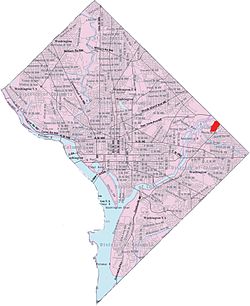
Mayfair or Parkside-Mayfair is a residential neighborhood in Northeast Washington, D.C., United States., on the eastern bank of the Anacostia River. It is bounded by Jay Street NE on the north, Foote Street on the south, Kenilworth Terrace and Anacostia Avenue on the west, and Kenilworth Avenue on the east. Mayfair is encircled by Jay Street and Hayes St., which met at the back of the neighborhood.

Naylor Gardens is a small neighborhood located in southeast Washington, D.C. It is bounded by Alabama Avenue SE, 30th Street SE, Erie Street SE, 32nd Street SE, Gainesville Street SE, 31st Street SE, and Naylor Road SE. The neighborhood is located in the area south and east of the Anacostia River.

River Terrace is an urban cul-de-sac neighborhood in Northeast Washington, D.C., on the eastern bank of the Anacostia River. River Terrace is Washington, DC's only planned unit development that has an unimpeded connection to and relationship with the Anacostia River.

Kenilworth Park & Aquatic Gardens is a National Park Service site located in the north eastern corner of Washington, D.C., and the Maryland state border. Nestled near the banks of the Anacostia River and directly west of the Baltimore–Washington Parkway, Kenilworth Park & Aquatic Gardens preserves a plethora of rare waterlilies and lotuses in the cultivated ponds near the river. The park also contains the Kenilworth Marsh, the largest remaining tidal marsh in Washington, D.C., and an adjacent recreational area.
Washington, D.C., is administratively divided into four geographical quadrants of unequal size, each delineated by their ordinal directions from the medallion located in the Crypt under the Rotunda of the Capitol. Street and number addressing, centered on the Capitol, radiates out into each of the quadrants, producing a number of intersections of identically named cross-streets in each quadrant. Originally, the District of Columbia was a near-perfect square. However, even then the Capitol was never located at the geographic center of the territory. As a result, the quadrants are of greatly varying size. Northwest is quite large, encompassing over a third of the city's geographical area, while Southwest is little more than a neighborhood and military base.

The Anacostia Waterfront Corporation (AWC) was a government-owned corporation established in 2004 by the government of District of Columbia, in the United States, to revitalize neighborhoods next to the Anacostia River and to coordinate the environmental rehabilitation and use of the river. The corporation was intended to have a 20-year lifespan, during which it would oversee an $8 billion public-private redevelopment plan covering the Anacostia River waterfront, as well as numerous parcels of land in the city east of the river. However, a change in mayoral administrations and frustration with the slow pace of redevelopment resulted in abolition of the corporation after three years.

The Anacostia Riverwalk Trail is a multi-use trail system in Washington, DC, which, when complete, will be ~25 miles long, spanning both sides of the Anacostia River, the Washington Channel waterfront, and projecting into neighborhoods away from the Anacostia. It has more recently been branded as part of a larger Anacostia Riverwalk Trail Network which includes an additional 8 segments and 15 miles of trail. On the north end it connects to the Anacostia Tributary Trail System; on the south end it will connect to the Oxon Hill Farm Trail and on the west it connects to the Rock Creek Park Trail and the 14th Street Bridge. Of the 19 planned segments, 14 are complete for a combined total of 16 miles.