Pleasant Plains is a neighborhood in central Washington, D.C. largely occupied by Howard University. For this reason it is also sometimes referred to as Howard Town or, less frequently, Howard Village.
It is situated in the Northwest quadrant of the city and bordered by 2nd Street, and McMillan Reservoir to the east; Florida Avenue and Barry Place to the south; Sherman Avenue to the west; and Harvard Street to the north. It is flanked on the eastern side by the Washington Veteran Affairs Medical Center and Washington Hospital Center, and by the Columbia Heights and Park View neighborhoods on the west and north sides.
Pleasant Plains, Howard University notwithstanding, is a residential neighborhood. A large portion of its residents are Howard affiliates, either students or employees. One of its major community anchors is the Banneker Recreation Center on Georgia Avenue, which reopened in July 2007 after a year of renovations. The adjacent Benjamin Banneker Academic High School has ranked among the 100 best public schools in the United States.[1]
Pleasant Plains is in Ward 1.
History
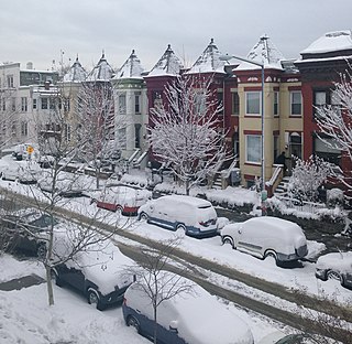
Intersection of 9th St. and Euclid St. NW, in Pleasant Plains, July 2021.
The neighborhood is a small portion of a large colonial estate named "Pleasant Plains," owned by the Holmead family. The property stretched from today’s Spring Road to Columbia Road, and from Georgia Avenue to Rock Creek.[2] The estate was apportioned and sold off over the course of the 19th century and divided into suburbs until it was annexed by the city of Washington in 1878 and became neighborhoods of the city. Essentially, the Pleasant Plains neighborhood is the area of the Holmead estate that was not settled as part of Columbia Heights. (In 1918, the city returned the name "Pleasant Plains" to the entire area of the original estate, but this is a semi-formal name for the section of town and not a neighborhood in and of itself.)
The 1879 Hopkins real estate map shows the Pleasant Plains subdivision being located south of Park Road, east of 14th Street, west of Sherman Avenue, and north of Florida Avenue.[3] From Howard down to Florida Avenue was a black-only neighborhood known as Howard Town. Residents of the adjacent LeDroit Park neighborhood built fences to keep black Howard Town residents out, and the black residents then tore down the fences in protest. The fences largely came down in 1901, and blacks began moving into LeDroit Park, effectively ending the segregated Howard Town section.[4]
Howard Town Center
In late 2002, Howard University and the District of Columbia began planning Howard Town Center, a $56 million mixed-use residential and retail project adjacent to the university campus in Pleasant Plains. Howard Town Center was plotted on the west side of lower Georgia Avenue - the neighborhood's major thoroughfare - between V Street and Barry Place NW; the land, owned by the District, was given to Howard University in exchange for a Howard tract on the east side of Florida Avenue NW that is currently used for surface parking. The development was designed to include 65,000 feet of retail (including a Fresh Grocer supermarket), 225 apartments (for market residents rather than university students), and a 7-level, 520-car parking garage.[5][6]
The university and city announced the project, and their selections for its developers, in April 2003. However, the announcement led immediately to a legal battle. Peoples Involvement Corporation, a tenant in the former Bond Bakery Building at W and Georgia (part of the tract the city was ceding to Howard for the project), claimed that it had been promised ownership of the Bond building in the 1970s. The city countered that there was no documentation of either a transfer of ownership or an intention to file one.[7] In 2005, a judge in the D.C. Superior court found in the city's favor, and in December 2006, D.C. CouncilmemberJim Graham introduced legislation (which passed the Council) to at last initiate the construction of Howard Town Center in Pleasant Plains in 2007.[8]
Geography
The neighborhood is a rectangle, narrow east to west, positioned on the boundary between NW and NE Washington, about halfway between the center of DC and the Maryland border. The Washington Post listed the neighborhood's borders in 2009 as the area bounded by Park Road NW to the north, the south - Florida Avenue, east - Warder and Sixth Streets, and west - Sherman Avenue NW. The Civic Association recognizes additional area to the west - to 14th Street.[9] The Washington Post's inclusion of the area between Warder Street and Georgia Avenue south of Park Road conflicts with the historical borders of neighboring Park View which includes this area.[10]
Economy
Real estate
The median selling price of homes in the three months ending September 2009, was $334,000.[9]
Education
In addition to Howard University and Banneker High School, the area also has the following schools:[9]
Harriet Tubman Elementary School
Park View Elementary School
Garnett-Patterson Middle School
Howard University Middle School of Math and Science
Infrastructure
Roads
U.S. Route 29 is Georgia Avenue, which nearly bisects the area, runs north and south.
Notes
↑ "Almost No Blacks at Many of the Nation's Highest-Rated Public High Schools". The Journal of Blacks in Higher Education (41): 60–62. January 1, 2003. doi:10.2307/3133768. JSTOR3133768.
1 2 3 Ann Cameron Siegal (October 18, 2009). "The District's Overlooked 'Bull's Eye'". The Washington Post. pp.1F.{{cite web}}: Missing or empty |url= (help)
↑ Park View Citizens' Association. Directory and History of Park View, 1921. p. 29.
Places adjacent to Pleasant Plains (Washington, D.C.)
Adams Morgan, commonly abbreviated as AdMo, is a neighborhood in Washington, D.C., located in Northwest D.C. Adams Morgan is noted as a historic hub for counterculture and as an arts district. It is also known for its popular entertainment district and culinary scene, centered on both 18th Street and Columbia Road.
Mount Pleasant is a neighborhood in Washington, D.C., located in Northwest D.C. The neighborhood is primarily residential, with restaurants and stores centered along a commercial corridor on Mt. Pleasant Street. Mount Pleasant is known for its unique identity and multicultural landscape, home to diverse groups such as the punk rock, the Peace Corps and Hispanic Washingtonian communities.
Southwest is the southwestern quadrant of Washington, D.C., the capital of the United States, and is located south of the National Mall and west of South Capitol Street. It is the smallest quadrant of the city, and contains a small number of named neighborhoods and districts, including Bellevue, Southwest Federal Center, the Southwest Waterfront, Buzzard Point, and the military installation known as Joint Base Anacostia–Bolling.
Northwest is the northwestern quadrant of Washington, D.C., the capital of the United States, and is located north of the National Mall and west of North Capitol Street. It is the largest of the four quadrants of the city, and it includes the central business district, the Federal Triangle, and the museums along the northern side of the National Mall, as well as many of the District's historic neighborhoods.
Columbia Heights is a neighborhood in Washington, D.C., located in Northwest D.C. The neighborhood is an important retail hub for the area, as home to DC USA mall and to numerous other restaurants and stores, primarily along the highly commercialized 14th Street. Columbia Heights is home to numerous historical landmarks, including Meridian Hill Park, National Baptist Memorial Church, All Souls Church, along with a number of embassy buildings.
Shaw is a neighborhood of Washington, D.C., located in the Northwest quadrant. Shaw is a major entertainment and retail hub, and much of the neighborhood is designated as a historic district, including the smaller Blagden Alley-Naylor Court Historic District. Shaw and the U Street Corridor have historically have been the city's hub for African-American social, cultural, and economic life.
LeDroit Park is a neighborhood in Washington, D.C. located immediately southeast of Howard University. Its borders include W Street to the north, Rhode Island Avenue and Florida Avenue to the south, Second Street NW to the east, and Howard University to the west. LeDroit Park is known for its history and 19th century protected architecture. The community's diversity entices new residents to the community, as well as its close proximity to the Shaw–Howard University Metro station and many dining options.
Takoma, Washington, D.C., is a neighborhood in Washington, D.C. It is located in Advisory Neighborhood Commission 4B, in the District's Fourth Ward, within the northwest quadrant. It borders the city of Takoma Park, Maryland.
Bloomingdale is a neighborhood in the Northwest quadrant of Washington, D.C., less than two miles (3 km) north of the United States Capitol building. It is a primarily residential neighborhood, with a small commercial center near the intersection of Rhode Island Avenue and First Street NW featuring bars, restaurants, and food markets.
Petworth is a neighborhood of Washington, D.C., located in Northwest D.C. While largely residential, Petworth is home to a notable commercial corridor of shops and restaurants, primarily along Georgia Avenue and Upshur Street, as well as a portion of 14th Street. The neighborhood is accessible via the Georgia Ave–Petworth station on the Green Line of the Washington Metro.
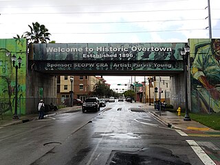
Overtown is a neighborhood of Miami, Florida, United States, just northwest of Downtown Miami. Originally called Colored Town in the Jim Crow era of the late 19th through the mid-20th century, the area was once the preeminent and is the historic center for commerce in the black community in Miami and South Florida.
Florida Avenue is a major street in Washington, D.C. It was originally named Boundary Street, because it formed the northern boundary of the Federal City under the 1791 L'Enfant Plan. With the growth of the city beyond its original borders, Boundary Street was renamed Florida Avenue in 1890.
Truxton Circle, sometimes known as East Shaw, is a neighborhood of Washington, D.C., located in Northwest D.C.
Park View is a neighborhood in Washington, D.C., located in Northwest D.C. The neighborhood is primarily residential with its main commercial corridor of shops and restauarants located along Georgia Avenue.
The Strivers' Section Historic District is a historic district located in the Dupont Circle neighborhood of Washington, D.C. Strivers' Section was historically an enclave of upper-middle-class African Americans, often community leaders, in the late 19th and early 20th centuries. It takes its name from a turn-of-the-20th-century writer who described the district as "the Striver's section, a community of Negro aristocracy." The name echoes that of Strivers' Row in Harlem, a New York City historic neighborhood of black professionals. The district is roughly bounded by Swann Street and the Dupont Circle Historic District on the south, Florida Avenue and the Washington Heights Historic District on the north and west, and the Sixteenth Street Historic District on the east.
Holmead's Burying Ground, also known as Holmead's Cemetery and the Western Burial Ground, was a historic 2.94-acre (11,900 m2) cemetery located in the Dupont Circle neighborhood of Washington, D.C., in the United States. It was founded by Anthony Holmead in 1794 as a privately owned secular cemetery open to the public. The city of Washington, D.C., constructed the Western Burial Ground on the remainder of the city block in 1798, and the two burial grounds became synonymous. The city took ownership of the private Holmead cemetery in 1820. The unified cemetery went into steep decline around 1850, and it was closed on March 6, 1874. Removal of remains, most of which were reinterred at Graceland Cemetery or Rock Creek Cemetery, continued until 1885.
The Sheridan-Kalorama Historic District is a neighborhood and historic district located in the northwest quadrant of Washington, D.C. The boundaries of the historic district include Rock Creek Park to the north and west, P Street to the south, and 22nd Street and Florida Avenue to the east. On the southwestern edge of the neighborhood is a stretch of Embassy Row on Massachusetts Avenue. The other neighborhood and historic district that lies to the east of Sheridan-Kalorama is Kalorama Triangle Historic District. The two neighborhoods are divided by Connecticut Avenue. For many years both neighborhoods were geographically connected before the stretch of Connecticut Avenue was installed toward the Taft Bridge. Oftentimes, both neighborhoods are simply called "Kalorama" or "Kalorama Heights".
A United States postage stamp and the names of a number of recreational and cultural facilities, schools, streets and other facilities and institutions throughout the United States have commemorated Benjamin Banneker's documented and mythical accomplishments throughout the years since he lived (1731–1806). Among such memorializations of this free African American almanac author, surveyor, landowner and farmer who had knowledge of mathematics, astronomy and natural history was a biographical verse that Rita Dove, a future Poet Laureate of the United States, wrote in 1983 while on the faculty of Arizona State University.
Oak Lawn was a large house and wooded estate that once stood on the edge of today's Dupont Circle and Adams Morgan neighborhoods in Washington, D.C. The estate was bounded by 19th Street, Columbia Road, Connecticut Avenue, and Florida Avenue. Previously called Widow's Mite, the estate was originally several hundred acres, but by the 19th century, had been reduced to around 10 acres. The house was built around 1820 and was greatly expanded in 1873 by Thomas P. Morgan, one half of the eponym of the Adams Morgan neighborhood. A large oak tree, nicknamed the Treaty Oak, was reportedly hundreds of years old and stood just a few yards from the house.
This page is based on this Wikipedia article Text is available under the CC BY-SA 4.0 license; additional terms may apply. Images, videos and audio are available under their respective licenses.