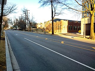
Burleith is a neighborhood in Washington, D.C., United States. It is bordered by 35th Street NW to the east, Reservoir Road NW and the historic Georgetown district to the south, Whitehaven Park to the north, and Glover Archbold Park to the west. The neighborhood is home to the Duke Ellington School of the Arts and the Washington International School.

Northwest is the northwestern quadrant of Washington, D.C., the capital of the United States, and is located north of the National Mall and west of North Capitol Street. It is the largest of the four quadrants of the city, and it includes the central business district, the Federal Triangle, and the museums along the northern side of the National Mall, as well as many of the District's historic neighborhoods.

Foxhall, also known as Foxhall Village, is a neighborhood in northwestern Washington, D.C., bordered by Reservoir Road on the north side, Foxhall Road on the west, Glover-Archbold Park on the east, and P Street NW on the south. The first homes were constructed along Reservoir Road and Greenwich Park Way in the mid-1920s. By the end of December, 1927, some 150 homes had been erected, and the community given the name of Foxhall Village.

Neighborhoods in Washington, D.C., United States are distinguished by their history, culture, architecture, demographics, and geography. The names of 131 neighborhoods are unofficially defined by the D.C. Office of Planning. Neighborhoods can be defined by the boundaries of wards, historic districts, Advisory Neighborhood Commissions, civic associations, and business improvement districts (BIDs); these boundaries will overlap. The eight wards each elect a member to the Council of the District of Columbia and are redistricted every ten years.

Streetcars in Washington, D.C. transported people across the city and region from 1862 until 1962.

Barney Circle is a small residential neighborhood located between the west bank of the Anacostia River and the eastern edge of Capitol Hill in southeast Washington, D.C., in the United States. The neighborhood is characterized by its sense of community, activism, walkability, and historic feel. The neighborhood's name derives from the eponymous former traffic circle Pennsylvania Avenue SE just before it crosses the John Philip Sousa Bridge over the Anacostia. The traffic circle is named for Commodore Joshua Barney, Commander of the Chesapeake Bay Flotilla in the War of 1812.

Sheridan Circle is a traffic circle and park in the Sheridan-Kalorama neighborhood of Washington, D.C. The traffic circle, one of two in the neighborhood, is the intersection of 23rd Street NW, Massachusetts Avenue NW, and R Street NW. The buildings along this stretch of Massachusetts Avenue NW are part of Embassy Row, which runs from Scott Circle to Observatory Circle. Sheridan Circle is a contributing property to the Massachusetts Avenue Historic District and the Sheridan-Kalorama Historic District, both listed on the National Register of Historic Places (NRHP). In addition, the equestrian statue of General Philip Sheridan is 1 of 18 Civil War Monuments in Washington, D.C., that were collectively listed on the NRHP.

Berkley is a neighborhood in the Northwest quadrant of Washington, D.C.

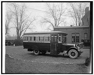
The Washington Railway and Electric Company (WRECo) was the larger of the two major streetcar companies in Washington, D.C., and its Maryland suburbs in the early decades of the 20th century.
Avalon at Foxhall is a high-rise building located in Washington, D.C., United States. Its construction was completed in 1982. The building rises to 54 metres (177 ft), containing 14 floors. The building is tied for the seventh-tallest commercial building in Washington, D.C., and tied for the tenth-highest building in Washington, D.C. among all buildings.

Washington, D.C., is administratively divided into four geographical quadrants of unequal size, each delineated by their ordinal directions from the medallion located in the Crypt under the Rotunda of the Capitol. Street and number addressing, centered on the Capitol, radiates out into each of the quadrants, producing a number of intersections of identically named cross-streets in each quadrant. Originally, the District of Columbia was a near-perfect square but contained more than one settlement; the Capitol was to be the center of the City of Washington. Thus, the Capitol was never located at the geographic center of the whole territory, which was eventually north of the Potomac River, consolidated into one city. As a result, the quadrants are of greatly varying size. Northwest is quite large, encompassing over a third of the city's geographical area, while Southwest is little more than a few neighborhoods, large parks, and a military base.

The following outline is provided as an overview of and topical guide to District of Columbia:

P Street refers to four different streets within the city of Washington, D.C. The streets were named by President George Washington in 1791 as part of a general street naming program, in which east–west running streets were named alphabetically and north–south running streets numerically.

The French ambassador's residence in Washington, D.C. is located at 2221 Kalorama Road, N.W., in the Kalorama neighborhood of northwest Washington, D.C.

The Wetzell-Archbold Farmstead is an historic stone and log farmhouse, located at 4437 Reservoir Road, Northwest, Washington, D.C., in the Foxhall neighborhood.

Glover Archbold Park is a 183-acre quasi-natural, stream-valley park in Northwest Washington, D.C., on the western edge of Georgetown University and adjacent to the Burleith-Hillandale, Glover Park, McLean Gardens, and Westchester neighborhoods. One of the "finger parks" of Rock Creek Park, the Glover-Archbold Park is administered by the National Park Service (NPS).

The Hillandale estate comprises a pair of historic structures located in the Burleith neighborhood in Washington, D.C. They have been listed on the National Register of Historic Places since 1995.

Western Avenue is one of three boundary streets between Washington, D.C., and the state of Maryland. It follows a southwest-to-northeast line, beginning at Westmoreland Circle in the south and ending at Oregon Avenue NW in the north. It is roughly 3.5 miles (5.6 km) in length. First proposed in 1893, it was constructed somewhat fitfully from about 1900 to 1931.

Charles Carroll Glover was an American banker and philanthropist who made major contributions to the modern landscape of Washington, D.C. in the late 19th and early 20th centuries. He was President of Riggs Bank, an effective advocate of urban beautification in Washington under the influence of the City Beautiful movement, and a generous donor of land and money for Washington's parks and monuments.
MacArthur Boulevard is a road in Montgomery County, Maryland, and Washington, D.C. The road follows a northwest–southeast route from the Great Falls area of the Chesapeake and Ohio Canal National Historical Park in Potomac, Maryland, to Foxhall Road NW and 44th Street NW in the Foxhall neighborhood of Washington, D.C., near the Georgetown Reservoir. MacArthur Boulevard runs parallel to the Clara Barton Parkway and the C&O Canal for most of its route, passing through the Palisades area of the District. In Cabin John, traffic is reduced to a single alternating lane as it passes over the Union Arch Bridge, the longest span masonry arch bridge in the Western Hemisphere, and which also carries the Washington Aqueduct.


