
Anacostia is a historic neighborhood in Southeast Washington, D.C. Its downtown is located at the intersection of Marion Barry Avenue SE and the neighborhood contains commercial and government buildings, mid-rise mixed development, city-sanctioned art murals and galleries ,a perfroming arts center, a playhouse theater, the local landmark, "The Big Chair," Fredrick Douglass's Home and is adjacent to the Fort Stanton Park neighborhood which hosts the Smithsonian Anacostia Community Museum. It is located directly east of and along the Anacostia River, after which the neighborhood is named.

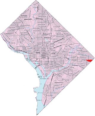
Southeast is the southeastern quadrant of Washington, D.C., the capital of the United States, and is located south of East Capitol Street and east of South Capitol Street. It includes the Capitol Hill and Anacostia neighborhoods, the Navy Yard, the Joint Base Anacostia-Bolling (JBAB), the U.S. Marine Barracks, the Anacostia River waterfront, Eastern Market, the remains of several Civil War-era forts, historic St. Elizabeths Hospital, RFK Stadium, Nationals Park, and the Congressional Cemetery. It also contains a landmark known as "The Big Chair," located on Martin Luther King Jr. Avenue. The quadrant is split by the Anacostia River, with the portion that is west of the river sometimes referred to as "Near Southeast". Geographically, it is the second-smallest quadrant of the city.

Congress Heights is a residential neighborhood in Southeast Washington, D.C., in the United States. The irregularly shaped neighborhood is bounded by the St. Elizabeths Hospital campus, Lebaum Street SE, 4th Street SE, and Newcomb Street SE on the northeast; Shepard Parkway and South Capitol Street on the west; Atlantic Street SE and 1st Street SE on the south; Oxon Run Parkway on the southeast; and Wheeler Street SE and Alabama Avenue SE on the east. Commercial development is heavy along Martin Luther King, Jr. Avenue and Malcolm X Avenue.
South Capitol Street is a major street dividing the southeast and southwest quadrants of Washington, D.C., in the United States. It runs south from the United States Capitol to the D.C.–Maryland line, intersecting with Southern Avenue. After it enters Maryland, the street becomes Indian Head Highway at the Eastover Shopping Center, a terminal or transfer point of many bus routes.

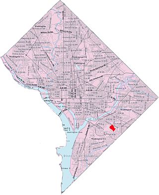
Hillcrest is a residential neighborhood in the southeast quadrant of Washington, D.C., United States. Hillcrest is located on the District-Maryland line in Ward 7, east of the Anacostia River.

Barry Farm is a neighborhood in Southeast Washington, D.C., located east of the Anacostia River and bounded by the Southeast Freeway to the northwest, Suitland Parkway to the northeast and east, and St. Elizabeths Hospital to the south. The neighborhood was renowned as a significant post-Civil-War settlement of free Blacks and freed slaves established by the Freedmen's Bureau. The streets were named to commemorate the Union generals, Radical Republicans, and Freedmen's Bureau officials who advanced the rights of Black Americans during the Civil War and Reconstruction: Howard Road SE for General Oliver O. Howard; Sumner Road SE for Massachusetts Senator Charles Sumner; Wade Road SE for Ohio Senator Benjamin Wade; Pomeroy Road SE for Kansas Senator Samuel C. Pomeroy; Stevens Road SE for Pennsylvania Congressman Thaddeus Stevens, and Nichols Avenue for Henry Nichols who was the first superintendent of Saint Elizabeth's Hospital. The neighborhood name is not a reference to the late former mayor of Washington, D.C., Marion Barry, but coincidentally has the same spelling.

Bellevue is a residential neighborhood in far Southeast and Southwest in Washington, D.C., United States. It is bounded by South Capitol Street, one block of Atlantic Street SE, and 1st Streets SE and SW to the north and east; Joliet Street SW and Oxon Run Parkway to the south; Martin Luther King Jr. Avenue SE, Shepherd Parkway, 2nd Street SW, and Xenia Street SW to the west. Bellevue was created from some of the earliest land patents in Maryland, and draws its name from a 1795 mansion built in the area. Subdivisions began in the 1870s, but extensive residential building did not occur until the early 1940s. Bellevue is adjacent to a number of federal and city agency buildings.
Capitol View is a neighborhood located in southeast Washington, D.C., in the United States. It is bounded by East Capitol Street to the north, Central Avenue SE to the southwest and south, and Southern Avenue SE to the southeast.

Fairlawn is a working class and middle class residential neighborhood in southeast Washington, D.C., United States. It is bounded by Interstate 295, Pennsylvania Avenue SE, Minnesota Avenue SE, Naylor Road SE, and Good Hope Road SE.

Garfield Heights is a residential neighborhood in Southeast Bounded by Suitland Parkway SE, Alabama Avenue SE, 28th Street SE, Gainesville Street SE, Naylor Road SE, and Southern Avenue SE.Washington, D.C., bordering Prince George's County, Maryland. Garfield Heights contains both apartment units and single-family detached houses.

Washington Highlands is a residential neighborhood in Southeast Washington, D.C., in the United States. It lies within Ward 8. Bounded by Oxon Run Park(Oxon-Run Trail)SE, Livingston Road SE, South Capitol Street SE, Southern Avenue SE, Valley Avenue SE, and 13th Street SE.

Good Hope is a residential neighborhood in southeast Washington, D.C., near Anacostia. The neighborhood is generally middle class and is dominated by single-family detached and semi-detached homes. The year-round Fort Dupont Ice Arena skating rink and the Smithsonian Institution's Anacostia Museum are nearby. Good Hope is bounded by Fort Stanton Park(Fort Circle Hiker-Biker Trail) SE, Alabama Avenue SE, Naylor Road SE, and U Street SE. The proposed Skyland Shopping Center redevelopment project is within the boundaries of the neighborhood.

Greenway is a residential neighborhood in Southeast Washington, D.C., in the United States. The neighborhood is bounded by East Capitol Street SE, Interstate 295 SE, Fairlawn Avenue SE, Minnesota Avenue SE, Pennsylvania Avenue SE,

Marshall Heights is a residential neighborhood in Southeast Washington, D.C. It is bounded by East Capitol Street, Central Avenue SE, Southern Avenue, Fitch Street SE, and Benning Road SE. It was an undeveloped rural area occupied by extensive African American shanty towns, but the neighborhood received nationwide attention after a visit by First Lady Eleanor Roosevelt in 1934, which led to extensive infrastructure improvements and development for the first time. In the 1950s, Marshall Heights residents defeated national legislation designed to raze and redevelop the neighborhood. Queen Elizabeth II of the United Kingdom visited the area in 1991, at a time when Marshall Heights was in the throes of a violent crack cocaine epidemic. Limited redevelopment has occurred in the neighborhood, which was the site of two notorious child murders in 1973.
Skyland is a neighborhood in Southeast Washington, D.C. It is bounded by Good Hope Road to the northeast, Alabama Avenue to the southeast, and Fort Stanton Park to the south and west. It is part of Ward 8. Also see article on the Anacostia neighborhood.

Woodland is a small residential and industrial neighborhood in Southeast Washington, D.C. Woodland lies in Washington's Ward 8, among the poorest and least developed of the city's wards. Like the neighborhoods around it, Woodland is almost exclusively African American. Woodland is bounded by Ainger Place SE to the north; Alabama Avenue SE and Knox Place SE to the east; Hartford Street SE to the south; and Langston Place SE, Raynolds Place SE, and Erie Street SE to the southwest. Fort Stanton Park forms the northwest and northern border of the neighborhood.

Randle Highlands is a neighborhood in Southeast Washington, D.C., east of the Anacostia River.

The Anacostia Historic District is a historic district in the city of Washington, D.C., comprising approximately 20 squares and about 550 buildings built between 1854 and 1930. The Anacostia Historic District was added to the National Register of Historic Places in 1978. "The architectural character of the Anacostia area is unique in Washington. Nowhere else in the District of Columbia does there exist such a collection of late-19th and early-20th century small-scale frame and brick working-class housing."

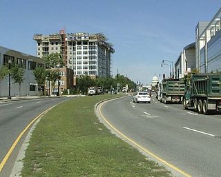
Martin Luther King Jr. Avenue is a major street in the District of Columbia traversing through both the Southwest and Southeast quadrants.
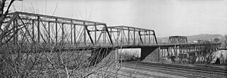
The Pennsylvania Avenue Bridge was a crossing of the Anacostia River in Washington, DC at the site of the present John Philip Sousa Bridge. It was constructed in 1890 and demolished around 1939.

