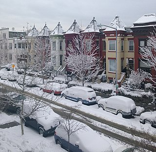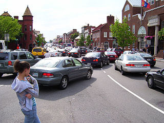
Northwest is the northwestern quadrant of Washington, D.C., the capital of the United States, and is located north of the National Mall and west of North Capitol Street. It is the largest of the four quadrants of the city, and it includes the central business district, the Federal Triangle, and the museums along the northern side of the National Mall, as well as many of the District's historic neighborhoods.

Northeast is the northeastern quadrant of Washington, D.C., the capital of the United States. It encompasses the area located north of East Capitol Street and east of North Capitol Street.

Shepherd Park is a neighborhood in the northwest quadrant of Washington, D.C. In the years following World War II, restrictive covenants which had prevented Jews and African Americans from purchasing homes in the neighborhood were no longer enforced, and the neighborhood became largely Jewish and African American. Over the past 40 years, the Jewish population of the neighborhood has declined but the neighborhood has continued to support a thriving upper and middle class African American community. The Shepherd Park Citizens Association and Neighbors Inc. led efforts to stem white flight from the neighborhood in the 1960s and 1970s, and it has remained a continuously integrated neighborhood, with very active and inclusive civic groups.

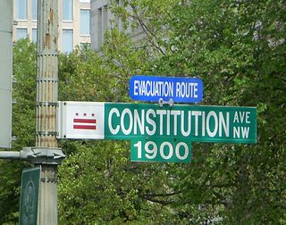
Constitution Avenue is a major east–west street in the northwest and northeast quadrants of the city of Washington, D.C., in the United States. It was originally known as B Street, and its western section was greatly lengthened and widened between 1925 and 1933. It received its current name on February 26, 1931, though it was almost named Jefferson Avenue in honor of Thomas Jefferson.

Bloomingdale is a neighborhood in the Northwest quadrant of Washington, D.C., less than two miles (3 km) north of the United States Capitol building. It is a primarily residential neighborhood, with a small commercial center near the intersection of Rhode Island Avenue and First Street NW featuring bars, restaurants, and food markets.

Petworth is a neighborhood of Washington, D.C., located in Northwest D.C. While largely residential, Petworth is home to a notable commercial corridor of shops and restaurants, primarily along Georgia Avenue and Upshur Street, as well as a portion of 14th Street. The neighborhood is accessible via the Georgia Ave–Petworth station on the Green Line of the Washington Metro.

The name "M Street" refers to two major roads in the United States capital of Washington, D.C. Because of the Cartesian coordinate system used to name streets in Washington, the name "M Street" can be used to refer to any east-west street located twelve blocks north or south of the dome of the United States Capitol. Thus, in all four quadrants of the city there are streets called "M Street", which are disambiguated by quadrant designations, namely, M Street NW, NE, SW, and SE.

Brightwood is a neighborhood in the northwestern quadrant of Washington, D.C. Brightwood is part of Ward 4.
The Inner Loop was two planned freeways around downtown Washington, D.C. The innermost loop would have formed an oval centered on the White House, with a central freeway connecting the southern segment to the northern segment and then continuing on to Interstate 95. Interstate 95 would have met Interstate 66, Interstate 295, Interstate 695, and US 50 while traversing the Inner Loop. A second loop was an arc across the northern section of the city, beginning at East Capitol Street at the Anacostia River and using the Missouri Avenue NW and Nebraska Avenue NW commercial corridors to terminate in Georgetown.

Fort Totten is a neighborhood located in Ward 5 of Northeast Washington, D.C.

Georgia Avenue is a major north-south artery in Northwest Washington, D.C., and Montgomery County, Maryland. In Washington, D.C., and for a short distance in Silver Spring, Maryland, Georgia Avenue is also U.S. Route 29. Howard University is located on Georgia Avenue.

New Hampshire Avenue is a diagonal avenue in Washington, D.C., beginning at the Kennedy Center and extending northeast for about 5 miles (8 km) and then continuing into Maryland, where it is designated Maryland Route 650. New Hampshire Avenue is not contiguous. It stops at 15th and W Streets NW, and resumes again on the other side of Columbia Heights at Park Road NW, a few blocks from Georgia Avenue.
Sherman Circle is an urban park and traffic circle in the Northwest Washington, D.C. neighborhood of Petworth at the intersection of Illinois Avenue, Kansas Avenue, 7th Street, and Crittenden Street NW. The circle is named in honor of Civil War general William Tecumseh Sherman. Administered by the National Park Service's Rock Creek Park unit, Sherman Circle together with four surrounding triangular parks covers 3.44 acres (1.39 ha) and is considered by the National Park Service a "cultural landscape."
Carole Highlands is an unincorporated community in Prince George's County, Maryland, United States. It is contained between East West Highway to the south, University Boulevard to the north, Larch Avenue, Hopewell Avenue, and 15th Avenue to the west, and Riggs Road to the east. Carole Highlands borders the adjacent neighborhoods of Chillum, Green Meadows, Lewisdale, and Langley Park in Prince George's County, while bordering the city of Takoma Park in Montgomery County. For statistical purposes, it is part of the Langley Park census-designated place (CDP). The community also has a community association and non-profit: Carole Highlands Neighborhood Association

Brightwood Park is a small neighborhood in Northwest Washington, D.C. in the United States. The neighborhood is bounded by Georgia Avenue NW to the west, Missouri Avenue NW to the northeast and Kennedy Street NW to the south. More recently, areas that are technically part of the northern extremity of the Petworth neighborhood have been increasingly referred to as Brightwood Park. Often these informal boundaries extend south to Emerson Street NW, and east to New Hampshire Avenue NW. Another definition places Hamilton Street NW as Brightwood Park's southern boundary. Yet another definition places Brightwood Park's southern boundary as Ingraham Street NW. The most expansive definition state Brightwood Park's borders as Missouri Avenue to the north, North Capitol Street on the east, Emerson Street to the south and Georgia Avenue on the west. It is located in Ward 4.

Sixteenth Street Heights is a large neighborhood of rowhouses, duplexes, and American Craftsman and American Foursquare detached houses in Northwest Washington, D.C.
Fort Stevens Ridge is a neighborhood in Northwest Washington, D.C. built during the 1920s. The neighborhood comprises about 50 acres (0.20 km2) and is very roughly bounded by Peabody Street, Fifth Street, Underwood Street, and Ninth Street. As of the 2010 census, the neighborhood had 2,597 residents. It was named for nearby Fort Stevens, a Civil War-era fort used to defend the nation's capital from invasion by Confederate soldiers.

Calvin Coolidge High School is a public high school of the District of Columbia Public Schools system located in the Takoma neighborhood in the Northwest quadrant of Washington, D.C. Its campus is listed on the National Register of Historic Places.

J.G. Whittier Elementary School is a public elementary school located in the Northwest quadrant of the District of Columbia.

Brightwood Education Campus is a public school located in the Northwest quadrant of the District of Columbia.


