
Anacostia is a historic neighborhood in Southeast Washington, D.C. Its downtown is located at the intersection of Marion Barry Avenue and Martin Luther King Jr. Avenue. It is located east of the Anacostia River, after which the neighborhood is named.

Congress Heights station is an island-platformed Washington Metro station situated in the Congress Heights neighborhood of Washington, D.C., United States. Opened on January 13, 2001, the station is operated by the Washington Metropolitan Area Transit Authority (WMATA). Serving only the Green Line, it is positioned at the intersection of Alabama Avenue and 13th Street, beneath St. Elizabeths Hospital. Congress Heights marks the terminus of the Green Line in the District of Columbia as it extends southeastward.

Southern Avenue station is an island platformed Washington Metro station in Prince George's County, Maryland, United States. The station was opened on January 13, 2001, and is operated by the Washington Metropolitan Area Transit Authority (WMATA). Providing service for only the Green Line, the station is located on the southern side of Southern Avenue, putting it just outside the District of Columbia, opposite Valley Terrace straddling the D.C/Maryland border. Southern Avenue is the first station in Maryland going southeast on the Green Line.

Naylor Road station is an island-platformed Washington Metro station in Hillcrest Heights, Maryland, United States. The station was opened on January 13, 2001, and is operated by the Washington Metropolitan Area Transit Authority (WMATA). Providing service for only the Green Line, the station is located between Naylor Road, Branch Avenue, and Suitland Parkway.

Suitland station is an island platformed Washington Metro station in Suitland, Maryland, United States. The station was opened on January 13, 2001, and is operated by the Washington Metropolitan Area Transit Authority (WMATA). The station is located at Silver Hill Road and Suitland Parkway, providing service for only the Green Line,.

Suitland is a suburb of Washington, D.C., approximately one mile (1.6 km) southeast of Washington, D.C. Suitland is a census designated place (CDP), as of the 2020 census, its population was 25,839. Prior to 2010, it was part of the Suitland-Silver Hill census-designated place.

Southeast is the southeastern quadrant of Washington, D.C., the capital of the United States, and is located south of East Capitol Street and east of South Capitol Street. It includes the Capitol Hill and Anacostia neighborhoods, the Navy Yard, the Joint Base Anacostia-Bolling (JBAB), the U.S. Marine Barracks, the Anacostia River waterfront, Eastern Market, the remains of several Civil War-era forts, historic St. Elizabeths Hospital, RFK Stadium, Nationals Park, and the Congressional Cemetery. It also contains a landmark known as "The Big Chair," located on Martin Luther King Jr. Avenue. The quadrant is split by the Anacostia River, with the portion that is west of the river sometimes referred to as "Near Southeast". Geographically, it is the second-smallest quadrant of the city.

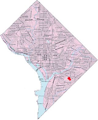
Hillcrest is a residential neighborhood in the southeast quadrant of Washington, D.C., United States. Hillcrest is located on the District-Maryland line in Ward 7, east of the Anacostia River.

Barry Farm is a neighborhood in Southeast Washington, D.C., located east of the Anacostia River and bounded by the Southeast Freeway to the northwest, Suitland Parkway to the northeast and east, and St. Elizabeths Hospital to the south. The neighborhood was renowned as a significant post-Civil-War settlement of free Blacks and freed slaves established by the Freedmen's Bureau. The streets were named to commemorate the Union generals, Radical Republicans, and Freedmen's Bureau officials who advanced the rights of Black Americans during the Civil War and Reconstruction: Howard Road SE for General Oliver O. Howard; Sumner Road SE for Massachusetts Senator Charles Sumner; Wade Road SE for Ohio Senator Benjamin Wade; Pomeroy Road SE for Kansas Senator Samuel C. Pomeroy; Stevens Road SE for Pennsylvania Congressman Thaddeus Stevens, and Nichols Avenue for Henry Nichols who was the first superintendent of Saint Elizabeth's Hospital. The neighborhood name is not a reference to the late former mayor of Washington, D.C., Marion Barry, but coincidentally has the same spelling.

Fairfax Village is a small neighborhood of garden apartments and townhouses located in southeast Washington, D.C. It is bounded by Alabama Avenue SE, Suitland Road SE, Pennsylvania Avenue SE, and Southern Avenue SE.

Fairlawn is a working class and middle class residential neighborhood in southeast Washington, D.C., United States. It is bounded by Interstate 295, Pennsylvania Avenue SE, Minnesota Avenue SE, Naylor Road SE, and Good Hope Road SE.
Shipley Terrace, formerly known as Randle Heights, is a large residential neighborhood in Southeast Washington, D.C., bordering Prince George's County, Maryland. The neighborhood, named after a former public housing complex in the neighborhood, which was largely occupied by low-income housing – primarily walkup and garden unit apartments. This neighborhood now has a mix of townhome communities, large single-family-home communities, as well as some low-income housing. It is a model neighborhood for the Hope VI revitalization Grant Program.

Washington Highlands is a residential neighborhood in Southeast Washington, D.C., in the United States. It lies within Ward 8. Bounded by Oxon Run Park(Oxon-Run Trail)SE, Livingston Road SE, South Capitol Street SE, Southern Avenue SE, Valley Avenue SE, and 13th Street SE.

Greenway is a residential neighborhood in Southeast Washington, D.C., in the United States. The neighborhood is bounded by East Capitol Street SE, Interstate 295 SE, Fairlawn Avenue SE, Minnesota Avenue SE, Pennsylvania Avenue SE,

Naylor Gardens is a small neighborhood located in southeast Washington, D.C. It is bounded by Alabama Avenue SE, Naylor Road SE, Good Hope Road SE, and Branch Avenue SE. The neighborhood is located in the area south and east of the Anacostia River.
Skyland is a neighborhood in Southeast Washington, D.C. It is bounded by Good Hope Road to the northeast, Alabama Avenue to the southeast, and Fort Stanton Park to the south and west. It is part of Ward 8. Also see article on the Anacostia neighborhood.

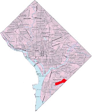
Randle Highlands is a neighborhood in Southeast Washington, D.C., east of the Anacostia River.

Douglass is a residential neighborhood in Southeast Washington, D.C., on the eastern side of St. Elizabeths Hospital, on the border of the Congress Heights Metro Station. It is bounded by Suitland Parkway to the north and east, Alabama Avenue to the south, and the St. Elizabeths campus to the west.

Martin Luther King Jr. Avenue is a major street in the District of Columbia traversing through both the Southwest and Southeast quadrants.

Fort Stanton is a residential neighborhood in Southeast Washington, D.C. It is bounded by Erie St SE. to the north, Suitland Parkway to the south, 16th St. SE to the west, and 19th Pl SE to the east. The neighborhood is named after the nearby civil War defense Fort Stanton. Fort Stanton is part of Ward 7, represented by Vince Gray. Fort Stanton is situated between the neighborhoods of Anacostia, to the north, Barry Farm to the west, Garfield Heights to the East, and Douglass to the south.

