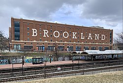
Brookland (Washington, D.C.)

Last updated
Brookland
Brookland - Washington, D.C.jpg
Brookland in 2022 with the Brookland–CUA station Metro station in the foreground
DC Neighborhoods - Brookland.svg
Brookland within the District of Columbia
Coordinates: 38°55′39″N76°59′24″W / 38.9275°N 76.99°W / 38.9275; -76.99
Country United States
District Washington, D.C.
WardWard 5
Government
  Councilmember Zachary Parker

Brookland, also known as Little Rome or Little Vatican, is a neighborhood located in the Northeast (NE) quadrant of Washington, D.C. It is best known for its numerous Catholic institutions, including schools, religious communities, shrines, institutes, and other organizations built and based around the Catholic University of America.

Contents

Historically centered along 12th Street NE, Brookland is bounded by Taylor Street NE and Michigan Avenue NE to the northwest; by Rhode Island Avenue NE to the southeast; by South Dakota Avenue NE to the northeast; and by subway (Washington Metro's Red Line) and train (CSX) tracks to the west. [1]

The western boundary of the railroad tracks originated with the completion of the former Metropolitan Branch of the Baltimore and Ohio Railroad in 1873, [2] which now incorporates the Washington Metro's Red Line. Brookland’s boundaries stretches to the National Shrine and includes Catholic University.

The Washington Metropolitan Area Transit Authority (WMATA) provides public transportation services to and throughout Brookland, with two subway stations and several bus lines. Most of the Brookland neighborhood is served by the Washington Metropolitan Area Red Line Brookland–CUA Metro station, located between Monroe Street NE and Michigan Avenue NE. A small portion of the Brookland neighborhood located on Rhode Island Avenue NE is served by the Red Line Rhode Island Avenue Metro Station.

History

Map of Brookland, 1879 BrooklandOldLOCImage.PNG
Map of Brookland, 1879

In 1632 the English Crown unilaterally took the land from the Piscataway Natives who inhabited the Potomac-Anacostia region. King Charles I of England in turn granted the land, which was to become the state of Maryland, to George Calvert, whose interest in the colony lay in "the sacred duty of finding a refuge for his Roman Catholic brethren." [3] It took until about 1675 for English settlers to reach what is now the DC area, after defeating the Powhatans that reduced the Native American numbers by roughly 90 percent. Archived 2020-08-10 at the Wayback Machine

Colonel Jehiel Brooks married into the land when he married Ann Margaret Queen, daughter of Nicholas Queen, and they received a 150-acre estate. [4] In 1722, the Queen Family raised a Roman Catholic Church, which morphed into St. Francis de Sales Parish in 1908.

For most of the 19th century the area was farmland owned by the prominent Middleton and Queen families. The Baltimore and Ohio Railroad later connected this portion of Washington County to downtown. Bellair, the 1840 brick Greek Revival mansion built by Colonel Jehiel Brooks, still stands. It is referred to as Brooks Mansion. It is the site of offices and production facilities for the Public Access Corporation of the District of Columbia, the city's Government-access television (GAVT) channel known as DCTV.

Change came rapidly during and after the American Civil War. First, Fort Slemmer and Fort Bunker Hill were constructed as defenses against the Confederate Army, and later the Old Soldiers' Home was constructed to the northwest. The population of the city itself increased with the expansion of the federal government, and the former Brooks family estate became a housing tract named "Brookland."

Growth continued throughout the 1870s when the Baltimore and Ohio Railroad opened its Western Branch Line in the developing Brookland neighborhood. [5] With the construction of nearby Sherwood, University Heights, and other tracts and with the expansion of Washington's streetcar system, a middle-class streetcar suburb developed. Eventually its expansion southward met Washington's northward expansion. Many Queen Anne style and other Victorian homes still stand.

The transition from a country estate towards a residential development beginning in 1887 "marked the extension of suburban growth into the rather isolated reaches of the northeastern sector" of D.C. [6] In its early days, the Brookland community was marked by "spacious lots and single family homes" which appealed to middle-class families and provided a "small town atmosphere. [6] "

Education

Landmarks

Dahlgreen Courts Dahlgreen Courts DC.jpg
Dahlgreen Courts

Catholic institutions

Franciscan Monastery of the Holy Land in America Franciscan Monastery in Brookland DC.JPG
Franciscan Monastery of the Holy Land in America

Brookland, together with its surrounding neighborhoods, has been at times referred to as Little Rome and Little Vatican because of the many Catholic organizations and institutions clustered around the Catholic University of America. [7] The university itself does not lie within Brookland's borders, but since the Catholic Church purchased the Middletown estate adjacent to Brookland in 1887, many Catholic groups have established themselves there and in the neighboring communities of Edgewood and Michigan Park. Ordered by year of establishment, major Catholic organizations that are physically located in Brookland include:

From 1984 until 2015, the Franciscans’ Holy Name College had served as the Howard University School of Divinity's East Campus. [10] [11] As a divinity school, the institution did not solely focus on Christianity. Rather, it sought to educate students in scripture and theology generally, and to prepare them to be academics or to be ordained to serve as clergy. In 2016, the Urban Land Institute studied the site and engaged community stakeholders to determine potential development that might take place at the location. As of 2017, the site is scheduled to be redeveloped into a living-learning campus with current historic structures and open space preserved. [11]

Community diversity

Racial Makeup of the District of Columbia (2019) [12]

  White alone (42.52%)
  Black alone (45.44%)
  Native American alone (0.27%)
  Asian alone (4.07%)
  Pacific Islander alone (0.03%)
  Some other race alone (4.37%)
  Two or more races (3.30%)

Racial Makeup of the District of Columbia excluding Hispanics from racial categories (2019) [12]
NH=Non-Hispanic

  White NH (37.29%)
  Black NH (44.15%)
  Native American NH (0.24%)
  Asian NH (4.02%)
  Pacific Islander NH (0.01%)
  Other race NH (0.34%)
  Two or more races NH (2.69%)
  Hispanic Any Race (11.26%)

Brookland integrated in the 20th century, especially after white flight took place following World War II and the US Supreme Court ruled in 1948 that restrictive covenants were unenforceable . Although there was some hostility directed at early black integration of the neighborhood, by the 1970s Brookland had developed into a neighborhood fairly integrated among economic classes and races.[ citation needed ]

During the mid-twentieth century, Brookland could boast of such prominent residents as Ralph Bunche, Sterling Allen Brown, Edward Brooke, Ellis O. Knox, Rayford W. Logan, Pearl Bailey, John P. Davis, Marvin Gaye, Paul Tsongas, Lucy Diggs Slowe, Lois Mailou Jones, and Robert C. Weaver. It remains a relatively diverse and stable area of Washington.[ citation needed ] African American architect Romulus C. Archer designed homes, buildings, and churches in the area. [13]

Brookland was also home to the playwright Jean Kerr and her playwright/critic husband Walter Kerr, who taught at nearby Catholic University of America. The writer Marjorie Kinnan Rawlings spent her childhood in Brookland.

Justine Ward, the music educator and author, lived in Brookland and built the large residence now occupied by the Servants of the Lord and the Virgin of Matara in the 1300 block of Quincy Street. The Department of Music at Catholic University is housed in a building named in Ward's honor. Also on Quincy Street is the Quincy House, a long-time residence of Catholic graduate students who regularly host coffee houses and other community events.

Development

In November 2011, D.C. based real estate developer Abdo broke ground on a large mixed-use development. [14] The project, known as Monroe Street Market, was fully completed in 2014. This area includes 27 artists' studios on an "Arts Walk,". and commercial businesses and restaurants. While there are new projects slated for 2017/2018, at least part of the community believes the area is being overly developed, which has led to a few court battles with developers. [15] A nearly-full-block parcel on Monroe Street between 9th and 10th Streets remains vacant at this time because of conflicts between neighbors and developers over the height of the planned mixed-use complex, meant to include over 200 apartments. [16]

See also

Related Research Articles

<span class="mw-page-title-main">Chillum, Maryland</span> Census-designated place in Maryland

Chillum is an unincorporated area and census-designated place in Prince George's County, Maryland, United States, bordering Washington, D.C., and Montgomery County.

<span class="mw-page-title-main">Dorchester, Boston</span> Neighborhood of Boston in Suffolk, Massachusetts, United States

Dorchester is a Bostonian neighborhood comprising more than 6 square miles (16 km2) in the City of Boston, Massachusetts, United States. Originally, Dorchester was a separate town, founded by Puritans who emigrated in 1630 from Dorchester, Dorset, England, to the Massachusetts Bay Colony. This dissolved municipality, Boston's largest neighborhood by far, is often divided by city planners in order to create two planning areas roughly equivalent in size and population to other Boston neighborhoods.

<span class="mw-page-title-main">Northeast (Washington, D.C.)</span> Quadrant in the United States

Northeast is the northeastern quadrant of Washington, D.C., the capital of the United States. It encompasses the area located north of East Capitol Street and east of North Capitol Street.

<span class="mw-page-title-main">Columbia Heights (Washington, D.C.)</span> Neighborhood of Washington, D.C.

Columbia Heights is a neighborhood in Washington, D.C., located in Northwest D.C. The neighborhood is an important retail hub for the area, as home to DC USA mall and to numerous other restaurants and stores, primarily along the highly commercialized 14th Street. Columbia Heights is home to numerous historical landmarks, including Meridian Hill Park, National Baptist Memorial Church, All Souls Church, along with a number of embassy buildings.

<span class="mw-page-title-main">Bryant, Seattle</span> Seattle Neighborhood in King, Washington, United States

Bryant is a residential neighborhood in northeast Seattle, Washington. According to the City of Seattle's neighborhood maps, it is bounded by 35th Avenue NE and NE 45th Place on the west, beyond which is Ravenna; Sand Point Way NE and 45th Ave NE on the east, beyond which are Laurelhurst and Windermere; and NE 75th Street and NE 65th Street on the north, beyond which are View Ridge and Wedgwood.

Trinidad is a neighborhood located in Ward 5, in the northeast quadrant of Washington, D.C., and is a largely residential area.

<span class="mw-page-title-main">Woodridge (Washington, D.C.)</span> Place in the United States

Woodridge is a residential neighborhood located in Ward 5 of Northeast Washington, D.C. Woodridge is contained between Eastern Avenue N.E. to the east, Taylor Street N.E. to the north, South Dakota Avenue N.E. to the west, and Bladensburg Road N.E. to the south. Its central commercial strips are Rhode Island Avenue NE and Bladensburg Road N.E. Woodridge borders the adjacent neighborhoods of Brookland, Langdon, North Michigan Park, and Fort Lincoln in Northeast Washington D.C. In addition to these neighborhoods in the District of Columbia, Woodridge borders the city of Mount Rainier and town of Cottage City in Maryland. In terms of public transportation, residents of Woodridge have access to the Brookland-CUA and Rhode Island Avenue Metro stations.

<span class="mw-page-title-main">Takoma (Washington, D.C.)</span> Neighborhood of Washington, D.C.

Takoma, Washington, D.C., is a neighborhood in Washington, D.C. It is located in Advisory Neighborhood Commission 4B, in the District's Fourth Ward, within the northwest quadrant. It borders the city of Takoma Park, Maryland.

<span class="mw-page-title-main">Petworth (Washington, D.C.)</span> Place

Petworth is a neighborhood of Washington, D.C., located in Northwest D.C. While largely residential, Petworth is home to a notable commercial corridor of shops and restaurants, primarily along Georgia Avenue and Upshur Street, as well as a portion of 14th Street. The neighborhood is accessible via the Georgia Ave–Petworth station on the Green Line of the Washington Metro.

<span class="mw-page-title-main">Ivy City</span> Neighborhood in Washington, D.C., U.S.

Ivy City is a small neighborhood in Northeast Washington, D.C., in the United States. About half the neighborhood is industrial or formerly industrial, dominated by warehouses. The Ivy City Yard, a railroad coach yard and maintenance facility for the passenger railroad Amtrak, is situated northwest across New York Avenue NE. Ivy City was laid out as a suburban development for African Americans in 1873. Development was slow. From 1879 to 1901, the neighborhood hosted the Ivy City Racetrack, a major horse racing facility in the District of Columbia. Construction on the rail yard began in 1907 and was complete within a year, although much of the facilities there were demolished in 1953 and 1954 as railroads switched from coal-fired locomotives to diesel-fueled or electric engines. The Alexander Crummell School, a major focal point of the community, opened in 1911. After some years of enrollment decline, it closed in 1972 but has not been demolished. The area has undergone some gentrification in the 21st century, although people living in the residential core of Ivy City remain very poor and unemployment is high.

<span class="mw-page-title-main">Queens Chapel</span> Neighborhood in Ward 5, United States

Queens Chapel is a mostly residential neighborhood with commercial elements located in Ward 5 of Northeast Washington, D.C.

<span class="mw-page-title-main">Michigan Park (Washington, D.C.)</span> Place in the United States

Michigan Park is a neighborhood in Ward 5 of Northeast Washington, D.C. in the Upper Northeast area element. The boundaries of Michigan Park and North Michigan Park neighborhoods are contested due to the history of racial disparity between the two, but in general Michigan Park is considered to be contained between South Dakota Avenue to the west, Eastern Avenue to the east, Galloway Street NE to the north and Taylor Street NE to the South. Both neighborhoods are in DC Neighborhood Cluster 20 along with the University Heights neighborhood. Michigan Park is home to two established Civic Associations: the North Michigan Park Civic Association which has its established boundaries that include both Michigan Park and North Michigan Park and the Queens Chapel Civic Association. The Queens Chapel association meets regularly at Union Wesley African Methodist Zion Church and its boundaries are between 16th Street NE and Webster Street NE to the north, Michigan Avenue NE to the south, and South Dakota Avenue NE to the west.

<span class="mw-page-title-main">Edgewood (Washington, D.C.)</span> Place in the United States

Edgewood is a neighborhood located in Ward 5 of Northeast Washington, D.C. Edgewood is bounded by Michigan Avenue NE to the north, Rhode Island Avenue NE to the south, North Capitol Street to the west, and the Washington Metro's Red Line to the east. The eastern boundary originates with the establishment of the former Metropolitan Branch of the Baltimore and Ohio Railroad in 1873, creating the physical barrier which today separates Edgewood from Brookland to the east.

<span class="mw-page-title-main">Stronghold (Washington, D.C.)</span> Place in the United States

Stronghold is the name of a neighborhood in Ward 5 of Northeast Washington D.C. Stronghold is contained between Michigan Avenue N.E. to the north, North Capitol Street N.W. to the west, and Glenwood Cemetery to both the south and east. Stronghold borders the adjacent neighborhoods of Edgewood, University Heights, and Brookland in Ward 5 of Northeast Washington D.C.

<span class="mw-page-title-main">University Heights (Washington, D.C.)</span>

University Heights is a neighborhood adjacent to The Catholic University of America in Ward 5 of Northeast Washington, D.C. in the Upper Northeast area element. It is located east of the University and west of the Franciscan Monastery, bounded by the tracks for the Red Line of the Washington Metro to the west; 14th Street NE to the east; Taylor Street to the north; and Otis Street to the south. University Heights is in DC Neighborhood Cluster 20 along with the Michigan Park and North Michigan Park neighborhoods.

<span class="mw-page-title-main">Woodley Park (Washington, D.C.)</span> Place in the United States

Woodley Park is a neighborhood in Washington, D.C., located in Northwest D.C. Primarily residential, Woodley Park hosts a commercial corridor of restaurants and shops located along Connecticut Avenue. The neighborhood is noted as the home of the National Zoological Park, part of the Smithsonian Institution.

<span class="mw-page-title-main">Pleasant Hill (Washington, D.C.)</span> Place in the United States

Pleasant Hill is a neighborhood located in Ward 5 of Northeast Washington, D.C. Pleasant Hill is contained between Allison Street NE and Bates Road NE to the north, Taylor Street NE to the south, the Washington Metropolitan Area Red Line tracks to the east, and North Capitol Street NW to the west. Pleasant Hill borders the adjacent neighborhoods of Fort Totten (north), North Michigan Park (northeast), Michigan Park (east), University Heights (south), Petworth (west), Brightwood Park (northwest), and Park View (southwest). It is adjacent to the Catholic University of America and even houses its athletic facilities. Pleasant Hill houses the Catholic University of America's soccer and football fields as well as its Raymond A. DuFour Athletic Center.

<span class="mw-page-title-main">Dance Place</span> Arts organization in Washington, D.C.

Dance Place is an arts organization in the Edgewood neighborhood of Northeast Washington, D.C. The nearest metro station is Brookland/CUA on the Red Line.
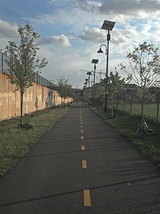
Latin American Montessori Bilingual Public Charter School is a public charter school in Washington, D.C. It operates in two buildings in the Northwest and Northeast quadrants of the city: one on 14th Street in Northwest's Sixteenth Street Heights and one at the corner of Perry Street and South Dakota Avenue in Northeast's Brookland neighborhood.

<span class="mw-page-title-main">St Anthony of Padua Church, Washington D.C.</span> Church in D.C., United States

St Anthony of Padua Church is the parish church of the Catholic Church parish in Washington, D.C., within the Archdiocese of Washington. Founded shortly after the Catholic University of America, the Franciscan Monastery, and the Dominican House of Studies, the parish church is located at 1029 Monroe Street NE in the Brookland neighborhood of Northeast Washington, commonly referred to as "Little Rome".

References

  1. https://goo.gl/maps/RHgnXHgo4LA1LhoeA Brookland Map
  2. "The Metropolitan Railroad" (PDF). The Evening Star. Washington, D.C. April 30, 1873. p. 4.
  3. "America as a Religious Refuge: The Seventeenth Century, Part 2 - Religion and the Founding of the American Republic | Exhibitions (Library of Congress)". www.loc.gov. 4 June 1998. Retrieved 2015-09-16.
  4. McDaniel, George W.; Pearce, John N.; Aurand, Martin, eds. (1988). Images of Brookland: The History and Architecture of a Washington Suburb. Washington, D.C.: Center for Washington Area Studies, George Washington University. p. 7. OCLC   8973194.
  5. Brookland Neighborhood Finding Aid, Special Collections Research Center, Estelle and Melvin Gelman Library, The George Washington University
  6. 1 2 McDaniel, George W.; Pearce, John N.; Aurand, Martin, eds. (1988). Images of Brookland: The History and Architecture of a Washington Suburb. Washington, D.C.: Center for Washington Area Studies, George Washington University. p. 3. OCLC   8973194.
  7. "Debates Over Development In D.C.'s "Little Rome"". The Kojo Nnamdi Show. October 13, 2016. Retrieved 5 January 2017.
  8. Anderson, Jeffrey (February 2, 2016), "The Catholic Church Is Selling Northeast DC to Developers", Washingtonian , retrieved August 31, 2016
  9. Seegers, Kelly (June 29, 2017), "Poor Clares of Perpetual Adoration close Washington monastery, trusting in God's providence", Catholic Standard, retrieved August 31, 2018
  10. Anderson, Jeffrey (February 2, 2016). "The Catholic Church Is Selling Northeast DC to Developers". The Washingtonian. Retrieved 5 January 2017.
  11. 1 2 Howard Newsroom Staff (November 3, 2017). "FLGA and ZOM Living Team Selected for Redevelopment and Master Planning". Howard University Office of University Communications. Retrieved 9 July 2019.
  12. 1 2 "B03002 HISPANIC OR LATINO ORIGIN BY RACE - District of Columbia - 2019 American Community Survey 1-Year Estimates". U.S. Census Bureau. July 1, 2019. Retrieved November 11, 2020.
  13. "Archer, Romulus Cornelius, Jr. (1890 - 1968) -- Philadelphia Architects and Buildings". www.philadelphiabuildings.org.
  14. Paul, Shilpi (November 9, 2011). "Brookland's Monroe Street Market Breaks Ground". Urban Turf. Retrieved 5 January 2017.
  15. Alpert, David (June 2, 2016). "A court ruling on a Brookland development could imperil future housing near Metro stations". Greater Greater Washington. Retrieved 5 January 2017.
  16. Segraves, Mark (14 September 2012). "Colonel Brooks Tavern closing after 32 years". WJLA-TV . Retrieved 11 November 2021.