Georgetown is a historic neighborhood and a commercial and entertainment district located in northwest Washington, D.C., situated along the Potomac River. Founded in 1751 in the Province of Maryland, the port of Georgetown predated the establishment of the federal district and the City of Washington by 40 years. Georgetown remained a separate municipality until 1871 when the United States Congress created a new consolidated government for the whole District of Columbia. A separate act passed in 1895 specifically repealed Georgetown's remaining local ordinances and renamed Georgetown's streets to conform with those in the City of Washington.

Mount Pleasant is a neighborhood in the northwestern quadrant of Washington, D.C. It is bounded by Rock Creek Park to the north and west; Harvard Street NW to the south; and 16th Street NW to the east. It is north of Adams Morgan and west of Columbia Heights. It is home to approximately 10,000 people.

Northwest is the northwestern quadrant of Washington, D.C., the capital of the United States, and is located north of the National Mall and west of North Capitol Street. It is the largest of the four quadrants of the city, and it includes the central business district, the Federal Triangle, and the museums along the northern side of the National Mall, as well as many of the District's historic neighborhoods.

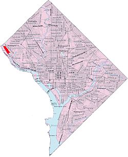
The Palisades, or simply Palisades, is a neighborhood in Washington, D.C., along the Potomac River, running roughly from the edge of the Georgetown University campus to the D.C.-Maryland boundary. MacArthur Boulevard is the main thoroughfare that passes through the Palisades.
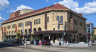
Columbia Heights is a neighborhood in Northwest Washington, D.C., United States. It has diverse demographics, the DC USA shopping mall and many restaurants, BloomBars, Meridian Hill/Malcom X Park, Howard University, Banneker Recreation Center, and All Souls Church.

Congress Heights is a residential neighborhood in Southeast Washington, D.C., in the United States. The irregularly shaped neighborhood is bounded by the St. Elizabeths Hospital campus, Lebaum Street SE, 4th Street SE, and Newcomb Street SE on the northeast; Shepard Parkway and South Capitol Street on the west; Atlantic Street SE and 1st Street SE on the south; Oxon Run Parkway on the southeast; and Wheeler Street SE and Alabama Avenue SE on the east. Commercial development is heavy along Martin Luther King, Jr. Avenue and Malcolm X Avenue.

Wesley Heights is a small affluent neighborhood of Washington, D.C. situated south of Spring Valley. Wesley Heights was founded in 1890 by a land speculation group led by John Waggaman and funded primarily by Charles C. Glover; Wesley Heights was further developed by the brothers William C. and Allison N. Miller during the 1920s. Modern-day Wesley Heights is bordered by Massachusetts Avenue, Nebraska Avenue, Battery-Kemble Park and Glover Parkway. Foxhall Road and New Mexico Avenue are the main roadway passing through Wesley Heights. To protect the character of the original historic housing design of Wesley Heights, the Wesley Heights Zoning Overlay was developed and approved by District of Columbia Zoning Commission on July 13, 1992, at the urging of the Wesley Heights Historical Society. Current homeowners and new housing development within the Wesley Heights overlay must meet specific building codes. The Wesley overlay covers areas west of New Mexico Avenue, Nebraska Avenue, Battery-Kemble Park and Glover Parkway. The overlay restriction does not cover development on housing located on the former Charles C. Glover country estate. Modern day Wesley Heights is located in Ward 3 Advisory Neighborhood Commission under 3D01.

American University Park is a neighborhood of Washington, D.C., named for the American University. AU Park, as it is often abbreviated, is situated against the Maryland border in the Northwest quadrant, bounded by Massachusetts, Wisconsin, Nebraska, and Western Avenues. Tenleytown and Friendship Heights lie to the east, Embassy Row to the southeast, and Spring Valley to the southwest. Politically, it is part of Ward 3 and Advisory Neighborhood Commission 3E.

Massachusetts Avenue is a major diagonal transverse road in Washington, D.C., and the Massachusetts Avenue Historic District is a historic district that includes part of it.

Wisconsin Avenue is a major thoroughfare in Washington, D.C., and its Maryland suburbs. The southern terminus begins in Georgetown just north of the Potomac River, at an intersection with K Street under the elevated Whitehurst Freeway. The section of Wisconsin Avenue in Georgetown was called High Street before the street names in Georgetown were changed in 1895 to conform to those of the L'Enfant Plan for the federal city.

Streetcars in Washington, D.C. transported people across the city and region from 1862 until 1962.
The name "M Street" refers to two major roads in the United States capital of Washington, D.C. Because of the Cartesian coordinate system used to name streets in Washington, the name "M Street" can be used to refer to any east-west street located twelve blocks north or south of the dome of the United States Capitol. Thus, in all four quadrants of the city there are streets called "M Street", which are disambiguated by quadrant designations, namely, M Street NW, NE, SW, and SE.
Park View is a neighborhood in central Washington, D.C., immediately north of Howard University.

Lanier Heights is a small urban neighborhood located in the northwest section of Washington, D.C., and is one of the early subdivisions which were created inside the District of Columbia, but which lay outside of the original, officially-planned City of Washington. Situated two miles north of the White House, Lanier Heights is within the larger and newer neighborhood of Adams Morgan, and is usually considered to be a part of that more prominent locale. The area of Lanier Heights, just about 50 acres in size, is bounded by 16th Street on the east, Adams Mill Road and the National Zoo on the west; Columbia Road to the south, and Harvard Street on the north. Developed mostly between 1900 and 1940, Lanier Heights consists primarily of row houses, plus a number of low- and medium-rise apartment buildings. The architecture is generally typical of the early twentieth century, in a variety of styles, especially Classical Revival. Some of the apartment houses have distinctive, well-crafted Art Deco designs. The area also contains a commercial stretch of stores on its southern side along Columbia Road. Nearby, just to the north of Lanier Heights, is the slightly older neighborhood of Mount Pleasant.

Fairlawn is a working class and middle class residential neighborhood in southeast Washington, D.C., United States. It is bounded by Interstate 295, Pennsylvania Avenue SE, Minnesota Avenue SE, Naylor Road SE, and Good Hope Road SE.

Good Hope is a residential neighborhood in southeast Washington, D.C., near Anacostia. The neighborhood is generally middle class and is dominated by single-family detached and semi-detached homes. The year-round Fort Dupont Ice Arena skating rink and the Smithsonian Institution's Anacostia Museum are nearby. Good Hope is bounded by Fort Stanton Park to the north, Alabama Avenue SE to the south, Naylor Road SE to the west, and Branch Avenue SE to the east. The proposed Skyland Shopping Center redevelopment project is within the boundaries of the neighborhood.

Greenway is a residential neighborhood in Southeast Washington, D.C., in the United States. The neighborhood is bounded by East Capitol Street to the north, Pennsylvania Avenue SE to the south, Interstate 295 to the west, and Minnesota Avenue to the east.

Kent is a neighborhood in Northwest Washington, D.C. in the United States, bounded by Loughboro Road to the north, MacArthur Boulevard to the southwest, and Chain Bridge Road and Battery Kemble Park to the southeast. It is a suburban neighborhood, home to some of the most expensive homes in the city with an average home sales price in 2012 of $1.7 million.

Sixteenth Street Heights is a large neighborhood of rowhouses, duplexes, and American Craftsman and American Foursquare detached houses in Northwest Washington, D.C..

The following outline is provided as an overview of and topical guide to District of Columbia: