K Street (Washington, D.C.)

Last updated

K Street Northwest and Northeast
1500 block of K Street.JPG
The 1500 block of K Street NW in Downtown, Washington, D.C.
Maintained by DDOT
Length4.0 mi (6.4 km) [1]
Location Northwest and Northeast, Washington, D.C., U.S.
West end Wisconsin Avenue in Georgetown
Major
junctions
East end Florida Avenue in Near Northeast
North L Street
South I Street
Construction
Commissioned 1791
K Street in Washington, D.C. has become a metonym for the American lobbying industry. K Street NW at 19th Street.jpg
K Street in Washington, D.C. has become a metonym for the American lobbying industry.

K Street is a major thoroughfare in the United States capital of Washington, D.C., known as a center for lobbying and the location of numerous advocacy groups, law firms, trade associations, and think tanks. In political discourse, "K Street" has become a metonym for lobbying in the United States, the same way Wall Street in New York City became a metonym for the financial markets of the United States, since many lobbying firms are or at least traditionally were located on the section in Northwest Washington which passes from Georgetown through a portion of Downtown Washington, D.C. [2]

Contents

Location

K Street (Washington, D.C.)
Invisible Square.svg
Mapscaleline.svg
3km
2miles
Red pog.svg
West end of K St. NW
Red pog.svg
East end of K St. NE

In the Washington D.C. street grid there are three (3) unconnected east-to-west street segments designated as K Street NW / NE, and also a southern K Street.

The middle segment of K Street NW / NE, which carries a segment of U.S. Route 29, begins in the city's Northwest quadrant as K Street NW, just west of the abutment of the old Aqueduct Bridge on the Georgetown waterfront. The street travels east underneath the Whitehurst Freeway, crosses Rock Creek on the K Street Bridge, and continues through downtown D.C. After its intersection with North Capitol Street, the street's designation changes to K Street NE as it enters the Northeast quadrant. The street ends at Florida Avenue in the Near Northeast neighborhood, just south of Gallaudet University.

K Street NE briefly reappears further east in the Carver neighborhood, extending from Blandensburg Road for six blocks to Maryland Avenue NE.

The westernmost (Georgetown) segment of K street NW was known as Water Street prior to the Georgetown street renaming of 1895. West of 33rd Street NW, the United States Postal Service still recognizes both "K Street" and "Water Street" in addresses. The westernmost end of K Street occupies the former right of way of the Georgetown Branch of the Baltimore and Ohio Railroad. When that line was abandoned, K Street was extended west to the Washington Canoe Club. The rest of the Georgetown right of way is now occupied by the Capital Crescent Trail, which begins at the terminus of K Street.

The southern K Street runs between the Potomac and Anacostia rivers, crossing the Southwest and Southeast quadrants (as K Street SW and K Street SE, respectively).

Traffic configuration

Current

International Finance Corporation (IFC) Headquarters at the crossroads of K Street and Pennsylvania Avenue at Washington Circle in the Foggy Bottom neighborhood Pennsylvania Avenue and K Street.JPG
International Finance Corporation (IFC) Headquarters at the crossroads of K Street and Pennsylvania Avenue at Washington Circle in the Foggy Bottom neighborhood

K Street provides a major east–west thoroughfare for traffic through Washington, primarily from Mount Vernon Square to the Whitehurst Freeway. The street continues through Georgetown under the Whitehurst Freeway; however most westbound traffic exits to the freeway. A portion of the street travels in a tunnel underneath Washington Circle, allowing through traffic to avoid the circle. Portions of the street are divided into both "local" (or service) lanes and "express" lanes in both directions. [3]

Proposed

The Washington Metropolitan Area Transit Authority has been studying the conversion of K Street into part of a proposed busway. [4] The route would begin at Georgetown University, cross downtown Washington on K Street, switch to Massachusetts Avenue at Mount Vernon Square, and end at Union Station. Currently, the DC Circulator provides service along most of the proposed route, although it must share right of way with other vehicles.

A streetcar line spanning from 26th Street NW to the H Street line's terminus at Union Station is planned as the next phase of DC's streetcar expansion. [5]

A proposal announced April 7, 2022, would redesign K Street between 12th and 21st Streets, N.W. The proposal would remove the service lanes in favor of dedicated bus and bicycle lanes. Under the proposal, construction would begin in the spring of 2023. [6]

Lobbying

"K Street" is the common metonym for Washington, D.C.'s lobbying industry, often used negatively in political campaign advertisements, the same way Wall Street in New York City became a metonymy for the financial markets of the United States. [7] [8] Many of the major Washington, D.C.-based lobbying firms were located on the section in Northwest Washington which passes from Georgetown through a portion of downtown D.C., although the strip has grown less popular for lobbyists in recent years. [2] [9]

Since the late 1980s, however, many of the largest lobbying firms have moved off of K Street into larger spaces on adjacent streets; as of 2012, only one of the top-20 largest lobbying firms has a K Street address. [9] The major lobbying firms that physically remain on K Street, as of 2017, include CGCN Group and K&L Gates; [10] although smaller and midsized lobbying and advocacy groups as well as law firms, trade associations, some think tanks, and members of the public affairs industry who commonly interact with each other still occupy spaces on K Street and adjacent areas of Downtown Washington, D.C.

The 2003 HBO television series K Street about a lobbying firm takes its name and location from the street. [11] [12] [13] [14] [15] [16]

See also

Related Research Articles

<span class="mw-page-title-main">Metonymy</span> Figure of speech in which something is referred to by the name of an associated thing

Metonymy is a figure of speech in which a concept is referred to by the name of something closely associated with that thing or concept.

<span class="mw-page-title-main">U.S. Route 240</span> Highway in the District of Columbia

U.S. Route 240 is a defunct designation for a short, but once very important, segment of highway between Frederick, Maryland, and Washington, D.C. It is now commonly known as Wisconsin Avenue, Maryland Route 355, and Interstate 270 (I-270).

<span class="mw-page-title-main">Northwest (Washington, D.C.)</span> Quadrant in the United States

Northwest is the northwestern quadrant of Washington, D.C., the capital of the United States, and is located north of the National Mall and west of North Capitol Street. It is the largest of the four quadrants of the city, and it includes the central business district, the Federal Triangle, and the museums along the northern side of the National Mall, as well as many of the District's historic neighborhoods.

<span class="mw-page-title-main">Northeast (Washington, D.C.)</span> Quadrant in the United States

Northeast is the northeastern quadrant of Washington, D.C., the capital of the United States. It encompasses the area located north of East Capitol Street and east of North Capitol Street.

<span class="mw-page-title-main">New York Avenue (Washington, D.C.)</span>

New York Avenue is a diagonal avenue radiating northeast from the White House in Washington, D.C. to the border with Maryland. It is a major east–west route in the city's Northwest and Northeast quadrants and connects downtown with points east and north of the city via Cheverly, Maryland, the John Hanson Highway, the Baltimore–Washington Parkway, and eventually, Interstate 95.

<span class="mw-page-title-main">John Philip Sousa Bridge</span> Bridge in Washington, D.C., United States

The John Philip Sousa Bridge, also known as the Sousa Bridge and the Pennsylvania Avenue Bridge, is a continuous steel plate girder bridge that carries Pennsylvania Avenue SE across the Anacostia River in Washington, D.C., in the United States. The bridge is named for famous United States Marine Band conductor and composer John Philip Sousa, who grew up near the bridge's northwestern terminus.

<span class="mw-page-title-main">Wisconsin Avenue</span> Thoroughfare in Washington, D.C. and its suburbs

Wisconsin Avenue is a major thoroughfare in Washington, D.C., and its Maryland suburbs. The southern terminus begins in Georgetown just north of the Potomac River, at an intersection with K Street under the elevated Whitehurst Freeway. Wisconsin Avenue ends just north of Bethesda, Maryland—though the road designated as Maryland Route 355 continues north for miles under the name of Rockville Pike.

<span class="mw-page-title-main">Rhode Island Avenue</span>

Rhode Island Avenue is a diagonal avenue in the Northwest and Northeast quadrants of Washington, D.C., and the capital's inner suburbs in Prince George's County, Maryland. Paralleling New York Avenue, Rhode Island Avenue was one of the original streets in Pierre L'Enfant's plan for the capital. It became a major commuter route, carrying U.S. Route 1 traffic into the city from Prince George's County.

<span class="mw-page-title-main">Streetcars in Washington, D.C.</span> Streetcars that existed in Washington until 1962

Streetcars in Washington, D.C. transported people across the city and region from 1862 until 1962.

<span class="mw-page-title-main">M Street (Washington, D.C.)</span> Four streets of the same name in Washington, D.C.

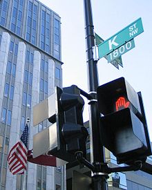
The name "M Street" refers to two major roads in the United States capital of Washington, D.C. Because of the Cartesian coordinate system used to name streets in Washington, the name "M Street" can be used to refer to any east-west street located twelve blocks north or south of the dome of the United States Capitol. Thus, in all four quadrants of the city there are streets called "M Street", which are disambiguated by quadrant designations, namely, M Street NW, NE, SW, and SE.

The Inner Loop was two planned freeways around downtown Washington, D.C. The innermost loop would have formed an oval centered on the White House, with a central freeway connecting the southern segment to the northern segment and then continuing on to Interstate 95. Interstate 95 would have met Interstate 66, Interstate 295, Interstate 695, and US 50 while traversing the Inner Loop. A second loop was an arc across the northern section of the city, beginning at East Capitol Street at the Anacostia River and using the Missouri Avenue NW and Nebraska Avenue NW commercial corridors to terminate in Georgetown.

<span class="mw-page-title-main">Ivy City</span> Neighborhood in Washington, D.C., U.S.

Ivy City is a small neighborhood in Northeast Washington, D.C., in the United States. About half the neighborhood is industrial or formerly industrial, dominated by warehouses. The Ivy City Yard, a railroad coach yard and maintenance facility for the passenger railroad Amtrak, is situated northwest across New York Avenue NE. Ivy City was laid out as a suburban development for African Americans in 1873. Development was slow. From 1879 to 1901, the neighborhood hosted the Ivy City Racetrack, a major horse racing facility in the District of Columbia. Construction on the rail yard began in 1907 and was complete within a year, although much of the facilities there were demolished in 1953 and 1954 as railroads switched from coal-fired locomotives to diesel-fueled or electric engines. The Alexander Crummell School, a major focal point of the community, opened in 1911. After some years of enrollment decline, it closed in 1972 but has not been demolished. The area has undergone some gentrification in the 21st century, although people living in the residential core of Ivy City remain very poor and unemployment is high.

<span class="mw-page-title-main">7th Street (Washington, D.C.)</span>

There are two north–south arteries in Washington, D.C. named 7th Street that are differentiated by the quadrants of the city in which they are located.

<span class="mw-page-title-main">Barney Circle</span> Neighborhood in the United States

Barney Circle is a small residential neighborhood located between the west bank of the Anacostia River and the eastern edge of Capitol Hill in southeast Washington, D.C., in the United States. The neighborhood is characterized by its sense of community, activism, walkability, and historic feel. The neighborhood's name derives from the eponymous former traffic circle Pennsylvania Avenue SE just before it crosses the John Philip Sousa Bridge over the Anacostia. The traffic circle is named for Commodore Joshua Barney, Commander of the Chesapeake Bay Flotilla in the War of 1812.

The streets and highways of Washington, D.C., form the core of the surface transportation infrastructure in Washington, D.C., the federal capital of the United States. Given that it is a planned city, the city's streets follow a distinctive layout and addressing scheme. There are 1,500 miles (2,400 km) of public roads in the city, of which 1,392 miles (2,240 km) are owned and maintained by city government.

<span class="mw-page-title-main">Transportation in Washington, D.C.</span> Overview of the transportation in Washington, DC

Washington, D.C. has a number of different modes of transportation available for use. Commuters have a major influence on travel patterns, with only 28% of people employed in Washington, D.C. commuting from within the city, whereas 33.5% commute from the nearby Maryland suburbs, 22.7% from Northern Virginia, and the rest from Washington, D.C.'s outlying suburbs.

<span class="mw-page-title-main">U.S. Route 29 in the District of Columbia</span> Highway in the District of Columbia

U.S. Route 29 (US 29) enters Washington, D.C., via the Key Bridge from Arlington County, Virginia, and exits at Silver Spring, Maryland. It predominantly follows city surface streets, although the portion of the route from the Key Bridge east to 26th Street Northwest is an elevated highway. The elevated section of US 29 in DC is better known as the Whitehurst Freeway. Called the city's most ridiculed bridge in 1989, there have been several attempts to have the Whitehurst Freeway torn down but cost and other considerations have stopped these proposals from being acted on.

Vlastimil Koubek was an American architect who designed more than 100 buildings, most of them in the Washington, D.C., metropolitan area, and whose total value topped $2 billion. Most of his work is Modernist in style, although he developed a few structures in other vernaculars. He created the site plan for the redevelopment of Rosslyn, Virginia, and his Ames Center anchored the area's economic recovery. He designed the World Building in Silver Spring, Maryland, which sparked redevelopment of that town's downtown; and the L'Enfant Plaza Hotel in Washington, D.C. In 1985, Washingtonian magazine called him one of 20 people "who in the past 20 years had the greatest impact on the way we live and who forever altered the look of Washington." In 1988, The Washington Post newspaper said his Willard Hotel renovation was one of 28 projects in the area that made a signal contribution to the "feel" and look of Washington, D.C.

Think Tank Row designates the cluster of think tanks that are located on or around Massachusetts Avenue NW in Washington, D.C., between Thomas Circle and Dupont Circle. The expression is a reference to Millionaire Row and Embassy Row, past and present designations for the same area.

<span class="mw-page-title-main">16 Avenue N</span> Road in Calgary, Alberta, Canada

16 Avenue N is a major road in Calgary, Alberta, that forms a 26.5-kilometre (16.5 mi) segment of Highway 1 and connects Calgary to Banff and Medicine Hat. It is a four to six-lane principal arterial expressway at its extremities, but is an urban arterial road between the Bow River and Bowness Road, and also between Crowchild Trail and Deerfoot Trail. Due to Calgary's quadrant system, it is known as 16 Avenue NW west of Centre Street and 16 Avenue NE to the east.

References

  1. Google (March 9, 2019). "K Street NW and NE" (Map). Google Maps . Google. Retrieved March 9, 2019.
  2. 1 2 Birnbaum, Jeffrey H. (June 22, 2005). "The Road to Riches Is Called K Street". The Washington Post. p. A01. Archived from the original on February 16, 2011. Retrieved June 17, 2008.
  3. David Alpert (July 30, 2009). "K Street Transitway options balance buses, bikes, cars, and loading". Greater Greater Washington. Archived from the original on October 12, 2011. Retrieved January 5, 2012.
  4. Halsey III, Ashley. "Navigating a Bus Path For K Street - Again." Washington Post. August 30, 2009.
  5. "From seedy to sought-after: D.C.'s Mount Vernon Triangle becoming urban village". Washington Post. January 30, 2010. Archived from the original on March 4, 2016. Retrieved January 5, 2012.
  6. "K Street makeover will bring dedicated bus lanes, remove service lanes" Archived April 8, 2022, at the Wayback Machine , The Washington Post, April 7, 2022
  7. "Lobbying Database - OpenSecrets". OpenSecrets.org. Archived from the original on July 28, 2011. Retrieved October 29, 2010.
  8. Montopoli, Brian (October 27, 2009). "Grayson Calls Linda Robertson A "K Street Whore"". cbsnews.com "Political Hotsheet". CBS. Archived from the original on October 24, 2010. Retrieved October 29, 2010.
  9. 1 2 Zak, Dan (February 5, 2012). "K Street: The route of all evil, or just the main drag?". The Washington Post. Archived from the original on January 1, 2016. Retrieved February 7, 2012.
  10. "Another lobbyist joins the administration". POLITICO. Archived from the original on July 17, 2017. Retrieved July 18, 2017.
  11. Stanley, Alessandra (September 14, 2003). "Inside Washington Politics, Turned Inside Out". The New York Times . p. 40.
  12. Shales, Tom (September 15, 2003). "HBO's K Street, In Uncharted Territory". Washington Post . pp. C01.
  13. Gallo, Phil (September 16, 2003). "K Street". Variety . p. 10.
  14. Bianculli, David (September 16, 2003). "Been Down This Street". The New York Daily News . p. 82.
  15. Buckman, Adam (September 16, 2003). "K Street Stands for "Kooky"". The New York Post . p. 82.
  16. Bianco, Robert (September 19, 2003). "Well-intentioned K Street is headed the wrong way". USA Today . pp. 12E.