U.S. Route 222 is a U.S. Highway that is a spur of US 22. It runs for 95 miles (153 km) from US 1 in Conowingo, Maryland to Interstate 78 (I-78)/Pennsylvania Route 309 in Dorneyville, Pennsylvania. US 222 is almost entirely in Pennsylvania, and serves as the state's principal artery between the Lancaster and Reading areas and the Lehigh Valley. US 222 heads north from US 1 in Conowingo and soon crosses from Maryland into Pennsylvania, continuing north through rural areas and passing through Quarryville and Willow Street before reaching Lancaster. The route passes through Lancaster on a one-way pair of city streets before becoming a freeway at US 30 north of the city. The US 222 freeway heads northeast, crossing US 322 in Ephrata and coming to an interchange with the Pennsylvania Turnpike (I-76). US 222 bypasses Reading to the west, where it meets US 422. The freeway section ends past Reading and the route continues northeast through rural areas, with a freeway bypass of Kutztown. US 222 bypasses Trexlertown on a multilane divided expressway before coming to its northern terminus at I-78/PA 309 in Dorneyville, where the US 222 right-of-way continues into Allentown as PA 222.
Benning Road is a major traveled street in Washington, D.C., and Prince George's County, Maryland.

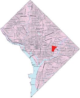
Congress Heights is a residential neighborhood in Southeast Washington, D.C., in the United States. The irregularly shaped neighborhood is bounded by the St. Elizabeths Hospital campus, Lebaum Street SE, 4th Street SE, and Newcomb Street SE on the northeast; Shepard Parkway and South Capitol Street on the west; Atlantic Street SE and 1st Street SE on the south; Oxon Run Parkway on the southeast; and Wheeler Street SE and Alabama Avenue SE on the east. Commercial development is heavy along Martin Luther King, Jr. Avenue and Malcolm X Avenue.
District of Columbia Route 295 (DC 295), also known as the Anacostia Freeway as well as the Kenilworth Avenue Freeway north of East Capitol Street, is a freeway in the District of Columbia, and currently the only signed numbered route in the District that is not an Interstate Highway or U.S. Highway. Also, DC 295 is one of the few city-level signed route numbers in the United States, along with Charlotte Route 4. The south end is at the junction of Interstate 295 (I-295), I-695, and the southern end of the 11th Street Bridges; its north end is at the border with Maryland where it continues as Maryland Route 201 (MD 201) and then the Baltimore–Washington Parkway.

New York Avenue is a diagonal avenue radiating northeast from the White House in Washington, D.C. to the border with Maryland. It is a major east–west route in the city's Northwest and Northeast quadrants and connects downtown with points east and north of the city via Cheverly, Maryland, the John Hanson Highway, the Baltimore–Washington Parkway, and eventually, Interstate 95.

The John Philip Sousa Bridge, also known as the Sousa Bridge and the Pennsylvania Avenue Bridge, is a continuous steel plate girder bridge that carries Pennsylvania Avenue SE across the Anacostia River in Washington, D.C., in the United States. The bridge is named for famous United States Marine Band conductor and composer John Philip Sousa, who grew up near the bridge's northwestern terminus.

Maryland Route 5 is a 74.34-mile (119.64 km) long state highway that runs north–south in the U.S. state of Maryland. The highway runs from Point Lookout in St. Mary's County north to the Washington, D.C. border in Suitland, Prince George's County. MD 5 begins as two-lane undivided Point Lookout Road which runs from Point Lookout, St. Mary's County, to an intersection with MD 235 in the northern part of the county. Point Lookout Road passes through rural areas as well as the county seat of Leonardtown. After the MD 235 intersection, the route becomes four-lane divided Three Notch Road and continues into Charles County, where it becomes Leonardtown Road. Here, the route bypasses Hughesville and continues north toward the Waldorf area, which it bypasses to the east on Mattawoman Beantown Road. The route merges onto U.S. Route 301 and enters Prince George's County, splitting from US 301 at an interchange in Brandywine. From here, MD 5 continues north on Branch Avenue, running through suburban areas, before becoming a freeway as it passes Andrews Air Force Base and has an interchange with Interstate 95 (I-95)/I-495. Past the Capital Beltway, the route runs through suburban areas of Hillcrest Heights and Suitland before reaching the D.C. border, where Branch Avenue SE continues, crossing Pennsylvania Avenue SE and eventually terminating at Randle Circle.

Massachusetts Avenue is a major diagonal transverse road in Washington, D.C., and the Massachusetts Avenue Historic District is a historic district that includes part of it.

The Suitland Parkway is a parkway in Washington, D.C., and Prince George's County, Maryland, administered and maintained by the U.S. National Park Service, National Capital Parks-East. The road has partial controlled access with a combination of interchanges and at-grade intersections, but without property access for neighboring land-owners. Conceived in 1937, it was built during World War II to provide a road connection between military facilities in the Washington, D.C. metropolitan area. It fully opened on December 9, 1944 as the Camp Springs highway, so called because it connected Camp Springs in Prince George's County with Bolling Air Force Base. However one lane of the highway was opened in mid-October 1944.

Streetcars in Washington, D.C. transported people across the city and region from 1862 until 1962.
U.S. Route 50 is a major east–west route of the U.S. Highway system, stretching just over 3,000 miles (4,800 km) from Ocean City, Maryland on the Atlantic Ocean to West Sacramento, California. In the U.S. state of Maryland, US 50 exists in two sections. The longer of these serves as a major route connecting Washington, D.C. with Ocean City; the latter is the eastern terminus of the highway. The other section passes through the southern end of Garrett County for less than 10 miles (16 km) as part of the Northwestern Turnpike, entering West Virginia at both ends. One notable section of US 50 is the dual-span Chesapeake Bay Bridge across the Chesapeake Bay, which links the Baltimore–Washington metropolitan area with the Eastern Shore region, allowing motorists to reach Ocean City and the Delaware Beaches.

Maryland Route 195 is a state highway in the U.S. state of Maryland. Known as Carroll Avenue, the state highway runs 1.90 miles (3.06 km) from Eastern Avenue at the District of Columbia boundary in Takoma Park north to MD 193 in Silver Spring. MD 195 is the main north–south state highway through Takoma Park in southeastern Montgomery County. The highway provides access to Washington Adventist University and Washington Adventist Hospital and crosses Sligo Creek on the Carroll Avenue Bridge. The state highway was constructed from Washington to Silver Spring in the late 1920s on a road that has existed since the 19th century. The Carroll Avenue Bridge was built in 1932 as the third bridge at the site. Reconstruction of the bridge began in 2015 and was completed in 2017.
Kingman Park is a residential neighborhood in the Northeast quadrant of Washington, D.C., the capital city of the United States. Kingman Park's boundaries are 15th Street NE to the west; C Street SE to the south; Benning Road to the north; and Anacostia Park to the east. The neighborhood is composed primarily of two-story brick rowhouses. Kingman Park is named after Brigadier General Dan Christie Kingman, the former head of the United States Army Corps of Engineers.

Maryland Route 355 (MD 355) is a 36.75-mile (59.14 km) north–south road in western central Maryland in the United States. The southern terminus of the route, Wisconsin Avenue, is located in the Bethesda CDP, at the Washington, D.C. border. It continues south into Washington, D.C. as Wisconsin Avenue NW. The northern terminus is just north of an overpass with Interstate 70 (I-70)/U.S. Route 40 (US 40) in the city of Frederick in Frederick County, where the road continues north as Market Street through Frederick towards MD 26.

Fairlawn is a working class and middle class residential neighborhood in southeast Washington, D.C., United States. It is bounded by Interstate 295, Pennsylvania Avenue SE, Minnesota Avenue SE, Naylor Road SE, and Good Hope Road SE.

Washington Highlands is a residential neighborhood in Southeast Washington, D.C., in the United States. It lies within Ward 8.

Good Hope is a residential neighborhood in southeast Washington, D.C., near Anacostia. The neighborhood is generally middle class and is dominated by single-family detached and semi-detached homes. The year-round Fort Dupont Ice Arena skating rink and the Smithsonian Institution's Anacostia Museum are nearby. Good Hope is bounded by Fort Stanton Park to the north, Alabama Avenue SE to the south, Naylor Road SE to the west, and Branch Avenue SE to the east. The proposed Skyland Shopping Center redevelopment project is within the boundaries of the neighborhood.

Greenway is a residential neighborhood in Southeast Washington, D.C., in the United States. The neighborhood is bounded by East Capitol Street to the north, Pennsylvania Avenue SE to the south, Interstate 295 to the west, and Minnesota Avenue to the east.

The Anacostia Historic District is a historic district in the city of Washington, D.C., comprising approximately 20 squares and about 550 buildings built between 1854 and 1930. The Anacostia Historic District was added to the National Register of Historic Places in 1978. "The architectural character of the Anacostia area is unique in Washington. Nowhere else in the District of Columbia does there exist such a collection of late-19th and early-20th century small-scale frame and brick working-class housing."
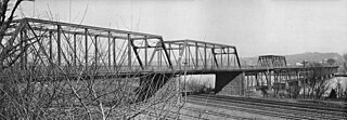
The Pennsylvania Avenue Bridge was a crossing of the Anacostia River in Washington, DC at the site of the present John Philip Sousa Bridge. It was constructed in 1890 and demolished around 1939.
