
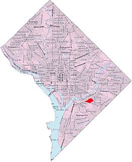
Southeast is the southeastern quadrant of Washington, D.C., the capital of the United States, and is located south of East Capitol Street and east of South Capitol Street. It includes the Capitol Hill and Anacostia neighborhoods, the Navy Yard, the Joint Base Anacostia-Bolling (JBAB), the U.S. Marine Barracks, the Anacostia River waterfront, Eastern Market, the remains of several Civil War-era forts, historic St. Elizabeths Hospital, RFK Stadium, Nationals Park, and the Congressional Cemetery. It also contains a landmark known as "The Big Chair," located on Martin Luther King Jr. Avenue. The quadrant is split by the Anacostia River, with the portion that is west of the river sometimes referred to as "Near Southeast". Geographically, it is the second-smallest quadrant of the city.

Woodridge is a residential neighborhood located in Ward 5 of Northeast Washington, D.C.. Woodridge is contained between Eastern Avenue N.E. to the east, Taylor Street N.E. to the north, South Dakota Avenue N.E. to the west, and Bladensburg Road N.E. to the south. Its central commercial strips are Rhode Island Avenue NE and Bladensburg Road N.E. Woodridge borders the adjacent neighborhoods of Brookland, Langdon, North Michigan Park, and Fort Lincoln in Northeast Washington D.C. In addition to these neighborhoods in the District of Columbia, Woodridge also borders the city of Mount Rainier and town of Cottage City in Maryland. In terms of public transportation, residents of Woodridge have access to the Brookland-CUA and Rhode Island Avenue Metro stations.

Scott Circle is a traffic circle in the northwest quadrant of Washington, D.C., at the junction of Massachusetts Avenue, Rhode Island Avenue, and 16th Street, N.W. It is named for the sculpture of Brevet Lt. General Winfield Scott that was erected in the circle in 1874.

Queens Chapel is a mostly residential neighborhood with commercial elements located in Ward 5 of Northeast Washington, D.C.. Queens Chapel is contained between Eastern Avenue N.E. to the north, Galloway Street N.E. to the south, Riggs Rd N.E. to the north, and the Washington Metropolitan Area Red Line train tracks to the west. Queens Chapel borders the adjacent neighborhoods of Riggs Park, Fort Totten, North Michigan Park, and Michigan Park, which also are located in Ward 5 of Northeast Washington D.C. In addition to these Ward 5 neighborhoods of Northeast Washington D.C., Queens Chapel also borders the neighborhood of Chillum, which is located in Prince George's County, Maryland. The Queens Chapel neighborhood is often confused with the Queens Chapel Neighborhood Association which is located in the Michigan Park neighborhood. It was named for early landowner Richard Queen.

University Heights is a neighborhood adjacent to The Catholic University of America in Ward 5 of Northeast Washington, D.C. in the Upper Northeast area element. It is located east of the University and west of the Franciscan Monastery, bounded by the tracks for the Red Line of the Washington Metro to the west; 14th Street NE to the east; Taylor Street to the north; and Otis Street to the south. University Heights is in DC Neighborhood Cluster 20 along with the Michigan Park and North Michigan Park neighborhoods.
Sherman Circle is an urban park and traffic circle in the Northwest Washington, D.C. neighborhood of Petworth at the intersection of Illinois Avenue, Kansas Avenue, 7th Street, and Crittenden Street NW. The circle is named in honor of Civil War general William Tecumseh Sherman. Administered by the National Park Service's Rock Creek Park unit, Sherman Circle together with four surrounding triangular parks covers 3.44 acres (1.39 ha) and is considered by the National Park Service a "cultural landscape."
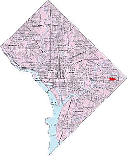
Benning Heights is a residential neighborhood located in northeast Washington, D.C. It is bounded by East Capitol Street to the south, Brooks Street NE to the north, 44th Street NE and Benning Road NE to the west, and Division Avenue NE to the east. It is served by the Benning Road Metro Rail station on the Blue Line and Silver Line of the Washington Metro.

Benning Ridge is a residential neighborhood located in Southeast Washington, D.C. It is bounded by Fort Chaplin Park to the northwest, Southern Avenue to the south, Benning Road to the east, and Ridge Road SE to the west. Benning Ridge is an unusual neighborhood for its location east of the Anacostia River: although it is surrounded by working-class and low-income African American neighborhoods, Benning Ridge is rather affluent, with a diverse population of middle- and upper-middle-class white and black residents.
Eastland Gardens is a small residential neighborhood, located in northeast Washington, D.C. It is bounded by Eastern Avenue NE to the north, the Watts Branch Tributary to the south, CSX Transportation tracks to the east and the Anacostia River to the west.

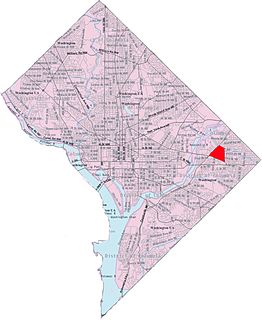
Fort Dupont is a residential neighborhood located in southeast Washington, D.C., east of the Anacostia River. It is bounded by East Capitol Street to the north, Fort Dupont Park to the south, Minnesota Avenue to the west, and Fort Chaplin Park to the east and northeast. Fort Dupont has a population of approximately 7,050.
Buena Vista is a residential neighborhood in Southeast Washington, D.C., in the United States. Buena Vista is located in Ward 8. The neighborhood is dominated by detached single-family housing and multi-family apartment complexes.

Dupont Park is a residential neighborhood located in southeast Washington, D.C. It is bounded by Fort Dupont Park to the north, Pennsylvania Avenue SE to the south, Branch Avenue to the west, and Fort Davis Park to the east. The neighborhood civic association uses Fairlawn Avenue and the Anacostia Freeway as the western boundary of the neighborhood.
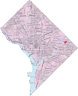
Central Northeast, also sometimes called Mahaning Heights, is a small neighborhood located in Northeast Washington, D.C. with Fort Mahan Park at its center. It is bounded by Nannie Helen Burroughs Avenue to the north, Benning Road to the south, the tracks of the Washington Metro and Minnesota Ave station to the west, and 44th Street NE to the east.
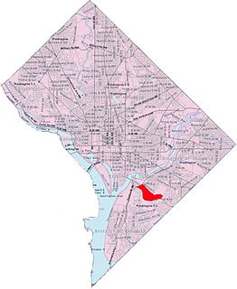
Park Naylor is a residential neighborhood located in southeast Washington, D.C. It takes its name from its northern and eastern borders, Naylor Road and Fort Stanton Park. Park Naylor's other boundaries are Minnesota Avenue to the west, and Good Hope Road SE to the south. Also see article on Anacostia.

Twining is a neighborhood in Southeast Washington, D.C., near the eastern bank of the Anacostia River. It is bounded by Minnesota Avenue NE to the northeast, Branch Avenue to the northwest, and Pennsylvania Avenue to the south. The Fort Dupont year-round ice skating rink, and the Smithsonian's Anacostia Neighborhood Museum are nearby. Also see article on Anacostia.

Randle Highlands is a neighborhood in Southeast Washington, D.C., east of the Anacostia River.
Penn Branch is a neighborhood in Southeast Washington, D.C., east of the Anacostia River. It is bounded by Pennsylvania Avenue SE to the south; Pope Branch Park and Pope Creek to the north; Branch Avenue to the west; and Fort Davis Park to the east. ‘Penn Branch’, takes its name from its location at the intersection of two major thoroughfares, Pennsylvania and Branch Avenue.

The Civil War Defenses of Washington were a group of Union Army fortifications that protected the federal capital city, Washington, D.C., from invasion by the Confederate States Army during the American Civil War. The sites of some of these fortifications are within a collection of National Park Service (NPS) properties that the National Register of Historic Places identifies as the Fort Circle. The sites of other such fortifications in the area have become parts of state, county or city parks or are located on privately owned properties. A trail connecting the sites is part of the Potomac Heritage Trail.
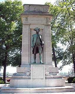
American Revolution Statuary is a group of fourteen statues in Washington, D.C., listed with the National Register of Historic Places. The statues are scattered across Washington, mainly in squares and traffic circles, with four statues of European officers displayed in Lafayette Square, across from the White House

Providence Hospital was a 408-bed hospital located in the District of Columbia, United States. Founded in 1861 on Capitol Hill by the Roman Catholic Daughters of Charity of Saint Vincent de Paul, it was the longest continuously operating hospital and the last public hospital in the District. It moved to Brookland in 1956. Providence Hospital was a member of Ascension Health, the largest non-profit health care organization in the United States.