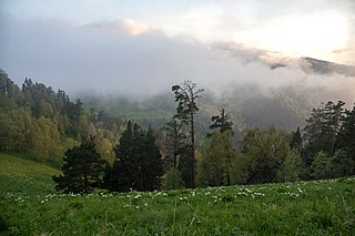
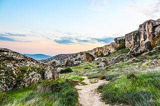
The Caucasus mixed forests is a temperate broadleaf and mixed forests ecoregion in the Caucasus Mountains, as well as the adjacent Lesser Caucasus range and the eastern end of the Pontic Mountains.

The Taiwan subtropical evergreen forests is an ecoregion that covers most of the island of Taiwan, with the exception of the southern tip of the island, which constitutes the South Taiwan monsoon rain forests ecoregion. The island's concentrated steep mountains host a range of forest types, from subtropical forests in the lowlands to temperate and alpine or montane forests.

The Western Himalayan broadleaf forests is a temperate broadleaf and mixed forest ecoregion which is found in the middle elevations of the western Himalayas, including parts of Nepal, India, and Pakistan.
The Northeastern Himalayan subalpine conifer forests are a temperate coniferous forests ecoregion of the middle to upper elevations of the eastern Himalayas and southeast Tibetan Plateau. The ecoregion occurs in southeastern Tibet Autonomous Region, China, in northern and eastern Arunachal Pradesh, India, and extreme eastern Bhutan.

The Western Himalayan subalpine conifer forests is a temperate coniferous forests ecoregion of the middle and upper elevations of the western Middle Himalayas of Nepal, India, and Pakistan.

Tugay is a form of riparian forest or woodland associated with fluvial and floodplain areas in arid climates. These wetlands are subject to periodic inundation, and largely dependent on floods and groundwater rather than directly from rainfall. Tugay habitats occur in semi-arid and desert climates in Central Asia. Because Tugay habitat is usually linear, following the courses of rivers in arid landscapes, Tugay communities often function as wildlife corridors. They have disappeared or become fragmented over much of their former range.

The Eastern Anatolian montane steppe is a temperate grasslands, savannas, and shrublands ecoregion. It is located in the Armenian Highlands, covering parts of eastern Turkey, Armenia, Azerbaijan, southern Georgia, and northwestern Iran.

The Sichuan Basin evergreen broadleaf forests are a critically endangered WWF ecoregion. The ecoregion occupies the Sichuan Basin in China and covers an area of 9,816,054 ha. The broadleaf forest habitat once covered the Sichuan Basin, but today is limited to mountains and preserved temple grounds in the basin and around the basin's rim. An especially well-preserved example of remaining forest exists on Mount Emei at the western edge of the Sichuan Basin. The original forests are thought to have been made up of subtropical oaks, laurels, and Schima. Much of the remaining Sichuan Basin has been converted to anthropogenic agricultural use in the last 5,000 years.

The Daba Mountains evergreen forests are a Global 200 endangered ecoregion located on the Daba Mountains in China. The forests are part of temperate broadleaf and mixed forests containing both coniferous and broadleaf trees covering a swath of Central China. Forests here provide a transitional area between evergreen forests to the south and deciduous forests to the north. The Daba Mountains evergreen forests cover areas of northeast Sichuan Province, southern Shaanxi Province, the northern half of Chongqing Municipality, and western Hubei Province.

The Qionglai-Minshan conifer forests are a World Wide Fund for Nature ecoregion in Southwest China. These forests are classified as temperate coniferous forests and are part of the Palearctic realm.

The Nujiang Lancang Gorge alpine conifer and mixed forests are a temperate coniferous forests ecoregion in Southwest China and northeastern Myanmar. The forests cover mountains and valleys in the western Hengduan Mountains and because of the extreme topography and relative remoteness, remain one of the best preserved habitats in China.
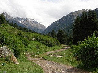
The Tian Shan montane conifer forests ecoregion covers the "forest belt" of the Tian Shan mountains - generally the north-facing slopes that get enough moisture, and are warm enough, for trees to grow. This conifer belt is found mostly between 1,500 and 2,700 meters.

The Tian Shan foothill arid steppe ecoregion covers the northern and western approaches to the Tian Shan mountains, centered on Lake Issyk-Kul in Kyrgyzstan. This region receives more moisture from Central Asia, thereby supporting more vegetation and diversity of plant and animal species than the deserts to the south.

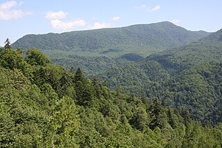
The Changbai Mountains mixed forests ecoregion covers the Changbai Mountains and surrounding foothills in China and North Korea. The region features extensive and naturally preserved deciduous and conifer forests. The region exhibits high biodiversity due to its relative isolation, temperate climate with high rainfall, and centrality to central Chinese, Siberian, and European floral communities. In 1979, a significant portion of the ecoregion was designated the Changbaishan Biosphere Reserve by UNESCO.

The Changjiang Plain evergreen forests ecoregion covers the plain of the Yangtze River (Changjiang) from where it leaves the mountains at the Three Gorges in the west, to the mouth of the Yangtze at the East China Sea. This plain is one of the most densely populated areas on Earth, and most of the original oak and conifer forests have long been converted to agriculture. Extensive wetlands, however, provide habitat for migratory waterfowl and for diverse aquatic species.

The Central Asian riparian woodlands ecoregion is spread out across the deserts and plains of central Asia between the Aral Sea and the mountains 2,000 kilometres (1,200 mi) to the east. The long narrow components of the ecoregion follow the large rivers fed by snowmelt, and provide critical habitat for migratory birds as they travel through the arid region. The vegetation is referred to as tugai, characterized by low tangles of trees and brush along the edges of the rivers and associated wetlands, and fed by groundwater instead of precipitation.
The Hokkaido montane conifer forests ecoregion covers the mountainous central regions of Hokkaido Island, the northernmost of Japan's main islands. Forests of spruce and fir thrive in the subalpine, cool climate. On the northeastern edge of the island, the conifer forests extend down to the sea under the influence of the cold Oyashio Current coming down from the north, although logging in recent years has put pressure on these stands.
The Azerbaijan shrub desert and steppe is a deserts and xeric shrublands ecoregion in western Asia. It lies in the lowlands west of the Caspian Sea, and covers portions of Azerbaijan, Georgia, and Iran.

The Central Afghan Mountains xeric woodlands ecoregion covers the xeric (dry) eastern and southern slopes of the central mountain range of Afghanistan, between the sandy desert to the south and the alpine meadows in the higher, wetter region to the north. Despite the 'woodlands' in the ecoregion name, very little of the territory is forested – less than 1% – but is instead sparse vegetation or herbaceous cover.

The Paropamisus xeric woodlands ecoregion covers the portion of northeastern Afghanistan north of the central mountain range and the Hindu Kush Mountains. The name is derived from the Old Persian name for the region, Parupraesanna. While there are low canopy woodlands in the northeast of the ecorgegion, most of the territory is desert or xeric (dry) scrubland.
