Teslin, Yukon

Last updated

Teslin
Desleen
Village
Village of Teslin
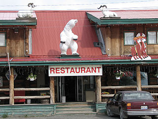
Teslin, Yukon in 2005.jpg
Southeast Teslin
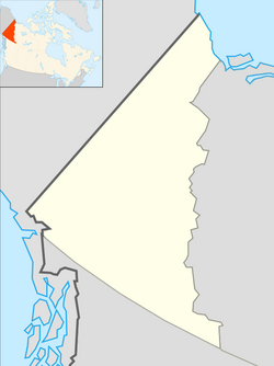
Location map Yukon 2.png
Red pog.svg
Teslin
Canada location map 2.svg
Red pog.svg
Teslin
Coordinates: 60°10′02″N132°43′18″W / 60.16722°N 132.72167°W / 60.16722; -132.72167 [1]
CountryCanada
Territory Yukon
Time zone UTC−07:00 (MST)
Website Official website

The community of Teslin (Tlingit: Desleen) includes the Village of Teslin in Yukon, Canada. Teslin is situated at historical Mile 804 on the Alaska Highway along Teslin Lake. [1] The Hudson's Bay Company established a small trading post at Teslin in 1903 (i.e. Teslin Post).

Contents

Teslin is home to the Teslin Inland Tlingit First Nations. The name Teslin came from a Tlingit word "Teslintoo." Teslin has one of the largest Native populations in Yukon. Much of the community's livelihood revolves around traditional hunting, trapping and fishing.

Demographics

Village of Teslin
Federal census population history of Teslin
YearPop.±%
1941 171    
1951 269+57.3%
1971264−1.9%
1976241−8.7%
1981 310+28.6%
1986 181−41.6%
1991 181+0.0%
1996 189+4.4%
2001 123−34.9%
2006 141+14.6%
2011 122−13.5%
2016 124+1.6%
2021 239+92.7%
Source: Statistics Canada
[2] [3] [4] [5] [6] [7] [8] [9] [10] [11] [12]

In the 2021 Census of Population conducted by Statistics Canada, Teslin had a population of 239 living in 126 of its 144 total private dwellings, a change of

Teslin Post 13

In the 2021 Census of Population conducted by Statistics Canada, Teslin Post 13 had a population of 19 living in 10 of its 11 total private dwellings, a change of

Arts and culture

Teslin is made up of two moieties; Wolf and Crow. Under the moiety of Wolf there are two clans; Eagle (Dakhl'awedi') and Wolf (Yanyedi). The Crow moiety have three clans; Raven's Children (Kukhhittan or Crow), Frog (Ishkitan) and Split tail Beaver (Deshitan). Under their matrilineal kinship system, children are considered born into the mother's clan, and descent is traced through her line. [13]

George Johnston (trapper) (1884–1972), trapper and photographer, founder of "Teslin Taxi." He captured the life of the inland Tlingit people of Teslin and Atlin in numerous photos taken between 1910 and 1940. [14] [15] Johnston also brought the first car to Teslin; it was a 1928 Chevrolet. He built a 3 to 5 mi (4.8 to 8.0 km) road for his "Teslin taxi" since the Alaska Highway had not been built yet. [16] In winter, he put chains on the car, painted it white, and drove it on frozen Teslin Lake. The '28 Chevy has been restored and is now on permanent display at the George Johnston Museum in Teslin. [17]

Government

In 1995 the Teslin Inland Tlingit negotiated and signed a land claims agreement with the federal government, under which they re-established their own government and became self-sustaining. [13] The Teslin Inland Tlingit now enact their own legal and political framework for government-to-government relations with Canada and the Yukon.

The Teslin Tlingit Council have the right to make their own laws and regulations. There are many different departments within Teslin Tlingit Council (TTC), for example: Finance, Lands and Resources, Health and Social. [13]

The people have developed the Teslin Tlingit Council Clan System Government, which combines traditional Tlingit Clan culture with contemporary organizational and management principles. The five clans (Eagle, Crow, Frog, Wolf, and Beaver) each appoint five members to the 25-member General Council, and have recognized Elders (persons 58 years and older) on the Elders Council. [18]

Geography

Climate

Teslin has a dry-summer subarctic climate (Köppen climate classification: Dfc). Summer days are mild along with cool nights. Winters are cold and snowy, with annual snowfall averaging 148.4 cm (58.4 in). Teslin is one of the warmest communities in the Yukon, with a yearly average of −0.6 °C (30.9 °F). [19]

Climate data for Teslin (Teslin Airport)
Climate ID: 2101100; coordinates 60°10′27″N132°44′09″W / 60.17417°N 132.73583°W / 60.17417; -132.73583 (Teslin Airport) ; elevation: 705 m (2,313 ft); 1981–2010 normals, extremes 1943–present
MonthJanFebMarAprMayJunJulAugSepOctNovDecYear
Record high humidex 8.810.312.219.428.435.133.932.226.617.810.68.035.1
Record high °C (°F)7.8
(46.0)
11.0
(51.8)
13.0
(55.4)
22.0
(71.6)
29.0
(84.2)
33.3
(91.9)
31.1
(88.0)
32.5
(90.5)
26.1
(79.0)
18.3
(64.9)
10.0
(50.0)
9.0
(48.2)
33.3
(91.9)
Mean maximum °C (°F)2.3
(36.1)
4.1
(39.4)
6.9
(44.4)
14.8
(58.6)
20.7
(69.3)
26.4
(79.5)
27.1
(80.8)
26.4
(79.5)
18.9
(66.0)
12.9
(55.2)
4.7
(40.5)
3.3
(37.9)
28.9
(84.0)
Mean daily maximum °C (°F)−12.6
(9.3)
−7.7
(18.1)
−0.2
(31.6)
7.0
(44.6)
13.6
(56.5)
18.8
(65.8)
20.2
(68.4)
18.6
(65.5)
12.6
(54.7)
4.3
(39.7)
−6.2
(20.8)
−8.9
(16.0)
5.0
(41.0)
Daily mean °C (°F)−17.1
(1.2)
−13.6
(7.5)
−6.5
(20.3)
0.7
(33.3)
6.9
(44.4)
11.9
(53.4)
14.1
(57.4)
12.2
(54.0)
7.3
(45.1)
0.4
(32.7)
−10.2
(13.6)
−13.4
(7.9)
−0.6
(30.9)
Mean daily minimum °C (°F)−21.5
(−6.7)
−19.5
(−3.1)
−12.8
(9.0)
−5.6
(21.9)
0.1
(32.2)
4.9
(40.8)
7.9
(46.2)
5.8
(42.4)
1.9
(35.4)
−3.6
(25.5)
−14.2
(6.4)
−17.8
(0.0)
−6.2
(20.8)
Mean minimum °C (°F)−38.8
(−37.8)
−34.6
(−30.3)
−29.0
(−20.2)
−16.6
(2.1)
−6.2
(20.8)
−1.3
(29.7)
2.4
(36.3)
−0.6
(30.9)
−5.9
(21.4)
−14.6
(5.7)
−26.8
(−16.2)
−34.1
(−29.4)
−42.5
(−44.5)
Record low °C (°F)−52.8
(−63.0)
−50.6
(−59.1)
−41.1
(−42.0)
−27.8
(−18.0)
−23.9
(−11.0)
−4.0
(24.8)
−1.7
(28.9)
−4.0
(24.8)
−20.0
(−4.0)
−25.0
(−13.0)
−40.6
(−41.1)
−48.0
(−54.4)
−52.8
(−63.0)
Record low wind chill −60.4−53.4−49.3−31.2−13.4−4.2−2.0−5.0−13.0−33.2−51.1−59.3−60.4
Average precipitation mm (inches)26.5
(1.04)
16.1
(0.63)
14.2
(0.56)
9.4
(0.37)
24.0
(0.94)
30.7
(1.21)
44.2
(1.74)
41.4
(1.63)
48.7
(1.92)
38.5
(1.52)
27.4
(1.08)
25.2
(0.99)
346.3
(13.63)
Average rainfall mm (inches)0.2
(0.01)
0.1
(0.00)
0.2
(0.01)
3.8
(0.15)
22.6
(0.89)
30.7
(1.21)
44.2
(1.74)
41.4
(1.63)
46.9
(1.85)
17.9
(0.70)
1.2
(0.05)
0.2
(0.01)
209.5
(8.25)
Average snowfall cm (inches)29.2
(11.5)
18.3
(7.2)
14.9
(5.9)
5.9
(2.3)
1.4
(0.6)
0.0
(0.0)
0.0
(0.0)
0.0
(0.0)
1.9
(0.7)
22.0
(8.7)
27.6
(10.9)
27.0
(10.6)
148.4
(58.4)
Average precipitation days (≥ 0.2 mm)10.87.97.45.210.312.214.814.815.815.013.912.2140.5
Average rainy days (≥ 0.2 mm)0.20.20.32.19.812.214.814.815.48.20.40.478.9
Average snowy days (≥ 0.2 cm)10.97.87.03.40.80.00.00.11.18.313.611.965.0
Average relative humidity (%)78.274.665.550.741.942.949.651.259.168.779.079.161.7
Source 1: Environment and Climate Change Canada Canadian Climate Normals 1981–2010, [19] wind chill [20]
Source 2: Météo Climat (mean maximum) [21] (mean minimum) [22]

Notable people

See also

Related Research Articles

<span class="mw-page-title-main">Whitehorse</span> Capital and largest city of Yukon, Canada

Whitehorse is the capital of the Yukon, and the largest city in Northern Canada. It was incorporated in 1950 and is located at kilometre 1426 on the Alaska Highway in southern Yukon. Whitehorse's downtown and Riverdale areas occupy both shores of the Yukon River, which rises in British Columbia and meets the Bering Sea in Alaska. The city was named after the White Horse Rapids for their resemblance to the mane of a white horse, near Miles Canyon, before the river was dammed.
<span class="mw-page-title-main">Beaver Creek, Yukon</span> Place in Yukon, Canada

Beaver Creek is a community in Yukon, Canada. Located at kilometre 1870.6 of the Alaska Highway, 1 NM southeast of Beaver Creek Airport and close to the Alcan - Beaver Creek Border Crossing, it is Canada's westernmost community. The community's main employers are a Canada Border Services Agency port, the White River First Nation and a number of tourist lodges.

<span class="mw-page-title-main">Dawson City</span> City in Yukon, Canada

Dawson City, officially the City of Dawson, is a city in the Canadian territory of Yukon. It is inseparably linked to the Klondike Gold Rush (1896–1899). Its population was 1,577 as of the 2021 census, making it the second-largest city in Yukon.
<span class="mw-page-title-main">Carcross</span> Place in Yukon, Canada

Carcross, originally known as Caribou Crossing, is an unincorporated community in Yukon, Canada, on Bennett Lake and Nares Lake. It is home to the Carcross/Tagish First Nation.

<span class="mw-page-title-main">Haines Junction, Yukon</span> Village in Yukon, Canada

Haines Junction is a village in Yukon, Canada. It is at Kilometre 1,632 of the Alaska Highway at its junction with the Haines Highway, hence the name of the community. According to the 2021 Census, the population was 688. However, the Yukon Bureau of Statistics lists the population count for 2022 as 1,018.

<span class="mw-page-title-main">Old Crow, Yukon</span> Place in Yukon, Canada

Old Crow is a community in the Canadian territory of Yukon.
<span class="mw-page-title-main">Burwash Landing</span> Place in Yukon, Canada

Burwash Landing is a small community, at historical mile 1093 on the Alaska Highway, in Yukon, Canada along the southern shore of Kluane Lake.

<span class="mw-page-title-main">Carmacks, Yukon</span> Village in Yukon, Canada

Carmacks is a village in Yukon, Canada, on the Yukon River along the Klondike Highway, and at the west end of the Robert Campbell Highway from Watson Lake. The population is 588, an increase from the Census of 2016. It is the home of the Little Salmon/Carmacks First Nation, a Northern Tutchone-speaking people.

<span class="mw-page-title-main">Watson Lake, Yukon</span> Town in Yukon, Canada

Watson Lake is a town in Yukon, Canada, located at mile 635 on the Alaska Highway close to the British Columbia border. It has a population of 790 in 2016. The town is named for Frank Watson, an American-born trapper and prospector, who settled in the area at the end of the 19th century.

<span class="mw-page-title-main">Mayo, Yukon</span> Village in Yukon, Canada

Mayo is a village in Yukon, Canada, along the Silver Trail and the Stewart River. It had a population of 200 in 2016. The Yukon Bureau of Statistics estimated a population of 496 in 2019. It is also the home of the First Nation of Na-Cho Nyak Dun, whose primary speak the northern variety of the Tutchone language. Na-Cho Nyäk Dun translates into "big river people."

<span class="mw-page-title-main">Ross River, Yukon</span>

Ross River is an unincorporated community in Yukon, Canada. It lies at the junction of the Ross River and the Pelly River, along the Canol Road, not far from the Campbell Highway. Primary access to the Campbell Highway is via a nine-mile access road. Formerly it was accessed along a six-mile Canol Road section that is no longer maintained. It is serviced by Ross River Airport, used mainly for charter and scheduled flights to and from Whitehorse and Watson Lake.

Pelly Crossing is a community in Yukon, Canada. It lies where the Klondike Highway crosses the Pelly River.

<span class="mw-page-title-main">Dettah</span> Yellowknives Dene First Nation in Northwest Territories, Canada

Dettah, sometimes spelled incorrectly as Detah, is a First Nations community in the North Slave Region of the Northwest Territories, Canada. Located just southeast of the capital of Yellowknife, it is a 6.5 km (4.0 mi) drive from that city by ice road across the north arm of Great Slave Lake in winter or a 27 km (17 mi) drive via the Ingraham Trail, year-round. The name means 'Burnt Point' in the Dogrib language and refers to a traditional fishing camp used by the Dene for hundreds of years.

<span class="mw-page-title-main">Destruction Bay</span> Place in Yukon, Canada

Destruction Bay is a small community on the Alaska Highway in Canada's Yukon on Kluane Lake.

Mount Lorne is a hamlet in Canada's Yukon. The hamlet is considered a local advisory area with an advisory council providing local government.

Marsh Lake is an unincorporated community on the Alaska Highway on the shores of Marsh Lake southeast of Whitehorse in Canada's Yukon. The area was organized in 2001, as a local area council to help the residents with some form of municipal government.

<span class="mw-page-title-main">Johnsons Crossing</span> Settlement in Yukon, Canada

Johnsons Crossing or Johnson's Crossing is a settlement in Yukon, Canada. It is located at historical mile 836 of the Alaska Highway, at the junction of the Canol Road where the highway crosses the Teslin River.

<span class="mw-page-title-main">Stewart Crossing</span> Settlement in Yukon, Canada

Stewart Crossing is a settlement in Yukon, Canada located on the Stewart River. It is about 179 km east of Dawson City on the Klondike Highway, near the junction with the Silver Trail, from which it is about 53 km (33 mi) southwest of Mayo. A Yukon government highway maintenance camp and a highway lodge are the most prominent facilities at Stewart Crossing. The settlement is named for where the Klondike Highway, crossed the Stewart River by means of a ferry from 1950 until completion of a bridge in the mid-1950s.

<span class="mw-page-title-main">Swift River, Yukon</span> Human settlement in Yukon, Canada

Swift River is a settlement in the Canadian territory of Yukon, primarily a service stop on the Alaska Highway at historical mile 733. The radius of the area is estimated to be about 22.71 square kilometres ). The only permanent population owns and operates, or is employed at, the area's commercial highway establishment. Other residents are transient, working at the Yukon government's highway maintenance camp.

References

  1. 1 2 "Teslin (village)". Geographical Names Data Base . Natural Resources Canada.
  2. Ninth Census of Canada, 1951 (PDF). Vol. SP-7 (Population: Unincorporated villages and hamlets). Dominion Bureau of Statistics. 31 March 1954. Retrieved 2 February 2022.
  3. "1976 Census of Canada: Population - Geographic Distributions" (PDF). Statistics Canada. June 1977. Retrieved 30 January 2022.
  4. "1981 Census of Canada: Census subdivisions in decreasing population order" (PDF). Statistics Canada. May 1992. Retrieved 30 January 2021.
  5. "1986 Census: Population - Census Divisions and Census Subdivisions" (PDF). Statistics Canada. September 1987. Retrieved 30 January 2022.
  6. "91 Census: Census Divisions and Census Subdivisions - Population and Dwelling Counts" (PDF). Statistics Canada. April 1992. Retrieved 30 January 2022.
  7. "96 Census: A National Overview - Population and Dwelling Counts" (PDF). Statistics Canada. April 1997. Retrieved 30 January 2022.
  8. "Population and Dwelling Counts, for Canada, Provinces and Territories, and Census Subdivisions (Municipalities), 2001 and 1996 Censuses - 100% Data (Yukon Territory)". Statistics Canada. 15 August 2012. Retrieved 30 January 2022.
  9. "Population and dwelling counts, for Canada, provinces and territories, and census subdivisions (municipalities), 2006 and 2001 censuses - 100% data (Yukon Territory)". Statistics Canada. 20 August 2021. Retrieved 30 January 2022.
  10. "Population and dwelling counts, for Canada, provinces and territories, and census subdivisions (municipalities), 2011 and 2006 censuses (Yukon)". Statistics Canada. 25 July 2021. Retrieved 30 January 2022.
  11. "Population and dwelling counts, for Canada, provinces and territories, and census subdivisions (municipalities), 2016 and 2011 censuses – 100% data (Yukon)". Statistics Canada. 8 February 2017. Retrieved 30 January 2022.
  12. 1 2 3 "Population and dwelling counts: Canada, provinces and territories, and census subdivisions (municipalities), Yukon". Statistics Canada. 9 February 2022. Retrieved 18 February 2022.
  13. 1 2 3 Governance
  14. The Cultural Work of Photography in Canada, edited by Carol Payne, Andrea Kunard
  15. "George Johnston captured the history of Teslin on film", Whiteshorse Star
  16. Jim C. Robb, Teslin Taxi, Yukon News, 2014
  17. "George Johnston", George Johnston Museum
  18. 1 2 Marian C. Horne, "Yukon's Self Governing First Nations", Canadian Parliamentary Review, Vol 33 no 2, 2010, accessed 5 October 2014
  19. 1 2 "Teslin A". Canadian Climate Normals 1981–2010. Environment Canada. 25 September 2013. Climate ID: 2101100. Retrieved 20 February 2014.
  20. "Refroidissement éolien (wind chill)". Données des stations pour le calcul des normales climatiques au Canada de 1981 à 2010 (in French). Environment and Climate Change Canada. 25 September 2013. Retrieved 26 February 2022.
  21. "Météo climat stats for Teslin". Météo Climat. Retrieved 23 February 2022.
  22. "Météo climat stats for Teslin". Météo Climat. Retrieved 23 February 2022.