
Palakkad is one of the 14 districts in the Indian state of Kerala. It was carved out of the southeastern region of the former Malabar District on 1 January 1957. It is located at the central region of Kerala and is the second largest district in the state after Idukki. The city of Palakkad is the district headquarters. Palakkad is bordered on the northwest by the Malappuram district, on the southwest by the Thrissur district, on the northeast by Nilgiris district, and on the east by Coimbatore district of Tamil Nadu. The district is nicknamed "The granary of Kerala". Palakkad is the gateway to Kerala due to the presence of the Palakkad Gap, in the Western Ghats. The 2,383 m high Anginda peak, which is situated in the border of Palakkad district, Nilgiris district, and Malappuram district, in Silent Valley National Park, is the highest point of elevation in Palakkad district. Palakkad city is about 347 kilometres (216 mi) northeast of the state capital, Thiruvananthapuram.
Nilambur is a major town, a municipality and a Taluk in the Malappuram district of the Indian state of Kerala. It is located close to the Nilgiris range of the Western Ghats on the banks of the Chaliyar River. This place is also known as 'Teak Town' because of the abundance of Nilambur teaks, which is a variety of a large, deciduous tree that occurs in mixed hardwood forests. Unlike many Municipalities of India; Nilambur is covered with large amounts of vegetation, making it very scenic.

Naranath Branthan is a character in Malayalam folklore. He was considered to be a divine person, a Mukhta who pretended to be mad. His chief activity consisted of rolling a big stone up a hill and then letting it fall back down. There is a large statue of Naranath in Pattambi, Palakkad district of Kerala where he is believed to have lived.
Alathur is a town, taluk and gram panchayat in Palakkad District, Kerala, India. It is the administrative headquarters of the Alathur Taluk and is situated about 24 km from the district headquarters Palakkad through National Highway 544.Gayathripuzha River ,one of the tributary of Bharathapuzha, flows through Alathur. Alathur is one among the 29 Parliamentary Constituencies in Kerala. A Mini Civil Station is also located here which provides government related services.

Pallippuram is a village near Pattambi,Palakkad district, Kerala, India. Situated in the western extremity of Palakkad district, part of the greater Paruthur Gramapanchayat, this place stands near the confluence of Bharathapuza River (Nila) and Tutha River (Tuthapuzha), and is bounded by these rivers to the south and west respectively.. The adjacent villages to Pallippuram are Muthuthala, Thiruvegappura, Irimbiliyam, Anakkara, Pattithara, and Thrithala. It falls under the Pattambi Assembly Constituency.

Muthuthala is a village and gram panchayat. It lies northwest of Pattambi in Palakkad district, of the state of Kerala, India. It is located on the banks of the Bharathapuzha River.

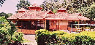
Pattambi is a town, tehsil, and municipality in the Palakkad District of Kerala, India. It is also the administrative headquarters of the Pattambi Taluk.
Athavanad is a village and Gram Panchayath in the Tirur Taluk, in the Malappuram District of the state of Kerala, India. The town lies on the National Highway 17, between Puthanathani and Valanchery. Puthanathani is the main town of the Athavanad village and the village office is located in Athavanad Para & Kurumbathoor. Nearby towns include Valanchery, Tavanur, Tirunavaya, Kuttippuram, Irimbiliyam, and Edayur.
Koppam is a growing town and gram panchayat in Pattambi taluk Palakkad district in the state of Kerala, India.

Parudur is a village and gram panchayat in Pattambi taluk, Palakkad district in the state of Kerala, India. Parudur was originally a part of Kuttippuram Block Panchayat in Tirur Taluk of erstwhile Kozhikode district, before the formation of Malappuram district. After the formation of Malappuram district, Tirur Taluk became a part of Malappuram and Parudur village was transferred to Ottapalam Taluk. Today it forms part of Pattambi taluk.
Vallapuzha is a village and gram panchayat in Pattambi Taluk, Palakkad district in the state of Kerala, India. Vallpuzha Kalapoot (Bull-Race) is famous across Kerala.
Vilayur is a village and gram panchayat in Pattambi, Palakkad district in the state of Kerala, India.

Kumaranellur is a small Village/hamlet in Pattambi Taluk in Palakkad District of Kerala, India. It comes under Kappur Grama Panchayath. It is located 75 km westwards from District headquarters Palakkad, 48 km southwards from the neighbouring district headquarters Malappuram, 27 km from Tirur, 22 km from Valanchery, 20 km from Pattambi, 20 km from Kunnamkulam, 15 km from Ponnani, 14 km from Kuttippuram, 8 km from Thrithala, and 5 km from Edappal town. This Place is in the border of the Palakkad District and Malappuram District. Malappuram District Kuttippuram is North towards this place and Edappal is westward from this place. Kumaranellur basically depends upon neighbouring Ponnani, Edappal, and Kuttippuram in Malappuram district for education and healthcare purposes. It is a part of Thrithala and Ponnani.

Shoranur Junction is an NSG–3 category Indian railway station in Palakkad railway division of Southern Railway zone. It is the railway station located at Shoranur, Palakkad District, Kerala. It comes under the Palakkad Railway Division of the Southern Railway. It is the largest railway station in the state of Kerala in terms of area. It is an important junction because it is the point at which the line from Chennai via Jolarpettai, Erode and Palakkad meets the coastal line from Mangalore to Kanyakumari. Further, Shoranur junction is the node from which a separate Branch line goes to the town of Nilambur, about 66 km to the north. The Nilambur–Shoranur line, which connects two tiny hill-towns, is one of the most picturesque in India.

Perinthalmanna Taluk, formerly known as Walluvanad Taluk, comes under Perinthalmanna revenue division in Malappuram district of Kerala, India. Its headquarters is the town of Perinthalmanna.The taluk encompasses 24 revenue villages. Perinthalmanna Taluk contains Perinthalmanna Municipality and 15 Gram panchayats. Most of the administrative offices are located in the Mini-Civil Station at Perinthalmanna.
Anakkara is a village and grama panchayat in Pattambi taluk, Palakkad district, Kerala, India. It is located on the southern bank of Bharathappuzha river. Anakkara is located about 8 km south of Kuttippuram town. It was a part of Ponnani taluk until 16 June 1969. The border Grama Panchayats of Anakkara are Kuttipuram and Irimbiliyam in Tirur Taluk, Thavanur, Kalady, and Vattamkulam in Ponnani taluk, and Parudur and Pattithara in Pattambi Taluk.

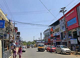
Perinthalmanna is a major town and municipality in Malappuram district, Kerala, India. It serves as the administrative centre for the Perinthalmanna taluk, as well as a revenue division, a community development block, and a police sub-division bearing the same name. It was formerly the headquarters of Valluvanad Taluk, which was one of the two Taluks in the Malappuram Revenue Division of the erstwhile Malabar District during the British Raj. The city is located 23 kilometres (14 mi) southwest of the city of Malappuram at the centre of the Kozhikode–Malappuram–Perinthalmanna–Palakkad National Highway 966.
Kodumunda is a small village in Muthuthala and Parudur gramapanchayath, Pattambi Taluk, Palakkad district Kerala. It is a minor trading center in Muthuthala Panchayath. The portions of Kodumunda in Parudur Panchayath are called west Kodumunda. The only railway station in Muthuthala is situated in Kodumunda and is home to four significant temples: Muthassiyarkavu, Cheruneerkara Shiva Temple, Manniyampathoor Saraswathi temple, and Madayil lakshminarasimha temple. Muthassiyarkavu thalapoli and Kodumunda nercha are the major festivals in this village.

Pattambi is a taluk at the western end of the Palakkad district in the state of Kerala, India. Town of Pattambi is the administrative headquarters of the taluk. Pattambi taluk is bounded by Ottapalam Taluk of Palakkad district to the east, Ponnani taluk of Malappuram district to the west, Tirur and Perinthalmanna Taluks of Malappuram district to the north, and Kunnamkulam Taluk of Thrissur district to the south.

The Kuttippuram Block Panchayat is the block-level administrative body that administers the region around Kuttippuram in Malappuram district, Kerala, India. It is also one of the 15 Block Panchayats established for the proper block-level administration of Gram panchayats in the district. Established in 1962, the block's current president is Vaseema Veleri since 2020. Kuttippuram Block Panchayat lies in two assembly constituencies – Kottakkal and Tirur – both of which are part of the Ponnani parliamentary constituency. The Block is headed by a President and council, and manages 155.83 km2 of Kuttippuram block, with a population of about 229,468 within that area.


