
Kollam, is an ancient seaport and the fourth largest city in the Indian state of Kerala. Located on the southern tip of the Malabar Coast of the Arabian Sea, the city is on the banks of Ashtamudi Lake and is 71 kilometers northwest of the state capital, Thiruvanathapuram (Trivandrum). Kollam is one of India's oldest continuously inhabited cities, with evidence of habitation stretching back to the megalithic; the city has also been a maritime entrepôt millennia, the earliest attestation of which dates back to the Phoenicians and Romans. It is the southern gateway to the Backwaters of Kerala, and is known for its cashew processing, coir manufacturing, and tourism industries.

Anizham Thirunal Marthanda Varma was the founding monarch of the southern Indian Kingdom of Travancore from 1729 until his death in 1758. He was succeeded by Rama Varma (1758–98).
Paravur is a municipality in the Kollam district of Kerala, India. Paravur is located 11.6 km (7.2 mi) southeast of the Kollam city centre, and is a part of the Kollam metropolitan area. Paravur railway station is the last station in Kollam district which is on the route to Trivandrum while travelling towards South India.
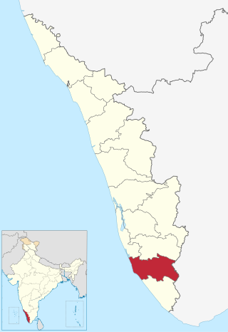
Kollam district, is one of 14 districts of the state of Kerala, India. The district has a cross-section of Kerala's natural attributes; it is endowed with a long coastline, a major Laccadive Sea seaport and an inland lake. The district has many water bodies. Kallada River is one among them, and land on the east bank of the river is East Kallada and that on the west bank is West Kallada.

Thrippunithura, also spelled Tripunithura,, is a municipality in the Ernakulam district of Kerala, India. It is part of the Kochi metropolitan area, 7 km (4.3 mi) east of the Kochi city centre. As per the 2011 Indian census, Thrippunithura has a population of 69,390. A prominent historical region, Thrippunithura was the capital of the erstwhile Kingdom of Cochin. The Hill Palace situated in Thripunithura was the palace of Maharaja of Cochin, the ruler of Kingdom of Cochin. Thrippunithura is known for its rich culture which includes the annual Vrishchikotsavam festival that takes place at the Sree Poornathrayeesa Temple.
Adoor is a municipality in the Pathanamthitta district of Kerala, India. It is the headquarters of the Adoor Taluk and Adoor Revenue Division. Adoor is located 18 km (11.2 mi) southwest of the district headquarters Pathanamthitta and 85 km (52.8 mi) north of the state capital Thiruvananthapuram.

Chengannur is a municipality in the Alappuzha district of Kerala, India. It is located 37 km (23.0 mi) south of the district headquarters in Alappuzha and about 98 km (60.9 mi) north of the state capital Thiruvananthapuram. As per the 2011 Indian census, Chengannur has a population of 23,466 people, and a population density of 1,607/km2 (4,160/sq mi).

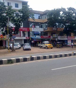
Kottarakkara, also transliterated as Kottarakara, is a town and municipality in the Kollam district of the Kerala, India. Kottarakkara lies 27 kilometres (17 mi) to the east of Kollam city centre.
Oyoor is a small township of Velinalloor village in the Kottarakara Taluk, Kollam District of Kerala, India. It is situated on the banks of the Ithikkara River. It is surrounded by several small satellite villages: Ugramkunnu in the south, Chenkulam in the west, Mylode in the north and Karingannoor in the east.
Ambalamkunnu is a small temple town in the Indian state of Kerala. It is situated 25 kilometers from Kollam, located at 76.90 °E 9.00 °N. It's a hilly area and houses a large number of temples. Some of the temples: Valiya Vila Bhagavathy temple, Nettayam Indilayappa swami temple, Meeyanakkavu Devi temple, Kayila Madan Kavu, Cheruvakkal Dharma Saastha temple, Vaaliyode Madan temple, Nelliparampu Sreekrishna Swami temple.
Kudavattoor is a small village of the Kottarakara Taluk in the Kollam district of the Indian state of Kerala. In the local Malayalam language, kuda means "umbrella" and vattor "round". A predominantly rural village, Kudavattoor comes under the administration of the Veliyam Grama Panchayat made up of Maroor, Cherukarakonam and Kudavattoor chandhamukku. The village is situated on the odanavattom kollam road, which provides access to Kollam via Kundara or Nedumankavu as well as to Kottarakara. Kollam, the district headquarters is situated about 25 km from Kudavattoor.

Chadayamangalam is a village located in Kollam district of Kerala state, India. It is located along the Ithikkara river and the MC road that passes across the major urban locations of Kerala. It acts as centre for Chadayamangalam block panchayat, gram panchayat and assembly constituency. It hosts numerous government institutions including hospitals, schools and police station. Chadayamangalam is well noticed for newly constructed Jatayu Earth’s Center, which is a tourism centre in the town with the world’s largest bird sculpture. The place is also referred to as Jatayumangalam.
Kalluvathukkal is a village in the Kollam district of the Indian state of Kerala. NH 47 passes through the village.There ia an Lower primary and Upper primary schools in kalluvathukkal panchayath. And Kalluvathukkal panchayat has its own school, classes from class 5th to 10th standard. A small stadium is located next to the school. The nearest towns are Chathannoor and Paripally. The place is infamous for the Kalluvathukkal hooch tragedy, which took place on 21 October 2000 and killed 31 people.
Vettikkavala is a village located in the Kollam district in the state of Kerala, India. The village is famous for Shiva-Vishnu temples which hosts a special deity called Vathukkal Njaali Kunju. An annual celebration of Pongala is held at the temple. The village is also well known for temple arts and a palace constructed by Sree Moolam Thirunal.
Hinduism, Islam and Christianity are the prominent religions in Kollam district. As per the Census 2011, out of the total population of 2,635,375 persons, 64.42% follow Hinduism, 19.30% follow Islam and 16.00% follow Christianity. Other religions comprise 0.04%, while 0.25% did not state any religion.
Malankara Church of God Thrikkannamangal is a church in Kottarakkara, Kerala, India, originally known as Malankara Poorna Suvisesha Sabha.
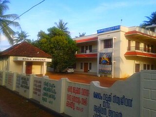
College of Engineering, Kottarakkara, commonly known as CEK, is an engineering institute in the state of Kerala, India. The college is affiliated with the APJ Abdul Kalam Technological University and the courses are recognised by AICTE.

The following outline is provided as an overview of and topical guide to Kerala:

Kuri railway station or Kura railway station(Code: KIF) is an 'HG 2' category halt railway station, situated at the Kollam–Sengottai branch line of Southern Railway, India. The station is situated between Avaneeswaram and Kottarakara railway stations in Kollam district, Kerala. The station is coming under Madurai railway division of Southern Railway zone. The nearest major railhead of Kuri railway station is Kollam Junction railway station.
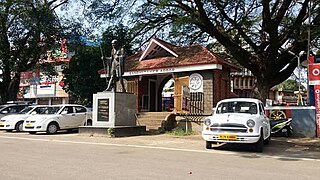
The history and culture of Kottarakkara in Kerala, India has a rich history. it used to be a palace in the 14th and 15th centuries. In fact, the name "Kottarakkara" means "land of palaces."


