
The Fan is a district of Richmond, Virginia, so named because of the "fan" shape of the array of streets that extend west from Belvidere Street, on the eastern edge of Monroe Park, westward to Arthur Ashe Boulevard. However, the streets rapidly resemble a grid after they go through what is now Virginia Commonwealth University. The Fan is one of the easterly points of the city's West End section, and is bordered to the north by Broad Street and to the south by VA 195, although the Fan District Association considers the southern border to be the properties abutting the south side of Main Street. The western side is sometimes called the Upper Fan and the eastern side the Lower Fan, though confusingly the Uptown district is located near VCU in the Lower Fan. Many cafes and locally owned restaurants are located here, as well as historic Monument Avenue, a boulevard formerly featuring statuary of the Civil War's Confederate president and generals. The only current statue is a more modern one of tennis icon Arthur Ashe. Development of the Fan district was strongly influenced by the City Beautiful movement of the late 19th century.

Manchester is a former independent city in Virginia in the United States. Prior to receiving independent status, it served as the county seat of Chesterfield County, between 1870 and 1876. Today, it is a part of the city of Richmond, Virginia.

Shockoe Slip is a district in the downtown area of Richmond, Virginia. The name "slip" referred to a narrow passageway leading from Main Street to where goods were loaded and unloaded from the former James River and Kanawha Canal. The rough boundaries of Shockoe Slip include 14th Street, Main Street, Canal Street and 12th Street.

Jordan is a village in the town of Waterford, Connecticut, and the historic center of the town. It was named from the Jordan River. The village was listed on the National Register of Historic Places as Jordan Village Historic District in 1990.

The Prospect Hill Historic District encompasses a large residential area in the Willimantic section of Windham, Connecticut. Located north of the Main Street commercial district, it was developed between about 1865 and 1930, and is one of the state's largest historic districts, with more than 800 contributing buildings. It is roughly bounded by Valley, Jackson, Bolivia, Washburn, Windham, and High Streets, and contains one of the state's largest single concentrations of Victorian-era residential architecture. It was listed on the National Register of Historic Places in 2003.

The Branford Point Historic District is a historic district in Branford, Connecticut. It was listed on the National Register of Historic Places in 1988. It includes a significant portion of the Branford Point neighborhood, generally considered to be the area along the west side of the Branford Harbor to the Amtrak railroad tracks. It is bounded on the west by the Short Beach neighborhood, on the north by Branford Center, and on the east by the Branford River. Harbor Street, Maple Avenue, and Stannard Avenue are the main thoroughfares of the neighborhood. In the 2000 Census, Branford Point was included by the U.S. Census Bureau in the Branford Center census-designated place.

The Downtown Torrington Historic District encompasses the historic central downtown area of Torrington, Connecticut. Centered on a crossing of the Naugatuck River, the 56-acre (23 ha) historic district is well-represented with architecture from the mid-19th to early 20th centuries. It was listed on the National Register of Historic Places in 1988.
Church Street Historic District is a historic district roughly on Church Street between Park Ave. and Highland St. in Ware, Massachusetts. This mainly residential area includes some of Ware's finest late 19th century houses and a well-preserved collection of Greek Revival houses. The area was developed primarily in response to the growth of industry to the south. The district was listed on the National Register of Historic Places in 1983.

The Lower Basin Historic District is a national historic district located in Lynchburg, Virginia. The district defines a commercial and industrial warehouse area located between the downtown commercial area to the south and the James River waterfront to the north. The district contains a variety of mostly late 19th- and early 20th-century, multi-story, brick warehouses and factories, two-to-three-story brick commercial buildings, and a number of structures associated with the James River and Kanawha Canal and the Norfolk and Western and Chesapeake and Ohio Railways. The district is named for a wide basin of the canal that once extended between Ninth Street and Horseford Road, and contains 60 contributing buildings, two contributing structures, and one contributing object-a monument commemorating the site of 18th-century Lynch's Ferry.

Pocahontas Island is a peninsula in Petersburg, Virginia, once on the opposite side of the Appomattox River from Petersburg. Since 1915 a new channel for the river separated it from Chesterfield County and the former channel no longer separates it from the city. Once a warehouse and wharf-filled urban landscape initially platted in 1749, the island was devastated by a 1993 tornado before citizen involvement caused creation of the Pocahontas Island Historic District, which in 2006 achieved listing on the National Register of Historic Places (NRHP) as a historic district because of its significance in African-American history and for its prehistoric indigenous archeological assets.

The Waterville Village Historic District encompasses most of the history 19th and early 20th-century village center of Waterville, Vermont. The village grew from beginnings late in the 18th century to serve as a modest civic, commercial, and residential hub for the rural community. It was added to the National Register of Historic Places in 2007.

Fine Creek Mills Historic District encompasses a historic mill-centered community in Powhatan County, Virginia, United States. It was listed on the National Register of Historic Places in 2004.

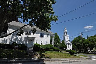
The Middleburg Historic District comprises the historic center of Middleburg, Virginia. The district extends along the downtown section of Washington Street, and is flanked on the east by Independence Street and to the west by Constitution Street. The district's commercial area is along Washington and Madison Streets. Middleburg was established in 1787, but the historic district includes a few 18th-century structures, with most dating to the mid-19th century. The district includes the Red Fox Inn & Tavern, the oldest building in town and listed individually on the National Register of Historic Places. Most of the structures in the core of the district are Federal style townhouses.

Shockoe Valley is an area in Richmond, Virginia, just east of downtown, along the James River, and is the entertainment center of the city. Located between Shockoe Hill and Church Hill, Shockoe Valley contains much of the land included in Colonel William Mayo's 1737 plan of Richmond, making it one of the city's oldest neighborhoods. Shockoe Valley encompasses the smaller neighborhoods of Shockoe Slip, Shockoe Bottom and Tobacco Row along Cary Street.

The Rochester Commercial and Industrial District encompasses the civic, commercial, and industrial heart of Rochester, New Hampshire. Oriented around the city's Central Square, the 6-acre (2.4 ha) district includes the city's major civic buildings, most of which are Classical Revival structures from the early 20th century, a number of commercial buildings dating as far back as the square's formation in the 1820s, and several late 19th-century industrial facilities. The district extends primarily along Main Street, from Bridge and Union Streets to Winter and Academy Streets, and includes properties extending along Wakefield and Hanson Streets, as well as other adjacent streets. The district was listed on the National Register of Historic Places in 1983.

The St. Johnsbury Historic District encompasses much of the historic civic and commercial center of St. Johnsbury, Vermont. Representing a significant expansion of the Railroad Street Historic District and the St. Johnsbury Main Street Historic District, it captures the historical tension and competition between Main Street and Railroad Street for primacy as the town's most important civic and commercial areas. The district was listed on the National Register of Historic Places in 1980.

The Downtown Seymour Historic District encompasses most of the historic downtown of Seymour, Connecticut. Sandwiched between Connecticut Route 8 and the tracks of the former Naugatuck Railroad line, now the Waterbury Branch, it developed in the mid-19th century as a successful industrial center dominated by the production of brass goods. The district was listed on the National Register of Historic Places in 1983.

Guilford Historic Town Center is a large historic district encompassing the entire town center of Guilford, Connecticut, in the United States. It is centered on the town green, laid out in 1639, and extends north to Interstate 95, south to Long Island Sound, west to the West River, and east to East Creek. It includes more than 600 historic structures, most built between the late 17th and early 20th centuries, reflecting the town's growth and history during that time. It was listed on the National Register of Historic Places in 1976.

The Pines Bridge Historic District encompasses a historic industrial and commercial village in North Haven, Connecticut. Located just west of the town green and centered around the Broadway bridge over the Quinnipiac River, the village developed first as a commercial hub around a 17th-century bridge at the site, and then as a small industrial village in the 19th century. Now mainly residential, it was listed on the National Register of Historic Places in 1988.

The Wallingford Center Historic District encompasses the historic 18th and 19th-century town center of Wallingford, Connecticut. Extending mainly along North and South Main Streets, the district includes high-quality residential, civic, commercial, and institutional architecture from the mid-18th to early 20th centuries, reflecting the community's growth. The district was listed on the National Register of Historic Places in 1993.


