Tiruchirappalli, also called Tiruchi or Trichy, is a major tier II city in the Indian state of Tamil Nadu and the administrative headquarters of Tiruchirappalli district. The city is credited with being the best livable city and the cleanest city of Tamil Nadu, as well as the fifth safest city for women in India. It is the fourth largest city as well as the fourth largest urban agglomeration in the state. Located 322 kilometres (200 mi) south of Chennai and 374 kilometres (232 mi) north of Kanyakumari, Tiruchirappalli sits almost at the geographic centre of Tamil Nadu state. The Cauvery Delta begins 16 kilometres (9.9 mi) west of the city where the Kaveri river splits into two, forming the island of Srirangam which is now incorporated into the Tiruchirappalli City Municipal Corporation. The city occupies an area of 167.23 square kilometres (64.57 sq mi) and had a population of 916,857 in 2011.

Thanjavur, also Tanjore, is a city in the Indian state of Tamil Nadu. Thanjavur is the 11th biggest city in Tamil Nadu. Thanjavur is an important center of South Indian religion, art, and architecture. Most of the Great Living Chola Temples, which are UNESCO World Heritage Monuments, are located in and around Thanjavur. The foremost among these, the Brihadeeswara Temple, built by the Chola emperor Rajaraja I, is located in the centre of the city. Thanjavur is also home to Tanjore painting, a painting style unique to the region.

The Thanjavur Nayak kingdom or Thanjavur Nayak dynasty were the rulers of Thanjavur in the 15th and 17th centuries. The Nayaks of the Balija social group, were originally appointed as provincial governors by the Vijayanagara Emperor in the 15th century, who divided the territory into Nayak kingdoms which were Madurai, Tanjore, Gingee and Kalahasthi. In the mid 15th century they became an independent kingdom, although they continued their alliance with the Vijayanagara Empire. The Thanjavur Nayaks were notable for their patronage of literature and the arts.

The Dindigul Fort or Dindigul Malai Kottai and Abirami amman Kalaheswarar Temple was built in 16th-century by Madurai Nayakar Dynasty situated in the town of Dindigul in the state of Tamil Nadu in India. The fort was built by the Madurai Nayakar king Muthu Krishnappa Nayakar in 1605. In the 18th century the fort passed on to Kingdom of Mysore. Later it was occupied by Hyder Ali and Tipu Sultan the fort was of strategic importance. In 1799 it went to the control of the British East India Company during the Polygar Wars. There is an abandoned temple on its peak apart from few cannons sealed with balls inside. In modern times, the fort is maintained by the Archaeological Survey of India and is open to tourists.

Ucchi Pillayar Temple is a 7th-century Hindu temple, one dedicated to Lord Ganesha located a top of Rockfort, Trichy, Tamil Nadu, India. According to legend, this rock is the place where Lord Ganesha ran from King Vibishana, after establishing the Ranganathaswamy deity in Srirangam. Tiruchirapalli Rock Fort is also fondly called as Malaikottai in Tamil.

Chanda Sahib was a subject of the Mughal Empire and the Nawab of the Carnatic between 1749 and 1752. Initially he was supported by the French during the Carnatic Wars. After his defeat at Arcot in 1751, he was captured by the Marathas of Thanjavur and executed.

Vellore Fort is a large 16th-century fort situated in heart of the Vellore city, in the state of Tamil Nadu, India built by Vijayanagara kings. The fort was at one time the headquarters of the Aravidu Dynasty of the Vijayanagara Empire. The fort is known for its grand ramparts, wide moat and robust masonry.
Bangaru Thirumala Nayaka, also known as Bangaru Tirumala and Vangaru Thirumala, was a member of Madurai Nayak royal family and Governor/Commander of the Madurai Nayak King Vijaya Ranga Chokkanatha (1704–1731). His son, a young boy was adopted and crowned to the Madurai Throne, with the queen Meenakshi as queen regent, when the Madurai king died without heir. Strife between Bangaru Thirumala and queen Meenakshi would later erupt into many battles leading to the downfall of the dynasty. Later, through marriage alliances with the Sinhalese royalty, relatives of Bangaru Thirumala came to rule the Kandy kingdom in Sri Lanka. They ruled till 1815 when the last king, Sri Vikrama Rajasinha was deposed and taken captive by the British. He was exiled to Vellore Fort from Kandy.
The Madurai Nayaks were rulers of Telugu origin from around 1529 until 1736, of a region comprising most of modern-day Tamil Nadu, India, with Madurai as their capital. The Nayak reign was an era noted for its achievement in arts, cultural and administrative reforms, revitalization of temples previously ransacked by the Delhi Sultans, and the inauguration of a unique architectural style.

Sankagiri Fort is a historical fort maintained by the Archaeological Survey of India. It is located 22 km from the city of Erode and 38 km from Salem. Sankari or Sankagiri is the town located around this place. The fort is 707 meters high and covers an area of 558.58 acres.

The Thanjavur Maratha kingdom ruled by the Bhonsle dynasty was a principality of Tamil Nadu between the 17th and 19th centuries. Their native language was Marathi. Venkoji was the founder of the dynasty.

Tiruchirappalli Rockfort, locally known as Malaikottai, is a historic fortification and temple complex built on an ancient rock. It is located in the city of Tiruchirappalli, on the banks of river Kaveri, Tamil Nadu, India. It is constructed on an 83 metres (272 ft) high rock. There are two Hindu temples inside, the Ucchi Pillayar Temple, Rockfort and the Thayumanaswami Temple, Rockfort. Other local tourist attractions include the famous Pallava-era Ganesha temple and the Madurai Nayak-era fort. The fort complex has witnessed fierce battles between the Madurai Nayakas and Adil Shahi dynasty of Bijapur, Carnatic region and Maratha Imperial forces. The fort played an important part during the Carnatic Wars, helping lay the foundations of the British Empire in India. The Rockfort is the most prominent landmark of the city.
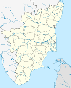
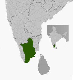
The Trichinopoly district was a district of the erstwhile Madras Presidency of British India. It covered the present-day districts of Tiruchirappalli, Karur, Ariyalur and Perambalur in the Indian state of Tamil Nadu. The administrative headquarters was the town of Trichinopoly, Trichy or Tiruchi, now known as Tiruchirappalli. The district covered an area of 2,632 square miles (6,820 km2) in 1907. It was bound by the districts of South Arcot to the north, Salem to the west, Coimbatore to the west and north-west, Tanjore to the east and Madurai to the south. The princely state of Pudukkottai remained within the jurisdiction of Trichinopoly district from 1865 to 1947.

Tiruchirappalli is believed to be of great antiquity and has been ruled by the Early Cholas, Mutharaiyars Early Pandyas, Pallavas, Medieval Cholas, Later Cholas, Later Pandyas, Delhi Sultanate, Ma'bar Sultanate, Vijayanagar Empire, Nayak Dynasty, the Carnatic state and the British at different times. The archaeologically important town of Uraiyur which served as the capital of the Early Cholas is a Neighborhood of Tiruchirapalli.

The Thayumanavar Temple is a temple situated in the Rockfort complex in the city of Tiruchirappalli, India. Shiva is worshiped as Thayumanavar, and is represented by the lingam and his consort Parvati is depicted as Mattuvar Kuzhalammai. The presiding deity is revered in the 7th century Tamil Saiva canonical work, the Tevaram, written by Tamil saint poets known as the nayanars and classified as Paadal Petra Sthalam.

Tamil Nadu is known for its ancient temple architecture known as the Dravidian architecture. Nearly 33,000 ancient temples, many at least 800 to 2000 years old, are found scattered all over Tamil Nadu. As per Tamil Nadu Hindu Endowments Board, there are 38,615 temples. Most of the largest Hindu Temples reside here. Studded with complex architecture, variety of sculptures, and rich inscriptions, the temples remain the very essence of the culture and heritage of Tamil land, with historical records dating back to at least 3,000 years.

The Chokkanatha Nayak Palace, now officially known as Rani Mangammal Mahal is a mid seventeenth century Palace, built by the Madurai Nayak rulers. It located in Tiruchirapalli, Tamil Nadu. at the base of the Tiruchirapalli Rock Fort. The palace was built by Chokkanatha Nayak, the then ruler of Madurai. It was also known as the Durbar Hall of the Madurai Nayaks when Tiruchirapally was their capital, from 1616 to 1634 and later from 1665 to 1736. Today the palace houses Government Museum and various state government offices around the palace complex.
Battle of Trichinopoly (1682) was a battle fought between the Maratha Empire and the Kingdom of Mysore. The Maratha forces under Sambhaji and his allies, besieged and captured the city of Tiruchirappalli.
The Maratha-Mysore War (1682) refers to a series of battles fought between the Maratha Empire and the Kingdom of Mysore in Southern India, both of which were attempting to establish supremacy in Southern India. The Maratha forces were led by Sambhaji and the Mysore forces were led by Chikka Devaraja.