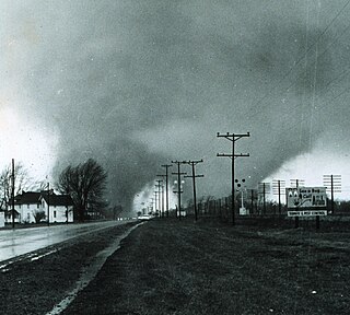
The 1965 Palm Sunday tornado outbreak was a historic severe weather event that affected the Midwestern and Southeastern United States on April 10–12,1965. The tornado outbreak produced 55 confirmed tornadoes in one day and 16 hours. The worst part of the outbreak occurred during the afternoon hours of April 11 into the overnight hours going into April 12. The second-largest tornado outbreak on record at the time,this deadly series of tornadoes inflicted a swath of destruction from Cedar County,Iowa,to Cuyahoga County,Ohio,and a swath 450 miles long (724 km) from Kent County,Michigan,to Montgomery County,Indiana. The main part of the outbreak lasted 16 hours and 35 minutes and is among the most intense outbreaks,in terms of tornado strength,ever recorded,including at least four "double/twin funnel" tornadoes. In all,the outbreak killed 266 people,injured 3,662 others,and caused $1.217 billion in damage. In 2023,tornado expert Thomas P. Grazulis created the outbreak intensity score (OIS) as a way to rank various tornado outbreaks. The 1965 Palm Sunday tornado outbreak received an OIS of 238,making it the fourth worst tornado outbreak in recorded history.

From May 2 to 8,1999,a large tornado outbreak took place across much of the Central and parts of the Eastern United States,as well as southern Canada. During this week-long event,152 tornadoes touched down in these areas. The most dramatic events unfolded during the afternoon of May 3 through the early morning hours of May 4 when more than half of these storms occurred. Oklahoma experienced its largest tornado outbreak on record,with 70 confirmed. The most notable of these was the F5 Bridge Creek–Moore tornado which devastated Oklahoma City and suburban communities. The tornado killed 36 people and injured 583 others;losses amounted to $1 billion,making it the first billion-dollar tornado in history. Overall,50 people lost their lives during the outbreak and damage amounted to $1.4 billion. For these reasons,the outbreak is known in Oklahoma as the May 3rd outbreak or the Oklahoma tornado outbreak of 1999.

From April 26 to 27,1991,multiple supercells across Oklahoma and Kansas led to a regional tornado outbreak. Forced by a potent trough and focused along a dryline,these distinct thunderstorms moved northeast through a moist and highly unstable environment. A total of 55 tornadoes were confirmed,many of which were strong,F2 or greater on the Fujita scale. A widely documented F5 tornado tore through Andover,Kansas,killing 17 people. Additional fatalities occurred from significant tornadoes in other portions of Kansas and Oklahoma,with 21 deaths recorded in total. An F4 tornado was detected by a mobile doppler weather radar team which observed winds up to 270 mph (430 km/h) at the top of the funnel,the first time winds of F5 intensity were measured by radar,and the highest winds recorded by radar at the time. A news team filming an F2 tornado sought shelter under a Kansas Turnpike overpass,causing a misconception that overpasses can provide adequate shelter during a tornado. This outbreak occurred within a transition period for the National Weather Service and proved the value of NEXRAD radars,which were utilized in Oklahoma to provide advanced warning to residents.

The 1985 United States–Canada tornado outbreak,referred to as the Barrie tornado outbreak in Canada,was a major tornado outbreak that occurred in Ohio,Pennsylvania,New York,and Ontario,on May 31,1985. In all 44 tornadoes were counted including 14 in Ontario,Canada. It is the largest and most intense tornado outbreak ever to hit this region,and the worst tornado outbreak in Pennsylvania history in terms of deaths and destruction.

The 1994 Palm Sunday tornado outbreak was the third notable US tornado outbreak to occur on Palm Sunday and the second to take place in the Southeastern United States. The outbreak produced 29 tornadoes from Texas to North Carolina,killing 40 people and injuring 491,and causing $140 million in damage. The deadliest storm of the outbreak,as well as in the US in 1994,was an F4 tornado that devastated Piedmont,Alabama. It struck the Goshen United Methodist Church right in the middle of the Palm Sunday service,collapsing the roof on the congregation and killing 20 people inside,including the Rev. Kelly Clem's 4-year-old daughter Hannah. Two other houses of worship were also destroyed mid-service. The supercell that formed this tornado tracked for 200 miles (322 km) to South Carolina.

This page documents notable tornadoes and tornado outbreaks worldwide in 2001. Strong and destructive tornadoes form most frequently in the United States,Bangladesh,and Eastern India,but they can occur almost anywhere under the right conditions. Tornadoes also develop occasionally in southern Canada during the Northern Hemisphere's summer and somewhat regularly at other times of the year across Europe,Asia,and Australia. Tornadic events are often accompanied with other forms of severe weather,including strong thunderstorms,strong winds,and hail.

This page documents the tornadoes and tornado outbreaks of 1982,primarily in the United States. Most tornadoes form in the U.S.,although some events may take place internationally. Tornado statistics for older years like this often appear significantly lower than modern years due to fewer reports or confirmed tornadoes.

This page documents the tornadoes and tornado outbreaks of 1974,primarily in the United States. Most tornadoes form in the U.S.,although some events may take place internationally. Tornado statistics for older years like this often appear significantly lower than modern years due to fewer reports or confirmed tornadoes.

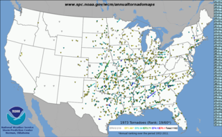
This page documents notable tornadoes and tornado outbreaks worldwide in 1973,but mostly features events in the United States. According to tornado researcher Thomas P. Grazulis,documentation of tornadoes outside the United States was historically less exhaustive,owing to the lack of monitors in many nations and,in some cases,to internal political controls on public information. Most countries only recorded tornadoes that produced severe damage or loss of life. Consequently,available documentation in 1973 mainly covered the United States. On average,most recorded tornadoes,including the vast majority of significant—F2 or stronger—tornadoes,form in the U.S.,although as many as 500 may take place internationally. Some locations,like Bangladesh,are as prone to violent tornadoes as the U.S.,meaning F4 or greater events on the Fujita scale.

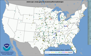
This page documents the tornadoes and tornado outbreaks of 1968,primarily in the United States. Most tornadoes form in the U.S.,although some events may take place internationally. Tornado statistics for older years like this often appear significantly lower than modern years due to fewer reports or confirmed tornadoes. Two F5 tornadoes struck Iowa in the Charles City and Maynard areas,combined they claimed 18 lives and this was one of very few cases in history where two F5 or EF5 tornadoes hit the same state,on the same day.

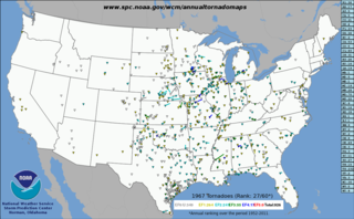
This page documents the tornadoes and tornado outbreaks of 1967,primarily in the United States. Most tornadoes form in the U.S.,although some events may take place internationally. Tornado statistics for older years like this often appear significantly lower than modern years due to fewer reports or confirmed tornadoes.
A widespread,destructive,and deadly tornado outbreak sequence affected the Southeastern United States from April 28 to May 2,1953,producing 24 tornadoes,including five violent F4 tornadoes. The deadliest event of the sequence was an F4 tornado family that ravaged Robins Air Force Base in Warner Robins,Georgia,on April 30,killing at least 18 people and injuring 300 or more others. On May 1,a pair of F4 tornadoes also struck Alabama,causing a combined nine deaths and 15 injuries. Additionally,another violent tornado struck rural Tennessee after midnight on May 2,killing four people and injuring eight. Additionally,two intense tornadoes impacted Greater San Antonio,Texas,on April 28,killing three people and injuring 20 altogether. In all,36 people were killed,361 others were injured,and total damages reached $26.713 million (1953 USD). There were additional casualties from non-tornadic events as well,including a washout which caused a train derailment that injured 10.

A localized but devastating series of severe thunderstorms affected the Great Lakes region during May 20-21,1953. The strongest of these storms produced three intense,long-tracked tornadoes in Iowa,Michigan,and Ontario. The worst tornado event was a violent F4 tornado that tore through the cities of Port Huron,Michigan,and Sarnia,Ontario,on May 21,damaging or destroying hundreds of structures and causing dozens of casualties. Overall,the tornadoes killed eight people,injured 123 others,and caused at least $17.6 million (1953 USD) in damage. Thunderstorm winds also caused an additional fatality when a tree fell on a house in Waterloo,Iowa.
A widespread and deadly tornado outbreak affected the Great Plains,Mississippi Valley,and Southeast between March 12–15,1953. At least 23 tornadoes were confirmed with the strongest one reaching F4 intensity and striking O'Brien,Texas on Friday the 13th. Overall,21 people were killed,72 others were injured,and damages were estimated at $6.835 million (1953 USD). There were additional casualties from non-tornadic events as well.

The first six days of December 1953 produced a destructive and deadly tornado outbreak sequence across the Southern United States. There were 19 confirmed tornadoes,including a large and violent F4 tornado that hit the northwest side of Alexandria,Louisiana and even more large and violent F5 tornado that hit Vicksburg,Mississippi. In all,the tornadoes killed 49 people,injured 404 others,and caused $45,709 million in damage. The death toll made this deadliest December tornado outbreak ever recorded and it would not be surpassed until 2021. This was also the last of the series of deadly and catastrophic tornado outbreaks to strike the US in 1953.

This page documents the tornadoes and tornado outbreaks of 1949,primarily in the United States. Most recorded tornadoes form in the U.S.,although some events may take place internationally. Tornado statistics for older years like this often appear significantly lower than modern years due to fewer reports or confirmed tornadoes.
This page documents the tornadoes and tornado outbreaks of 1948,primarily in the United States. Most tornadoes form in the U.S.,although some events may take place internationally. Tornado statistics for older years like this often appear significantly lower than modern years due to fewer reports or confirmed tornadoes. Also,prior to 1950,tornadoes were not officially surveyed by the U.S. Weather Bureau,which would later become the National Weather Service,and thus had no official rating. All documented significant tornadoes were instead given unofficial ratings by tornado experts like Thomas P. Grazulis.

This page documents the tornadoes and tornado outbreaks of 1947,primarily in the United States. Most recorded tornadoes form in the U.S.,although some events may take place internationally. Tornado statistics for older years like this often appear significantly lower than modern years due to fewer reports or confirmed tornadoes.
This page documents the tornadoes and tornado outbreaks of 1946,primarily in the United States. Most recorded tornadoes form in the U.S.,although some events may take place internationally. Tornado statistics for older years like this often appear significantly lower than modern years due to fewer reports or confirmed tornadoes.

The tornado outbreak of June 8,1995 was a severe,localized outbreak in the Texas Panhandle and Western Oklahoma. It is most well known for the tornado that hit Pampa,along with the Allison F4,the Kellerville F4,and the Hoover F2. In total,29 tornadoes were recorded during that day,with 23 being in Western Oklahoma and the Texas Panhandle. One cyclic supercell in the Texas Panhandle produced at least 5 of those 23 tornadoes,while another spawned at least 8. There were 3 F4s,and the tornadoes caused 11 injuries.


