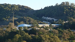
The Marin Islands are the two small islands, named East Marin and West Marin, in San Rafael Bay, an embayment of San Pablo Bay in Marin County, California.

Waldo is a ghost town located in Josephine County, Oregon, United States, about three miles from the California border. It was settled in 1852 as a gold mining camp called Sailor's Diggings. The place was later renamed "Waldo" in honor of William Waldo, who in 1853 was the Whig candidate for governor of California. This was apparently because, believing the settlement was in California, William Waldo campaigned there and convinced the populace that they should vote for him. The town was the first county seat of Josephine County. The post office for Waldo was established in 1856; service was discontinued in 1928.
The Waldo Grade is a highway grade between the Golden Gate Bridge and Marin City along U.S. Route 101 and State Route 1. It is defined as the stretch of roadway between the Spencer Offramp and Marin City, within the city of Sausalito. This grade is traversed by a full freeway multi-lane highway facility. This portion of US 101/SR 1 is an important link in surface transportation connecting the city of San Francisco to Marin County and the North Bay. Nearby locations to the Waldo Grade include: the city of Sausalito, the U.S. Army Corps of Engineers Bay Model, The Marine Mammal Center and the Golden Gate National Recreation Area. It, and nearby Waldo Point along Richardson Bay between Sausalito and Mill Valley, is named after 1850s California politician William Waldo.

Dogtown is an unincorporated community in the rural West Marin region of coastal Marin County, California in the San Francisco Bay Area's North Bay. It lies at an elevation of 187 feet. With a population of 30, the town is located beside the Golden Gate National Recreation Area and Point Reyes National Seashore, in the Olema Valley west of the Bolinas Ridge mountain range.

Belvedere Island is a rocky island in Marin County, California which was separated by a marsh from the mainland and has now been linked by two spits. Part of the town of Belvedere, California is located on the island.

Paradise Cay, also known as County Service Area No. 29, is an unincorporated enclave, surrounded by the town of Tiburon in Marin County, California, located 2 miles (3 km) south of Point San Quentin at an elevation of 23 feet. The waterfront community lies at the foot of the Tiburon Peninsula south of Corte Madera Creek along San Francisco Bay. The community is in ZIP code 94920 and area code 415.

McNears Beach is an unincorporated community on San Pablo Bay in Marin County, California.

Manzanita is an unincorporated community in Marin County, California. Manzanita is also known as the Unincorporated Sausalito Houseboat Community. It is located 6.25 miles (10 km) south of downtown San Rafael, at an elevation of 16 feet. It is located near Marin City.

Millerton is a small unincorporated community in Marin County, California. It is located 3.5 miles (5.6 km) northwest of Point Reyes Station, at an elevation of 43 feet. Millerton is near Point Reyes Station. The community is in ZIP code 94929 and area codes 415 and 628.

Waldo Junction is an unincorporated community in Yuba County, California. It is located on Dry Creek 9.5 miles (15.3 km) northeast of Wheatland, at an elevation of 256 feet.

Cypress Grove is an unincorporated community in Marin County, California. It is located on the northeast shore of Tomales Bay 5.5 miles (8.9 km) south of Tomales, at an elevation of 13 feet.

Forest Knolls is an unincorporated community in Marin County, California. It is located 9 miles (14 km) southwest of Novato, at an elevation of 249 feet. For census purposes, Forest Knolls is aggregated with Lagunitas into the census-designated place Lagunitas-Forest Knolls.

Irving is a former settlement in Marin County, California. It was located on the Northwestern Pacific Railroad 10.5 miles (17 km) southwest of downtown Novato, at an elevation of 138 feet. Irving still appeared on maps as of 1914.

Reynolds is an unincorporated community in Marin County, California. It is located on the northeast shore of Tomales Bay and on the Northwestern Pacific Railroad 7 miles (11 km) south of Tomales, at an elevation of 30 feet.

Shafter is an unincorporated community in Marin County, California. It is located on the Northwestern Pacific Railroad 10.5 miles (17 km) southwest of downtown Novato, at an elevation of 167 feet.

Vincent Landing is an unincorporated community in Marin County, California. It is located on the northeast shore of Tomales Bay 2.5 miles (4 km) southwest of Tomales, at an elevation of 20 feet.

Coyote Creek is a stream in the Richardson Bay watershed, draining Tamalpais-Homestead Valley, California eastward into Richardson Bay, Marin County, California, United States. The stream originates on Coyote Ridge and flows 2.5 miles (4.0 km) to the bay at the south end of Bothin Marsh.

Corte Madera Creek is a short stream which flows southeast for 4.5 miles (7.2 km) in Marin County, California. Corte Madera Creek is formed by the confluence of San Anselmo Creek and Ross Creek in Ross and entering a tidal marsh at Kentfield before connecting to San Francisco Bay near Corte Madera.


