Walker Township, Juniata County, Pennsylvania

Last updated
Walker Township,
Juniata County,
Pennsylvania
Walker Township, Juniata County.JPG
Farm and mountain in Walker Township
Map of Juniata County, Pennsylvania Highlighting Walker Township.PNG
Map of Juniata County, Pennsylvania highlighting Walker Township
Map of Pennsylvania highlighting Juniata County.svg
Map of Juniata County, Pennsylvania
Country United States
State Pennsylvania
County Juniata
Settled1765
Incorporated1822
Area
[1]
  Total29.35 sq mi (76.02 km2)
  Land28.83 sq mi (74.66 km2)
  Water0.52 sq mi (1.35 km2)
Population
 (2020) [2]
  Total2,797 Increase2.svg
  Estimate 
(2022) [2]
2,793
  Density95.88/sq mi (37.02/km2)
Time zone UTC-5 (EST)
  Summer (DST) UTC-4 (EDT)
Area code 717
FIPS code 42-067-80568
Website walkertownship.org

Walker Township is a township in Juniata County, Pennsylvania, United States. The population was 2,797 at the 2020 census. [2]

Contents

Geography

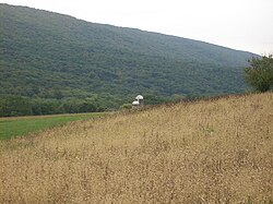
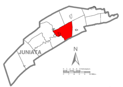
According to the United States Census Bureau, the township has a total area of 29.35 square miles (76.02 km2), of which 28.83 square miles (74.66 km2) are land and 0.52 square miles (1.35 km2), or 1.78%, are water. [3]

Walker Township is in central Juniata County and is bordered by Fermanagh and Fayette Townships to the north, Delaware Township to the east, Perry County to the south, and Turbett Township to the west and south. The borough of Port Royal and Milford Township form the western border of the township. The census-designated place of Mexico is along the Juniata River in Walker Township. Other unincorporated places in the township include Vandyke, Centre, Locust Run, Mount Pleasant, and Van Wert.

Demographics

Historical population
CensusPop.Note
1850 1,493
1860 1,71915.1%
1870 1,608−6.5%
1880 1,6995.7%
1890 1,490−12.3%
1900 1,392−6.6%
1910 1,4171.8%
1920 1,352−4.6%
1930 1,52412.7%
1940 1,68110.3%
1950 1,620−3.6%
1960 1,7558.3%
1970 1,7670.7%
1980 2,12420.2%
1990 2,3319.7%
2000 2,59811.5%
2010 2,7385.4%
2020 2,7972.2%
2022 (est.)2,793 [2] −0.1%
U.S. Decennial Census [4]

As of the census [5] of 2000, there were 2,598 people, 920 households, and 734 families residing in the township. The population density was 89.5 inhabitants per square mile (34.6/km2). There were 997 housing units at an average density of 34.4 per square mile (13.3/km2). The racial makeup of the township was 98.85% White, 0.50% African American, 0.04% Native American, 0.19% Asian, 0.23% from other races, and 0.19% from two or more races. Hispanic or Latino of any race were 0.58% of the population.

There were 920 households, out of which 35.8% had children under the age of 18 living with them, 71.2% were married couples living together, 5.1% had a female householder with no husband present, and 20.2% were non-families. 16.8% of all households were made up of individuals, and 9.2% had someone living alone who was 65 years of age or older. The average household size was 2.82 and the average family size was 3.18.

In the township the population was spread out, with 27.1% under the age of 18, 8.1% from 18 to 24, 29.0% from 25 to 44, 23.0% from 45 to 64, and 12.8% who were 65 years of age or older. The median age was 36 years. For every 100 females there were 102.0 males. For every 100 females age 18 and over, there were 97.3 males.

The median income for a household in the township was $37,639, and the median income for a family was $41,351. Males had a median income of $27,047 versus $22,070 for females. The per capita income for the township was $16,118. About 6.4% of families and 9.6% of the population were below the poverty line, including 12.8% of those under age 18 and 6.3% of those age 65 or over.

Walker Township was unfortunately the municipality in which a lone gunman took on the state and local law enforcement on July 8 ,2023, critically wounding one Pennsylvania State Police Lieutenant and killing a State Trooper. The gunman was killed in a shootout that day with law enforcement.


Related Research Articles

<span class="mw-page-title-main">Woodbury Township, Bedford County, Pennsylvania</span> Township in Pennsylvania, United States

Woodbury Township is a township that is located in Bedford County, Pennsylvania, United States. As of the 2020 census, the population was 1,180.

<span class="mw-page-title-main">Frankstown Township, Blair County, Pennsylvania</span> Township in Pennsylvania, United States

Frankstown Township is a township in Blair County, Pennsylvania, United States. It is part of the Altoona Metropolitan Statistical Area. The population was 7,399 at the 2020 census. The township was named after Stephen Franks, a pioneer citizen.

<span class="mw-page-title-main">Juniata Township, Blair County, Pennsylvania</span> Township in Pennsylvania, United States

Juniata Township is a township in Blair County, Pennsylvania, United States. It is part of the Altoona, PA Metropolitan Statistical Area. The population was 968 at the 2020 census.

<span class="mw-page-title-main">South Shenango Township, Pennsylvania</span> Township in Pennsylvania, United States

South Shenango Township is a township in Crawford County, Pennsylvania, United States. The population was 1,831 at the 2020 census, down from 2,037 at the 2010 census.

<span class="mw-page-title-main">Beale Township, Pennsylvania</span> Township in Pennsylvania, United States

Beale Township is a township in Juniata County, Pennsylvania, United States. The population was 769 at the 2020 census, a decline from the figure of 830 tabulated in 2010.

<span class="mw-page-title-main">Delaware Township, Juniata County, Pennsylvania</span> Township in Pennsylvania, United States

Delaware Township is a township in Juniata County, Pennsylvania, United States. The population was 1,610 at the 2020 census.

East Waterford is a census-designated place (CDP) in Tuscarora and Lack townships in Juniata County, Pennsylvania, United States. The population was 196 at the 2010 census.

<span class="mw-page-title-main">Fayette Township, Pennsylvania</span> Township in Pennsylvania, United States

Fayette Township is a township in Juniata County, Pennsylvania, United States. The population was 3,339 at the 2020 census.

<span class="mw-page-title-main">Fermanagh Township, Juniata County, Pennsylvania</span> Township in Pennsylvania, United States

Fermanagh Township is a township in Juniata County, Pennsylvania, United States. The population was 2,865 at the 2020 census, an increase over the figure of 2,811 tabulated in 2010.

<span class="mw-page-title-main">Greenwood Township, Juniata County, Pennsylvania</span> Township in Pennsylvania, United States

Greenwood Township is a township in Juniata County, Pennsylvania, United States. The population was 533 at the 2020 census, an increase over the figure of 617 tabulated in 2010.

<span class="mw-page-title-main">McAlisterville, Pennsylvania</span> Census-designated place in Pennsylvania, United States

McAlisterville is an unincorporated community and census-designated place (CDP) in Fayette Township, Juniata County, Pennsylvania, United States. The population was 971 at the 2010 census.

<span class="mw-page-title-main">Mexico, Juniata County, Pennsylvania</span> Census-designated place in Pennsylvania, United States

Mexico is an unincorporated community and census-designated place (CDP) in Walker Township, Juniata County, Pennsylvania, United States.

<span class="mw-page-title-main">Milford Township, Juniata County, Pennsylvania</span> Township in Pennsylvania, United States

Milford Township is a township in Juniata County, Pennsylvania, United States. The population was 1,989 at the 2020 census, a decline from the figure of 2,088 tabulated in 2010.

<span class="mw-page-title-main">Richfield, Pennsylvania</span> Census-designated place in Pennsylvania, United States

Richfield is an unincorporated community and census-designated place (CDP) in Juniata and Snyder counties in Pennsylvania, United States. The population was 549 at the 2010 census.

<span class="mw-page-title-main">Spruce Hill Township, Pennsylvania</span> Township in Pennsylvania, United States

Spruce Hill Township is a township in Juniata County, Pennsylvania, United States. The population was 786 at the 2020 census, a decline from the figure of 834 tabulated in 2010.

<span class="mw-page-title-main">Turbett Township, Pennsylvania</span> Township in Pennsylvania, United States

Turbett Township is a township in Juniata County, Pennsylvania, United States. The population was 977 at the 2020 census, a decline from the figure of 981 tabulated in 2010.

<span class="mw-page-title-main">Sugar Grove Township, Mercer County, Pennsylvania</span> Township in Pennsylvania, United States

Sugar Grove Township is a township in Mercer County, Pennsylvania. The population was 950 at the 2020 census, a decrease from 971 in 2010.

<span class="mw-page-title-main">Granville Township, Mifflin County, Pennsylvania</span> Township in Pennsylvania, United States

Granville Township is a township in Mifflin County, Pennsylvania, United States. The population was 4,625 at the 2020 census.

<span class="mw-page-title-main">Greenwood Township, Perry County, Pennsylvania</span> Township in Pennsylvania, United States

Greenwood Township is a township in Perry County, Pennsylvania, United States. The population was 1,032 at the 2020 census.

<span class="mw-page-title-main">Northeast Madison Township, Pennsylvania</span> Township in Pennsylvania, United States

Northeast Madison Township is a township in Perry County, Pennsylvania, United States. The population was 828 at the 2020 census.

References

  1. "2016 U.S. Gazetteer Files". United States Census Bureau. Retrieved Aug 14, 2017.
  2. 1 2 3 4 Bureau, US Census. "City and Town Population Totals: 2020-2022". Census.gov. US Census Bureau. Retrieved January 31, 2024.
  3. "Geographic Identifiers: 2010 Census Summary File 1 (G001): Walker township, Juniata County, Pennsylvania". American Factfinder. U.S. Census Bureau. Archived from the original on February 13, 2020. Retrieved November 26, 2018.
  4. "Census of Population and Housing". Census.gov. Retrieved June 4, 2016.
  5. "U.S. Census website". United States Census Bureau . Retrieved 2008-01-31.

40°33′00″N77°22′35″W / 40.55000°N 77.37639°W / 40.55000; -77.37639