White Lake, New York | |
---|---|
Coordinates: 43°32′9″N75°8′42″W / 43.53583°N 75.14500°W | |
Country | United States |
State | New York |
County | Oneida |
Town | Forestport |
Area | |
• Total | 2.43 sq mi (6.30 km2) |
• Land | 2.05 sq mi (5.31 km2) |
• Water | 0.38 sq mi (0.99 km2) |
Elevation | 1,430 ft (436 m) |
Population (2020) | |
• Total | 121 |
• Density | 59.00/sq mi (22.78/km2) |
Time zone | UTC-5 (Eastern (EST)) |
• Summer (DST) | UTC-4 (EDT) |
ZIP Code | 13494 (Woodgate) |
Area code(s) | 315/680 |
FIPS code | 36-81644 |
GNIS feature ID | 2806955 [2] |
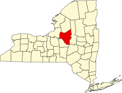
White Lake is a census-designated place (CDP) in the town of Forestport, Oneida County, New York, United States. It was first listed as a CDP prior to the 2020 census. [2]
The CDP is in northeastern Oneida County, at the southwestern edge of the Adirondacks. It is in the northern part of the town of Forestport and surrounds White Lake, the outlet of which flows south through Bear Creek and Woodhull Creek to the Black River at Woodhull. The White Lake CDP includes part of the hamlet of Woodgate.
New York State Route 28 runs through the community, leading southwest 10 miles (16 km) to State Route 12 at Alder Creek and northeast 16 miles (26 km) to Old Forge. Via NY 12, Utica is 34 miles (55 km) south of White Lake.
Census | Pop. | Note | %± |
---|---|---|---|
2020 | 121 | — | |
U.S. Decennial Census [3] |
Orleans is a town in Jefferson County, New York, United States. The population was 2,789 at the 2010 census, up from 2,463 in 2000. The town is located in the northern part of the county and is north of Watertown. Orleans is named after the commune of Orléans in France.
Forestport is a town in Oneida County, New York, United States. The population was 1,535 at the 2010 census.
Bridgeport is a hamlet located partly in the town of Sullivan in Madison County, New York, United States and partly in the town of Cicero in Onondaga County. The population was 1,490 at the 2010 census.
Brewerton is a census-designated place (CDP) in the town of Cicero in Onondaga County and the town of Hastings in Oswego County in the U.S. state of New York. It lies at the west end of Oneida Lake at its outlet into the Oneida River. The population was 4,029 at the 2010 census. Maps of the 19th century indicate that this area was once known as Fort Brewerton, while Brewerton meant the Cicero portion.
New York State Route 28 (NY 28) is a state highway extending for 281.69 miles (453.34 km) in the shape of a "C" between the Hudson Valley city of Kingston and southern Warren County in the U.S. state of New York. Along the way, it intersects several major routes, including Interstate 88 (I-88), U.S. Route 20 (US 20), and the New York State Thruway twice. The southern terminus of NY 28 is at NY 32 in Kingston and the northern terminus is at US 9 in Warrensburg. In Kingston, NY 28 is co-designated as Interstate 587 from its southern terminus at NY 32 to the roundabout linking it to the Thruway (I-87).
Paul Smiths is a hamlet and census-designated place (CDP) in the Town of Brighton in Franklin County, New York, United States. It is located on Lower Saint Regis Lake in the Adirondacks, 12 miles (19 km) northwest of Saranac Lake, located at 44°26' North 74°15' West. The population of the CDP was 671 at the 2010 census.
Lakeville is a hamlet and census-designated place (CDP) in the town of Livonia, Livingston County, New York, United States. Its population was 756 as of the 2010 census.
Hemlock is a hamlet and census-designated place (CDP) in the town of Livonia, Livingston County, New York, United States. The population was 557 as of the 2010 census.
Central Bridge is a hamlet and census-designated place (CDP) within the towns of Schoharie and Esperance in Schoharie County, New York, United States. As of the 2010 census, the population was 593.
Bliss is the largest hamlet and a census-designated place (CDP) in the town of Eagle, Wyoming County, New York, United States. As of the 2010 census, it had a population of 527.
Beaver Dam Lake is a census-designated place (CDP) in the towns of New Windsor, Blooming Grove, and Cornwall in Orange County, New York, United States. As of the 2020 census, it had a population of 2,609.
Lime Lake is a hamlet and census-designated place (CDP) in the northeast part of the town of Machias, in Cattaraugus County, New York, United States. As of the 2010 census, it had a population of 867. Prior to the 2010 census, the area was delineated as part of the Lime Lake-Machias CDP.
Machias is a hamlet and census-designated place (CDP) in the northeast part of the town of Machias, in Cattaraugus County, New York, United States. As of the 2010 census, it had a population of 471. Prior to the 2010 census, the area was delineated as part of the Lime Lake-Machias CDP.
Pine Valley is a hamlet and census-designated place in the towns of Catlin and Veteran in Chemung County, New York, United States. The population was 813 at the 2010 census.
Rodman is a hamlet and census-designated place (CDP) in the town of Rodman, Jefferson County, New York, United States. As of the 2010 census, the CDP population was 153, out of 1,176 in the entire town of Rodman.
Conesus is a hamlet in the town of Conesus, Livingston County, New York, United States. The population of the CDP was 308 at the 2010 census, out of 2,473 in the entire town of Conesus. In 2010 the CDP was listed as "Conesus Hamlet".
Websters Crossing is a hamlet and census-designated place (CDP) in the town of Springwater, Livingston County, New York, United States. Its population was 69 as of the 2010 census. New York State Route 15 passes through the community.
Scottsburg is a hamlet and census-designated place (CDP) in Livingston County, New York, United States. Its population was 117 as of the 2010 census. New York State Route 256 passes through the community.
Marcy is an unincorporated community and census-designated place (CDP) in the town of Marcy, Oneida County, New York, United States. It was first listed as a CDP prior to the 2020 census.
Castleton Four Corners is a census-designated place (CDP) in the town of Castleton, Rutland County, Vermont, United States. It consists of the unincorporated villages of Castleton Corners and Hydeville. As of the 2020 census, the CDP had a population of 699, out of 4,458 in the entire town.