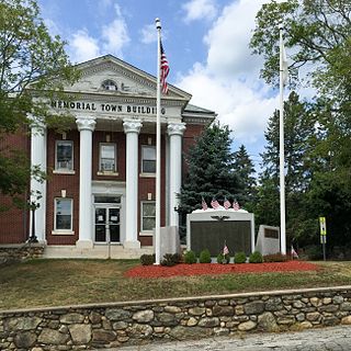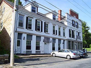
North Providence is a town in Providence County, Rhode Island, United States. The population was 34,114 at the 2020 census.

The following turnpikes were chartered and built in Rhode Island:
- West Glocester Turnpike 1794
- Providence and Norwich Turnpike 1794
- Rhode Island and Connecticut Turnpike 1803
- Glocester Turnpike 1804
- Providence and Douglass Turnpike 1805
- Rhode Island Turnpike 1805
- Loisquisset Turnpike 1806
- Providence and Pawtucket Turnpike 1807
- Farnum and Providence Turnpike 1808
- Woonasquatucket Turnpike 1810
- Powder Mill Turnpike 1810
- Natick Turnpike 1812
- Valley Falls Turnpike 1813
- Foster and Scituate Turnpike 1813
- Foster and Scituate Central Turnpike 1813
- Coventry and Cranston Turnpike
- Providence and Pawcatuck Turnpike 1816
- Hopkinton and Richmond Turnpike 1820
- Smithfield Turnpike 1823
- Pawtuxet Turnpike 1825
- Mineral Spring Turnpike 1825
- Pawtucket and Providence East Turnpike 1825
- Fall River and Watupper Turnpike 1827
- Stone Bridge and Fall River Turnpike 1838

The Moshassuck River is a river in the U.S. state of Rhode Island. It flows 8.9 miles (14.3 km) from the town of Lincoln to the city of Providence. There are six dams along the river's length.

The Woonasquatucket River, sometimes called "the Woony", is a river in the U.S. state of Rhode Island. It flows approximately 15.8 miles (25.4 km) and drains a watershed of 130 km2 (50 sq mi).

Smith Hill is a neighborhood in Providence, Rhode Island. Its traditional bounds are the Woonasquatucket River, the Chad Brown public housing complex, Interstate 95 and West River.

Slatersville is a village on the Branch River in the town of North Smithfield, Rhode Island, United States. It includes the Slatersville Historic District, a historic district listed on the National Register of Historic Places. The historic district has been included as part of the Blackstone River Valley National Historical Park. The North Smithfield Public Library is located in Slatersville.

Forestdale is a village and historic district in North Smithfield, Providence County, Rhode Island, United States, one-half mile from Slatersville, Rhode Island. The historic district runs east and west along Main Street and north on Maple Avenue. School Street is the primary road through the village, and the one-room schoolhouse for which the street is named still stands. The Branch River runs through the valley adjacent to the School Street. The Village Haven Restaurant and local VFW chapter are also located in the village.

Union Village or "Bank Village" is a village and historic district located in North Smithfield and Woonsocket, Rhode Island on Rhode Island Route 146A. Union Village developed because it was at the cross roads of old Great Road and Pound Hill Road.

This is a list of the National Register of Historic Places listings in Providence County, Rhode Island.

The Smith–Appleby House Museum is a historic house museum in Smithfield, Rhode Island. It is now home to the Smithfield Historical Society.

The Smithfield Friends Meeting House, Parsonage and Cemetery, is a Friends Meeting House of the Religious Society of Friends (Quakers), rebuilt in 1881. It is located at 108 Smithfield Road in Woonsocket, Rhode Island. The meetinghouse is home to one of the oldest Quaker communities in the region.

The 1761 Milestone is a mile marker located at 640 South Main Street in Woonsocket, Rhode Island. The stone originally marked the junction of a Colonial highway from Great Road and an east-west route from Boston, Massachusetts to Connecticut. It was rediscovered during the installation of an electrical road. In 1898, it was restored to its original location by the local chapter of the Daughters of the American Revolution. The stone is embedded in a low retaining wall at the corner of South Main Street and Smithfield Road. It was added to the National Register of Historic Places on November 24, 1982, and is historically significant as a Colonial-era highway marker.

Allendale Mill is a historic mill at 494 Woonasquatucket Avenue in North Providence, Rhode Island, on the banks of the Woonasquatucket River.

The Greystone Mill Historic District encompasses an early 20th-century textile mill complex on Greystone Avenue in Johnston and North Providence, Rhode Island. The complex consists of three brick buildings on the North Providence side of the Woonasquatucket River, a dam spanning the river, and a water tank near the dam in Johnston. The main structure consists of a series of structures combined to form a rambling structure, built between 1904 and 1911 to designs by Frank Sheldon and Son, an architectural firm that was a leading designer of textile facilities at the time.

The Sassafras Site, designated RI-55, is a prehistoric archaeological site in Albion, a village of Lincoln, Rhode Island. The site was discovered by archaeologists while surveying an area for a potential replacement for the Albion Street bridge, which spans the Blackstone River between Lincoln and Cumberland. The site encompasses a regionally significant quartz stone tool workshop.

The Dyerville Mill is an historic textile mill complex at 610 Manton Avenue in Providence, Rhode Island, USA. Its oldest buildings dating to 1835, it is one of the oldest textile mills in the city. The complex is located between Manton Avenue and the Woonasquatucket River, just south of the Dyerville Mill Pond. Remnants of the head race run south from the pond, through the property, with the tail race exiting to the southwest. The main mill building is a 3+1⁄2-story L-shaped stuccoed stone structure. The picker house is a 2+1⁄2-story stone structure southwest of the main mill, with a brick extension that also gives it an L shape and creates a courtyard with the main building. A 20th-century warehouse stands south of this complex. The mill was established by Elisha Dyer, father of Elisha Dyer and grandfather of Elisha Dyer, Jr., and was operated by the Dyer family until 1867. It was then operated by cotton broker Truman Beckwith and his son. The Joslin Manufacturing Company purchased the business in 1903 and operated textile production on the site until the 1930s. The site has thereafter seen other light industrial uses.

The Rising Sun Mill, formerly the National and Providence Worsted Mills, are a historic textile mill complex located at 166 Valley Street in Providence, Rhode Island. The complex consists of thirteen brick and stone structures, ranging in height from one to four stories, located on the banks of the Woonasquatucket River in the Olneyville neighborhood of the city. Most of them were built between 1880 and 1890, with a small number from 1907 and later. The National and Providence Company and its successors operated here from 1881 into the 1950s, a time period when Providence was a leading manufacturer of worsted wool material.

Providence Dyeing, Bleaching, Calendring Company is an historic industrial complex located at 46,50,52,60 Valley Street and 80 Delaine Street in Providence, Rhode Island. It consists of 18 small-to-medium-sized brick and stone structures in a parcel 4 acres (1.6 ha) in size, between Valley Street and the Woonasquatucket River. Although most of these buildings were constructed between 1900 and 1920, the oldest building in the complex is a single-story rubble stone structure which may contain elements of an 18th-century mill structure, and is known to have achieved its present form around 1837. The original water privilege for this mill site was granted to Christopher Olney in 1773 for a paper mill.

The Greystone Historic District is a historic district encompassing the early 20th-century mill village of Greystone in North Providence, Rhode Island. The district most significant elements is the Greystone Mill, a complex of brick industrial buildings on the North Providence side of the Woonasquatucket River, as well as the dam spanning the river and a water tank in Johnston. The village, entirely in North Providence, was developed between 1904 and 1912 by Joseph Benn and Company, the mill proprietors, to provide housing for its workers. The main focus of the village is on junction of Greystone Road and Oakleigh Avenue. The company built a variety of housing types, including duplexes and tenements, which line some of the side streets. There are four houses, dating as far back as 1822, that predate the primary industrial activity here. The most prominent feature of the village is the Greystone (Primitive) Methodist Church on Oakleigh Avenue.
The Stillwater Mill was a former textile factory located in Smithfield, Rhode Island.


