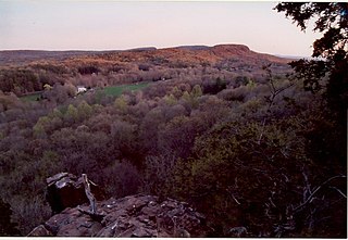
Berlin is a town in the Capitol Planning Region, Connecticut, United States. The population was 20,175 at the 2020 census. It was incorporated in 1785. The geographic center of Connecticut is located in the town. Berlin is residential and industrial, and is served by the Amtrak station of the same name. Berlin also has two hamlets: Kensington and East Berlin.

Route 372 is a 14.95-mile (24.06 km) state highway in Hartford and Middlesex counties in central Connecticut, United States, running from Plainville to Cromwell, and serving to communicate between the numerous freeways in the area. The section of Route 372 from Route 10 in Plainville to the Plainville-New Britain town line is designated the Joseph E. Tinty Memorial Highway. The section of Route 372 from the interchange with Route 72 in New Britain to the intersection with Route 71A and SR 571 in Berlin is designated the Polish Legion of American Veterans Memorial Highway.

In US geography, the Colchester Village Historic District encompasses most of the historic village center of Colchester, Connecticut. It is located at the junction of Route 16, Route 85, and Norwich Avenue. Roughly, the district extends to the northwest along Broadway Street as far as Jaffe Terrace; east along Norwich Avenue to just short of Pleasant Street; south along South Main Street to just north of Hall Hill Road; west along Linwood Avenue to just east of Kmick Lane. The historic district was listed on the National Register of Historic Places (NRHP) in 1994.
The Simsbury Center Historic District is a 75-acre (30 ha) historic district located in the town center area of Simsbury, Connecticut. It encompasses seven blocks of Hopmeadow Street, as well as the cluster of commercial, civic, and residential buildings along Railroad, Station, and Wilcox Streets, and Phelps Lane. Although its oldest element is the cemetery, most of its buildings were built in the late 19th and early 20th century. It was listed on the National Register of Historic Places in 1996.
The Pine Meadow Historic District encompasses most of the historic 19th-century village of Pine Meadow in New Hartford, Connecticut, United States. Located at a bend in the West Branch of the Farmington River southeast of New Hartford center, it is a well-preserved example of a rural industrial village. The district was listed on the National Register of Historic Places in 1996.

The Chester Center Historic District is a historic district encompassing the historic center of Chester, Massachusetts. The area was first laid out by Chester's first settlers in 1763. It remained the center of commerce and civic life in the rural agricultural community until railroads were built in other areas of the town in the 1840s. The village center declined in importance as economic activity moved to areas more readily accessible to the railroad, and the town hall was eventually moved to Chester Factories. The district includes properties on Skyline Trail near the intersection of Bromley and Lyman Roads, and features Greek Revival, colonial, and Federal architecture. It was listed on the National Register of Historic Places in 1988.

Goshen Historic District is a historic district encompassing the town center village of Goshen, Connecticut. Centered at the junction of Connecticut Routes 4 and 63, the village developed historically as a rural crossroads of two turnpikes, and has retained its rural character. It is dominated by residential architecture from the first half of the 19th century, and includes churches, a store, and the town's former 1895 town hall. It was listed on the National Register of Historic Places in 1982.

The Main Street Historic District encompasses the historic civic, commercial, and residential center of Durham, Connecticut. The district is primarily linear and runs along Main Street from between Higganum Road and Town House Road in the south to Talcott Lane in the north, and along Maple Avenue, which parallels Main Street. The district includes most of its colonial architecture, as well as many of its civic buildings. It was listed on the National Register of Historic Places in 1986.

Norwichtown is a historic neighborhood in the city of Norwich, Connecticut, United States. It is generally the area immediately north of the Yantic River between I-395 and Route 169.
Marion is a neighborhood in the town of Southington, Connecticut, United States. It is generally the area in the vicinity of the intersection of Route 322 and Marion Avenue, just north of the Cheshire town line.

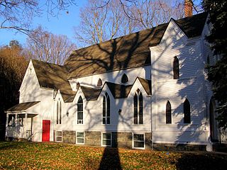
St. Andrew's is a historic Episcopal church at 247 New Milford Turnpike, in the Marbledale village of Washington, Litchfield County, Connecticut. Built in 1822, it is believed to be one of the first Gothic Revival style churches to be built in rural Connecticut. It was listed on the National Register of Historic Places in 1994.

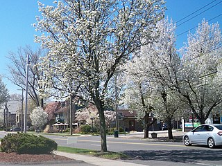
The Greenwich Avenue Historic District is a historic district representing the commercial and civic historical development of the downtown area of the town of Greenwich, Connecticut. The district was listed on the National Register of Historic Places on August 31, 1989. Included in the district is the Greenwich Municipal Center Historic District, which was listed on the National Register the year before for the classical revival style municipal buildings in the core of Downtown. Most of the commercial buildings in the district fall into three broad styles, reflecting the period in which they were built: Italianate, Georgian Revival, and Commercial style. The district is linear and runs north–south along the entire length of Greenwich Avenue, the main thoroughfare of Downtown Greenwich, between U.S. Route 1 and the New Haven Line railroad tracks.

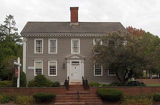
The Josiah Cowles House is a historic house at 184 Marion Avenue, in the Plantsville section of Southington, Connecticut. Built in the mid-18th century, it is a well-preserved local example of Georgian architecture. It was listed on the National Register of Historic Places in 1989. It presently houses a bed and breakfast inn.

The Spring Hill Historic District encompasses a rural 19th-century village stretching along Storrs Road in Mansfield, Connecticut. Spring Hill developed as a rural waystation on an early 19th-century turnpike, and has seen only modest development since the late 19th century. The district was listed on the National Register of Historic Places in 1979.

The Jaffrey Center Historic District encompasses the traditional civic heart of the small town of Jaffrey, New Hampshire. The district lies to the west of the Jaffrey's main business district, extending along Main Street from Harkness Road to the Jaffrey Common, and along Thorndike Pond Road northward from Main Street. It includes the town's oldest civic buildings, and was its main center until the mills of East Jaffrey eclipsed it. The district was listed on the National Register of Historic Places in 1975.

The Orford Street Historic District encompasses a particularly attractive stretch of Orford Street in Orford, New Hampshire. It was described as early as the 18th century as "the most charming country village", with a tree-lined promenade that is still a focus of the town center. The district consists of about 0.5 miles (0.80 km) of Orford Street, between its junctions with New Hampshire Route 25A and Archertown Road, and was listed on the National Register of Historic Places in 1977.
The New Ipswich Center Village Historic District encompasses the historic center of the rural town of New Ipswich, New Hampshire. The center village is the town's most densely populated area, with a history dating to the town's founding in 1735. The district extends along Turnpike Road between King and Porter Roads, and southward in a roughly triangular shape, the southern point of which is at the junction of Main Street and Willard Road. The village includes a large number of residences, which were mainly agricultural at first, but also include a number of properties built as summer resort houses in the late 19th and early 20th centuries. It also includes most of the town's historic civic buildings, including its historic town hall, and the Barrett House, now a museum property owned by Historic New England. The district was listed on the National Register of Historic Places in 1991.
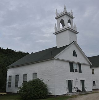
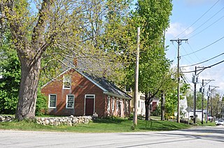
The Washington Common Historic District encompasses a cluster of three civic buildings and the town common in the center of Washington, New Hampshire. The town common began as a 2-acre (0.81 ha) parcel acquired in 1787, and the current town hall followed in 1789. It is a two-story wood-frame building which originally served as both a civic and religious meeting house. The adjacent Gothic Revival Congregational Church was built in 1840. The third structure is the Schoolhouse, a 2+1⁄2-story two-room school built in 1883. The district was listed on the National Register of Historic Places in 1986.

The Palisado Avenue Historic District encompasses a predominantly residential streetscape in northeastern Windsor, Connecticut. Extending along Palisado Avenue between the Farmington River and Bissell Ferry Road, it is a basically 18th-century street view, populated mainly with houses from the 18th to the 20th centuries. The district was listed on the National Register of Historic Places in 1987.
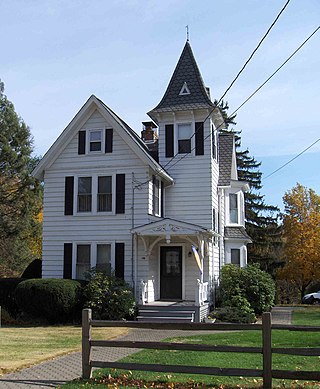
Spring Glen is a neighborhood in the southeastern portion of the town of Hamden, Connecticut. It is primarily residential, mostly single-family homes with a few two-family. Commercial development is entirely on its principal street, Whitney Avenue. It was developed throughout the first half of the twentieth century as a trolley suburb of New Haven. It was named for the Spring Glen dairy farm established by James J. Webb in 1858 in what would become part of the neighborhood.


