"},"area_total_km2":{"wt":"1.02"},"population_footnotes":{"wt":"{{NZ population data 2018||||y}}"},"population_as_of":{"wt":"{{NZ population data 2018|||y}}"},"population_total":{"wt":"{{NZ population data 2018|Okato|y}}"},"population_density_km2":{"wt":"auto"},"subdivision_type":{"wt":"Country"},"subdivision_name":{"wt":"[[New Zealand]]"},"subdivision_type1":{"wt":"[[Regions of New Zealand|Region]]"},"subdivision_name1":{"wt":"[[Taranaki Region]]"},"subdivision_type2":{"wt":"[[Territorial authorities of New Zealand|Territorial authority]]"},"subdivision_name2":{"wt":"[[New Plymouth District]]"},"subdivision_type3":{"wt":"Ward"},"subdivision_name3":{"wt":"{{ubl|Kaitake-Ngāmotu General Ward|Te Purutanga Mauri Pūmanawa Māori Ward}}"},"subdivision_type4":{"wt":"Community"},"subdivision_name4":{"wt":"Kaitake Community"},"seat_type":{"wt":"[[New Zealand electorates|Electorates]]"},"seat":{"wt":"{{ubl|[[New Plymouth (New Zealand electorate)|New Plymouth]]|[[Te Tai Hauāuru]] ([[Māori electorates|Māori]])}}"},"leader_title":{"wt":"Territorial Authority"},"leader_name":{"wt":"[[New Plymouth District Council]]"},"leader_title1":{"wt":"Regional council"},"leader_name1":{"wt":"[[Taranaki Regional Council]]"},"coordinates":{"wt":"{{Coord|39|12|S|173|53|E|region:NZ_type:city|display=it}}"},"image_map":{"wt":"{{Infobox mapframe|coord={{coord|39|11|21|S|173|52|39|E}}|zoom=9}}"},"image":{"wt":""}},"i":0}}]}" id="mwCw">Place in Taranaki Region, New Zealand
Ōkato | |
---|---|
![]() Hempton Hall in Ōkato in 1968 | |
![]() | |
Coordinates: 39°12′S173°53′E / 39.200°S 173.883°E | |
Country | New Zealand |
Region | Taranaki Region |
Territorial authority | New Plymouth District |
Ward |
|
Community | Kaitake Community |
Electorates | |
Government | |
• Territorial Authority | New Plymouth District Council |
• Regional council | Taranaki Regional Council |
Area | |
• Total | 1.02 km2 (0.39 sq mi) |
Population (June 2023) [2] | |
• Total | 710 |
• Density | 700/km2 (1,800/sq mi) |
Ōkato is a small town in rural Taranaki, New Zealand. It is situated about 25 minutes drive around the coast from New Plymouth on State Highway 45. Ōakura is 12 km to the north-east, and Warea is 9 km to the south-west. [3] [4] The place offers popular rocky surfing spots around coastal beaches. The town was established as a military settlement in the 1860s. [5]
The New Zealand Ministry for Culture and Heritage gives a translation of "place of Kato" for Ōkato. [6] While "Kato" was probably a personal name, an alternative translation is "place of full tide/tsunami". [7] In July 2020, the name of the locality was officially gazetted as Ōkato by the New Zealand Geographic Board. [8]
Ōkato has all the elements of a New Zealand rural community with sporting facilities (rugby grounds, bowling club, squash courts, tennis courts and swimming pool), Coastal Taranaki School, a police station, and a volunteer fire brigade.
Ōkato was also notable as the home of Okato Cheese which was manufactured by the Okato Co-operative Dairy Company. This manufacturing site closed some years after merging with Egmont Co-operative Dairy. Activities in the Ōkato area include the Stony River walkway, which has a number of locations for photographing Mt Taranaki.
The rural community of Puniho is located just south of Ōkato.
Ōkato is defined by Statistics New Zealand as a rural settlement and covers 1.02 km2 (0.39 sq mi) [1] and had an estimated population of 710 as of June 2023, [2] with a population density of 696 people per km2. Ōkato is part of the larger Kaitake statistical area.
Year | Pop. | ±% p.a. |
---|---|---|
2006 | 531 | — |
2013 | 561 | +0.79% |
2018 | 606 | +1.56% |
Source: [9] |
Ōkato had a population of 606 at the 2018 New Zealand census, an increase of 45 people (8.0%) since the 2013 census, and an increase of 75 people (14.1%) since the 2006 census. There were 228 households, comprising 291 males and 315 females, giving a sex ratio of 0.92 males per female, with 153 people (25.2%) aged under 15 years, 93 (15.3%) aged 15 to 29, 276 (45.5%) aged 30 to 64, and 84 (13.9%) aged 65 or older.
Ethnicities were 92.1% European/Pākehā, 23.8% Māori, 0.5% Pacific peoples, 0.5% Asian, and 1.5% other ethnicities. People may identify with more than one ethnicity.
Although some people chose not to answer the census's question about religious affiliation, 58.9% had no religion, 29.2% were Christian, 1.0% had Māori religious beliefs, 1.5% were Buddhist and 1.5% had other religions.
Of those at least 15 years old, 84 (18.5%) people had a bachelor's or higher degree, and 84 (18.5%) people had no formal qualifications. 30 people (6.6%) earned over $70,000 compared to 17.2% nationally. The employment status of those at least 15 was that 213 (47.0%) people were employed full-time, 75 (16.6%) were part-time, and 18 (4.0%) were unemployed. [9]
Kaitake statistical area covers 170.29 km2 (65.75 sq mi) [1] and had an estimated population of 2,310 as of June 2023, [10] with a population density of 14 people per km2.
Year | Pop. | ±% p.a. |
---|---|---|
2006 | 1,554 | — |
2013 | 1,632 | +0.70% |
2018 | 1,932 | +3.43% |
Source: [11] |
Kaitake had a population of 1,932 at the 2018 New Zealand census, an increase of 300 people (18.4%) since the 2013 census, and an increase of 378 people (24.3%) since the 2006 census. There were 687 households, comprising 966 males and 972 females, giving a sex ratio of 0.99 males per female. The median age was 39.5 years (compared with 37.4 years nationally), with 471 people (24.4%) aged under 15 years, 270 (14.0%) aged 15 to 29, 969 (50.2%) aged 30 to 64, and 225 (11.6%) aged 65 or older.
Ethnicities were 94.7% European/Pākehā, 13.8% Māori, 0.8% Pacific peoples, 1.6% Asian, and 1.6% other ethnicities. People may identify with more than one ethnicity.
The percentage of people born overseas was 16.0, compared with 27.1% nationally.
Although some people chose not to answer the census's question about religious affiliation, 57.1% had no religion, 31.8% were Christian, 0.3% had Māori religious beliefs, 0.6% were Buddhist and 2.0% had other religions.
Of those at least 15 years old, 312 (21.4%) people had a bachelor's or higher degree, and 234 (16.0%) people had no formal qualifications. The median income was $34,600, compared with $31,800 nationally. 261 people (17.9%) earned over $70,000 compared to 17.2% nationally. The employment status of those at least 15 was that 771 (52.8%) people were employed full-time, 291 (19.9%) were part-time, and 51 (3.5%) were unemployed. [11]
Coastal Taranaki School is a coeducational composite (years 1-13) school with a roll of 302 as of April 2023. [12] [13] The school was formed in 2005 from the merger of Newall School, Okato Primary School, Okato College and Warea School. It was initially called Okato Area School but changed its name. [14]
Taranaki is a region in the west of New Zealand's North Island. It is named after its main geographical feature, the stratovolcano Mount Taranaki, also known as Mount Egmont.
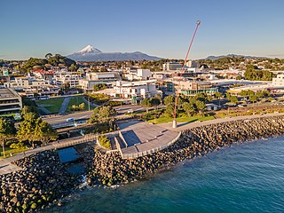
New Plymouth is the major city of the Taranaki region on the west coast of the North Island of New Zealand. It is named after the English city of Plymouth, in Devon, from where the first English settlers to New Plymouth migrated. The New Plymouth District, which includes New Plymouth City and several smaller towns, is the 10th largest district in New Zealand, and has a population of 88,900 – about two-thirds of the total population of the Taranaki Region and 1.7% of New Zealand's population. This includes New Plymouth City (59,600), Waitara (7,550), Inglewood (3,870), Ōakura (1,730), Ōkato (561) and Urenui (429).
Stratford is the only town in Stratford District, and the seat of the Taranaki region, in New Zealand's North Island. It lies beneath the eastern slopes of Mount Taranaki, approximately halfway between New Plymouth and Hāwera, near the geographic centre of the Taranaki Region. The town has a population of 6,320, making it the 62nd largest urban area in New Zealand, and the fourth largest in Taranaki.
Inglewood is a town in the Taranaki Region of New Zealand's North Island. It is 16 kilometres (10 mi) southeast of New Plymouth on State Highway 3, close to Mount Taranaki, and sits 200 metres (660 ft) above sea level. The town services a mainly dairy farming region.
Patea is the third-largest town in South Taranaki District, New Zealand. It is on the western bank of the Pātea River, 61 kilometres north-west of Whanganui on State Highway 3. Hāwera is 27 km to the north-west, and Waverley 17 km to the east. The Pātea River flows through the town from the north-east and into the South Taranaki Bight.
Waitara is a town in the northern part of the Taranaki region of the North Island of New Zealand. Waitara is located just off State Highway 3, 15 kilometres (9.3 mi) northeast of New Plymouth.
Ōpunake is a small town on the southwest coast of Taranaki in New Zealand's North Island. It is located 45 kilometres southwest of New Plymouth. Rahotu is 16 km to the northwest. Manaia is 29 km to the southeast. State Highway 45 passes through the town. The town has a population of 1,440.
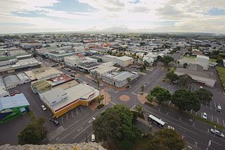
Hāwera is the second-largest centre in the Taranaki region of New Zealand's North Island, with a population of 10,350. It is near the coast of the South Taranaki Bight. The origins of the town lie in a government military base that was established in 1866, and the town of Hāwera grew up around a blockhouse in the early 1870s.
Mōkau is a small town on the west coast of New Zealand's North Island, located at the mouth of the Mōkau River on the North Taranaki Bight. Mōkau is in the Waitomo District and Waikato region local government areas, just north of the boundary with the New Plymouth District and the Taranaki Region. Prior to 1989, the town was classed as being in Taranaki, and there is still a feeling that the community of interest is most associated with New Plymouth, 90 km to the southwest. State Highway 3 passes through the town on its route from Te Kūiti to Waitara and, eventually, New Plymouth.
Lepperton is a small village in North Taranaki, New Zealand. It is approximately 6 km (3.7 mi) inland from Waitara township, 5 km (3.1 mi) west of the Waitara River, and 1 km (0.62 mi) east of State Highway 3A, which connects Inglewood to Waitara.
Midhirst is a small village in Taranaki, New Zealand, approximately 4 km north of Stratford, on State Highway 3. Inglewood is 17 km (11 mi) north of Midhirst, and New Plymouth is 35 km (22 mi) to the northwest.
Ōakura is a small township in New Plymouth District, Taranaki, in the western North Island of New Zealand. It is located on State Highway 45, 15 kilometres south-west of New Plymouth. Ōkato is 12 km further south-west. The Oakura River flows past the town and into the North Taranaki Bight. To the south is the Kaitake Range, part of Egmont National Park.
Westown is a suburb of New Plymouth, in the western North Island of New Zealand. It is located to the southwest of the city centre and west of Frankleigh Park.
Moturoa is a coastal suburb of New Plymouth, in the western North Island of New Zealand. It is located to the west of the city centre, bordering Port Taranaki and the Sugar Loaf Islands. One of the islands, Moturoa, the largest, shares its name with the suburb.
Urenui is a settlement in northern Taranaki, in the North Island of New Zealand. It is located on State Highway 3 close to the shore of the North Taranaki Bight, 13 kilometres east of Waitara and 6 km south-west of Mimi. The Urenui River flows past the settlement into the North Taranaki Bight.
Awakino is a settlement in the south of Waitomo District, in the North Island of New Zealand. It is located on State Highway 3 at the mouth of the Awakino River, five kilometres north of Mokau. It is 79 km southwest of Te Kūiti, and 98 km northeast of New Plymouth.
Ohangai is a locality in South Taranaki, New Zealand. It is approximately 10 km east of Hāwera and 6 km north of Mokoia
Uruti is a locality in northern Taranaki, in the North Island of New Zealand. It is located on State Highway 3, north-east of Mimi and south-west of Ahititi. The Uruti Stream meets the Mimi River at this point. The river flows past the settlement into the North Taranaki Bight.
The New Plymouth District is one of the districts of New Zealand within Taranaki. It includes the city of New Plymouth and smaller towns such as Inglewood, Ōakura and Waitara.
Bell Block is a town in Taranaki, New Zealand. State Highway 3 runs through it. It is 6 km north-east of the centre of New Plymouth and 1 km from the outer edge of New Plymouth at Waiwhakaiho. Waitara is about 9 km to the north-east. New Plymouth Airport is located immediately to the north-east of Bell Block.