
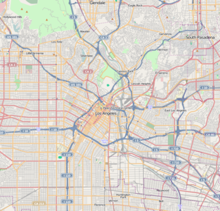
The Los Angeles Community College District (LACCD) is the community college district serving Los Angeles, California, United States and some of its neighboring cities and certain unincorporated areas of Los Angeles County. Its headquarters are in Downtown Los Angeles. Over the past seventy-seven years LACCD has served as educator to more than three million students. In addition to typical college aged students, the LACCD also serves adults of all ages. Indeed, over half of all LACCD students are older than 25 years of age, and more than a quarter are 35 or older. LACCD educates almost three times as many Latino students and nearly four times as many African-American students as all of the University of California campuses combined. Eighty percent of LACCD students are from underserved populations. The Los Angeles Community College District is the largest community college district in the United States and is one of the largest in the world. The nine colleges within the district offer educational opportunities to students in Los Angeles. It serves students located in the Alhambra, Beverly Hills, Burbank, Culver City, Garvey, Las Virgenes, Los Angeles, Montebello, Palos Verdes and San Gabriel school districts. The district covers the Los Angeles city limits, San Fernando, Calabasas, Agoura Hills, Hidden Hills, Burbank, West Hollywood, Beverly Hills, Culver City, Alhambra, Monterey Park, San Gabriel, Rosemead, Montebello, Commerce, Vernon, Huntington Park, Bell, Cudahy, Bell Gardens, South Gate, Gardena, Carson, Lomita, Palos Verdes Estates, Rolling Hills, Rancho Palos Verdes, and numerous unincorporated communities, including East Los Angeles, Florence-Firestone, Athens, and Walnut Park. The LACCD consists of nine colleges and covers an area of more than 882 square miles (2,280 km2).
Alhambra High School is a public high school in Alhambra, California established in 1898. Existing in the Alhambra Unified School District, it administers one of the most extensive high school and adult education programs in California, offering hundreds of academic, cultural, and recreational courses, day and evening, many located on the school grounds. In 2005, it was given a California Distinguished Schools award.
The San Gabriel Valley is one of the principal valleys of Southern California, lying generally to the east of the city of Los Angeles. Surrounding features include:
Route 710, consisting of the non-contiguous segments of State Route 710 and Interstate 710 (I-710), is a major north–south state highway and Interstate Highway in the Los Angeles metropolitan area of the U.S. state of California. Also called the Los Angeles River Freeway prior to November 18, 1954, the highway was initially planned to connect Long Beach and Pasadena, but a gap in the route exists from Alhambra to Pasadena through South Pasadena due to community opposition to its construction.
Sam Hanks was an American racecar driver who won the 1957 Indianapolis 500. He was a barnstormer, and raced midget and Championship cars.

Weingart Stadium is a 22,355-capacity multi-purpose stadium located at East Los Angeles College, in Monterey Park, California. It was built in 1951 at a cost of $3.1 million, and following renovations in 1984 it was renamed after philanthropist Ben Weingart.
El Sereno is a Los Angeles neighborhood in the Eastside Los Angeles region of Los Angeles County, California.

The Los Angeles County Department of Public Works (LACDPW) is responsible for the construction and operation of Los Angeles County's roads, building safety, sewerage, and flood control. DPW also operates traffic signals and intelligent transportation systems, drinking water systems in certain communities, operates five airports, paratransit and fixed route public transport, administers various environment programs, issues various permits for activities in the public roadway, and has a Department Emergency Operations Center that works in conjunction with the County Emergency Operations Center operated by the Sheriff's Department. The department is headquartered at 900 South Fremont Avenue in Alhambra, California.
The Alhambra Unified School District is a school district based in Alhambra, California.

Mark Keppel High School is a four-year California Distinguished School located in the city of Alhambra, California, in the Alhambra Unified School District. The school is on the southern edge of Alhambra, adjacent to the city of Monterey Park, and borders the Interstate 10 Freeway. Mark Keppel serves students from portions of Alhambra, Monterey Park, and Rosemead. Mark Keppel has been accredited by the Western Association of Schools and Colleges in 1996, 2002, 2008, and 2014.
Gabrielino High School is a public high school located on San Gabriel Boulevard in San Gabriel, California, 10 miles (16 km) east of downtown Los Angeles, serving the 9th to 12th grades. It was established in 1994. Gabrielino High School is accredited by Western Association of Schools and Colleges (WASC).

Atlantic Boulevard/Atlantic Avenue/Los Robles Avenue is a major north-south thoroughfare in eastern Los Angeles County, California.
Garvey Avenue is a west-east thoroughfare in the San Gabriel Valley. It is named after Richard Garvey, Sr., a former postal horse rider and ranch owner who donated part of his land to create the thoroughfare, which became an important link between Los Angeles and the San Gabriel Valley, especially prior to the establishment of the Interstate Highway System.
Garfield Avenue is a major north-south street in Los Angeles County, California, US.
Naud Junction was an area in northern Downtown Los Angeles, California. It was located at the junction of Main Street and Alameda Street, where Southern Pacific Railroad trains veered off Alameda to tracks along Alhambra Avenue and the Los Angeles River.

Historically there has been a population of Chinese Americans in Los Angeles and the Los Angeles Metropolitan Area. As of 2010, there were 393,488 Chinese Americans in Los Angeles County, 4.0% of the county's population, and 66,782 Chinese Americans in the city of Los Angeles.
Abram M. Edelman (1863–1941) was an American architect from Los Angeles, California. Some of his buildings are listed on the National Register of Historic Places.


