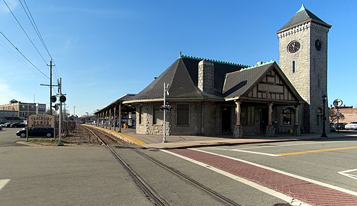
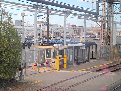
List of MBTA Commuter Rail stations

Last updated

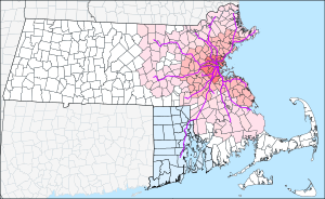
MBTA Commuter Rail and funding district map.svg
MBTA Commuter Rail Map.svg
Geographic and stylized maps of the MBTA Commuter Rail system

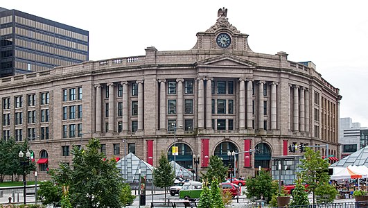
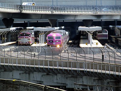
MBTA Commuter Rail is the commuter rail system for the Greater Boston metropolitan area of Massachusetts. It is owned by the Massachusetts Bay Transportation Authority (MBTA) and operated under contract by Keolis. In 2022, it was the fifth-busiest commuter rail system in the United States with an average weekday ridership of 78,800. [1] The system's routes span 394 miles (630 km) and cover roughly the eastern third of Massachusetts plus central Rhode Island. [2] [3] They stretch from Newburyport in the north to North Kingstown, Rhode Island, in the south, and reach as far west as Worcester and Fitchburg. The system is split into two parts, with lines north of Boston having a terminus at North Station and lines south of Boston having a terminus at South Station.

Contents

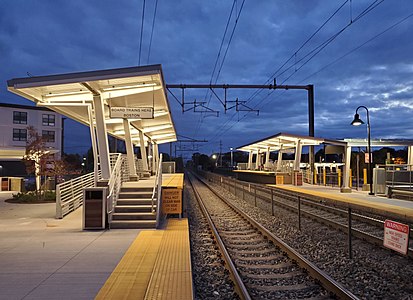
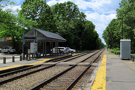
As of May 2024, there are 136 active stations on twelve lines, two of which have branches. 110 active stations are accessible; 26 are not. Six additional stations (Prides Crossing, Mishawum, Hastings, Silver Hill, Plimptonville, and Plymouth) are indefinitely closed due to service cuts during the COVID-19 pandemic. One station (Winchester Center) is temporarily closed due to structural deterioration. Six additional stations are under construction as part of the South Coast Rail project; several other stations are planned.

The MBTA was formed in 1964 to subsidize suburban commuter rail service operated by the Boston and Maine Railroad, New York Central Railroad, and New York, New Haven and Hartford Railroad. Subsidies began in stages from 1965 to 1973; a number of stations closed in 1965–1967 before service to them was subsidized, of which 26 have not reopened. Contraction continued into the early 1980s; 42 additional stations closed between 1967 and 1981 have not reopened. Expansion of the system began in the late 1970s, including extensions of existing lines and the reopening of several lines discontinued before the MBTA era. Three additional low-ridership stations have closed since 1981, while several others have been relocated.

Key

StationIndicates the MBTA's official name for the station.
Wheelchair symbol.svg Indicates whether the station is accessible. (See MBTA accessibility for further details.)
LineIndicates the lines that stop at the given station. A bold line designation indicates that the station is a terminus for that line.
ConnectionsDenotes any links to MBTA subway and MBTA bus routes, to other bus systems, to Amtrak trains, or to the CapeFLYER at the station.
City/neighborhoodIdentifies the municipality (and for Boston, the neighborhood) in which the station is located.
Fare zoneIdentifies which of the eleven fare zones the station is in. The zones are 1A, 1, 2, 3, 4, 5, 6, 7, 8, 9, and 10, with Zone 1A being the closest to North Station and South Station, and Zone 10 being the farthest.
Daily boardingsAverage daily boardings (in both directions) from an April 2018 count.
Station infoA link to the station's information page on the MBTA website.

Stations

Station Wheelchair symbol.svg LineConnectionsCity/neighborhoodFare zone [4] Daily boardings [5] Station info
South Station Wheelchair symbol.svg
  MBTA bus (4, 7,  11)

BSicon LOGO Amtrak2.svg Amtrak: Acela , Lake Shore Limited , Northeast Regional
Aiga bus trans.svg Intercity buses at South Station Bus Terminal

Boston/Downtown 1A28,416 Link
JFK/UMass Wheelchair symbol.svg
  MBTA bus (8, 16,  41)
Boston/Dorchester 1A362 Link
Quincy Center Wheelchair symbol.svg
  MBTA bus (210, 211, 215, 216, 217, 220, 222, 225, 230, 236, 238,  245)
Quincy 1773 Link
Weymouth Landing/East Braintree Wheelchair symbol.svg
  MBTA bus (225,  226)
Weymouth 2507 Link
East Weymouth Wheelchair symbol.svg Weymouth 2587 Link
West Hingham Wheelchair symbol.svg Hingham 3325 Link
Nantasket Junction Wheelchair symbol.svg Hingham 4218 Link
Cohasset Wheelchair symbol.svg Cohasset 4351 Link
North Scituate Wheelchair symbol.svg Scituate 5336 Link
Greenbush Wheelchair symbol.svg Scituate 6441 Link
Braintree Wheelchair symbol.svg
  MBTA bus (226, 230,  236)
Braintree 2204 Link
South Weymouth Wheelchair symbol.svg Weymouth 3581 Link
Abington Wheelchair symbol.svg Abington 4645 Link
Whitman Wheelchair symbol.svg Whitman 5362 Link
Hanson Wheelchair symbol.svg Hanson 6380 Link
Halifax Wheelchair symbol.svg Halifax 7276 Link
Kingston Wheelchair symbol.svg Aiga bus trans.svg GATRA (Freedom Link, Liberty Link, SAIL) Kingston 8657 Link
Plymouth Wheelchair symbol.svg Aiga bus trans.svg GATRA (Freedom Link, Liberty Link) Plymouth 821 Link
Holbrook/​Randolph Wheelchair symbol.svg
  MBTA bus (238,  240)
Randolph 3473 Link
Montello Wheelchair symbol.svg

Aiga bus trans.svg BAT (10/11)

Brockton 4416 Link
Brockton Wheelchair symbol.svg

Aiga bus trans.svg BAT (1, 2, 3, 4, 5, 6, 8, 9, 10/11, 12, 13, 14, BSU 28)

Brockton 4546 Link
Campello Wheelchair symbol.svg Aiga bus trans.svg BAT (8, 12) Brockton 5334 Link
Bridgewater Wheelchair symbol.svg Bridgewater 6600 Link
Middleborough/​Lakeville Wheelchair symbol.svg Aiga bus trans.svg GATRA (Downtown Middleborough Shuttle, Link 4) Lakeville 8867 Link
Newmarket Wheelchair symbol.svg
  MBTA bus (8,  10)
Boston/Dorchester 1A75 Link
Uphams Corner Wheelchair symbol.svg
  MBTA bus (15,  41)
Boston/Dorchester 1A151 Link
Four Corners/Geneva Wheelchair symbol.svg
  MBTA bus (19,  23)
Boston/Dorchester 1A245 Link
Talbot Avenue Wheelchair symbol.svg
  MBTA bus (22)
Boston/Dorchester 1A213 Link
Morton Street Wheelchair symbol.svg
  MBTA bus (21,  26)
Boston/Mattapan 1A264 Link
Blue Hill Avenue Wheelchair symbol.svg
  MBTA bus (28, 29, 30,  31)
Boston/Mattapan 1A Link
Fairmount Wheelchair symbol.svg
  MBTA bus (24,  33)
Boston/Hyde Park 1A543 Link
Readville Wheelchair symbol.svg
  MBTA bus (32,  33)
Boston/Hyde Park 2426 Link
Back Bay Wheelchair symbol.svg
  MBTA bus (10,  39)

BSicon LOGO Amtrak2.svg Amtrak: Acela , Lake Shore Limited , Northeast Regional
Aiga bus trans.svg Intercity buses at Copley Square

Boston/Back Bay 1A8,103 Link
Ruggles Wheelchair symbol.svg
  MBTA bus (8, 15, 19, 22, 23, 28, 43, 44, 45, 47, CT2,  CT3)
Boston/Roxbury Crossing 1A2,640 Link
Forest Hills Wheelchair symbol.svg
  MBTA bus (16, 21, 30, 31, 32, 34, 34E, 35, 36, 37, 38, 39, 40, 42, 50,  51)
Boston/Jamaica Plain 1A142 Link
Hyde Park Wheelchair symbol.svg
  MBTA bus (24, 32, 33,  50)
Boston/Hyde Park 1526 Link
Route 128 Wheelchair symbol.svg BSicon LOGO Amtrak2.svg Amtrak: Acela , Northeast Regional Westwood 21,721 Link
Canton Junction Wheelchair symbol.svg Canton 31,115 Link
Canton Center Wheelchair symbol.svg Canton 3470 Link
Stoughton Wheelchair symbol.svg Aiga bus trans.svg BAT (14) Stoughton 4917 Link
Sharon Wheelchair symbol.svg Sharon 41,308 Link
Mansfield Wheelchair symbol.svg Aiga bus trans.svgBlue Apple Bus Mansfield 61,966 Link
Attleboro Wheelchair symbol.svg Aiga bus trans.svg GATRA (10, 12, 15, 16, 18) Attleboro 71,547 Link
South Attleboro Wheelchair symbol.svg Aiga bus trans.svg GATRA (11, 16)
Aiga bus trans.svg RIPTA (1 , 35)
Attleboro 71,144 Link
Pawtucket/​Central Falls Wheelchair symbol.svg Aiga bus trans.svg RIPTA (R-Line , 1 , 71 , 72 , 73 , 75 , 76 , 78 , 80 , QX) Pawtucket, RI 8 Link
Providence Wheelchair symbol.svg BSicon LOGO Amtrak2.svg Amtrak: Acela , Northeast Regional

Aiga bus trans.svg RIPTA (R-Line , 3 , 4 , 50 , 51 , 54 , 55 , 56 , 57 , 58 , 66 , 72)

Providence, RI 82,091 Link
T. F. Green Airport Wheelchair symbol.svg Aiga bus trans.svg RIPTA (14) Warwick, RI 9227 Link
Wickford Junction Wheelchair symbol.svg Aiga bus trans.svg RIPTA (14 , 65x , 66) North Kingstown, RI 10235 Link
Endicott Dedham 2256 Link
Dedham Corporate Center Wheelchair symbol.svg Dedham 2763 Link
Islington Westwood 3128 Link
Norwood Depot Wheelchair symbol.svg Norwood 3285 Link
Norwood Central Wheelchair symbol.svg Norwood 31,041 Link
Windsor Gardens Norwood 4257 Link
Plimptonville Walpole 412 Link
Walpole Walpole 4744 Link
Foxboro Wheelchair symbol.svg Foxborough 4 Link
Norfolk Wheelchair symbol.svg Aiga bus trans.svg GATRA (Medway T shuttle) Norfolk 5875 Link
Franklin/Dean College Franklin 6633 Link
Forge Park/495 Wheelchair symbol.svg Franklin 6683 Link
Roslindale Village Wheelchair symbol.svg
  MBTA bus (14, 30, 34, 34E, 35, 36, 37, 40, 50,  51)
Boston/Roslindale 1479 Link
Bellevue Wheelchair symbol.svg
  MBTA bus (35, 36, 37,  38)
Boston/West Roxbury 1340 Link
Highland Wheelchair symbol.svg
  MBTA bus (35, 36,  37)
Boston/West Roxbury 1394 Link
West Roxbury Wheelchair symbol.svg
  MBTA bus (35, 36,  37)
Boston/West Roxbury 1444 Link
Hersey Wheelchair symbol.svg Needham 2525 Link
Needham Junction Wheelchair symbol.svg
  MBTA bus (59)
Needham 2366 Link
Needham Center Wheelchair symbol.svg
  MBTA bus (59)
Needham 2224 Link
Needham Heights Wheelchair symbol.svg
  MBTA bus (59)
Needham 2329 Link
Lansdowne Wheelchair symbol.svg
  MBTA bus (8, 19, 60,  65)

At Kenmore:

  Green Line (B, C, D)
  MBTA bus (8, 19, 57, 60,  65)
Boston/Fenway-Kenmore 1A1,195 Link
Boston Landing Wheelchair symbol.svg
  MBTA bus (64)
Boston / Allston-Brighton 1A600 Link
Newtonville
  MBTA bus (59, 553, 554,  556)
Newton 1476 Link
West Newton
  MBTA bus (553,  554)
Newton 2256 Link
Auburndale Newton 2248 Link
Wellesley Farms Wellesley 3298 Link
Wellesley Hills Wellesley 3336 Link
Wellesley Square Wellesley 3626 Link
Natick Center Aiga bus trans.svg MWRTA (10, 11, Natick Commuter Shuttle, MathWorks Express Shuttle) Natick 4736 Link
West Natick Wheelchair symbol.svg Aiga bus trans.svg MWRTA (10, 11) Natick 4944 Link
Framingham Wheelchair symbol.svg BSicon LOGO Amtrak2.svg Amtrak: Lake Shore Limited
Aiga bus trans.svg MWRTA (2, 3, 4, 5, 6, 7, 9)
Aiga bus trans.svg Greyhound
Framingham 51,130 Link
Ashland Wheelchair symbol.svg Aiga bus trans.svg MWRTA (5) Ashland 6931 Link
Southborough Wheelchair symbol.svg Aiga bus trans.svgMarlborough Commuter Shuttle Southborough 6525 Link
Westborough Wheelchair symbol.svg Westborough 7754 Link
Grafton Wheelchair symbol.svg Aiga bus trans.svg WRTA (B) Grafton 8528 Link
Worcester Wheelchair symbol.svg BSicon LOGO Amtrak2.svg Amtrak: Lake Shore Limited

Aiga bus trans.svg WRTA (1, 2, 3, 4, 5, 6, 7, 11, 12, 14, 15, 16, 19, 23, 24, 26, 27, 29, 30, 31, 33, 42)
Aiga bus trans.svg PVTA (B79)
Aiga bus trans.svg Greyhound , Peter Pan

Worcester 81,298 Link
North Station Wheelchair symbol.svg BSicon LOGO Amtrak2.svg Amtrak: Downeaster
  MBTA bus (4)
Aiga bus trans.svg EZRide
Boston/Downtown 1A18,427 Link
Porter Wheelchair symbol.svg
  MBTA bus (77, 83,  96)
Cambridge 1A1,468 Link
Belmont Center
  MBTA bus (74,  75)
Belmont 1159 Link
Waverley
  MBTA bus (73,  554)
Belmont 1115 Link
Waltham Wheelchair symbol.svg
  MBTA bus (61, 70, 553, 554, 556,  558)
Aiga bus trans.svg 128 Business Council: W1
Waltham 2521 Link
Brandeis/Roberts Wheelchair symbol.svg Waltham 2369 Link
Kendal Green Weston 3114 Link
Hastings Weston 318 Link
Silver Hill Weston 311 Link
Lincoln Lincoln 4288 Link
Concord Concord 5367 Link
West Concord Wheelchair symbol.svg Concord 5359 Link
South Acton Wheelchair symbol.svg Aiga bus trans.svgMaynard Commuter Shuttle, Cross Acton Transit Acton 6991 Link
Littleton/Route 495 Wheelchair symbol.svg Aiga bus trans.svg MART: Harvard Commuter Shuttle Littleton 7490 Link
Ayer Ayer 8276 Link
Shirley Shirley 8155 Link
North Leominster Wheelchair symbol.svg Aiga bus trans.svg MART (Intercity/MWCC, 1, 3, 9) Leominster 8239 Link
Fitchburg Wheelchair symbol.svg Aiga bus trans.svg MART (Clinton Worcester Commuter, Intercity/MWCC, Townsend Commuter Shuttle, Wachusett Commuter Shuttle, 1, 2, 3, 4, 5, 6, 7, 11) Fitchburg 8287 Link
Wachusett Wheelchair symbol.svg Aiga bus trans.svg MART (Wachusett Commuter Shuttle, 11)
Aiga bus trans.svg Wachusett Mountain shuttle (winter)
Fitchburg 8132 Link
West Medford
  MBTA bus (94,  95)
Medford 1A628 Link
Wedgemere Wheelchair symbol.svg Winchester 1310 Link
Winchester Center Winchester 1456 Link
Mishawum Woburn 232 Link
Anderson/​Woburn Wheelchair symbol.svg BSicon LOGO Amtrak2.svg Amtrak: Downeaster
Aiga bus trans.svg Logan Express
Woburn 21,296 Link
Wilmington Wheelchair symbol.svg Aiga bus trans.svg LRTA (12) Wilmington 3584 Link
North Billerica Wheelchair symbol.svg Aiga bus trans.svg LRTA (3/4, 13) North Billerica 5922 Link
Lowell Wheelchair symbol.svg Aiga bus trans.svg LRTA (1/8, 2, 3/4, 5, 6/9, 7, 10, 11, 12, 13, 14, 15, 16, 17, 18, 20)
Aiga bus trans.svg MVRTA (24)
Lowell 61,522 Link
Malden Center Wheelchair symbol.svg
  MBTA bus (97, 99, 101, 104, 105, 106, 108, 131, 132, 137, 411,  430)
Malden 1A147 Link
Oak Grove Wheelchair symbol.svg
  MBTA bus (131, 132,  137)
Malden 1A Link
Wyoming Hill
  MBTA bus (131, 132,  137)
Melrose 1138 Link
Melrose/Cedar Park Melrose 199 Link
Melrose Highlands Wheelchair symbol.svg Melrose 1306 Link
Greenwood Wakefield 292 Link
Wakefield Wakefield 2483 Link
Reading Wheelchair symbol.svg Reading 2855 Link
North Wilmington Wilmington 358 Link
Ballardvale Wheelchair symbol.svg Andover 4200 Link
Andover Wheelchair symbol.svg Aiga bus trans.svg MVRTA (2, 21) Andover 5409 Link
Lawrence Wheelchair symbol.svg Aiga bus trans.svg MVRTA (3, 9) Lawrence 6482 Link
Bradford Wheelchair symbol.svg Bradford 7170 Link
Haverhill Wheelchair symbol.svg BSicon LOGO Amtrak2.svg Amtrak: Downeaster
Aiga bus trans.svg MVRTA (1, 13, 14, 15, 16, 17, 18)
Haverhill 7290 Link
Chelsea Wheelchair symbol.svg
  MBTA bus (112,  114)
Chelsea 1A Link
River Works Lynn 1A27 Link
Lynn Wheelchair symbol.svg
  MBTA bus (426, 426W, 429, 435, 436, 439, 441, 442, 455,  456)
Lynn 1A549 Link
Swampscott Wheelchair symbol.svg Swampscott 3891 Link
Salem Wheelchair symbol.svg
  MBTA bus (435, 450, 450W, 451, 455,  456)
Salem 32,326 Link
Beverly Wheelchair symbol.svg Aiga bus trans.svg CATA (City of Beverly shuttle, Beverly Commuter) Beverly 41,382 Link
North Beverly Wheelchair symbol.svg Beverly 5202 Link
Hamilton/Wenham Wheelchair symbol.svg Hamilton 5262 Link
Ipswich Wheelchair symbol.svg Aiga bus trans.svg CATA (Ipswich/Essex Explorer (summer)) Ipswich 6407 Link
Rowley Wheelchair symbol.svg Rowley 7113 Link
Newburyport Wheelchair symbol.svg Aiga bus trans.svg MVRTA (19, 20) Newburyport 8463 Link
Montserrat Wheelchair symbol.svg Aiga bus trans.svg CATA (City of Beverly Shuttle) Beverly 4254 Link
Prides Crossing Beverly 515 Link
Beverly Farms Wheelchair symbol.svg Beverly 5107 Link
Manchester Wheelchair symbol.svg Manchester-by-the-Sea 6198 Link
West Gloucester Wheelchair symbol.svg Aiga bus trans.svg CATA (West Gloucester) Gloucester 737 Link
Gloucester Wheelchair symbol.svg Aiga bus trans.svg CATA (Beverly Commuter, Lanesville, Saturday Mall, Gloucester Crossing/Business Express, Stage Fort Park Shuttle (summer)) Gloucester 7296 Link
Rockport Wheelchair symbol.svg Aiga bus trans.svg CATA (Beverly Commuter, Lanesville, Rockport Shuttle (summer only)) Rockport 8165 Link

Future stations

Under construction

Middleborough station near completion, 2023 Middleborough station near completion (1), August 2023.jpg
Middleborough station near completion, 2023

Six stations are under construction as part of the South Coast Rail project.

StationLineCityPlanned openingRefs
Middleborough Middleborough mid-2024 [6]
East Taunton East Taunton mid-2024 [6]
Church Street New Bedford mid-2024 [6]
New Bedford New Bedford mid-2024 [6]
Freetown Freetown mid-2024 [6]
Fall River Fall River mid-2024 [6]

Planned

The planned site of Battleship Cove station Battleship Cove station site, October 2020.JPG
The planned site of Battleship Cove station

Five additional stations are planned, but not funded, as part of the second phase of the South Coast Rail project. West Station is planned as part of the redevelopment of the former Beacon Park Yard, while South Salem is municipally planned.

StationLineCityRefs
Battleship Cove Fall River [7]
Easton Village North Easton [7]
North Easton North Easton/Stoughton [7]
Raynham Place Raynham [7]
South Salem Salem [8]
Taunton Taunton [7]
West Station Boston [9]

Former stations

Stations closed without MBTA subsidy

Remains of the platform of Salem Street station Salem Street station, September 2014.JPG
Remains of the platform of Salem Street station
An early-20th-century postcard of Medway station Medway station postcard (2).jpg
An early-20th-century postcard of Medway station
Durham station, closed by the B&M in 1967, has been served by Amtrak since 2001. Downeaster arriving at Durham station, May 2017.JPG
Durham station, closed by the B&M in 1967, has been served by Amtrak since 2001.

The MBTA was formed in August 1964 to subsidize suburban commuter rail services. Subsidies for Boston and Maine Railroad (B&M) lines north of Boston began in 1965; subsidies for New York Central Railroad and New Haven Railroad lines west and south of Boston began later. [10] If a railroad was given ICC permission to discontinue a service, the MBTA would subsidize operation within its funding district (within about 15–25 miles [24–40 km] of Boston), while municipalities outside the district could contract with the MBTA to fund continued service.

A number of out-of-district stations (and several in-district stations) were closed in January 1965; most reopened that June, or over the next decades. However, several minor stations were never reopened. In June 1967, the B&M discontinued never-subsidized Boston–Dover and Boston–Concord round trips - the last remains of B&M interstate service. [10] Several out-of-district stations were also closed in April 1966 when the MBTA began subsidizing several New Haven Railroad lines. [10]

This listing includes only stations closed when MBTA or local subsidies began, or on services that were never subsidized. Stations that later reopened are not listed.

StationLineCityDate closed [10]
Blackstone Blackstone Line Blackstone April 24, 1966
Medway West Medway Branch Medway April 24, 1966
West Medway West Medway Branch Medway April 24, 1966
Ordway Central Mass Branch Hudson January 18, 1965
Gleasondale Central Mass Branch Hudson January 18, 1965
Hudson Central Mass Branch Hudson January 18, 1965
Riverview Fitchburg Line Waltham January 18, 1965
Walnut Hill Lowell Line Woburn January 18, 1965
Silver Lake Lowell Line Wilmington January 18, 1965
East Billerica Lowell Line Billerica January 18, 1965
North Chelmsford Boston–Concord Chelmsford June 30, 1967
Wakefield Junction Reading Line Wakefield January 18, 1965
Salem Street Boston–Dover Wilmington June 30, 1967
Atkinson Boston–Dover Atkinson, NH June 30, 1967
Plaistow Boston–Dover Plaistow, NH June 30, 1967
Newton Junction Boston–Dover Newton, NH June 30, 1967
Powwow River Boston–Dover East Kingston, NH June 30, 1967
East Kingston Boston–Dover East Kingston, NH June 30, 1967
Exeter Boston–Dover Exeter, NH June 30, 1967
Newfields Boston–Dover Newfields, NH June 30, 1967
Newmarket Boston–Dover Newmarket, NH June 30, 1967
Durham Boston–Dover Durham, NH June 30, 1967
Dover Boston–Dover Dover, NH June 30, 1967
Hampton Portsmouth Line Hampton, NH January 4, 1965
North Hampton Portsmouth Line North Hampton, NH January 4, 1965
Portsmouth Portsmouth Line Portsmouth, NH January 4, 1965

Stations dropped after the start of MBTA subsidies

The abandoned outbound platform of Lechmere Warehouse station, the most recent station to permanently close Former outbound platform of Lechmere Warehouse station, April 2017.JPG
The abandoned outbound platform of Lechmere Warehouse station, the most recent station to permanently close
The Minuteman Bikeway now passes through the former trainshed of Lexington Depot Lexington Depot from the northwest, May 2017.JPG
The Minuteman Bikeway now passes through the former trainshed of Lexington Depot
The short-lived Tufts University station Tufts University station with RDC, September 1977.png
The short-lived Tufts University station

The following stations had MBTA-subsidized service at one point, but are no longer served by the MBTA. Most were closed between 1967 and 1981, as four limited-service lines and a number of low-ridership stations were dropped. Three additional low-ridership stations were dropped in the 1980s and 1990s. [10]

StationLineCityDate closed [10] [11]
Mount Hope Boston/Roslindale November 3, 1979
East Foxboro Foxborough November 1977
East Dedham Dedham April 21, 1967
Stone Haven Dedham April 21, 1967
Dedham Dedham April 21, 1967
Charles River Dover April 21, 1967
Dover Dover April 21, 1967
Farm Street Medfield April 21, 1967
Medfield Medfield April 21, 1967
Clicquot Millis April 21, 1967
Millis Millis April 21, 1967
Riverside Newton October 28, 1977
Waltham North Waltham November 26, 1971
Waltham Highlands Waltham November 26, 1971
Weston Weston November 26, 1971
Cherry Brook Weston November 26, 1971
Tower Hill Wayland November 26, 1971
Wayland Wayland November 26, 1971
East Sudbury Sudbury November 26, 1971
South Sudbury Sudbury November 26, 1971
Clematis Brook Waltham June 1978
Beaver Brook Waltham June 1978
West Acton Acton March 1, 1975
Littleton Littleton March 1, 1975
Gardner Gardner December 31, 1986
Lake Street Arlington January 10, 1977
Arlington Arlington January 10, 1977
East Lexington Lexington January 10, 1977
Pierce's Bridge Lexington January 10, 1977
Munroe Lexington January 10, 1977
Lexington Lexington January 10, 1977
North Lexington Lexington January 10, 1977
Bedford Bedford January 10, 1977
Tufts University Medford October 1979
Cross Street Woburn January 30, 1981
Woburn Woburn January 30, 1981
Winchester Highlands Winchester June 1978
Lechmere Warehouse Woburn 1996
Nashua Nashua, NH March 1, 1981
Merrimack Merrimack, NH March 1, 1981
Manchester Manchester, NH March 1, 1981
Concord Concord, NH March 1, 1981
Shawsheen Andover April 27, 1980
North Andover North Andover November 1974
Harbor Gloucester January 7, 1985

Relocated stations

Remains of the former Salem station, disused since 1987, with the repurposed station building at right Platforms and building of former Salem station, May 2012.JPG
Remains of the former Salem station, disused since 1987, with the repurposed station building at right

Most stations reconstructed (or closed and reopened) during the MBTA era have been rebuilt on or adjacent to the site of the old station. However, several stations have been substantially relocated.

StationLineCityDate closed [10] Notes
Pawtucket-Central Falls Pawtucket, RI February 20, 1981 Pawtucket/Central Falls station opened 0.5 miles (0.80 km) southwest in 2023.
Providence Providence, RI February 20, 1981Amtrak service moved to Providence station (on a new alignment 0.25 miles (0.40 km) north) in 1986; MBTA service to Providence resumed in 1988 using the new station.
Lawrence Lawrence December 6, 2005Moved 0.4 miles (0.6 km) east
Salem Salem August 10, 1987Moved 0.5 miles (0.8 km) north
Newburyport Newburyport April 2, 1976MBTA service resumed in 1998 using a station 1.0 mile (1.6 km) south.
Chelsea Chelsea November 15, 2021Moved 0.4 miles (0.64 km) west

Related Research Articles

<span class="mw-page-title-main">Massachusetts Bay Transportation Authority</span> Public transport agency in the U.S.

The Massachusetts Bay Transportation Authority is the public agency responsible for operating most public transportation services in Greater Boston, Massachusetts. The MBTA transit network includes the MBTA subway with three metro lines, two light rail lines, and a five-line bus rapid transit system ; MBTA bus local and express service; the twelve-line MBTA Commuter Rail system, and several ferry routes. In 2023, the system had a ridership of 239,981,700, or about 755,500 per weekday as of the fourth quarter of 2023, of which the rapid transit lines averaged 267,100 and the light rail lines 80,300, making it the fourth-busiest rapid transit system and the third-busiest light rail system in the United States. As of the fourth quarter of 2023, average weekday ridership of the commuter rail system was 97,100, making it the fifth-busiest commuter rail system in the U.S.

<span class="mw-page-title-main">MBTA Commuter Rail</span> Greater Boston commuter rail system

The MBTA Commuter Rail system serves as the commuter rail arm of the Massachusetts Bay Transportation Authority's (MBTA's) transportation coverage of Greater Boston in the United States. Trains run over 394 mi (634 km) of track to 134 stations. It is operated under contract by Keolis, which took over operations on July 1, 2014, from the Massachusetts Bay Commuter Railroad Company (MBCR).

<span class="mw-page-title-main">Forest Hills station (MBTA)</span> Transit station in Boston, Massachusetts, US

Forest Hills station is an intermodal transfer station in Boston, Massachusetts. It serves the MBTA rapid transit Orange Line and three MBTA Commuter Rail lines and is a major terminus for MBTA bus routes. It is located in Forest Hills, in the southern part of the Jamaica Plain neighborhood. Most Providence/Stoughton Line and Franklin/Foxboro Line trains, and all Amtrak Northeast Corridor trains, pass through the station without stopping. Forest Hills station is fully accessible on all modes.

<span class="mw-page-title-main">South Attleboro station</span> Railway station in Attleboro, Massachusetts, US

South Attleboro station is an MBTA Commuter Rail Providence/Stoughton Line station in Attleboro, Massachusetts. It is located under Newport Avenue in the South Attleboro neighborhood, just north of the Rhode Island border. The station has two side platforms serving the two tracks of the Northeast Corridor, formerly connected by a footbridge to a park-and-ride lot; only the north platform is in use.

<span class="mw-page-title-main">Fairmount Line</span> MBTA Commuter Rail line

The Fairmount Line or Dorchester Branch is a line of the MBTA Commuter Rail system in Boston, Massachusetts, USA. Except for a short portion in Milton, it lies entirely within Boston, running southwest from South Station through the neighborhoods of Dorchester, Mattapan and Hyde Park. Weekend service began on November 29, 2014. Most trains reverse direction at the south end at Readville, but some Franklin/Foxboro Line trains use the Fairmount Line rather than the Northeast Corridor.

<span class="mw-page-title-main">Framingham/Worcester Line</span> MBTA commuter railroad line

The Framingham/Worcester Line of the MBTA Commuter Rail system runs west from Boston, Massachusetts to Worcester, Massachusetts through the MetroWest region, serving 17 station stops in Boston, Newton, Wellesley, Natick, Framingham, Ashland, Southborough, Westborough, Grafton, and Worcester. It is the third longest and third busiest line in the MBTA Commuter Rail system. Service on the line is a mix of local and express trains serving Worcester plus short-turn Framingham locals.

<span class="mw-page-title-main">Fitchburg Line</span> MBTA Commuter Rail line

The Fitchburg Line is a branch of the MBTA Commuter Rail system which runs from Boston's North Station to Wachusett station in Fitchburg, Massachusetts. The line is along the tracks of the former Fitchburg Railroad, which was built across northern Massachusetts, United States, in the 1840s. Winter weekend service includes a specially equipped seasonal "ski train" to Wachusett Mountain.

<span class="mw-page-title-main">Braintree station (MBTA)</span> Transit station in Braintree, Massachusetts, US

Braintree station is an intermodal transit station in Braintree, Massachusetts. It serves the MBTA's Red Line and the MBTA Commuter Rail Old Colony Lines as well as MBTA buses.

<span class="mw-page-title-main">Franklin/Foxboro Line</span> MBTA Commuter Rail line

The Franklin/Foxboro Line is part of the MBTA Commuter Rail system. It runs from Boston's South Station in a southwesterly direction toward Franklin, Massachusetts. Most weekday trains use the Northeast Corridor before splitting off onto the namesake Franklin Branch at Readville, though some weekday trains and all weekday service use the Dorchester Branch between Boston and Readville.

<span class="mw-page-title-main">Wollaston station</span> Rapid transit station in Quincy, Massachusetts, US

Wollaston station is a rapid transit station in Quincy, Massachusetts. Located in the Wollaston neighborhood, it serves the MBTA's Red Line. It was opened in September 1971 as the second of three stations in the original South Shore Extension, replacing a mainline rail station which had been located there from 1845 to 1959. Wollaston station was closed from January 8, 2018, to August 16, 2019, for renovations to the station, including flood mitigation and accessibility improvements.

<span class="mw-page-title-main">Old Colony Lines</span> Commuter rail lines in Massachusetts, US

The Old Colony Lines are a pair of branches of the MBTA Commuter Rail system, connecting downtown Boston, Massachusetts with the South Shore and cranberry-farming country to the south and southeast. The two branches operate concurrently for 10 miles (16 km) via the Old Colony Mainline from South Station to Braintree station. The Middleborough/Lakeville Line then winds south through Holbrook, Brockton, Bridgewater, Middleborough, and Lakeville via the Middleborough Main Line and Cape Main Line. The Kingston Line heads southeast to serve Weymouth, Abington, Whitman, Hanson, Halifax, and Kingston by way of the Plymouth branch. Limited service to Plymouth was provided prior to April 2021 but was cut due to low ridership and budget constraints. The Greenbush Line, which was also part of the Old Colony Division, was reactivated in 2007 as a separate project.

<span class="mw-page-title-main">Providence/Stoughton Line</span> Line of the Boston MBTA Commuter Rail system

The Providence/Stoughton Line is an MBTA Commuter Rail service in Massachusetts and Rhode Island, primarily serving the southwestern suburbs of Boston. Most service runs entirely on the Northeast Corridor between South Station in Boston and Providence station or Wickford Junction station in Rhode Island, while the Stoughton Branch splits at Canton Junction and terminates at Stoughton. It is the longest MBTA Commuter Rail line, and the only one that operates outside Massachusetts. The line is the busiest on the MBTA Commuter Rail system, with 17,648 daily boardings in an October 2022 count.

<span class="mw-page-title-main">Readville station</span> Railway station in Boston, Massachusetts, US

Readville station is a Massachusetts Bay Transportation Authority (MBTA) commuter rail station located in the Readville section of the Hyde Park neighborhood of Boston, Massachusetts. It is served by the MBTA Commuter Rail Fairmount, Franklin/Foxboro, and Providence/Stoughton Lines. Readville is the outer terminus for most Fairmount service, though some trips continue as Franklin/Foxboro Line trains. The station is located at a multi-level junction, with the Attleboro Line tracks at ground level and the Dorchester Branch above. Franklin/Foxboro Line trains that run on the Northeast Corridor use a connecting track with a separate platform. An MBTA maintenance and storage yard and a CSX Transportation freight yard are located near the station.
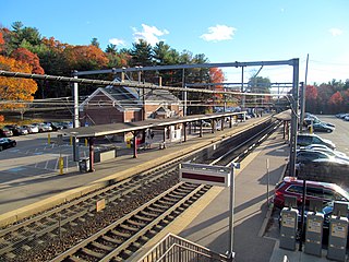
<span class="mw-page-title-main">Sharon station</span> Railway station in Sharon, Massachusetts, US

Sharon station is an MBTA Commuter Rail station in Sharon, Massachusetts. It serves the Providence/Stoughton Line. The station has two separate entrances for inbound trains to Boston and for outbound trains to Providence and beyond. New platforms were constructed in 2014 to make the station accessible.
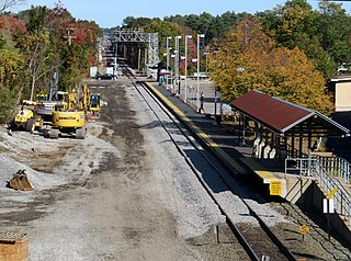
<span class="mw-page-title-main">Norfolk station (MBTA)</span> Rail station in Norfolk, Massachusetts, US

Norfolk station is an MBTA Commuter Rail station in Norfolk, Massachusetts, served by the Franklin/Foxboro Line. The station has one platform which serves a single track, with a mini-high section for accessibility. The Norfolk County Railroad opened through the North Wrentham village of Wrentham in 1849. A branch line to Medway was open from 1852 to 1864. The station was renamed Norfolk along with the town in 1870. Several different railroads operated the line, with the New York, New Haven and Hartford Railroad running it for much of the 20th century. Massachusetts Bay Transportation Authority (MBTA) subsidies began in 1966, and the agency bought the line in 1973. The mini-high platform was added in 1990.

<span class="mw-page-title-main">Middleborough/Lakeville station</span> Commuter rail station in Lakeville, Massachusetts, US

Middleborough/Lakeville station is an MBTA Commuter Rail station in Lakeville, Massachusetts, just south of the Middleborough border. It is the southern terminus of the Middleborough/Lakeville Line; it is also an intermediate stop for seasonal CapeFlyer service to Cape Cod. Middleborough/Lakeville has a single full-length high-level side platform serving the line's single track.

<span class="mw-page-title-main">Prides Crossing station</span> Former railway station in Beverly, Massachusetts

Prides Crossing station is a former MBTA Commuter Rail station on the Newburyport/Rockport Line, located in the village of Prides Crossing in Beverly, Massachusetts. It was opened by the Eastern Railroad as a flag stop in the mid-19th century. A stick style wooden station building was constructed around 1880 as wealthy residents built summer homes in the area. The Eastern Railroad was acquired in 1885 by the Boston and Maine Railroad (B&M), which operated commuter service to Prides Crossing until the Massachusetts Bay Transportation Authority (MBTA) took over in the 1970s. Prides Crossing was reduced to peak-hour-only service in 1981. It was temporarily closed in December 2020 because of low ridership and a lack of accessibility, with the closure becoming indefinite in April 2021. The former station building, not used by the railroad since the mid-20th century, is occupied by a private business.

<span class="mw-page-title-main">Windsor Gardens station</span> Railway station in Norwood, Massachusetts, US

Windsor Gardens station is a Massachusetts Bay Transportation Authority (MBTA) Franklin/Foxboro Line station in southern Norwood, Massachusetts. The station has a single side platform serving a single track; it is not accessible. The only entrance to the station is from an adjacent apartment complex; use of the station is not restricted to residents of the complex, though there is no public parking.
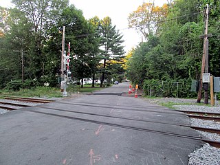
<span class="mw-page-title-main">Hastings station (MBTA)</span> Former railway station in Weston, Massachusetts

Hastings station was an MBTA Commuter Rail Fitchburg Line station in Weston, Massachusetts. The station had a small parking area but no platforms; passengers boarded trains from the Viles Street grade crossing. It was originally opened in the 1890s to serve the adjacent Hook & Hastings organ factory. The factory closed in 1935, but the station remained open with limited service. It was temporarily closed by the Massachusetts Bay Transportation Authority (MBTA) in December 2020 due to its low ridership and lack of accessibility; indefinite closure became effective in April 2021.
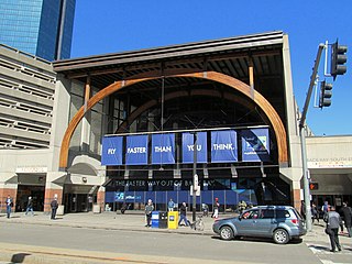
<span class="mw-page-title-main">Back Bay station</span> Railway station in Boston, Massachusetts, US

Back Bay station is an intermodal passenger station in Boston, Massachusetts. It is located just south of Copley Square in Boston's Back Bay and South End neighborhoods. It serves MBTA Commuter Rail and MBTA subway routes, and also serves as a secondary Amtrak intercity rail station for Boston. The present building, designed by Kallmann McKinnell & Wood, opened in 1987. It replaced the New Haven Railroad's older Back Bay station – which opened in 1928 as a replacement for an 1899-built station – as well as the New York Central's Huntington Avenue and Trinity Place stations which had been demolished in 1964.
References

  1. "Transit Ridership Report: Fourth Quarter 2022" (PDF). American Public Transportation Association. March 1, 2023. p. 5.
  2. "Ridership and Service Statistics" (PDF) (14th ed.). Massachusetts Bay Transportation Authority. 2014.
  3. "Commuter Rail Safety and Resiliency Program". Massachusetts Bay Transportation Authority. Archived from the original on November 2, 2022.
  4. "Commuter Rail Fare Zones" (PDF). Massachusetts Bay Transportation Authority. March 23, 2021.
  5. Central Transportation Planning Staff (2019). "2018 Commuter Rail Counts". Massachusetts Bay Transportation Authority.
  6. 1 2 3 4 5 6 Medeiros, Dan (September 29, 2023). "South Coast Rail passenger service is being delayed. Here's why, explained in 60 seconds". The Herald News. Archived from the original on September 30, 2023.
  7. 1 2 3 4 5 "South Coast Rail Full Build (Stoughton Electric)". Massachusetts Department of Transportation.
  8. Copeland, Dave (March 19, 2020). "City Officials Plan South Salem MBTA Commuter Rail Stop". Salem Patch. Retrieved June 7, 2021.
  9. Vaccaro, Adam (December 2, 2017). "Transit station delayed for big Mass. Pike project". Boston Globe.
  10. 1 2 3 4 5 6 7 Belcher, Jonathan. "Changes to Transit Service in the MBTA district" (PDF). Boston Street Railway Association.
  11. Humphrey, Thomas J.; Clark, Norton D. (1985). Boston's Commuter Rail: The First 150 Years. Boston Street Railway Association. ISBN   9780685412947.