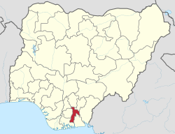
Arochukwu Local Government Area, sometimes referred to as Arochuku or Aro Oke-Igbo, is the third largest local government area in Abia State in southeastern Nigeria and homeland of the Igbo subgroup, Aro people.

The Nigerian National Assembly delegation from Abia comprises three Senators representing Abia Central, Abia South, and Abia North, and eight Representatives representing Ikwuano/Umuahia North/Umuahia South, Bende, Isuikwato/Umunneochi, Arochukwu/Ohafia, Aba North/Aba South, Ukwa East/Ukwa West, Isiala Ngwa North/South and Obingwa/Osisioma/Ugbunagbo.
Ohafia is an Igbo town in the Ohafia local government area (LGA) in Abia State, Nigeria. It is an Igbo speaking region. The ancestral capital of Ohafia town is the centrally located village of Elu. Ohafia Local Government Area, is an administrative jurisdiction assigned by the Nigeria Government, which covers the entire Ohafia villages and other Clans such as Abiriba and Nkporo, with its Administrative Headquarters at Ebem Ohafia.
The Presbyterian Church of Nigeria is a church in Nigeria and subscribes to the Westminster Confession of Faith.
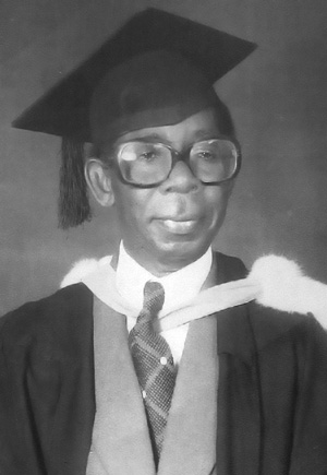
Dick W. Emuchay, also referred to as "Sir D. W. Emuchay", was a British-Nigerian medical doctor and administrator. He served as the first chairman of the Public Service Commission of the East Central State. In 1981, Samuel Onunaka Mbakwe, Governor of Imo State, appointed Emuchay as the Pro-Chancellor and Chairman Governing Council of the newly created Imo State University, later Abia State University He served in that position until 1985. He is reputed to have set up the first privately run rural hospital, when in 1961 he set up a 180-bed cottage hospital in his home town of Azumini, in Ukwa East, Abia State.
Mao Arukwe Ohuabunwa is a Nigerian politician, businessman and a former Senator who represented Abia North Senatorial District in the 8th National Assembly having served in the 4th and 5th National Assembly as Member representing Arochukwu/Ohafia constituency of Abia State under the Peoples Democratic Party between 1999 and 2007.
The Anglican Province of Aba is one of the 14 ecclesiastical provinces of the Church of Nigeria. It comprises 9 dioceses:
The South East is the one of the six geopolitical zones of Nigeria representing both a geographic and political region of the country's inland southeast. It comprises five states – Abia, Anambra, Ebonyi, Enugu, and Imo.
The 2019 Abia State gubernatorial election occurred on March 9, 2019. Incumbent PDP Governor Okezie Ikpeazu won re-election for a second term, defeating APC's Uchechukwu Sampson Ogah, and several minor party candidates. The major contenders for the race signed a peace accord agreement in January 2019.
The 2023 Abia State gubernatorial election took place on 18 March 2023, to elect the Governor of Abia State, concurrent with elections to the Abia State House of Assembly as well as twenty-seven other gubernatorial elections and elections to all other state houses of assembly. The election, which was postponed from its original 11 March date, was held three weeks after the presidential election and National Assembly elections. Incumbent PDP governor Okezie Ikpeazu was term-limited and could not seek a third term. Alex Otti, a banker, gained the office for the Labour Party by a margin of victory over first runner-up and PDP nominee—Okey Ahiwe, the former chief of staff to Ikpeazu.
The 2019 Nigerian House of Representatives elections in Abia State was held on February 23, 2019, to elect members of the House of Representatives to represent Abia State, Nigeria.
The 2019 Abia State House of Assembly election was held on March 9, 2019, to elect members of the Abia State House of Assembly in Nigeria. All the 24 seats were up for election in the Abia State House of Assembly.

The 2023 Nigerian Senate elections in Abia State will be held on 25 February 2023, to elect the 3 federal Senators from Abia State, one from each of the state's three senatorial districts. The elections will coincide with the 2023 presidential election, as well as other elections to the Senate, and elections to the House of Representatives; with state elections being held two weeks later. Primaries were held between 4 April and 9 June 2022.
The 2023 Abia State House of Assembly election was take place on 18 March 2023, to elect members of the Abia State House of Assembly. The election was held concurrent with the state gubernatorial election as well as twenty-seven other gubernatorial elections and elections to all other state houses of assembly. It was held three weeks after the presidential election and National Assembly elections.
The 2023 Nigerian presidential election in Abia State was held on 25 February 2023 as part of the nationwide 2023 Nigerian presidential election to elect the president and vice president of Nigeria. Other federal elections, including elections to the House of Representatives and the Senate, were also held on the same date while state elections were held two weeks afterward on 11 March.
The 2023 Nigerian House of Representatives elections in Abia State was held on 25 February 2023, to elect the 3 House of Representatives members from Abia State, one from each of the state's three senatorial districts. The elections will coincide with the 2023 presidential election, as well as other elections to the House of Representatives and elections to the Senate; with state elections being held two weeks later. Primaries were held between 4 April and 9 June 2022.
The Abia State elections in 2023 were held on 25 February, 11 March, and 28 April 2023. As part of the nationwide election, the state voted for President and Vice President on 25 February. Additionally, elections for the Senate and the House of Representatives were held on the same day. On 11 March, the election for Governor of Abia State took place alongside elections to the state House of Assembly. Local government elections were scheduled for 28 April.
Kelechi Onuzuruike is a Nigerian politician. He is the Former Deputy Chief Whip of the Abia State House of Assembly. He formerly represented Umuahia North state constituency in the Abia State House of Assembly.
Ndoki also known as Ọkwa are a tribe of Igbo people that are located at the hinterland of Igboland and coastal region of Bonny and Opobo.