Kakkera is a TMC in the southern state of Karnataka, India. Administratively, it is in the Shorapur taluka of Yadgir district in Karnataka state.
Kodekal (Kodigal) is a panchayat village in the southern state of Karnataka, India. It is located in the Hunasgi Taluka of Yadgir district in Karnataka. Kodekal is 8.5 km by road north-northeast of Jogandabhavi, and 4 km by road northwest of Bardevanhal, across the Dhon River.

Wadgera is a taluka panchayat in the southern state of Karnataka, India. Administratively, Wadgera is in the Yadgir district in Karnataka. It was created 2017 out of the southern portion of Shahapur Taluka. The administrative center is the village of Wadgera, 23 km by road south of the City of Yadgir and 39 km by road southeast of the town of Shahapur. The nearest rail station and the nearest railhead are in Yadgir.
Yergol is a panchayat village in the southern state of Karnataka, India. It is located in the Yadgir Taluka of Yadgir district in Karnataka. It has a famous temple of Shri Gavisiddeshwara Samsthana Matha, Sanji Bheemaraya Devastana, Sri Ramachandra Tirtha Brindavana of Uttaradi Matha, Ramalingeshwara Devastana.
A. Kalenahalli is a village in the southern state of Karnataka, India. For revenue and land management purposes it is under Dandiganahalli Hobli, of Channarayapatna Taluka of Hassan District in Karnataka state; for other administrative and governmental purposes it is under Kumbenahalli gram panchayat of Channarayapatna Taluka.
Abbihalli is a village in the southern state of Karnataka, India. It is located in the Mulbagal taluk of Kolar district in Karnataka.
Achampalli (Mulbagal) is a village in the southern state of Karnataka, India. It is located in the Mulbagal taluk of Kolar district in Karnataka.
Achola is a village in the southern state of Karnataka, India. Administratively, Achola is under Akera B. gram panchayat, Yadgir Taluka of Yadgir District in Karnataka.
Adwadgi is a village in the southern state of Karnataka, India. Administratively, Adwadgi is under Sugooru gram panchayat, Shorapur Taluka of Yadgir district in Karnataka. The village of Adwadgi is 3 km (1.9 mi) by road northeast of the village of Sugur and 7.5 km (4.7 mi) by road south of the village of Hemnoor. The nearest railhead is in Yadgir.
Agara (Malur) is a village in the southern state of Karnataka, India. It is located in the Malur taluk of Kolar district in Karnataka.

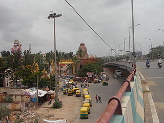
Agara Bangalore is a panchayat village in the southern state of Karnataka, India. It is located in the Bangalore South taluk of Bangalore Urban district in Karnataka, on Outer Ring Road, near Koramangala and HSR Layout. The Agara Bus Stop connects Koramangla with ITPL, Varthur, etc. Agara is visited for its Oriyan temple, Agara Lake, Ayyappa Temple & Aanjaneya Temple. After winning the Sreerangapattana war, the British moved their army to Banaglore. In British times, it was one of the biggest army cantonments in south Asia. Madras Engineer Groups was operating from Agara.
Agastihal is a small village in the southern state of Karnataka, India. Administratively Agastihal is under Gundgurthi panchayat village, Wadgera Taluka of Yadgir district in Karnataka. Agastihal is 2.7 km by road southwest of Gundgurthi, and 7 km by road northeast of Hattigudur.
Agnihal is a village in the southern state of Karnataka, India. Administratively, it is under Gonal panchayat village, Wadgera Taluka of Yadgir district in Karnataka.
Agthirth is a village in the southern state of Karnataka, India. Administratively, it is under Agni gram panchayat, Shorapur Taluka of Yadgir District in Karnataka. Agthirth is 1.5 km by road east of the village of Agni, and 8.5 km by road west of the village of Baichbal.
Ainapur is a village in the southern state of Karnataka, India. Administratively, Ainapur is under the Yaktapur gram panchayat, Shorapur Taluka of Yadgir District in Karnataka.
Agara may refer to a place in:

Tayalur is a panchayat village in the southern state of Karnataka, India famous for dargah of Sufi saint Hazrat shaik mohiuddin shah khadri shuttari R.A. It is located in the Mulbagal Taluka of Kolar district in Karnataka.
Kolhar is a Taluk of vijayapura district in Bombay Karnataka, "Reports of National Panchayat Directory: Village Panchayat Names of Basavana Bagewadi, Bijapur, Karnataka". Ministry of Panchayati Raj, Government of India. Archived from the original on 13 November 2011.</ref> in the southern state of Karnataka, India. It is located in the Kolhar taluka of Bijapur district in Karnataka.
Wadgera is a panchayat village in the southern state of Karnataka, India. Administratively, Wadgera is under the Jevargi Taluka, Kalaburagi district, Karnataka. Wadgera is 5 km by road north of the village of Hadnoor and 64 km by road southwest of the taluka headquarters village of Jevargi.


