
Kolar district is a district in the state of Karnataka, India.
Bengaluru Urban district is the most densely populated of the thirty-one districts that comprise the Indian state of Karnataka. It is surrounded by the Bangalore Rural district on the east and north, the Ramanagara district on the west and the Krishnagiri district of Tamil Nadu on the south. Bangalore Urban district came into being in 1986, with the partition of the erstwhile Bangalore district into Bangalore Urban and Bangalore Rural districts. Bangalore Urban has three taluks : Bangalore City, Yelahanka and Anekal. It has seventeen hoblies, 872 villages, eleven rural habitations, five towns, one tier-three city and one tier-one city, administered by ninety-six Village Panchayats , ninety-seven Taluk Panchayats , five Town Municipal Councils (Purasabes), one City Municipal Council (Nagarasabe) and one City Corporation .
Malur is a town and taluk headquarters in Kolar district of the Indian state of Karnataka. It is 30 km from Kolar, the district headquarters, and about 50 km from Bangalore. It is accessible from Bangalore by road and railways. The Chennai Central-Bangalore City line passes through Malur, with trains to various parts of India, including Tirupati, Chennai, Kochi, Trivandrum, Patna and Calcutta.
Bangalore Rural district is one of the 31 districts in Karnataka, India. It was formed in 1986, when Bangalore District was divided into Bangalore Rural and Bangalore Urban. Presently in Bangalore Rural district, there are 4 talukas: Devanahalli, Nelamangala, Doddaballapura, Hoskote. It has 20 hoblies, 294 villages, 3 towns, 2 tier-three cities, administered by 66 Village Panchayats , 3Town Municipal Councils (Purasabes) and 2 City Municipal Councils (Nagarsabes).

Bijapur district, officially known as Vijayapura district, is a district in the state of Karnataka in India. The city of Bijapur is the headquarters of the district, and is located 530 km northwest of Bangalore. Bijapur is well known for the great monuments of historical importance built during the Adil Shahi dynasty.

Udupi district is an administrative subdivision in the Karnataka state of India, with the district headquarters in the city of Udupi. It is situated in the Canara old north Malabar coastal region. There are seven taluks, 233 villages and 21 towns in Udupi district. The three northern tehsils of Udupi, Kundapur and Karkala, were partitioned from Dakshina Kannada district to form Udupi district on 25 August 1997. Moodabidri was officially declared as new tehsil (taluk) in 2018.

Kolar or Kolara is a city in the Indian state of Karnataka. It is the headquarters of Kolar district. The city is known for its milk production and gold mines. It is also known for the Someshwara and Kolaramma temples.

Davanagere district is an administrative district of Karnataka state in India. It is the centre of Karnataka. The city of Davanagere is the district headquarters. It had a population of 1,643,494 of which 32.31% was urban as of 2011. This district was separated from Chitradurga district in 1997 by the then Chief minister of Karnataka J. H. Patel including Chennagiri and Honali Taluks Shimoga district.
Gangavathi is a city, municipality and taluk in the Koppal district of the Indian state of Karnataka. It is one of the main commercial hubs in the Kalyana-Karnataka region. It is also the largest city, in terms of area and population, in the Koppal district.
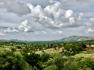
Hosanagara is a panchayat town in Shimoga district in the Indian state of Karnataka. It is nested in western ghats of India. The World Cattle Conference with main emphasis on cow was held in month of April 2007 in Hosanagar. The different uses of cow were exhibited. Near Hosanagar there is a mutt named Sri Ramachandrapura Math, 6 km from the town.

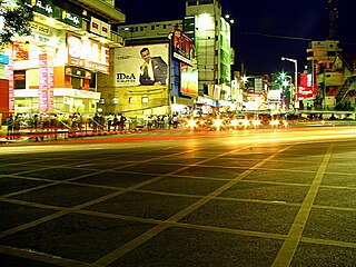
Krishnarajapuram (Krishnarajapura) often abbreviated as K R Puram or K R Pura, is an eastern suburb of Bangalore, the capital of the Indian state of Karnataka. It is one of the zones of BBMP. It is 15 km (9.3 mi) from Bangalore City railway station. The Old Madras Road passes through this locality. A lake called 'Vengayyana Lake' is in the heart of this area. The Yele Mallappa Shetty Lake near Medahalli, situated just outside the eastern limits of KR Pura, is one of the largest lakes in Bangalore.

Srinivaspur is a town located in the Kolar district of Karnataka state, India. The latitude 13.33 and longitude 78.22 are the geocoordinate of the Srinivaspur. Bengaluru is the nearby state capital for Srinivaspur town. It is located around 106 km away from Bengaluru and 80 km from BIAL. The other surrounding state capitals are Chennai 225.9 km., Pondicherry 233.2 km., Hyderabad 453.4 km.,

Channarayapatna or Channarayapattana is a town and Taluk headquarters in Hassan district of Karnataka, India. It lies on the Bangalore-Mangalore National Highway-75 in Karnataka, India. Jain pilgrimage Shravanabelagola is a famous site in the taluk. Channarayapatna has major railway connection from Bangalore to Mangalore, Karwar, and Mysore.
Basavana Bagewadi is a municipality and taluka in Bijapur district in the state of Karnataka, India.
Koodali is a census town and grama panchayat in Thalassery taluk of Kannur district in Kerala state, India. Koodali is located 15.5 km (9.6 mi) east of Kannur city on Kannur-Mattanur road.

Badiyadka officially known as "Badiadka" is a town and gram panchayat in the Kasaragod district, state of Kerala, India.
Kuruburu is a village in Chintamani Taluk in the Chikballapur district in the state of Karnataka, India.

Hanamasagar (Halasagar) is a village in the southern state of Karnataka, India. It is located in Vijayapur taluk, of Vijayapur district, Karnataka and is nearly 40km from the district headquarter Vijayapur. It is a small village which is a pilgrim, having the post office at Kambagi and Babaleshwar hobli.
Bijapur Taluk, officially Vijayapura Taluka, is a taluka in the Indian state of Karnataka. It is located in the Bijapur district. The administrative centre for Bijapur Taluka is in the city of Bijapur. The taluka is located in the southwest quadrant of the district. In the 2011 census there were forty-six panchayat villages in Bijapur Taluka. The main river in the taluka is the Don River.
Araleri is a gram panchayat village in Karnataka, India. Araleri is located in Malur Taluk of Kolar district which is also one of the constituency of Kolar Jilla Panchayat and Malur Taluk Panchayat, at a distance of 6 km from the town of Malur and 32 km from Kolar.
