
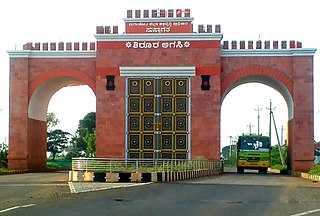
Kolar district is a district in the state of Karnataka, India.

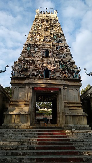
Puttur (Pronunciation:) is a city in Dakshina Kannada district of Karnataka state in India. The Puttur Shree Mahalingeshwara Temple is located here.

Belagavi district, formerly also known as Belgaum district, is a district in the state of Karnataka, India. The district is known as the sugar bowl of Karnataka with 150,000 hectares being used for commercial production. It has overtaken Mandya district in sugarcane production over the last decade. The city of Belgaum (Belagavi) is the district headquarters in Belagavi district. It houses the Second legislative building, where the Karnataka Legislature holds session once a year. The district is famous for its native sweet, Kunda. According to the 2011 Census of India, it has a population of 4,779,661, of which 24.03% live in urban areas, making it the second most populous district in Karnataka, after Bangalore Urban. The district has an area of 13,415 km2 (5,180 sq mi), making it the largest district in terms of size in Karnataka It is bounded by Kolhapur District and Sangli district of Maharashtra state on the west and north, on the northeast by Bijapur district, on the east by Bagalkot district, on the southeast by Gadag district, on the south by Dharwad and Uttara Kannada districts, and on the southwest by the state of Goa.

Gadag district is a district in the state of Karnataka, India. It was formed in 1997, when it was split from Dharwad district. As of 2011, it had a population of 1064570. The overall population increased by 13.14 percent from 1991 to 2001. Gadag district borders Bagalkot district on the north, Koppal district on the east, Vijayanagara district on the southeast, Haveri district on the southwest, Dharwad district on the west and Belgaum District on the northwest. It is famous for the many monuments from the Western Chalukya Empire. It has seven talukas: Gadag, Gajendragad, Ron, Shirhatti, Nargund, Lakshmeshwar and Mundargi.
Bagalkote, is a city in the state of Karnataka, India, which is also the headquarters of Bagalkot district. It is situated on branch of River Ghataprabha, The population of the urban agglomeration was 111,933 according to the provisional results of 2011 national census of India, the city is spread over an area of 49.06 square kilometres (18.94 sq mi) with an average elevation of 532 m (1,745 ft) above MSL.
Hulkuru or Guttahalli is a small village in the Kolar Gold Fields Taluk of Kolar district in Karnataka, India. It is situated about 15 kilometers from Kolar Gold Fields.

Vimanapura or Baiyyappanahalli Vimanapura is an eastern suburb of Bangalore in Karnataka in India. It is so called because it is near Bangalore HAL airport. Vimanapura houses many of the HAL offices and the HAL hospital. The busy Old Airport Road goes through it.
Ramanagar is a village in Belgaum district of Karnataka, India.

Vijayanagara district is a district in the southern Indian state of Karnataka, located in the Kalyana-Karnataka region.
Baiyyappanahalli or New Baiyyappanahalli Extension is one of the neighbourhoods in Bengaluru,located in the eastern part of the city. It is part of C. V. Raman Nagar in East Bengaluru. The area is a transport hub and popular for Baiyappanahalli metro station,Sir M. Visvesvaraya Terminal and Baiyyappanahalli railway station.
Baiyyappanahalli Manavarthe Kaval or Old Baiyyappanahalli is one of the early settlements in Bengaluru. It is part of C. V. Raman Nagar Assembly constituency in East Bengaluru. This former village was included in the Bangalore Mahanagara Palike on 7 December 1995.
Ramnagar is a village in the southern state of Karnataka, India. It is situated in Joida Taluk of Uttara Kannada. Ramnagar is the junction where roads coming from Dharwad, Belagavi and Anmod (Goa) meet. Ramnagar is at the distance of four Kilometre from Londa. Ramnagar is basically rehabilitation area for the people displaced by Hydro electric projects (Dams) built across river Kali in the state of Karnataka.Few shops and road side eateries are there in Ramnagar. It has a Post office, branch of nationalised bank, Police station and Industrial training Institute(I.T.I). There is also NWKRTC bus stand at Ramnagar. Most of the NWKRTC,KSRTC,KKRTC(formerly NEKRTC) buses coming from different places of Karnataka state going towards Goa state have a stop here.
Guttahalli is a small village in the Kolar Gold Fields Taluk of Kolar district in Karnataka, India. It is situated about 4 kilometers from Kolar Gold Fields, forming the outskirts of the city.
Guttahalli is a small village in the Bangarapet Taluk of Kolar district in Karnataka, India. It is situated about 7 kilometers from Bangarapet.
Guttahalli is a small village in the Bangarapet Taluk of Kolar district in Karnataka, India. It is situated about 7 kilometers from Bangarapet.
Guttahalli is a small village in the Kolar Taluk of Kolar district in Karnataka, India. It is situated about 25 kilometers from Kolar.
Guttahalli is a small village in the Kolar Taluk of Kolar district in Karnataka, India. It is situated about 15 kilometers from Kolar.
Guttahalli is a small village in the Chintamani Taluk of Chikkaballapura district in Karnataka, India. It is situated about 9 kilometers from Chintamani.
Guttahalli is a small village in the Chintamani Taluk of Chikkaballapura district in Karnataka, India. It is situated about 12 kilometers from Chintamani.
N. G. Hulkur is a village in the Kolar Gold Fields Taluk of Kolar district in Karnataka, India. It is situated about 25 kilometers from Kolar Gold Fields, situated very close to Andhra Pradesh border.

