Albert County, New Brunswick

Last updated

Albert County
NB Alma2 tango7174.jpg
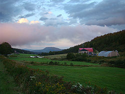
Farm landscape near Alma
Map of New Brunswick highlighting Albert County.png
Location within New Brunswick
Coordinates: 45°49′N64°51′W / 45.82°N 64.85°W / 45.82; -64.85
Country Canada
Province New Brunswick
Established1845
Area
[1]
  Land1,806.23 km2 (697.39 sq mi)
Population
 (2021) [1]
  Total
30,749
  Density17.0/km2 (44/sq mi)
  Pop 2016-2021
Increase2.svg 5.5%
  Dwellings
13,476
Time zone UTC-4 (AST)
  Summer (DST) UTC-3 (ADT)
Area code 506

Albert County (2021 population 30,749) [1] is New Brunswick's third-youngest county, located on the Western side of the Petitcodiac River on the Chignecto Bay in the Bay of Fundy; the shire town is Hopewell Cape. The county was established in 1845 from parts of Westmorland County and Saint John County, and named after Prince Albert. [2] Since the abolition of county municipal governments in 1967, its best-known use is as a census division.

Contents

The mineral albertite was discovered a few miles away in 1849, giving rise to Albert Mines. [3]

Census subdivisions

Municipalities

There are four municipalities within Albert County (listed by 2021 population): [4]

Official NameStatusArea km2PopulationParish
Riverview Town34.1020,584 Coverdale
Hillsborough Village12.811,348 Hillsborough
Riverside-Albert Village3.39348 Hopewell
Alma Village47.64282 Alma

Parishes

The county's six parishes serve as rural census subdivisions, which do not include the municipalities within them (listed by 2021 population): [4]

Official NameArea km2PopulationmunicipalitiesUnincorporated communities
Coverdale 236.004,766 Riverview (town) Colpitts Settlement / Five Points / Grub Road / Lower Coverdale / Lower Turtle Creek / Middlesex / Middle Coverdale / Nixon / Pine Glen / Price / Salisbury Back Road / Stoney Creek / Synton / Turtle Creek / Upper Coverdale
Hillsborough 304.031,397 Hillsborough (village) Albert Mines / Baltimore / Beech Hill / Berryton / Caledonia Mountain / Dawson Settlement / Edgetts Landing / Isaiah Corner / Osborne Corner / Rosevale / Salem / Shenstone / Steeves Mills / Steevescote / Weldon
Elgin 519.541,064 Church Hill / Churchs Corner / Elgin / Ferndale / Forest Hill / Goshen / Gowland Mountain / Harrison Settlement / Hillside / Little River / Mapleton / Meadow / Midland / Parkindale / Pleasant Vale / Prosser Brook / Ross Corner
Hopewell 149.14597 Riverside-Albert (village) Cape Station / Chemical Road / Chester / Curryville / Demoiselle Creek / Hopewell Cape / Hopewell Hill / Lower Cape / McGinleys Corner / Memel Settlement / Mountville / Shepody
Harvey 276.85358 Beaver Brook / Brookville / Cape Enrage / Derrys Corner / Germantown / Harvey / Harvey Bank / Little Ridge / Midway / New Horton / New Ireland / Upper New Horton / Waterside / West River
Alma 222.745 [a] Alma (village) Mitchells Corner / Teahans Corner

Demographics

Historical Census Data - Albert County, New Brunswick
YearPop.±%
1851 6,313    
1861 9,444+49.6%
1871 10,672+13.0%
1881 12,329+15.5%
1891 10,971−11.0%
1901 10,925−0.4%
1911 9,691−11.3%
1921 8,607−11.2%
1931 7,679−10.8%
1941 8,421+9.7%
1951 9,910+17.7%
1956 10,943+10.4%
1961 12,485+14.1%
1966 13,944+11.7%
1971 16,307+16.9%
1976 22,159+35.9%
1981 23,632+6.6%
1986 N/A    
1991 25,640    
1996 26,492+3.3%
2001 26,749+1.0%
2006 27,562+3.0%
2011 28,846+4.7%
2016 29,158+1.1%
2021 30,749+5.5%
[5] [1]

As a census division in the 2021 Census of Population conducted by Statistics Canada, Albert County had a population of 30,749 living in 12,913 of its 13,476 total private dwellings, a change of 5.5% from its 2016 population of 29,158. With a land area of 1,806.23 km2 (697.39 sq mi), it had a population density of 17.0/km2 (44.1/sq mi) in 2021. [1]

Canada census – Albert community profile
2021 2016 2011
Population30,749 (+5.5% from 2016)29,158 (+1.1% from 2011)28,846 (+4.7% from 2006)
Land area1,806.23 km2 (697.39 sq mi)1,807.88 km2 (698.03 sq mi)1,806.54 km2 (697.51 sq mi)
Population density17/km2 (44/sq mi)16.1/km2 (42/sq mi)16.0/km2 (41/sq mi)
Median age46.0 (M: 44.8, F: 47.2)45.0 (M: 44.0, F: 46.0)42.9 (M: 41.8, F: 43.9)
Private dwellings13,476 (total)  12,913 (occupied)13,111 (total) 12,573 (total) 
Median household income$77,500$66,521$60,952
References: 2021 [4] 2016 [6] 2011 [7]

Language

Canada Census Mother Tongue - Albert County, New Brunswick [5]
CensusTotal
English
French
English & French
Non-official languages
YearResponsesCountTrendPop %CountTrendPop %CountTrendPop %CountTrendPop %
2016
28,930
26,105Decrease2.svg 0.2%90.24%1,995Increase2.svg 8.1%6.90%235Increase2.svg 17.5%0.81%535Increase2.svg 30.5%1.85%
2011
28,590
26,135Increase2.svg 4.0%91.41%1,845Increase2.svg 17.1%6.45%200Increase2.svg 207.7%0.70%410Decrease2.svg 16.3%1.43%
2006
27,260
25,130Increase2.svg 2.0%92.19%1,575Increase2.svg 9.4%5.78%65Decrease2.svg 43.5%0.24%490Increase2.svg 78.2%1.80%
2001
26,470
24,640Decrease2.svg 0.1%93.09%1,440Increase2.svg 10.8%5.44%115Increase2.svg 15.0%0.43%275Increase2.svg 44.7%1.04%
1996
26,255
24,665n/a93.94%1,300n/a4.95%100n/a0.38%190n/a0.72%

Access Routes

Highways and numbered routes that run through the county, including external routes that start or finish at the county limits: [8]

Protected areas and attractions

Sunset over the Bay of Fundy near Waterside NB Fundy5 tango7174.jpg
Sunset over the Bay of Fundy near Waterside

Notable people

See also

Notes

  1. Population is rounded in census for privacy reasons.

References

  1. 1 2 3 4 5 "Population and dwelling counts: Canada and census divisions". Statistics Canada. February 9, 2022. Retrieved April 3, 2022.
  2. Hamilton, William Baillie (1996). Place Names of Atlantic Canada. University of Toronto Press. p. 43. ISBN   0-8020-7570-3.
  3. Hamilton, William (1978). The Macmillan Book of Canadian Place Names. Toronto: Macmillan. p. 70. ISBN   0-7715-9754-1.
  4. 1 2 3 "2021 Community Profiles". 2021 Canadian census . Statistics Canada. February 4, 2022. Retrieved October 19, 2023.
  5. 1 2 Statistics Canada: 1996, 2001, 2006, 2011 census
  6. "2016 Community Profiles". 2016 Canadian census . Statistics Canada. August 12, 2021. Retrieved September 3, 2019.
  7. "2011 Community Profiles". 2011 Canadian census . Statistics Canada. March 21, 2019. Retrieved March 31, 2014.
  8. Atlantic Canada Back Road Atlas ISBN   978-1-55368-618-7