
A petroglyph is an image created by removing part of a rock surface by incising, picking, carving, or abrading, as a form of rock art. Outside North America, scholars often use terms such as "carving", "engraving", or other descriptions of the technique to refer to such images. Petroglyphs, estimated to be 20,000 years old are classified as protected monuments and have been added to the tentative list of UNESCO's World Heritage Sites. Petroglyphs are found worldwide, and are often associated with prehistoric peoples. The word comes from the Greek prefix petro-, from πέτρα petra meaning "stone", and γλύφω glýphō meaning "carve", and was originally coined in French as pétroglyphe.

Petit Jean State Park is a 3,471-acre (1,405 ha) park in Conway County, Arkansas managed by the Arkansas Department of Parks and Tourism. It is located atop Petit Jean Mountain adjacent to the Arkansas River in the area between the Ouachita Mountains and Ozark Plateaus.
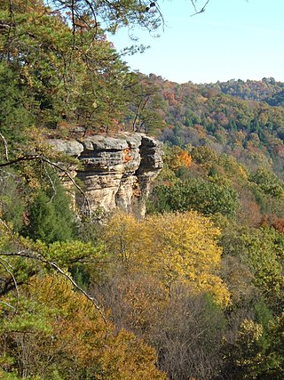
The Hocking Hills is a deeply dissected area of the Allegheny Plateau in Appalachian Ohio, primarily in Hocking County, that features cliffs, gorges, rock shelters, and waterfalls. The relatively extreme topography in this area is due to the Blackhand Sandstone, a particular formation that is thick, hard and weather-resistant, and so forms high cliffs and narrow, deep gorges.

In archaeology, rock art is human-made markings placed on natural surfaces, typically vertical stone surfaces. A high proportion of surviving historic and prehistoric rock art is found in caves or partly enclosed rock shelters; this type also may be called cave art or parietal art. A global phenomenon, rock art is found in many culturally diverse regions of the world. It has been produced in many contexts throughout human history. In terms of technique, the four main groups are:

Pictograph Cave is an area of three caves located 5 miles (8.0 km) south of Billings, Montana, United States, preserved and protected in the 23-acre (9.3 ha) Pictograph Cave State Park.

The Palatki Heritage Site is an archaeological site and park located in the Coconino National Forest, near Sedona, in Arizona, United States at approximately 34 55' 4"N, 111 53' 59"W. In the Hopi language Palatki means 'red house'.

Sydney rock engravings, or Sydney rock art, are a form of Australian Aboriginal rock art in the sandstone around Sydney, New South Wales, Australia, that consist of carefully drawn images of people, animals, or symbols. Many thousands of such engravings are known to exist in the Sydney region, although the locations of most are not publicised to prevent damage by vandalism, and to retain their sanctity, as they are still regarded as sacred sites by Indigenous Australians. There are two art environments in Sydney Basin, rock shelters and engraving sites.

Chumash rock art is a genre of paintings on caves, mountains, cliffs, or other living rock surfaces, created by the Chumash people of Southern California. Pictographs and petroglyphs are common through interior California, the rock painting tradition thrived until the 19th century. Chumash rock art is considered to be some of the most elaborate and plentiful rock art tradition in the region.

Devil's Den State Park is a 2,500-acre (1,000 ha) Arkansas state park in Washington County, near West Fork, Arkansas in the United States. The park was built by the Civilian Conservation Corps, beginning in 1933. Devil's Den State Park is in the Lee Creek Valley in the Boston Mountains, which are the southwestern part of The Ozarks. The park, with an 8 acres (3.2 ha) CCC-built lake, is open for year-round recreation, with trails for hiking, mountain biking and horseback riding. Devil's Den State Park also has several picnic areas, a swimming pool and cabins, with camping sites ranging from modern to primitive. Fossils of coral and crinoids can be found along the banks and within Lee Creek at Devil's Den State Park.

Seminole Canyon State Park and Historic Site is a state park in the U.S. state of Texas. It is located off U.S. Route 90, east of the Pecos River High Bridge, 9 miles (14 km) west of Comstock in Val Verde County. The park is conducive to camping, biking, bird watching, back packing and archeological study. Cave art and archeological artifacts date back to the earliest human habitation in the area. The park is part of the larger Seminole Canyon Archeological District on the National Register of Historic Places.
Brown Bluff is a rock art site in Washington County, Arkansas. The site consists of a prepared panel of sandstone extending some 80 metres (87 yd), on which have been painted pictographs in red. The site has been estimated to date to the Mississippian period, c. AD 1100–1600. The artwork is reminiscent of artwork found in the Arkansas River valley, and is one of the few places such artwork has been found in the western Ozark Mountains.
The Cooper's Bluff Site is a prehistoric panel of pictographs in Searcy County, Arkansas. Located under a sheltering overhang, it measures about 4.5 by 1.8 metres, and is accompanied by a scatter of prehistoric Native American artifacts. It is estimated to have been painted about 1500 CE.
The Fox Pictograph is a prehistoric rock art site in Stone County, Arkansas. Located near the community of Fox, it is one of two documented examples of rock art depicting humans in the state. It is a stick figure, painted in red pigment, with an unusual depiction of ear ornaments. The figure is about 127 centimetres (50 in) in height.
The Pictograph Cave is a prehistoric rock art site near Mountain View, Arkansas. It consists of a panel of painted art, most of which is abstract wavy lines similar to art found at Petit Jean State Park. It is one of the furthest-removed expressions of this category of artwork from the Petit Jean area, and was listed on the National Register of Historic Places in 1982 for its information and research potential.
The Serpent Cave is a prehistoric rock art site near Clarksville, Arkansas. It consists of a panel depicting a serpentine figure, a common motif in rock art of the Mississippian culture. Why a motif of that culture is found as far west as it is is unknown.

Chumash Indian Museum is a Native American Interpretive Center in northeast Thousand Oaks, California. It is the site of a former Chumash village, known as Sap'wi. It is located in Oakbrook Regional Park, a 432-acre park which is home to a replica of a Chumash village and thousand year-old Chumash pictographs. The pictographs by nearby Birthing Cave are not open to the public, but can be observed on docent-led tours. Chumash people inhabited the village 10,000 years ago.

The Ambadevi rock shelters are part of an extensive cave site, where the oldest yet known traces of human life in the central province of the Indian subcontinent were discovered. The site is located in the Satpura Range of the Gawilgarh Hills in Betul District of the Indian state of Madhya Pradesh, north of Dharul village in Amravati district of Maharashtra. Studies of various rock paintings and petroglyphs present in the caves suggest, that the Ambadevi rock shelters were inhabited by prehistoric human settlers since around 25,000 years ago. First discoveries of clusters of numerous rock shelters and caves were made by Vijay Ingole and his team beginning on 27 January 2007. Named after the nearby ancient Ambadevi Cave Temple, the site has also been referred to as the Satpura-Tapti valley caves and the Gavilgarh-Betul rock shelters. The Ambadevi rock shelters rank among the most important archaeological discoveries of the early 21st Century in India, on par with the 20th Century discovery of the Bhimbetka rock shelters.
Big Gyp Cave Pictograph site (14CM305) in Comanche County, Kansas, is an archeological site with pictographs in a cave. It was listed on the National Register of Historic Places in 1978.
