Related Research Articles

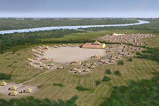
Angel Mounds State Historic Site, an expression of the Mississippian culture, is an archaeological site managed by the Indiana State Museum and Historic Sites that includes more than 600 acres of land about 8 miles (13 km) southeast of present-day Evansville, in Vanderburgh and Warrick counties in Indiana. The large residential and agricultural community was constructed and inhabited from AD 1100 to AD 1450, and served as the political, cultural, and economic center of the Angel chiefdom. It extended within 120 miles (190 km) of the Ohio River valley to the Green River in present-day Kentucky. The town had as many as 1,000 inhabitants inside the walls at its peak, and included a complex of thirteen earthen mounds, hundreds of home sites, a palisade (stockade), and other structures.

Spiro Mounds is an archaeological site located in present-day eastern Oklahoma that remains from an indigenous Indian culture that was part of the major northern Caddoan Mississippian culture. The 80-acre site is located within a floodplain on the southern side of the Arkansas River. The modern town of Spiro developed approximately seven miles to the south.

Millstone Bluff is a natural bluff in Pope County, Illinois, United States, located near the community of Glendale. Listed on the National Register of Historic Places because of its archaeological significance, Millstone Bluff is one of three National Register sites in Pope County, along with the Golconda Historic District and part of the Kincaid Mounds State Historic Site.

The Nodena site is an archeological site east of Wilson, Arkansas, and northeast of Reverie, Tennessee, in Mississippi County, Arkansas, United States. Around 1400–1650 CE an aboriginal palisaded village existed in the Nodena area on a meander bend of the Mississippi River. The Nodena site was discovered and first documented by Dr. James K. Hampson, archaeologist and owner of the plantation on which the Nodena site is located. Artifacts from this site are on display in the Hampson Museum State Park in Wilson, Arkansas. The Nodena site is the type site for the Nodena phase, believed by many archaeologists to be the province of Pacaha visited by Spanish explorer Hernando de Soto in 1542.

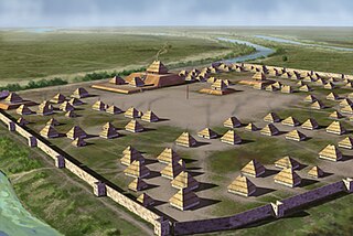
The Eaker site (3MS105) is an archaeological site on Eaker Air Force Base near Blytheville, Arkansas, that was declared a National Historic Landmark in 1996. The site is the largest and most intact Late Mississippian Nodena phase village site within the Central Mississippi Valley, with archaeological evidence indicating a palisaded village some 50 acres (20 ha) in size, with hundreds of structures. The site's major period of occupation was 1350–1450 CE, although evidence of occupation dates back to 600 CE. The site is also hypothesized to have been occupied by the Quapaw prior to a migration further south, after which they made contact with Europeans in the late 17th century.

The Menard–Hodges site (3AR4), is an archaeological site in Arkansas County, Arkansas. It includes two large platform mounds as well as several house mounds. It is the type site for the Menard phase, a protohistoric Mississippian culture group.

Parkin Archeological State Park, also known as Parkin Indian Mound, is an archeological site and state park in Parkin, Cross County, Arkansas. Around 1350–1650 CE an aboriginal palisaded village existed at the site, at the confluence of the St. Francis and Tyronza rivers. Artifacts from this site are on display at the site museum. The Parkin site is the type site for the Parkin phase, an expression of the Mississippian culture from the Late Mississippian period. Many archeologists believe it to be part of the province of Casqui, documented as visited by Spanish explorer Hernando de Soto in 1542. Archeological artifacts from the village of the Parkin people are dated to 1400–1650 CE.

The Kincaid Mounds Historic Site c. 1050–1400 CE, is a Mississippian culture archaeological site located at the southern tip of present-day U.S. state of Illinois, along the Ohio River. Kincaid Mounds has been notable for both its significant role in native North American prehistory and for the central role the site has played in the development of modern archaeological techniques. The site had at least 11 substructure platform mounds, and 8 other monuments.

The C.H. Nash Museum at Chucalissa is located on and exhibits excavated materials of the Mississippian culture archaeological site known as Chucalissa which means "abandoned house" in Chickasaw. The site is located adjacent to the T. O. Fuller State Park within the city of Memphis, Tennessee, United States. Chucalissa was designated National Historic Landmark in 1994 due to its importance as one of the best-preserved and major prehistoric settlement sites in the region.

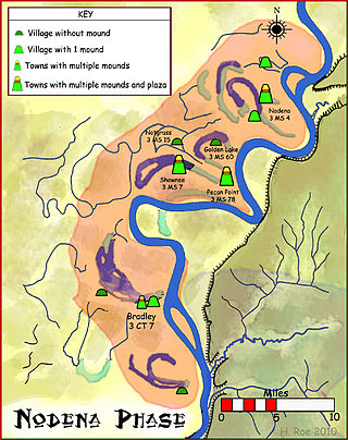
The Nodena phase is an archaeological phase in eastern Arkansas and southeastern Missouri of the Late Mississippian culture which dates from about 1400–1650 CE. The Nodena phase is known from a collection of villages along the Mississippi River between the Missouri Bootheel and Wapanocca Lake. They practiced extensive maize agriculture and artificial cranial deformation and were members of a continent wide trade and religious network known as the Southeastern Ceremonial Complex, which brought chert, whelk shells, and other exotic goods to the area.
Sand Gap is an unincorporated community in Freeman Township, Pope County, Arkansas, United States. Sand Gap is located at the junction of Arkansas highways 7 and 16.
The Roland Site is an archaeological site located on Dry Lake, an extinct channel of the White River in Arkansas County, Arkansas. It was inhabited intermittently from the beginning of the common era to late prehistoric times, but its most intensive inhabitation was by peoples of the Plum Bayou culture, in a time known as the Late Woodland period.
The Hughes Mound Site, (3SA11), is an archeological site in Saline County, Arkansas near Benton. The 4.5-acre (1.8 ha) is an important Caddoan Mississippian culture village center, at the northeastern frontier of that civilization. It is the only known platform mound site south of Benton on the Saline River. The site has not been dated, but artifacts found there are consistent with the Caddoan period; no contact-period artifacts have been found.

The Spikebuck Town Mound and Village Site is a prehistoric and historic archaeological site on Town Creek near its confluence with the Hiwassee River within the boundaries of present-day Hayesville, North Carolina. The site encompasses the former area of the Cherokee village of Quanassee and associated farmsteads. The village was centered on what is known as Spikebuck Mound, an earthwork platform mound, likely built about 1,000 CE by ancestral indigenous peoples during the South Appalachian Mississippian culture period.

Too-Cowee, was an important historic Cherokee town located near the Little Tennessee River north of present-day Franklin, North Carolina. It also had a prehistoric platform mound and earlier village built by ancestral peoples. As their expression of public architecture, the Cherokee built a townhouse on top of the mound. It was the place for their community gatherings in their highly decentralized society. The name translates to "pig fat" in English. British traders and colonists referred to Cowee as one of the Cherokee Middle Towns along this river; they defined geographic groupings based in relation to their coastal settlements, such as Charlestown, South Carolina.
Nununyi was a historic village of the Cherokee people in western North Carolina, located on the eastern side of the Oconaluftee River. Today it is within the boundaries of the present-day city of Cherokee in Swain County. It was classified by English traders and colonists as among the "Out Towns" of the Cherokee in this area east of the Appalachian Mountains.
Archeological Site 3NW79 is a prehistoric pictograph site in the Ozark-St. Francis National Forest, in Newton County, Arkansas. It consists of a panel of twenty figures, set in a sheltered area. It is expected to contribute to the understanding of Mississippian cultures that lived in the area c. 1000-1500 CE.
Archeological Site 3PP142 is a prehistoric rock art site in Pope County, Arkansas. The art at the site, which is on state-owned land, is believed to have been painted during the period of the Mississippian culture. The 11 drawings at this site are part of a larger collection within the state that are expected to improve the understanding of Mississippian religious practices during that time.
Archeological Site 3PP144 is a prehistoric rock art site in Pope County, Arkansas. The art at the site, which is Ozark-St. Francis National Forest, consists two drawings in black pigment, of unknown age. This site are part of a larger collection within the state that are expected to improve the understanding of how rock art in the Ozark Mountains region was made, and for what purpose.
Archeological Ste 3YE958 is a prehistoric rock art site in the Riverview Recreation Area of Dardanelle, Arkansas. The site consists of a rock panel that has been painted with nine figures in red pigment. The date of the paintings is unknown, but was probably executed during the period of the Mississippian culture, when a significant number of similar works were made elsewhere in the Ozark Mountains. Analysis of this panel is expected to expand knowledge of the mechanisms and motives of the painters.
References
- 1 2 "National Register Information System". National Register of Historic Places . National Park Service. July 9, 2010.
- ↑ "Summary description of site 3PP141". Arkansas Preservation. Retrieved April 17, 2016.