Atkins, Arkansas

Last updated

Atkins, Arkansas
City
Atkins1.jpg
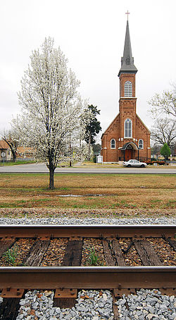
Atkins Roman Catholic Church of the Assumption
Pope County Arkansas Incorporated and Unincorporated areas Atkins Highlighted 0502590.svg
Location of Atkins in Pope County, Arkansas.
USA Arkansas location map.svg
Red pog.svg
Atkins, Arkansas
Location in Arkansas.
Coordinates: 35°14′37″N92°56′18″W / 35.24361°N 92.93833°W / 35.24361; -92.93833
CountryUnited States
State Arkansas
County Pope
Area
[1]
  Total6.14 sq mi (15.89 km2)
  Land6.13 sq mi (15.88 km2)
  Water0.01 sq mi (0.01 km2)
Elevation
[2]
367 ft (112 m)
Population
 (2020)
  Total2,859
  Density466.39/sq mi (180.09/km2)
Time zone UTC−06:00 (Central (CST))
  Summer (DST) UTC−05:00 (CDT)
ZIP Code
72823
Area code 479
FIPS code 05-02590
GNIS feature ID2403125 [2]

Atkins is a city in Pope County, Arkansas, United States. The population was 3,016 at the 2010 census. It is part of the Russellville Micropolitan Statistical Area.

Contents

Geography

Atkins is located at 35°14′37″N92°56′18″W / 35.24361°N 92.93833°W / 35.24361; -92.93833 (35.243485, -92.938212). [3]

According to the United States Census Bureau, the city has a total area of 6.1 square miles (16 km2), all land. Many Atkins residents commute to nearby Russellville for work, school, and recreation.

History

The town is named after Elisha Atkins, [4] a Boston sugar importer who financed the Little Rock and Fort Smith Railroad which spawned the growth of the town after the Civil War. It was formally platted in 1872. Atkins built its first school in 1875 and boasted its own newspaper, the Atkins Chronicle in 1894. The town served as a local cotton depot with a number of cotton gins operating in town. The 1927 flooding of the Arkansas River damaged the town and subsequent road buildings gradually shifted the town to orient northwards away from the river. [5]

Atkins was the site of the Goldsmith Pickle Company which started producing pickled cucumbers in 1946. The town thus laid claim to be the “Pickle Capital of the World” with some 1200 acres devoted to growing cucumbers. Along the same line Atkins was the original home of the fried dill pickle, created by Bernell “Fatman” Austin. [6] The pickle plant came under owners through the years until 2002 when the plant shuttered but left the town with the two-day "Picklefest" legacy held each May. [7]

Demographics

Historical population
CensusPop.Note
1880 519
1890 66027.2%
1900 74512.9%
1910 1,25868.9%
1920 1,52921.5%
1930 1,364−10.8%
1940 1,322−3.1%
1950 1,291−2.3%
1960 1,3917.7%
1970 2,01544.9%
1980 3,00249.0%
1990 2,834−5.6%
2000 2,8781.6%
2010 3,0164.8%
2020 2,859−5.2%
U.S. Decennial Census [8]
2014 Estimate [9]

2020 census

Atkins racial composition [10]
RaceNumberPercentage
White (non-Hispanic)2,55689.4%
Black or African American (non-Hispanic)210.73%
Native American 190.66%
Asian 70.24%
Pacific Islander 10.03%
Other/Mixed 1565.46%
Hispanic or Latino 993.46%

As of the 2020 United States census, there were 2,859 people, 1,164 households, and 759 families residing in the city.

2010 census

As of the census [11] of 2010, there were 3,016 people in 1,118 households, including 849 families, in the city. The population density was 471.8 inhabitants per square mile (182.2/km2). There were 1,288 housing units at an average density of 211.1 per square mile (81.5/km2). The racial makeup of the city was 95.6% White, 0.9% Black or African American, 0.8% Native American, 0.1% Asian, 1.2% from other races, and 1.2% from two or more races. 2.3% of the population were Hispanic or Latino of any race.

Of the 1,118 households 30.4% had children under the age of 18 living with them, 53% were married couples living together, 12.1% had a female householder with no husband present, and 28.4% were non-families. 25.3% of households were one person and 11.2% were one person aged 65 or older. The average household size was 2.50 and the average family size was 2.95.

The age distribution was 23.4% under the age of 18, 9.4% from 18 to 24, 25% from 25 to 44, 24.5% from 45 to 64, and 17.7% 65 or older. The median age was 38.8 years. For every 100 females, there were 90.4 males. For every 100 females age 18 and over, there were 90.7 males.

The median household income was $40,112 and the median family income was $49,754. Males had a median income of $33,191 versus $38,833 for females. The per capita income for the city was $18,605. About 6.4% of families and 8.8% of the population were below the poverty line, including 6.3% of those under age 18 and 7.9% of those age 65 or over.

Notable people

Related Research Articles

<span class="mw-page-title-main">Gateway, Arkansas</span> Town in Arkansas, United States

Gateway is a town in Benton County, Arkansas, United States. The population was 436 at the 2020 census, up from 405 in 2010. It is part of the Northwest Arkansas region. The town's name reflects its situation as the "gateway" to and from Arkansas.

<span class="mw-page-title-main">South Lead Hill, Arkansas</span> Town in Arkansas, United States

South Lead Hill is a town in Boone County, Arkansas, United States. The population was 102 at the 2010 census. It is part of the Harrison Micropolitan Statistical Area.

<span class="mw-page-title-main">Hermitage, Arkansas</span> City in Arkansas, United States

Hermitage is a city in Bradley County, Arkansas, United States. The United States Census Bureau estimated the population to be 830 as of the 2010 census.

<span class="mw-page-title-main">Weldon, Arkansas</span> Town in Arkansas, United States

Weldon is a town in Jackson County, Arkansas, United States. The population was 75 at the 2010 census.

<span class="mw-page-title-main">Keo, Arkansas</span> Town in Arkansas, United States

Keo is a town in southwest Lonoke County, Arkansas, United States. The population was 256 at the 2010 census. It is part of the Little Rock–North Little Rock–Conway Metropolitan Statistical Area.

<span class="mw-page-title-main">East Camden, Arkansas</span> City in Arkansas, United States

East Camden is a city in Ouachita County, Arkansas, United States. The population was 931 at the 2010 census. It is part of the Camden Micropolitan Statistical Area. East Camden was originally called Billkitts Rental Housing and began as a planned community created to support the nearby Shumaker Naval Ammunition Depot.

<span class="mw-page-title-main">Hector, Arkansas</span> Town in Arkansas, United States

Hector is a town in Pope County, Arkansas, United States. The population was 450 at the 2010 census. It is part of the Russellville Micropolitan Statistical Area.

<span class="mw-page-title-main">London, Arkansas</span> City in Arkansas, United States

London is a city in Pope County, Arkansas, United States. The population was 1,039 at the 2010 census. It is part of the Russellville Micropolitan Statistical Area.

<span class="mw-page-title-main">Pottsville, Arkansas</span> City in Arkansas, United States

Pottsville is a city in Pope County, Arkansas, United States. As of the 2020 census the population was 3,140. It is part of the Russellville Micropolitan Statistical Area.

<span class="mw-page-title-main">Russellville, Arkansas</span> City in Arkansas, United States

Russellville is the county seat and largest city in Pope County, Arkansas, United States, with a 2021 estimated population of 29,338. It is home to Arkansas Tech University. Arkansas Nuclear One, Arkansas' only nuclear power plant is nearby. Russellville borders Lake Dardanelle and the Arkansas River.

<span class="mw-page-title-main">Alexander, Arkansas</span> City in Arkansas, United States

Alexander is a city in Pulaski and Saline counties in the U.S. state of Arkansas. Located in Central Arkansas, the town was founded as a construction camp for the nearby railroad. Following its completion, the citizens decided to incorporate in 1887. Alexander is home to the Arkansas Juvenile Assessment and Treatment Center. The population was 2,901 at the 2010 census.

<span class="mw-page-title-main">Lockesburg, Arkansas</span> City in Arkansas, United States

Lockesburg is a city in Sevier County, Arkansas, United States. The population was 739 at the 2010 census.

<span class="mw-page-title-main">Bald Knob, Arkansas</span> City in Arkansas, United States

Bald Knob is a city in White County, Arkansas, United States. The population was 2,897 at the 2010 census. Located at the intersection of two of the state's natural regions, Bald Knob is often promoted as "where the Ozarks meet the Delta". Bald Knob is known for its yearly Home Fest held during Mother's Day weekend. It was once known as the leading strawberry producer in the world in the 1950s. Bald Knob was established in 1881.

<span class="mw-page-title-main">Belleville, Arkansas</span> City in Arkansas, United States

Belleville is a city in Yell County, Arkansas, United States. The population was 441 at the 2010 census. It is part of the Russellville Micropolitan Statistical Area.

<span class="mw-page-title-main">Corinth, Arkansas</span> Town in Arkansas, United States

Corinth is a town in Yell County, Arkansas, United States. The population was 65 at the 2000 census. It is part of the Russellville Micropolitan Statistical Area.

<span class="mw-page-title-main">Dardanelle, Arkansas</span> City in Arkansas, United States

Dardanelle is a city in northeast Yell County, Arkansas, United States. The population was 4,517 at the 2020 census. Along with Danville, it serves as a county seat for Yell County. It is located near Lake Dardanelle.

<span class="mw-page-title-main">Plainview, Arkansas</span> City in Arkansas, United States

Plainview is a city in Yell County, Arkansas, United States. The population was 608 at the 2010 census. It is part of the Russellville Micropolitan Statistical Area.

<span class="mw-page-title-main">Russellville, Indiana</span> Town in Indiana, United States

Russellville is a town in Russell Township, Putnam County, in the U.S. state of Indiana. The population was 358 at the 2010 census.

<span class="mw-page-title-main">Norlina, North Carolina</span> Town in North Carolina, United States

Norlina is a town in Warren County, North Carolina, United States. The population was 1,118 at the 2010 census.

<span class="mw-page-title-main">Russellville, Arkansas micropolitan area</span>

The Russellville Micropolitan Statistical Area (μSA), as defined by the United States Census Bureau, is an area consisting of two counties in the U.S. state of Arkansas, anchored by the city of Russellville.

References

  1. "2020 U.S. Gazetteer Files". United States Census Bureau. Retrieved October 29, 2021.
  2. 1 2 U.S. Geological Survey Geographic Names Information System: Atkins, Arkansas
  3. "US Gazetteer files: 2010, 2000, and 1990". United States Census Bureau. February 12, 2011. Retrieved April 23, 2011.
  4. "Atkins Historic District, National Register of Historic Places" (PDF). Arkansas Heritage. Department of Parks, Heritage and Tourism. July 13, 2009. Retrieved May 1, 2023. In 1873, the town of Atkins was established with the coming of the Iron Mountain Railroad. The railroad ran from Little Rock to Fort Smith. The town was named for Elisha Atkins, a financier from Boston, Massachusetts, who volunteered to finish the building of the railroad after the stockholders ran out of money three miles from (what became Atkins). The stockholders named the town Atkins in his honor...
  5. "Atkins, Pope County"
  6. "Atkins"
  7. "The Atkins Pickle Company"
  8. "Census of Population and Housing". Census.gov. Retrieved June 4, 2015.
  9. "Annual Estimates of the Resident Population for Incorporated Places: April 1, 2010 to July 1, 2014". Archived from the original on May 22, 2015. Retrieved June 4, 2015.
  10. "Explore Census Data". data.census.gov. Retrieved January 1, 2022.
  11. "U.S. Census website". United States Census Bureau . Retrieved January 10, 2017.
  12. Reichler, Joseph L., ed. (1979) [1969]. The Baseball Encyclopedia (4th ed.). New York: Macmillan Publishing. ISBN   0-02-578970-8.