Norristown, Arkansas

Last updated

Norristown, Arkansas
19th century river settlement and, later, neighborhood in Russellville
Map of Dardanelle and Vicinity in Arks 1877.jpg
1877 map shows Dardanelle and Norristown on the Arkansas River as well as roads, properties, and geographic features.
USA Arkansas location map.svg
Red pog.svg
Norristown, Arkansas
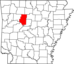
Norristown's position in Arkansas.
Usa edcp location map.svg
Red pog.svg
Norristown, Arkansas
Norristown, Arkansas (the United States)
Coordinates: 35°16′30″N93°10′01″W / 35.27500°N 93.16694°W / 35.27500; -93.16694
CountryUnited States
State Arkansas
County Pope
Elevation
548 ft (167 m)
Time zone UTC-6 (Central (CST))
  Summer (DST) UTC-5 (CDT)
GNIS feature ID79314

Norristown was a 19th-century town and trading center on the Arkansas River [1] and, later, an incorporated town on Norristown Mountain in Illinois Township, Pope County, Arkansas, United States. The town merged with Russellville on August 14, 1980. [2] [3] [4]

Contents

History

Founded in 1829, [5] the settlement of Norristown was located south of Russellville, on the Arkansas River, upstream and across the river from Dardanelle. Samuel and Susan H. Norris, originally from New Jersey, having settled at Dwight Mission on the Illinois Bayou, subsequently moved to a point on the Arkansas River opposite Dardanelle Rock, giving the place the name of Norristown. [6] The settlement steadily grew over the years until about 300 or 400 people inhabited the area. By 1834, it was a small community that served as the county seat [7] of Pope County until the seat was moved to Dover in 1841 after Yell County was created out of Pope County and Norristown was no longer centrally located in the county. On the bank of the seasonally navigable Arkansas River and on an established mail post road, the town served as a regional trade and shipping center; its main tavern was one of the important stops between Little Rock and Fort Smith. Thousands of bales of cotton were loaded on steamboats at Norristown to transport to Little Rock and New Orleans. [8] During the Civil War, heavy equipment for mining and processing niter from a mine in Newton County came by river to Norristown. [9]

The town was laid out in what looked like a capital T. Its two streets were unmarked, but residents referred to them as "River Street" and "Main Street". Its post office, established in 1839 with Samual Norris as postmaster, [10] closed in 1882. [11]

During the 1830s and 40s removal period of eastern Native Americans to the Indian Territory, thousands passed through Norristown, many crossing the river on the ferry located there. [12] [13] [14] [15] [16]

In 1855, Cephas Washburn, founder of Dwight Presbyterian Mission on Illinois Bayou west of present-day Russellville, moved to Norristown where he worked as a minister and was instrumental in the establishment of Presbyterian churches at Dardanelle and Galley (Galla) Rock.

Norristown was active throughout the mid-1800s but by the end of the century, little remained. [17] With the erratic nature of the Arkansas River and the construction of the Little Rock & Fort Smith Railroad through nearby Russellville, [18] riverboat shipping declined and disappeared as did small riverside shipping and market centers like Norristown. Part of the town caved into the river in an 1898 flood [19] while the rest was converted into farmland. [20] The Norristown Cemetery, utilized from 1852 to 1934 and listed in the National Register of Historic Places, is the town's last remnant. [21]

The site of the original settlement of Norristown is now the location of Old Post Road Park, a US Corps of Engineers recreational area. The park's name is derived from the first postal route in this part of Arkansas, which ran through Norristown. [22] An 1830 ferry crossed the river from the present-day location of the park's boat ramp.

In the 20th century, an unincorporated community, also called Norristown, developed on and around Norristown Mountain, a 4.5-mile-long ridge between Russellville and the Arkansas River. [23] Subsequently, incorporated as the town of Norristown, it was consolidated into Russellville on August 14, 1980.

Related Research Articles

<span class="mw-page-title-main">Indian Territory</span> Historic sovereign territory set aside for Native American nations, 1834–1907

Indian Territory and the Indian Territories are terms that generally described an evolving land area set aside by the United States government for the relocation of Native Americans who held original Indian title to their land as an independent nation-state. The concept of an Indian territory was an outcome of the U.S. federal government's 18th- and 19th-century policy of Indian removal. After the American Civil War (1861–1865), the policy of the U.S. government was one of assimilation.

<span class="mw-page-title-main">Trail of Tears</span> Forced relocation and ethnic cleansing of the southeastern Native American tribes

The Trail of Tears was the forced displacement of approximately 60,000 people of the "Five Civilized Tribes" between 1830 and 1850, and the additional thousands of Native Americans within that were ethnically cleansed by the United States government.

<span class="mw-page-title-main">Yell County, Arkansas</span> County in Arkansas, United States

Yell County is a county in the U.S. state of Arkansas. As of the 2020 census, the population was 20,263. The county has two county seats, Dardanelle and Danville. Yell County is Arkansas's 42nd county, formed on December 5, 1840, from portions of Scott and Pope counties. It was named after Archibald Yell, who was the state's first member of the United States House of Representatives and the second governor of Arkansas. He died in combat at the Battle of Buena Vista during the Mexican–American War.

<span class="mw-page-title-main">Pope County, Arkansas</span> County in Arkansas, United States

Pope County is a county in the U.S. state of Arkansas. As of the 2020 census, the population was 63,381. The county seat is Russellville. The county was formed on November 2, 1829, from a portion of Crawford County and named for John Pope, the third governor of the Arkansas Territory. Pope County was the nineteenth county formed. The county's borders changed eighteen times in the 19th century with the creation of new counties and adjustments between counties. The current boundaries were set on March 8, 1877.

<span class="mw-page-title-main">Russellville, Arkansas</span> City in Arkansas, United States

Russellville is the county seat and largest city in Pope County, Arkansas, United States, with a 2022 estimated population of 29,133. It is home to Arkansas Tech University. Arkansas Nuclear One, Arkansas' only nuclear power plant is nearby. Russellville borders Lake Dardanelle and the Arkansas River.

<span class="mw-page-title-main">Dardanelle, Arkansas</span> City in Arkansas, United States

Dardanelle is a city in northeast Yell County, Arkansas, United States. The population was 4,517 at the 2020 census. Along with Danville, it serves as a county seat for Yell County. It is located near Lake Dardanelle.

<span class="mw-page-title-main">Tombigbee River</span> River in Alabama and Mississippi, United States

The Tombigbee River is a tributary of the Mobile River, approximately 200 mi (325 km) long, in the U.S. states of Mississippi and Alabama. Together with the Alabama, it merges to form the short Mobile River before the latter empties into Mobile Bay on the Gulf of Mexico. The Tombigbee watershed encompasses much of the rural coastal plain of western Alabama and northeastern Mississippi, flowing generally southward. The river provides one of the principal routes of commercial navigation in the southern United States, as it is navigable along much of its length through locks and connected in its upper reaches to the Tennessee River via the Tennessee-Tombigbee Waterway.

<span class="mw-page-title-main">Dardanelle and Russellville Railroad</span>

The Dardanelle and Russellville Railroad Company (D&R) is a Class III short-line railroad headquartered in Russellville, Arkansas.

<span class="mw-page-title-main">Arkansas Highway 16</span> American state highway

Highway 16 is an east–west state highway in Arkansas. The route begins in Siloam Springs at US Highway 412 (US 412) and Highway 59 and runs east through Fayetteville and the Ozark National Forest to US Highway 67 Business (US 67B) in Searcy. Highway 16 was created during the 1926 Arkansas state highway numbering, and today serves as a narrow, winding, 2-lane road except for overlaps of 10 miles (16 km) through Fayetteville. Much of the highway winds through the Ozarks, including the Ozark National Forest, where a portion of the highway is designated as an Arkansas Scenic Byway. The route has two spur routes in Northwest Arkansas; in Fayetteville and Siloam Springs.

<span class="mw-page-title-main">Lake Dardanelle</span> Reservoir in Arkansas

Lake Dardanelle is a major reservoir on the Arkansas River in Arkansas, USA. and is an integral part of the McClellan-Kerr Arkansas River Navigation System (MKARNS), which allows barge transportation from the Mississippi River to the Tulsa Port of Catoosa in northeastern Oklahoma. MKARNS went into service along its full length in 1971.

The Butterfield Overland Mail in Indian Territory was part of the overall Butterfield Overland Mail service (1857–1861) created by Congress March 3, 1857. The route crossed Indian Territory from Colbert's Ferry to Fort Smith, Arkansas which was the Center for the Overland Mail's' 7th Division. Fort Smith was also the junction point of the south bound coaches with the Memphis mail and its passengers. From Fort Smith the 7th Division route crossed the Poteau River into Indian Territory into the Choctaw Nation at Skullyville and left the Chickasaw Nation at Colbert's Ferry into Texas. There were 12 stage stations in Indian Territory, located from 13 to 19 miles (31 km) apart. The total length of the route across the territory was approximately 197 miles (317 km). The Butterfield route met with the Texas Road near Geary's Station and followed it southward to the Red River.

<span class="mw-page-title-main">Arkansas Highway 247</span> Highway in Arkansas

Highway 247 is a designation for four north–south state highways in the Arkansas River Valley. Two are low traffic, two-lane, rural connector highways serving sparsely populated areas of the River Valley. A third segment is a four-lane divided highway bypassing Pottsville. A fourth segment mostly runs as Poor Farm Road in Morrilton among several educational buildings in the city. The first rural segment was created in 1957, with the Morrilton segment created in 1965 and a second rural segment in 1966. The final designation came in 1973. All segments are maintained by the Arkansas Department of Transportation (ArDOT).

<span class="mw-page-title-main">Arkansas Highway 326</span> State highway in Arkansas, United States

Highway 326 is a designation for two state highways in Pope County. One route of 9.96 miles (16.03 km) in Russellville begins at Highway 7 and Highway 7 Truck and runs northeast to Highway 7. A second route of 6.52 miles (10.49 km) begins at Highway 124 and runs east to Highway 105. All routes are maintained by the Arkansas State Highway and Transportation Department (AHTD).

Shiloh is a populated area that lies partly in Russellville and partly in unincorporated Pope County, Arkansas, United States. It is located between Interstate 40 and Dover on Arkansas Highway 7.

The 3rd Regiment Arkansas Volunteer Cavalry (1864–1865) was a cavalry regiment that served in the Union Army during the American Civil War. Although Arkansas joined the Confederate States of America in 1861, not all of its citizens supported secession. Arkansas formed 11 regiments that served in the Union Army.

Skullyville County was a political subdivision of the Choctaw Nation of Indian Territory, prior to Oklahoma being admitted as a state. The county formed part of the Nation's Moshulatubbee District, or First District, one of three administrative super-regions.

The Memphis to Little Rock Road was a settlement road constructed between 1819 and Reconstruction in Arkansas. The project was one of many internal improvements to assist settlement of the Old Southwest as well as military defense of the Arkansas Territory.

<span class="mw-page-title-main">Jacob L. Shinn</span> Leader in Russellville, AR.

Jacob Lawson Shinn was a prosperous and influential mid to late-nineteenth-century leader in Russellville, Pope County, Arkansas. A successful merchant who established his first store in about 1852, Shinn was instrumental in bringing the Little Rock and Fort Smith Railroad (LR&FS) through town and moving the county seat from Dover to Russellville. At one time the wealthiest man and largest property owner in Pope County, he donated land for a railway station and right-of-way through Russellville for the LR&FS railroad as well as property for the new courthouse, the Russellville school system, and the church that he and his wife attended. After financial setbacks that reduced his wealth drastically, Shinn continued his service to the community until he died in office months after being elected mayor of Russellville.

<span class="mw-page-title-main">Dardanelle pontoon bridge</span> Historic floating bridge in service for nearly 4 decades in the late 19th and early 20th centuries.

The Dardanelle pontoon bridge was a floating bridge on the Arkansas River connecting Pope and Yell counties at Dardanelle, Arkansas. The bridge was used for nearly four decades in the late 19th and early 20th centuries, except for periods when its operation was interrupted by high river flows or other disruptions.

<span class="mw-page-title-main">Joseph H. Battenfield</span> American newspaper publisher and merchant

Joseph H. Battenfield was an American newspaper publisher and merchant based in Russellville, Arkansas, in the years after the American Civil War. His weekly newspaper regularly took local officials to task over what he saw as the plundering of county wealth and published details of unwarranted attempts by county officials to get martial law declared in Pope County. On September 8, 1872, during a period that came to be known as the Pope County Militia War, his newspaper office and press were burned, supposedly by the militia of Sheriff Elisha Dodson.

References

  1. Biographical and Historical Memoirs of Western Arkansas. Chicago and Nashville: The Southern Publishing Company. 1891. p. 208.
  2. United States Board on Geographic Names (1982). Decisions on Geographic Names in the United States. Department of the Interior. p. 2.
  3. "Ordinance #969 Approving the Consolidation of the Town of Norristown to the City of Russellville". Russellville, Arkansas. Russellville Document Center. August 14, 1980. Retrieved March 29, 2022.
  4. "Norristown". Geographic Names Information System. United States Geological Survey. December 31, 1999. Retrieved March 30, 2022. Former incorporated Town of Norristown merged with Russellville on August 14, 1980. Elevation: 171 meters/561 feet
  5. Shinn, Josiah Haze (1908). Pioneers and Makers of Arkansas. Little Rock, Arkansas: Genealogical and Historical Publishing Company. Retrieved February 16, 2023. Norristown was founded in 1829 by Samuel Norris of New Jersey, and for a time was a pretty lively place.
  6. "Mrs. Susan H. Norris Obituary". The Democrat. Russellville, Arkansas. October 23, 1890. p. 2. Died, at Norristown, Pope County, Ark., at the residence of her grandson Hon. Joseph Brearly, on the 27th of September, 1890, Mrs. Susan H. Norris, in the 98th year of her age.
  7. "Dardanelle, ad for public sale of lots". Weekly Arkansas Gazette. Little Rock, Arkansas. August 15, 1838. Retrieved December 1, 2022. Dardanelle is... on the southern bank of the Arkansas river (nearly opposite to Norristown, the county seat of Pope), at the point where the military road crosses the same, being nearly the centre of the State.
  8. Graveley, Ernestine (Summer 1951). "Early Twin Cities of Arkansas: Dardanelle and Norristown". The Arkansas Historical Quarterly. 10 (1). Van Buren & Fayetteville, Arkansas: Arkansas Historical Association: 177–181. Retrieved March 23, 2023.
  9. Johnson, James (1990). "Bullets for Johnny Reb: Confederate Nitre and Mining Bureau in Arkansas". The Arkansas Historical Quarterly. 49 (2). Arkansas Historical Association: 136. doi:10.2307/40027817. JSTOR   40027817 . Retrieved April 2, 2022. Entrepreneurs had to furnish their niter mines with equipment before they could become operational on a large scale. The equipment was bulky, heavy, and costly. The machinery for Thompson's Cave Creek mine came from New Orleans via the Mississippi and Arkansas rivers to Norristown, three miles south of Russellville, then was freighted sixty-five miles across the Boston Mountains to the factory site by wagon.
  10. "New Post Offices". Arkansas Ties, Wayback Machine. Little Rock, Arkansas: Arkansas Gazette. March 27, 1839. Archived from the original on February 21, 2015. Retrieved April 2, 2022. New Post Offices - The following post offices have been recently established in Arkansas: Bolivia, Poinsett county, Wm. Thrawer, P.M.; Norristown, Pope county, Samuel Norris, P.M.; Richland, Jefferson County, Nath'l H. Fish, P.M.
  11. "Norristown (Pope County)". Encyclopedia of Arkansas. Central Arkansas Library System (CALS). Retrieved April 2, 2022.
  12. "Journey of Survival". Arkansas Natural and Cultural Resources Council. Retrieved March 30, 2022. Although the settlement at Dardanelle had existed for decades before Indian removal began, during the removal period its importance was eclipsed by Norristown on the north side of the river. Located on (Norristown) Mountain south of present-day Russellville, it was named for Samuel Norris, the leading merchant, who settled at the site in 1829 and later took over the ferry. It was at this ferry that traffic from the Little Rock Road to Fort Gibson crossed to take the Military Road south of the river, laid out in 1831. It especially accommodated those whose destination was the Choctaw Agency at Scullyville. The Chickasaws and Choctaws, primarily, took the southern route past Fort Smith, but contingents of other tribes did as well. Most of the Creeks and three large contingents of Cherokees continued on the north side of the river, taking the road to old Dwight Mission, which branched off the Military Road near Potts' Stand, or another road that became the Hickeytown Road, opened in 1834. Between late 1831 and 1842, groups of Choctaws, Muscogees (Creeks), Seminoles, and Chickasaws, passed through or by Norristown.
  13. "Journey of Survival". Arkansas Natural and Cultural Resources Council. Retrieved March 30, 2022. Choctaw: On December 24, 1831, the first group of Choctaws to cross the river at Dardanelle consisted of eighteen Choctaws who had crossed the Mississippi at Memphis with twenty-four saddle horses and were driving a herd of about seventy-five "loose horses" belonging to Samuel Garland's party. Ponies were significant in Choctaw culture and were a vital part of the Choctaw economy, and the Choctaws were determined to get as many of their animals to the West as possible. Another small group belonging to Choctaw Peter Pitchlynn's party from the Aheput Okla ("Spread out potato people") District, followers of Chief Mushulatubbee, passed through with a herd in January 1832, while the main party went up river by steamboat. The first major overland group to cross the river at Norristown, numbering over 1,000, was led by Capt. John Page in December 1832. This group had fallen prey to cholera between Memphis and Rock Roe, a number had died, and many were sick. They had taken the Post Road by way of Erwin's settlement to reach Cadron and the Military Road. Said one traveler, "The poor Indians suffer dreadfully, their exposed situation to the weather, their unwholesome diet, and the impossibility of their procuring efficient medical aid, are sufficient to give them cholera or something worse." They crossed the river at Dardanelle on December 6, at which time Page issued rations of bacon, corn meal, and salt to 1,052 persons and forage for 2,014 horses and oxen. This group was followed by some 450 under the direction of Wharton Rector. They had started west on their own but had stalled in the swamp west of Memphis and were subsisting by hunting. When a removal agent found them, he sent them with Rector by way of Erwin's settlement to Cadron and on up the Military Road. The last Choctaw party to cross the river numbered 190, directed by John M. Millard in December 1833. They, too, had traveled from the Grand Prairie on the old Arkansas Post to Cadron Road by way of Erwin's settlement and then up the Military Road.
  14. "Journey of Survival". Arkansas Natural and Cultural Resources Council. Retrieved March 30, 2022. Creek: United States officials used the authority of the Treaty of Washington (1832) to forcibly remove the Creeks, although it was not specifically a removal treaty. Between 1834 and 1837, more Creeks than members of any other tribe went overland through Arkansas. Lt. John T. Sprague, conducting a large party of Cussetas and Cowetas, camped at Potts' Stand, now Pottsville, for several days after November 12, 1836. Sprague's party had split at Memphis, some going by steamboat and others, with him, by land. At Little Rock they were supposed to meet, but the steamboat had been ordered to go to Cadron. When they left Little Rock, Tuckabatche Hadjo, the Coweta chief, and about 100 followers remained behind to wait for stragglers and the return of a group with his brother, who were hunting bears in the swamp east of the St. Francis. When Sprague's contingent reached Cadron, the steamboat had been delayed by low water, so he continued with a plan to meet them at Dardanelle. When the John Nelson arrived at Dardanelle on November 13, Sprague took about three hundred of "the lame, sick, and blind" and others to Norristown and ferried them across the river to board the boat. Tuckabatche Hadjo had boarded her at Little Rock and, with his followers, disembarked and went to Potts' Stand. Sprague's party remained there until November 19, waiting for stragglers along the road to catch up. When they departed that day, Tuckabatche Hadjo and his party refused once more to move on until all of the stragglers caught up. Sprague's group went on, along the Dwight road.
  15. "Journey of Survival". Arkansas Natural and Cultural Resources Council. Retrieved March 30, 2022. Seminole: Seminole removal began in 1836 and did not end until 1859. The Seminoles took up arms to resist removal, and as the war went on, removal parties were made up of prisoners or those who had surrendered. Nearly all removed through Arkansas on steamboats. They traveled overland only when low water forced them off the river. Only two small groups of Seminoles, one in 1838 and one in 1842, passed through Norristown. The Apalachicolas and Dog Island Creeks had run aground at Taylor's Bar below Cadron in 1838, and started overland from there. On December 4, 1838, Samuel Norris ferried the party of 285 across the river along with 4 horsemen and 8 wagons and teams. He supplied the group with fresh beef, corn, and corn meal. The steamboat Liverpool was chartered to take them from Dardanelle to the mouth of the Illinois River near Fort Gibson. The Halleck Tustenuggee band of about 100, had run aground below Little Rock in 1842 and had taken the Military Road from there. When they crossed the ferry at Norristown is uncertain, but they arrived in the Creek Nation in Indian Territory on September 6.
  16. "Journey of Survival". Arkansas Natural and Cultural Resources Council. Retrieved March 30, 2022. Chicasaw: Chickasaws removed under provisions of the Treaty of Pontotoc (1832) and a Supplemental Treaty (1834). Many of the Chickasaws traveled the Southwest Trail from Little Rock on their way to the Choctaw Nation, while large numbers traveled by steamboat up the Arkansas to Fort Coffee. Only five groups passed through Norristown in 1837 and 1838, numbering over 2,000. The first was a group of 38 Chickasaws led by William R. Guy, driving about 58 horses. They crossed the ferry at Norristown the first week in August 1837. The second was a small group led by William Love. The third group numbered 1,796 Chickasaws with over 3,000 horses. They crossed the river at Norristown in January 1838 with 70 large and 3 small wagons. Wrote Charles "Boggy" Johnson, who was with the group: "We had only two small flats to ferry with, and it took us a week to cross the river." He added, "The day we left Dardanelle, the dreaded 'schokwah' small pox broke out, and there our real trouble commenced." The fourth group was the Clean House Chickasaws who numbered about 150. They crossed the river on Norris's ferry on February 22, 1838. The last group was made up of Chickasaws who had started west on their own. At Little Rock, they agreed to be led the rest of the way by John M. Millard. They left Little Rock on May 29, 1838, and crossed Samuel Norris's ferry with their wagons, horses, cattle, and oxen on June 8.
  17. Biographical and Historical Memoirs of Western Arkansas. Chicago and Nashville: The Southern Publishing Company. 1891. p. 208. Retrieved January 24, 2023. Nothing remains to mark the site of this once ambitious settlement.
  18. "Norristown". Russellville Democrat. Russellville, Arkansas: The Russellville Printing Association. July 20, 1876. p. 3. A quiet little village..., some 3 miles from the station of Russellville... For many years Norristown was the principle mercantile point of the county. Since the completion of the L. R. & F. S. Ry. most of the business men have left the place and removed to Russellville. It is still a quiet, pleasant little town.., with a population of 100 or 150 souls.
  19. "When Norristown Lived". Daily Arkansas Gazette. Little Rock, Arkansas. January 24, 1909. p. 2. Retrieved December 1, 2022. During the flood and big rise of the Arkansas river in 1898, and at subsequent dates, the big banks and the soft sandy soil upon which the town stood gave way to the strong current which beat upon them, and tumbled into the river. The loss of the land and many fine buildings which went into the river that year at Norristown and other places in Pope county, has never been estimated. The loss was heavy, though, and gave the once sturdy town a blow from which it never recovered.
  20. "Norristown (Pope County)". Encyclopedia of Arkansas. Central Arkansas Library System (CALS). Retrieved April 2, 2022.
  21. "Norristown Cemetery". Encyclopedia of Arkansas. Central Arkansas Library System (CALS). Retrieved April 2, 2022.
  22. "Project History". US Army Corps of Engineers. Little Rock District. Retrieved March 30, 2022. Old Post Road Park occupies the former site of Norristown, a once thriving river town and Pope County Seat. The park derives its name from the fact that the first postal route in this part of Arkansas ran through Norristown. As early as 1834, a four horse coach was used to carry mail through Norristown on the route between Little Rock and Dwight Mission.
  23. "Norristown Mountain". Geographic Names Information System. United States Geological Survey. April 29, 1980. Retrieved March 30, 2022.