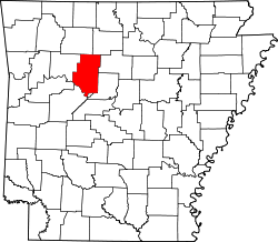
Piney, Pope County, Arkansas

Last updated
Piney, Arkansas
USA Arkansas location map.svg
Red pog.svg
Piney, Arkansas
Piney's position in Arkansas.
Usa edcp location map.svg
Red pog.svg
Piney, Arkansas
Piney, Arkansas (the United States)
Coordinates: 35°26′26″N93°11′25″W / 35.44056°N 93.19028°W / 35.44056; -93.19028 Coordinates: 35°26′26″N93°11′25″W / 35.44056°N 93.19028°W / 35.44056; -93.19028
Country Flag of the United States.svg  United States
State Flag of Arkansas.svg  Arkansas
County Pope
Elevation
165 m (541 ft)
Time zone UTC-6 (Central (CST))
  Summer (DST) UTC-5 (CDT)
GNIS feature ID78016

Piney is an unincorporated community in Martin Township, Pope County, Arkansas, United States. [1]

Related Research Articles

Ozarks Highland region in central-southern United States

The Ozarks, also known as the Ozark Mountains or Ozark Plateau, is a physiographic region in the U.S. states of Missouri, Arkansas, Oklahoma and the extreme southeastern corner of Kansas. The Ozarks cover a significant portion of northern Arkansas and most of the southern half of Missouri, extending from Interstate 40 in central Arkansas to Interstate 70 in central Missouri.

Piney Woods Ecoregion of the United States

The Piney Woods is a temperate coniferous forest terrestrial ecoregion in the Southern United States covering 54,400 square miles (141,000 km2) of East Texas, southern Arkansas, western Louisiana, and southeastern Oklahoma. These coniferous forests are dominated by several species of pine as well as hardwoods including hickory and oak. Historically the most dense part of this forest region was the Big Thicket though the lumber industry dramatically reduced the forest concentration in this area and throughout the Piney Woods during the 19th and 20th centuries. The World Wide Fund for Nature considers the Piney Woods to be one of the critically endangered ecoregions of the United States. The United States Environmental Protection Agency (EPA) defines most of this ecoregion as the South Central Plains.

Piney may refer to:

Arkansas Timberlands

The Arkansas Timberlands is a region of the U.S. state of Arkansas generally encompassing the area south of the Ouachita Mountains, south of Central Arkansas and west of the Arkansas Delta. With several different definitions in use by various state agencies, the Arkansas Timberlands is essentially a region known for dense pine and cypress forests covering hilly terrain and lining numerous rivers. Modern settlement created a significant logging industry and subsequent clearance agriculture which provided the basis of the local economy until the discovery of petroleum. Local tourism is largely based on the popularity of deer hunting and bass fishing. Attractions there include Marks' Mills Battleground Historical Monument, Jenkins' Ferry Battleground Historical Monument, Overflow National Wildlife Refuge, Felsenthal National Wildlife Refuge, South Arkansas Arboretum, Arkansas Museum of Natural Resources, White Oak Lake State Park, Poison Springs Battleground State Park, Millwood State Park, and Pond Creek National Wildlife Refuge. The Arkansas Timberlands is the birthplace of former President of the United States Bill Clinton.

The Piney Woods usually refers to a terrestrial ecoregion in the US southern states of Arkansas, Louisiana and Texas.

Highway 123 is a designation for two state highways in Arkansas. One route begins at Salmon Lane in Boone County and runs 1.63 miles (2.62 km) north to US Highway 65 Business (US 65B) in Harrison. A second route begins at Highway 103 in Clarksville and runs 67.74 miles (109.02 km) northeast to US 65 and US 65B in Western Grove. A suffixed route, designated Highway 123Y runs near Lurton, giving non-truck travelers access to Highway 7. All three routes are maintained by the Arkansas Department of Transportation (ArDOT).

Piney, Oklahoma Census-designated place in Oklahoma, United States

Piney is a census-designated place (CDP) in Adair County, Oklahoma, United States. The population was 115 at the 2010 census. Piney was the "head town" of the first wave of relocated Cherokee people who relocated there from their ancestral homelands in the southeastern United States.

Highway 359 is a north–south state highway in Johnson County. The route of 12.85 miles (20.68 km) runs north from U.S. Route 64 (US 64) near Piney to US 64 in Lamar.

Piney, Arkansas may refer to:

Big Piney Creek is a river located in Ozark National Forest in the state of Arkansas. It is a tributary of the Arkansas River and therefore part of the Mississippi River watershed. Managed by the United States Forest Service, it flows for 70.8 miles (113.9 km) through Pope, Johnson and Newton counties. The headwaters of the creek are in a rugged, remote area just east of Arkansas Route 21 south of the community of Fallsville and the mouth of the creek empties into Lake Dardanelle on the Arkansas River.

Piney Township, Carroll County, Arkansas Township in Arkansas, United States

Piney Township is one of twenty-one current townships in Carroll County, Arkansas, USA. As of the 2010 census, its total population was 226.

Piney Creek may refer to the following places in the United States:

Big Piney Creek Bridge United States historic place

The Big Piney Creek Bridge is a historic bridge, carrying Arkansas Highway 123 across Big Piney Creek in Ozark-St. Francis National Forest, northeast of Hagarville, Arkansas. Its main span is a Warren through truss structure, 141 feet (43 m) in length, with steel deck girder approach spans giving the bridge a total length of 461 feet (141 m). The trusses are mounted on concrete piers. The bridge was built in 1931, during a period of financial hardship, and was for economic reasons built with a single-lane 12-foot (3.7 m) roadway.

Metalton is an unincorporated community in southern Carroll County, Arkansas United States. The community is located on Arkansas Highway 21 between Cabanal to the north and Omega to the south. The communities of Rudd and Gobbler lie to the southeast along Arkansas Highway 103. The community lies near the intersection of Piney Creek with its tributary Cedar Creek. The community sits at an elevation of 1,345 ft (410 m).

Rudd also known as Piney is an unincorporated community in southern Carroll County, Arkansas, United States. The community is located among mountain peaks along Piney Creek on Arkansas Highway 103. Gobbler lies to the southeast and Metalton lies to the northwest. The site is at an elevation of 1,447 ft (441 m).

Tate Cromwell "Piney" Page was an American football player and coach. He served as the head football coach at Transylvania University in Lexington, Kentucky from 1938 to 1941 and at Central Missouri State College—now known as the University of Central Missouri—from 1948 to 1951, compiling a career college football coaching record of 23–43–5. Page was the head coach for Central Missouri State during the famous 1951 Central Missouri State vs. Southwestern football game in which a team rejected a touchdown awarded by the game officials. He was later dean of the College of Education at Western Kentucky University. Page graduated from Arkansas Tech University in 1930 and was a football letter-winner at Tulane University in 1933.

Cauthron is an unincorporated community in Scott County, in the U.S. state of Arkansas.

Hurricane Creek is a tributary to the Big Piney Creek, a river in Ozark-St. Francis National Forest in the state of Arkansas, which is a tributary of the Arkansas River and which is, in turn, part of the Mississippi River System. It is managed by the United States Forest Service and categorized as one the Wild and Scenic Rivers of the United States.

References

  1. "Feature Detail Report for: Piney, Arkansas." USGS. Profile. Retrieved June 23, 2010.