Nogo, Arkansas

Last updated

Nogo, Arkansas
USA Arkansas location map.svg
Red pog.svg
Nogo, Arkansas
Usa edcp location map.svg
Red pog.svg
Nogo, Arkansas
Coordinates: 35°38′27″N92°52′46″W / 35.64083°N 92.87944°W / 35.64083; -92.87944
Country United States
State Arkansas
County Pope
Elevation
1,726 ft (526 m)
Time zone UTC-6 (Central (CST))
  Summer (DST) UTC-5 (CDT)
Area code 479
GNIS feature ID72874 [1]

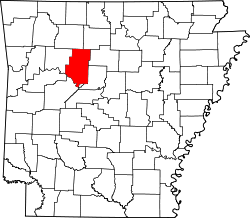
Nogo is a small unincorporated community in Smyrna Township, Pope County, Arkansas, United States. [1] It is part of the Russellville Micropolitan Statistical Area.

Nogo is situated in the Boston Mountains, 11 miles northwest of Kincannon Mountain and 28 miles northeast of Russellville on Arkansas Highway 27 at 35°38′27″N92°52′46″W / 35.64083°N 92.87944°W / 35.64083; -92.87944 , within the Ozark National Forest.

The elevation is 1,720 feet above sea level. [2]

Related Research Articles

<span class="mw-page-title-main">Stone County, Arkansas</span> County in Arkansas, United States

Stone County is located in the Ozark Mountains in the U.S. state of Arkansas. The county is named for the rugged, rocky area terrain of the Ozarks. Created as Arkansas's 74th county on April 21, 1873, Stone County has two incorporated cities: Mountain View, the county seat and most populous city, and Fifty-Six. The county is also the site of numerous unincorporated communities and ghost towns.

<span class="mw-page-title-main">Pope County, Arkansas</span> County in Arkansas, United States

Pope County is a county in the U.S. state of Arkansas. As of the 2020 census, the population was 63,381. The county seat is Russellville. The county was formed on November 2, 1829, from a portion of Crawford County and named for John Pope, the third governor of the Arkansas Territory. Pope County was the nineteenth county formed. The county's borders changed eighteen times in the 19th century with the creation of new counties and adjustments between counties. The current boundaries were set on March 8, 1877.

<span class="mw-page-title-main">Faulkner County, Arkansas</span> County in Arkansas, United States

Faulkner County is a county located in the Central Arkansas region of the U.S. state of Arkansas. As of the 2020 census, the population was 123,498, making it the fifth most populous of Arkansas's 75 counties. The county seat and largest city is Conway. Faulkner County was created on April 12, 1873, one of nine counties formed during Reconstruction, and is named for Sandford C. Faulkner, better known as Sandy Faulkner, a popular figure in the state at the time.

<span class="mw-page-title-main">Cleburne County, Arkansas</span> County in Arkansas, United States

Cleburne County is a county located in the U.S. state of Arkansas. As of the 2020 census, the population was 24,711. The county seat and most populous city is Heber Springs. The county was formed on February 20, 1883, as the last of Arkansas's 75 counties to be formed. It is named for Confederate Major-General Patrick Cleburne. Cleburne is an alcohol prohibition or dry county.

<span class="mw-page-title-main">Atkins, Arkansas</span> City in Arkansas, United States

Atkins is a city in Pope County, Arkansas, United States. The population was 3,016 at the 2010 census. It is part of the Russellville Micropolitan Statistical Area.

<span class="mw-page-title-main">Dover, Arkansas</span> City in Arkansas, United States

Dover is a town in Pope County, Arkansas, United States. The population was 1,378 at the 2010 census. Dover is located in the Arkansas River Valley, and is part of the Russellville Micropolitan Statistical Area.

<span class="mw-page-title-main">London, Arkansas</span> City in Arkansas, United States

London is a city in Pope County, Arkansas, United States. The population was 1,039 at the 2010 census. It is part of the Russellville Micropolitan Statistical Area.

<span class="mw-page-title-main">Russellville, Arkansas</span> City in Arkansas, United States

Russellville is the county seat and largest city in Pope County, Arkansas, United States, with a 2022 estimated population of 29,133. It is home to Arkansas Tech University. Arkansas Nuclear One, Arkansas' only nuclear power plant is nearby. Russellville borders Lake Dardanelle and the Arkansas River.

<span class="mw-page-title-main">Fifty-Six, Arkansas</span> Town in Arkansas, United States

Fifty-Six is an incorporated town in Stone County, Arkansas, United States. As of the 2020 census, the city had a total population of 158, a decrease of 15 people from 2010.

<span class="mw-page-title-main">Mountain View, Arkansas</span> City in Arkansas, United States

Mountain View is the largest city in and the county seat of Stone County, Arkansas, United States, located in the Ozarks. The city's economy is largely based on tourism related to its title as the "Folk Music Capital of the World". The city is also known for outdoors recreation opportunities, including Blanchard Springs Caverns, trout fishing on the White River and the Ozark National Forest.

<span class="mw-page-title-main">West Fork, Arkansas</span> City in Arkansas, United States

West Fork is a city in Washington County, Arkansas, United States. The population is 2,331 at the 2020 census. It is part of the Northwest Arkansas region.

<span class="mw-page-title-main">New Liberty, Iowa</span> City in Iowa, USA

New Liberty is a city in Scott County, Iowa, United States. The population was 138 at the time of the 2020 census.

<span class="mw-page-title-main">Little Missouri River (Arkansas)</span> River

The Little Missouri River, or Little Mo, is a 147-mile-long (237 km) waterway that runs from the Ouachita Mountains of southwest Arkansas into the rolling hills area in the surrounding countryside.

<span class="mw-page-title-main">Lake Dardanelle</span> Reservoir in Arkansas

Lake Dardanelle is a major reservoir on the Arkansas River in Arkansas, USA. and is an integral part of the McClellan-Kerr Arkansas River Navigation System (MKARNS), which allows barge transportation from the Mississippi River to the Tulsa Port of Catoosa in northeastern Oklahoma. MKARNS went into service along its full length in 1971.

<span class="mw-page-title-main">Russell Township, Putnam County, Indiana</span> Township in Indiana, United States

Russell Township is one of thirteen townships in Putnam County, Indiana. As of the 2020 census, its population was 755 and it contained 335 housing units.

<span class="mw-page-title-main">Russellville, Arkansas micropolitan area</span> Micropolitan Statistical Area in Arkansas, United States

The Russellville Micropolitan Statistical Area (μSA), as defined by the United States Census Bureau, is an area consisting of two counties in the U.S. state of Arkansas, anchored by the city of Russellville.

<span class="mw-page-title-main">Arkansas River Valley</span> Region in Arkansas, United States

The Arkansas River Valley is a region in Arkansas defined by the Arkansas River in the western part of the state. Generally defined as the area between the Ozark and Ouachita Mountains, the River Valley is characterized by flat lowlands covered in fertile farmland and lakes periodically interrupted by high peaks. Mount Magazine, Mount Nebo, and Petit Jean Mountain compose the Tri-Peaks Region, a further subdivision of the River Valley popular with hikers and outdoors enthusiasts. In addition to the outdoor recreational activities available to residents and visitors of the region, the River Valley contains Arkansas's wine country as well as hundreds of historical sites throughout the area. It is one of six natural divisions of Arkansas.

<span class="mw-page-title-main">Guy-Greenbrier earthquake swarm</span> Earthquake swarm in Arkansas, United States

The Guy-Greenbrier earthquake swarm occurred in central Arkansas beginning in August 2010. The epicenters of earthquakes in the swarm showed a linear distribution, with a clear overall shift in activity towards the southwest with time, and the largest event in the swarm was the 2011 Arkansas earthquake, at 4.7 on the moment magnitude scale.

North Sylamore Creek is a tributary of South Sylamore Creek in Stone County, Arkansas in the United States.

References

  1. 1 2 "Nogo, Arkansas". Geographic Names Information System . United States Geological Survey, United States Department of the Interior.
  2. USGS. Populated Place Data. Retrieved June 20, 2010.